DJI Terra Flagship (Permanente)
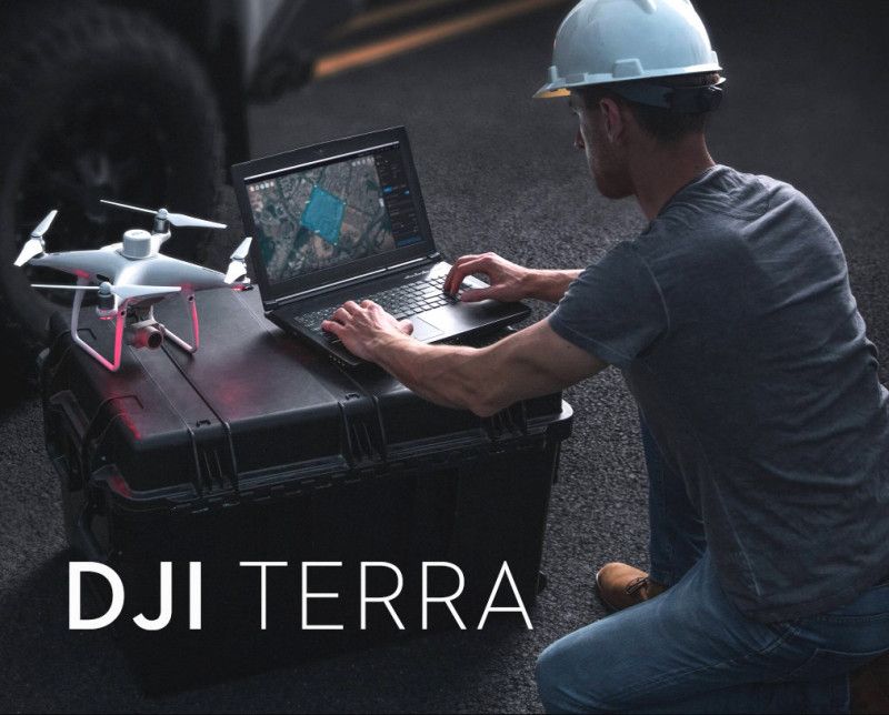
O principal software de mapeamento e reconstrução, transformando dados brutos de drones em ativos digitais precisos e fotorrealistas.
- Modelagem 3D de última geração com splatting gaussiano: Gere modelos 3D impressionantes, com qualidade fotográfica e detalhes realistas. Essa tecnologia de última geração se destaca na reprodução precisa de elementos complexos, como estruturas finas e complexas, objetos transparentes ou reflexivos e vegetação densa, ao mesmo tempo em que aumenta significativamente a velocidade de reconstrução de cenas em grande escala.
- Fotogrametria de alta precisão: Gere rapidamente ortomosaicos 2D de nível de levantamento, mapas ortofotográficos digitais verdadeiros (TDOM) e modelos de superfície digitais (DSM). Suporta imagens de luz visível e integração com drones DJI RTK para precisão centimétrica sem a necessidade de Pontos de Controle de Solo (GCPs).
- Reconstrução LiDAR: Integre e processe profundamente dados de nuvem de pontos de cargas úteis DJI LiDAR (como o Zenmuse L2) para gerar nuvens de pontos de alta precisão, mapas 2D e modelos de malha 3D a partir de uma única aquisição.
- Reconstrução multiespectral: Processar dados de drones multiespectrais (por exemplo, Mavic 3 Multispectral) para criar mapas de índice de vegetação como NDVI e NDRE para agricultura de precisão e sensoriamento remoto.
- Recursos avançados de fluxo de trabalho: Inclui ferramentas especializadas para modelagem de linhas de energia e subestações e oferece suporte a fluxos de trabalho PPK (Post-Processing Kinematic).
DJI Modify Flagship (Permanente)
Software complementar inteligente da DJI para refinar e aperfeiçoar os modelos criados no DJI Terra, garantindo um resultado final polido e pronto para apresentação.
- Integração perfeita do fluxo de trabalho: Inicie o DJI Modify diretamente de um projeto do DJI Terra para uma transição suave da modelagem para o pós-processamento.
- Reparo de malha inteligente: Identifique e repare automaticamente defeitos comuns em malhas 3D com ferramentas assistidas por IA, incluindo:
- Remoção de peças flutuantes: Remova sem esforço peças geométricas soltas ou suspensas.
- Preenchimento de buracos: Detecte, contorne e preencha automaticamente buracos ou lacunas na malha.
- Achatamento: Detecte e achate objetos em superfícies de forma inteligente (por exemplo, veículos, pedestres) para um modelo mais limpo.
- Reparo de textura: Use ferramentas avançadas como Apagar e Clone para corrigir e mesclar texturas perfeitamente.
- Reparo de superfície de água: Defina e repare superfícies de água de forma inteligente com efeitos de preenchimento realistas.
- Edição abrangente de nuvem de pontos: Desbloqueie ferramentas avançadas para refinamento detalhado de nuvens de pontos, incluindo:
- Classificação de Nuvem de Pontos: Classifique pontos de forma inteligente (por exemplo, solo, vegetação, edifícios, fios) para seleção e edição precisas.
- Suavização, redução de amostragem e redução de ruído: Limpe e otimize nuvens de pontos para melhor visualização e desempenho.
- Geração de resultados de terreno: Crie automaticamente modelos de terreno precisos.
- Entrega rápida e compartilhamento: Exporte modelos refinados em uma variedade de formatos padrão do setor (por exemplo, PLY, OBJ, B3DM) para integração imediata com GIS, CAD, BIM e outras plataformas.
Detalhes da licença principal
- Licença Permanente: Compra única que garante uso perpétuo do software.
- Atualizações gratuitas: Normalmente inclui um período de atualizações gratuitas de software (por exemplo, um ano) a partir da data de ativação.
- Autorização: Normalmente oferece suporte à vinculação a um único dispositivo (computador) com autorização on-line.








Avaliações
Ainda não existem avaliações.