

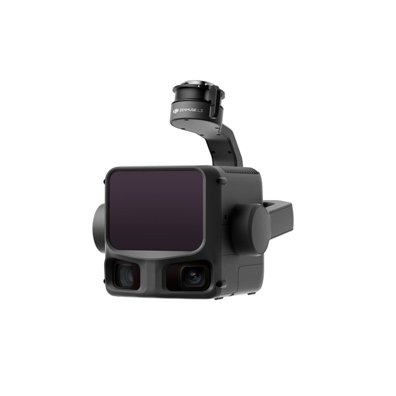
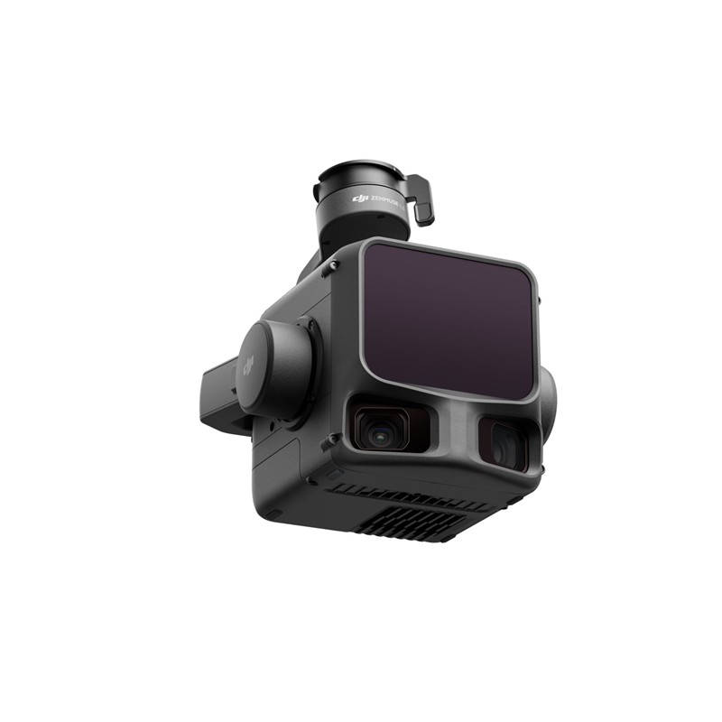
Principales caractéristiques et performances
- Performances LiDAR longue portée :
- Comprend un 1535 nm Classe 1 Capteur LiDAR.
- Exceptionnel Portée de détection maximale jusqu'à 950 mètres (sur des objets avec une réflectivité 10%), permettant des vols à haute altitude pour une couverture plus large tout en maintenant la précision.
- Pénétration supérieure : Offres jusqu'à 16 retours pour capturer des points au sol plus détaillés sous une végétation dense, ce qui est crucial pour la cartographie forestière et topographique.
- Précision ultra-fine : Une divergence du faisceau laser incroyablement faible (0,25 mrad, soit une taille de spot environ plus petite que celle du L2) permet la détection précise d'objets fins comme les lignes électriques et les branches.
- Système de caméra cartographique RGB double de 100 MP :
- Intègre capteurs CMOS Micro 4/3 doubles pour capturer de superbes orthophotos de 100 MP (ou 25 MP en mode rapide).
- Fournit un Champ de vision ultra-large (FOV) jusqu'à 107° pour une couverture étendue.
- Permet la génération de nuages de points en vraies couleurs et des cartes orthophotographiques numériques haute résolution (DOM).
- Haute précision et efficacité :
- Réalise précision au centimètre près (par exemple, 3 cm vertical / 5 cm horizontal) lorsqu'il est associé à des plateformes compatibles prenant en charge RTK.
- La version améliorée IMU de haute précision le système permet démarrage instantané sans préchauffage nécessaire.
- Efficacité massive, capable de couvrir jusqu'à 100 km² par jour.
- Flux de travail transparent :
- Faisant partie d'un écosystème DJI unifié, de la planification de vol intelligente à DJI Pilot 2 au traitement de données puissant dans DJI Terra et édition avancée dans DJI Modifier.
- Permet la capture simultanée de données LiDAR et RGB à partir d'un seul vol.
Optimisé pour les applications professionnelles
Le Zenmuse L3 est l'outil de référence pour les professionnels de :
- Levés topographiques et géomatique : Réaliser des relevés à l'échelle 1:1000 avec une efficacité inégalée.
- Inspection des infrastructures : Modélisation et inspection précises d'infrastructures telles que les lignes électriques et les ponts.
- Surveillance forestière et environnementale : Modélisation précise des strates de la canopée et du terrain sous une couverture dense.
- Exploitation minière et extraction de matériaux : Calcul efficace des volumes et surveillance des changements sur le site.
La Zenmuse L3 permet aux professionnels de capturer des données géospatiales plus rapidement, plus en profondeur et plus précises, rationalisant ainsi les flux de travail et réduisant les coûts opérationnels.
Compatibilité
DJI Matrice 400 (nécessite un connecteur de nacelle unique Zenmuse L3)
Contenu
1x DJI Zenmuse L3
1 connecteur de cardan simple Zenmuse L3
1x étui de rangement
4x amortisseurs de cardan
2 cartes mémoire CFexpress de type B
1 lecteur de cartes CFexpress de type B


Avis
Il n’y a pas encore d’avis.