


Principales caractéristiques et technologie
- Technologie SLAM intégrée : Il intègre des algorithmes SLAM de qualité industrielle, permettant un positionnement et une cartographie précis et sans faille dans les zones où les signaux GNSS sont faibles ou indisponibles (par exemple, à l'intérieur des bâtiments, dans les tunnels, dans les zones urbaines denses).3 Il prend en charge les deux Pure SLAM et RTK-SLAM fusion.
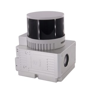
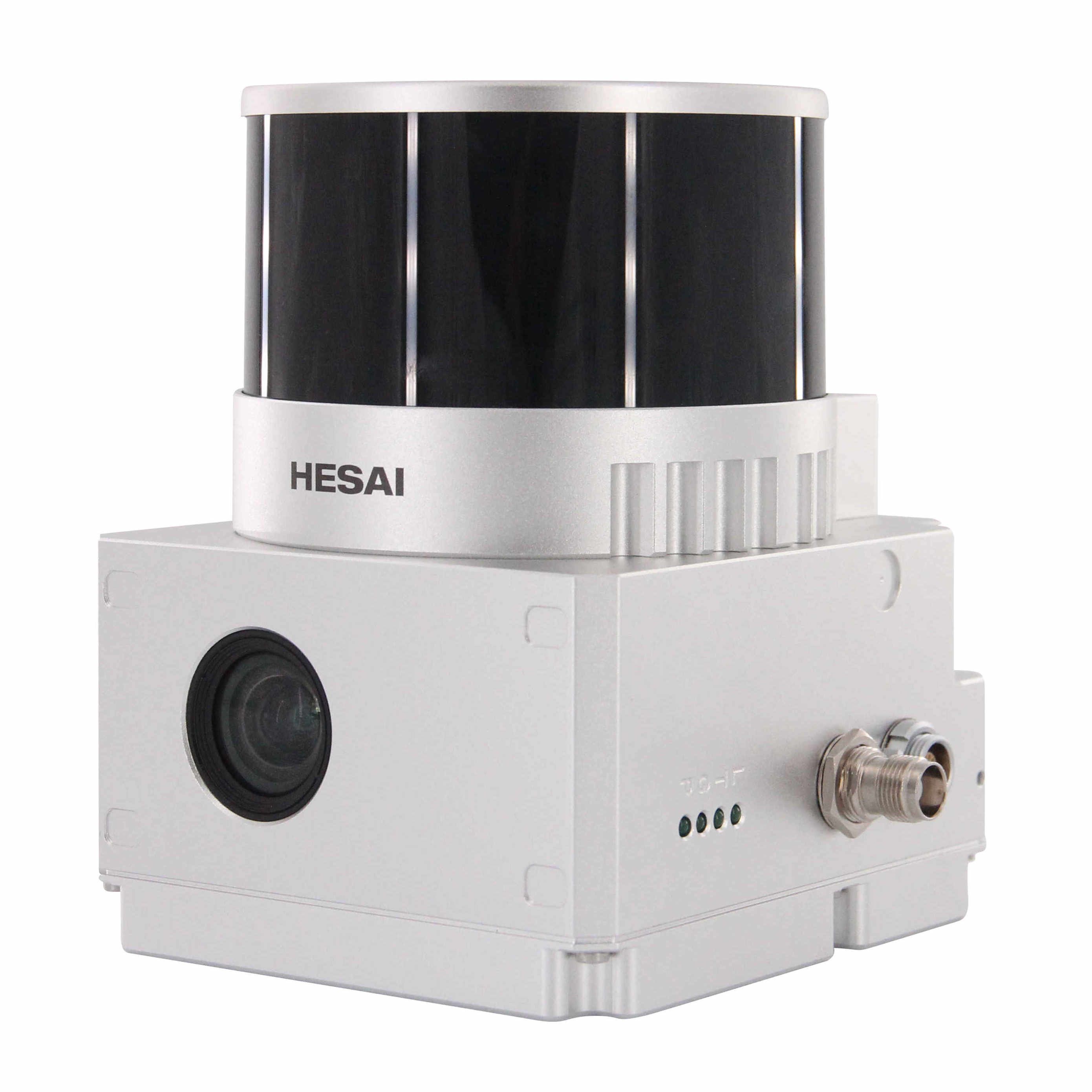
- Acquisition de données haute densité : Equipé d'un Capteur LiDAR rotatif à 32 canaux (souvent le Hesai XT32), le système capture jusqu'à 1 280 000 points par seconde (double écho), garantissant une représentation dense et fiable de l'environnement scanné.
- Champ de vision large (FOV) : Offre une large gamme de balayage avec un 360° horizontal et 270° vertical Champ de vision optimisé, minimisant les angles morts et maximisant la couverture avec un minimum d'effort.
- Nuage de points coloré en temps réel : La caméra RVB haute définition intégrée (généralement 3 x 5 MP la résolution) permet la capture de données de nuage de points colorées en temps réel, offrant un contexte visuel riche pour faciliter l'interprétation des données et la modélisation 3D.
- Haute précision : Réalise un Précision absolue de 5 cm et un Précision relative de 1,5 cm, garantissant des données de qualité équivalente à celle des enquêtes.
Polyvalence et design
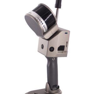
- Fonctionnement multiplateforme : Le GS-120G présente une conception minimaliste et flexible, ce qui lui permet d'être monté sur de multiples plateformes, notamment :
- portable (mode principal)
- Sac à dos
- Aéroporté (Charge utile d'un drone/UAV)
- Véhicule
- Système de positionnement robuste : Intègre un système de navigation inertielle (INS) haute performance et un module GNSS multi-constellation (GPS, GLONASS, BDS, GALILEO), assurant une précision centimétrique lorsque des signaux satellites sont disponibles.
- Flux de travail convivial : Il présente un design minimaliste et un corps léger (15$ ≈ 2,2 kg $), et comprend logiciel de traitement de données en un clic (par exemple, PointCreator) et une application mobile intuitive pour la prévisualisation en temps réel du nuage de points.
Résumé des spécifications techniques
| Spécification | Détail |
| Canaux laser | 32 lignes |
| Portée maximale | 120 m |
| Taux de points | Jusqu'à 1 280 000 points |
| Précision absolue | 5 cm |
| Poids (avec batterie) | environ 2,2 kg |
| Assistance GNSS | Constellation complète (GPS, GLONASS, BDS, GALILEO) |
| stockage de données | 128 Go Carte SD |
| Temps de fonctionnement | environ 2 heures (Batterie interne) |
Applications idéales
Le Geosun GS-120G est un outil indispensable pour les professionnels dans les domaines suivants :
- Modélisation des informations du bâtiment (BIM) et Levés topographiques conformes à l'existant
- Levé topographique et Modélisation numérique
- Cartographie des garages et tunnels souterrains
- Mesure du volume des stocks
- Étude minière et Inspection des infrastructures
Le GS-120G permet aux utilisateurs de capturer rapidement des données 3D géoréférencées précises, révolutionnant ainsi les flux de travail en matière d'arpentage et de cartographie.


Avis
Il n’y a pas encore d’avis.