Principales caractéristiques et avantages
- Polyvalence ultime (intégration ciel-sol) : Sa conception légère et compacte permet un fonctionnement fluide sur plusieurs plateformes :
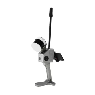
- Portable : Idéal pour la cartographie rapide en intérieur, en tunnel et en extérieur à courte portée.
- UAV/Drone : Facile à monter sur des plateformes multirotors pour les levés aériens à grande échelle.
- Sac à dos/Véhicule : Adaptable à la cartographie mobile dans des zones urbaines ou industrielles complexes
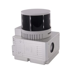
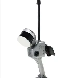
- Acquisition de données haute densité : Equipé d'un 32 canaux unité laser (Hesai XT32), le GS-130G capture jusqu'à 1 920 000 points par seconde (triple écho), garantissant des données de nuage de points 3D denses, fiables et à haute résolution.
- Précision au centimètre près : Doté d'un design sophistiqué GNSS/INS (unité de point de vente gSpin 210) Un algorithme de fusion combiné à des algorithmes SLAM avancés permet d'obtenir une précision de position absolue élevée :
- Précision de la portée : 1 cm
- Précision de la position horizontale : 0,02 m
- Portée étendue : Offre une portée de détection puissante allant jusqu'à 300 mètres, assurant une couverture efficace pour les grands projets, l'inspection des lignes électriques et les levés miniers.
- Fonctionnement sans faille : Le système comprend un Champ de vision (FOV) horizontal de 360° et vertical de 270°, garantissant une collecte de données exhaustive sans angles morts, quel que soit l'environnement d'exploitation (intérieur, extérieur ou souterrain).
- Flux de travail intuitif : Il prend en charge la prévisualisation en temps réel via une application mobile dédiée et est fourni avec le logiciel de post-traitement spécialisé de Geosun (comme gAirHawk), simplifiant le calcul des trajectoires et l'optimisation des nuages de points.
Résumé des spécifications techniques
| Composant | Spécification |
| Capteur laser | HESAI XT32 (32 canaux) |
| Taux de points | Jusqu'à 1 920 000 points/seconde (triple écho) |
| Portée maximale | 300 mètres |
| Précision de la portée | 1 cm |
| Poids | Environ 1,7 kg (avec batterie) |
| Système de positionnement | GNSS+INS (gSpin 210) |
| Plateformes de transport | Sac à dos pour drone multirotor portable |
| stockage de données | 128 Go (compatible avec les cartes microSD jusqu'à 256 Go) |
La Geosun GS-130G est le choix professionnel des organisations exigeant une modélisation numérique 3D de haute précision, notamment Levés topographiques, levés de tunnels miniers, construction de villes numériques, surveillance des lignes électriques et levés de bâtiments.





Avis
Il n’y a pas encore d’avis.