


Características y capacidades clave
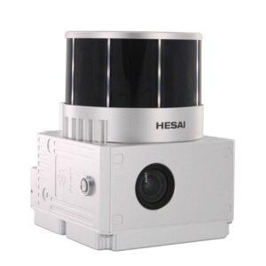
- Detección de rango medio: El GS-960 cuenta con un escáner láser (a menudo un Hesai XT16 o similar) con un rango de medición típico de hasta 500 m con una reflectividad de 20% y un rango máximo que alcanza los 750 m o incluso 1000 m con una reflectividad de 80%. Esto permite una recopilación de datos eficaz en una buena área operativa.
- Frecuencia de puntos altos y ecos múltiples: Captura nubes de puntos densas con una velocidad de datos de hasta 640.000 puntos por segundo (doble eco) o incluso 1.920.000 puntos por segundo (triple eco en algunas configuraciones). Admite múltiples retornos, lo que es crucial para penetrar la vegetación y capturar las características del suelo.
- Sistema POS integrado: El sistema incorpora un robusto sistema de posicionamiento y determinación de actitud GNSS (sistema global de navegación por satélite) e IMU (unidad de medición inercial) (por ejemplo, gSpin 310 o AGS 303). Esto garantiza una alta precisión en la posición (horizontal 0,02 m, vertical 0,03 m) y actitud (precisión de cabeceo/balanceo de 0,005°, precisión de rumbo de 0,017°), lo que genera nubes de puntos georreferenciadas con precisión.
- Cámara de alta resolución incorporada: Equipada a menudo con una cámara RGB de fotograma completo de 26 MP o 45 MP, la GS-960 puede adquirir simultáneamente imágenes con colores intensos. Esto permite la creación de nubes de puntos 3D realistas y coloreadas, además de ser compatible con flujos de trabajo fotogramétricos.
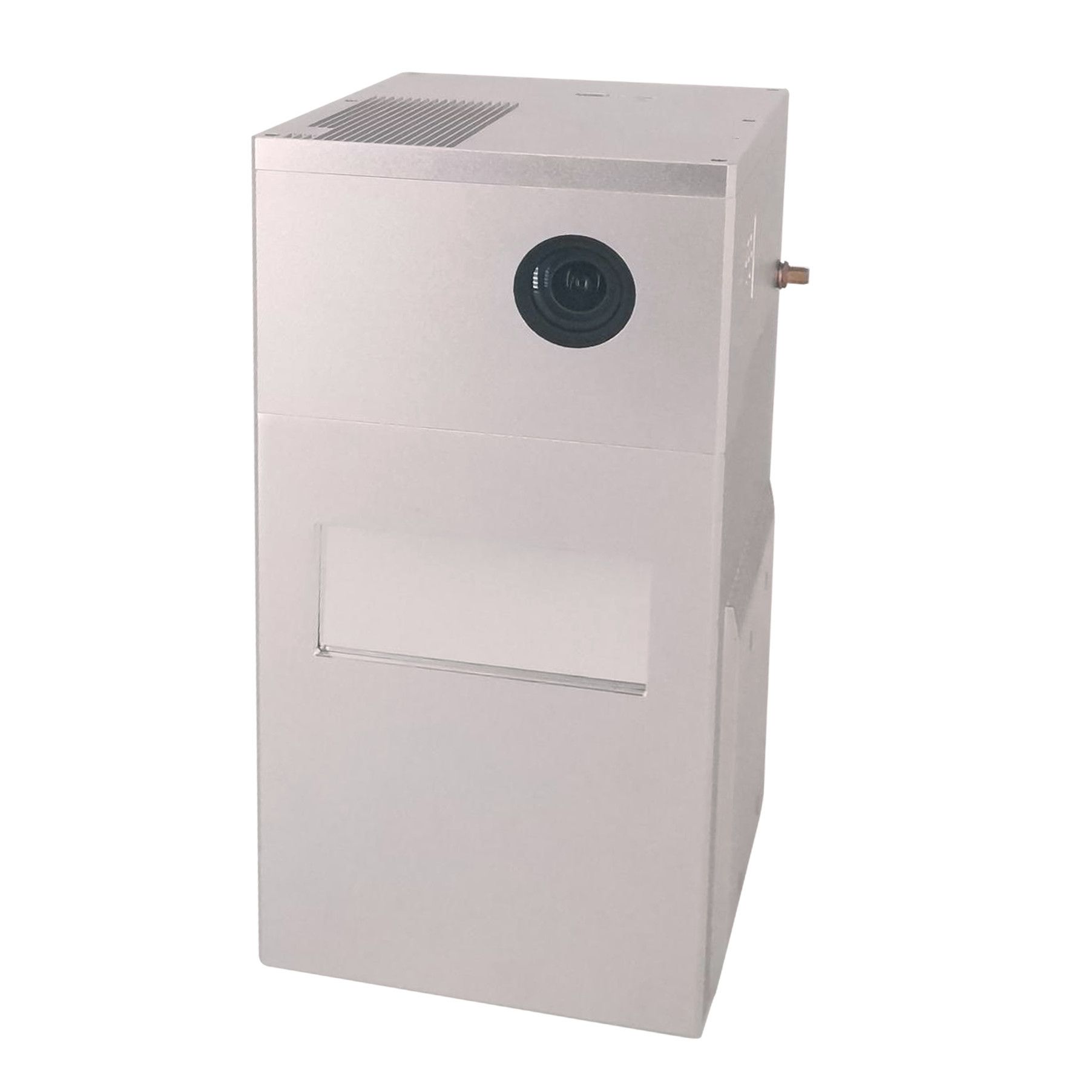
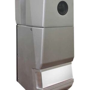
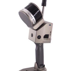
- Diseño ligero y compacto: Con un peso que normalmente oscila entre 1,4 kg y 1,7 kg (con cámara), el GS-960 está diseñado para una fácil integración con varias plataformas de drones, incluidos modelos populares como el DJI Matrice 300/350 RTK, aviones multirotor y VTOL, así como vehículos terrestres.
- Paquete completo de software: Geosun ofrece un paquete de software completo, que incluye software POS de preprocesamiento para el cálculo de trayectoria y software de posprocesamiento gAirHawk para la generación de datos de nubes de puntos en formatos estándar como LAS y TXT personalizado.
- Aplicaciones versátiles: El GS-960 es una solución versátil ampliamente utilizada para adquirir información espacial 3D en diversos campos como:
- Topografía y cartografía: Mapeo topográfico, modelos digitales de elevación (DEM) y levantamientos catastrales.
- Silvicultura: Inventario forestal, estimación de biomasa y mapeo de hábitat.
- Inspección de línea eléctrica: Mapeo detallado de corredores de líneas eléctricas para mantenimiento y seguridad.
- Agricultura: Agricultura de precisión, análisis de cultivos y gestión del rendimiento.
- Mapeo de emergencias: Adquisición rápida de datos 3D para respuesta a desastres.
- Minería: Cálculos de volúmenes y monitoreo de sitios mineros.
El Geosun GS-960 ofrece una combinación equilibrada de rendimiento, portabilidad y precisión, lo que lo convierte en la opción ideal para los profesionales que buscan una solución LiDAR confiable para una amplia gama de proyectos de mapeo aéreo y móvil.


Valoraciones
No hay valoraciones aún.