

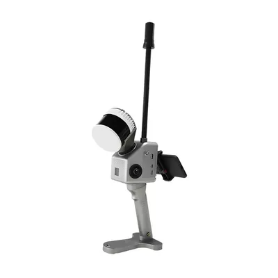

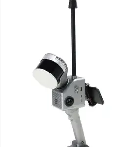
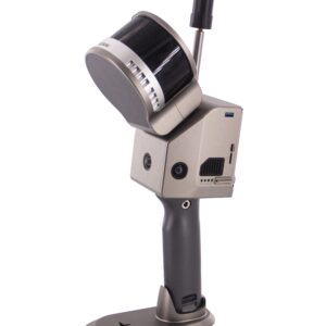
Características y beneficios clave
- Máxima versatilidad (integración cielo-tierra): Su diseño ligero y compacto permite un funcionamiento perfecto en múltiples plataformas:
- Portátil: Perfecta para mapeo rápido en interiores, túneles y exteriores a corta distancia.
- UAV/Dron: Fácilmente montable en plataformas multirrotor para estudios aéreos a gran escala.
- Mochila/Vehículo: Adaptable para el mapeo móvil en áreas urbanas o industriales complejas
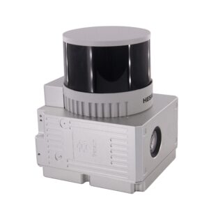
- Captura de datos de alta densidad: Equipado con un 32 canales La unidad láser (Hesai XT32) del GS-130G captura hasta 1.920.000 puntos por segundo (eco triple), garantizando datos de nube de puntos 3D densos, fiables y de alta resolución.
- Precisión centimétrica: Cuenta con un sofisticado GNSS/INS (Unidad POS gSpin 210) algoritmo de fusión combinado con algoritmos SLAM avanzados, logrando una alta precisión de posición absoluta:
- Precisión de alcance: 1 cm
- Precisión de la posición horizontal: 0,02 m
- Rango extendido: Ofrece un potente rango de detección de hasta 300 metros, proporcionando una cobertura eficiente para grandes proyectos, inspección de líneas eléctricas y estudios mineros.
- Funcionamiento impecable: El sistema cuenta con un Campo de visión (FOV) de 360° horizontal y 270° vertical, garantizando una recopilación de datos completa y sin puntos ciegos, independientemente del entorno operativo (interior, exterior o subterráneo).
- Flujo de trabajo intuitivo: Admite la previsualización en tiempo real mediante una aplicación móvil complementaria y viene con el software de postprocesamiento especializado de Geosun (como gAirHawk), simplificando el cálculo de trayectorias y la optimización de nubes de puntos.
Resumen de especificaciones técnicas
| Componente | Especificación |
| Sensor láser | HESAI XT32 (32 canales) |
| Tasa de puntos | Hasta 1.920.000 puntos/seg (Triple eco) |
| Alcance máximo | 300 metros |
| Precisión del rango | 1 cm |
| Peso | Aprox. 1,7 kg (con batería) |
| Sistema de posicionamiento | GNSS+INS (gSpin 210) |
| Plataformas de transporte | UAV multirrotor portátil, vehículo, mochila |
| Almacenamiento de datos | 128 GB (admite tarjetas microSD de hasta 256 GB) |
La Geosun GS-130G es la opción profesional para organizaciones que requieren modelado digital 3D de alta precisión, incluyendo Levantamiento topográfico, levantamiento de túneles mineros, construcción de ciudades digitales, patrullaje de líneas eléctricas y levantamiento de edificios.


Valoraciones
No hay valoraciones aún.