
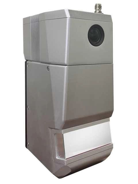
Sistema de escaneo LiDAR Geosun gAirHawk serie GS-1500N
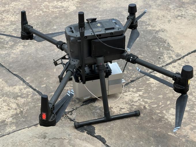
gAirHawk GS-1500N es un tipo de sistema de adquisición de datos de nube de puntos LiDAR compacto y de largo alcance, un escáner láser de largo alcance FT-800 integrado, un sistema de determinación de actitud y posicionamiento GNSS e IMU y una unidad de control de almacenamiento capaz de realizar mediciones dinámicas y en tiempo real. , recopile masivamente datos de nubes de puntos de alta precisión e información de imágenes enriquecida. Se utiliza ampliamente en la adquisición de información espacial 3D en topografía, electricidad, silvicultura, agricultura y planificación territorial.
Especificación
| Sistema de escaneo LiDAR gAirHawk GS-1500N | ||
| Nombre del árticulo | Parámetros del sistema | |
| GS-1500NParámetros | Peso | 2,2 kilos |
| Temperatura de trabajo | -20℃~+60℃ | |
| Rango de poder | 12V-24V | |
| Consumo | 65W | |
| Plataforma de transporte | Drone multirrotor 6 Aixs, VTOL | |
| Almacenamiento | Almacenamiento de 64 GB, soporte máximo de tarjeta TF de 128 GB | |
| Unidad láser
|
Rango de medición | 1500m@80% |
| Clase de láser | 1535 nm Clase 1 (IEC 60825-1:2014) | |
| Número de línea láser | FT-800 de haz único | |
| Precisión de medición | 5 mm a 100 m | |
| Máx. rango | 1500m | |
| Devolver | 5 ecos | |
| Frecuencia de escaneo | 50 HZ-2000 HZ | |
| Divergencia del haz | 0,3 mrad | |
| campo de visión | 100°, ajustable | |
| Unidad POS | Frecuencia de actualización | 200 Hz |
| Liderear Punteria | 0,010° | |
| Precisión de tono | 0,003° | |
| Precisión de rodadura | 0,003° | |
| Precisión de posición | Horizontal: 0,01 m, Vertical: 0,02 m | |
| Tipo de señal GNSS | GPSL1/L2/L5 GLONASL1/L2 BDS B1/B2/B3 GAL E1/E5a/5b | |
| IMU | ggirar 410 | |
| Software de preprocesamiento | software de punto de venta | Información de salida: posición, velocidad, actitud |
| software de nube de puntos | Formato de datos de nube de puntos de salida: formato LAS, formato TXT personalizado | |
| Cámara (integrada) | campo de visión | 48*33 grados |
| Píxel efectivo | 45 MP (cámara de fotograma completo) | |
| Longitud focal (mm) | 16 | |
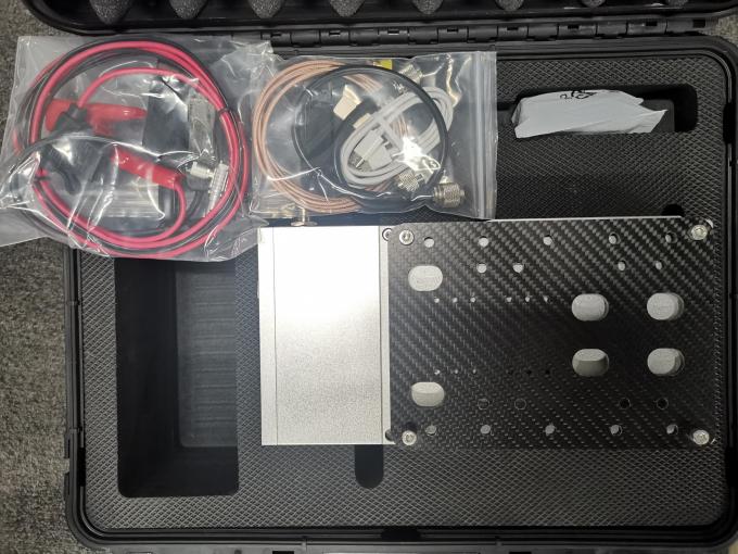
Paquete de sistema de escaneo LiDAR gAirHawk GS-1500N
El sistema de escaneo LiDAR gAirHawk GS-1500N se empaqueta en una maleta con un revestimiento de material EVA en el interior y luego se cubre con una caja de cartón rígido.
El paquete del sistema de escaneo uav LiDAR es adecuado para envíos aéreos y marítimos.

Valoraciones
No hay valoraciones aún.