


Aspectos destacados del producto
- Licencia Permanente Educativa: Una licencia permanente diseñada para uso académico, que proporciona acceso ilimitado para la institución.
- 10 dispositivos de control: Permite utilizar el software en hasta 10 dispositivos independientes, lo que lo convierte en una solución ideal para la enseñanza en el aula, entornos de laboratorio y equipos de investigación.
- Modelado y mapeo 3D integral: DJI Terra es un software robusto que utiliza fotogrametría y tecnologías de reconstrucción de última generación, incluyendo Salpicadura gaussiana 3D, para transformar entornos del mundo real capturados por drones DJI en activos digitales de alta precisión.
Características y capacidades clave
- Reconstrucción de alta precisión:
- Fotogrametría: Genera rápidamente alta precisión Mapas de ortofotos 2D (TDOM) y detallado Modelos 3D (incluidas nubes de puntos y DSM) a partir de imágenes de luz visible.
- Salpicadura gaussiana 3D (función destacada): Genera rápidamente modelos 3D increíblemente detallados y realistas con una representación mejorada de elementos complejos como estructuras finas y vegetación.
- Reconstrucción LiDAR: Admite una profunda integración y procesamiento de datos recopilados por cargas útiles LiDAR de DJI (por ejemplo, Zenmuse L2) para generar nubes de puntos de color verdadero y modelos de malla 3D de gran precisión.
- Reconstrucción multiespectral: Aprovecha datos multiespectrales de drones compatibles (por ejemplo, DJI Mavic 3 Multispectral) para generar mapas de índice de vegetación como NDVI y NDRE para la investigación en agricultura y teledetección.
- Integración perfecta de hardware y software: Diseñado para funcionar perfectamente con una gama de drones y cargas útiles DJI Enterprise (por ejemplo, serie Matrice, Zenmuse P1, Zenmuse L2), agilizando todo el flujo de trabajo de topografía aérea.
- Herramientas de análisis de datos: Proporciona herramientas para medir fácilmente coordenadas, distancias, áreas y volúmenes dentro de los modelos reconstruidos.
- Flexibilidad de autorización: Admite modos de autorización en línea y fuera de línea.
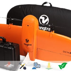
Este paquete es una solución completa que permite a los estudiantes e investigadores dominar las últimas técnicas de mapeo y análisis espacial con drones para diversas aplicaciones, incluidas Topografía y cartografía, planificación urbana inteligente, inspección agrícola, forestal y de infraestructura.


Valoraciones
No hay valoraciones aún.