Características y capacidades clave
- Licencia permanente: Unlike other subscription-based models, this is a permanent license, meaning access to the software’s features remains active indefinitely without the need for annual renewals.
- Soporte para múltiples dispositivos: The “10 Control Devices” aspect allows for the software to be used on multiple computers simultaneously, facilitating collaborative projects and coursework.
- Advanced Reconstruction Technologies:
- Salpicadura gaussiana 3D: A next-generation technology that quickly generates highly realistic and detailed 3D models from photos, accurately restoring complex scenes, and improving the representation of fine structures and reflective objects.
- Photogrammetry: Rapidly generates high-precision 3D models, point clouds, true digital orthophoto maps (TDOM), and digital surface models (DSM) from visible light imagery.
- LiDAR Reconstruction: Enables deep integration of LiDAR and visible light data to simultaneously generate high-precision point clouds, 2D maps, and 3D mesh models from a single LiDAR acquisition.
- Reconstrucción multiespectral: Processes multispectral data from compatible DJI drones (like the Mavic 3 Multispectral and Phantom 4 Multispectral) to create vegetation index maps (NDVI, NDRE) and reflectance maps for agricultural and remote sensing research.
- Flujo de trabajo eficiente: DJI Terra integrates seamlessly with DJI Enterprise drones, providing a unified hardware and software solution that streamlines the entire aerial surveying process, from data acquisition and processing to application.
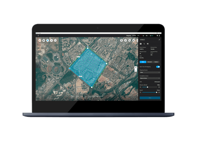
- Versatile Mission Planning: The software allows users to plan a variety of automated flight missions, including oblique, corridor, and detailed inspection missions, to collect the necessary data for specific projects.
- Measurement and Analysis Tools: Users can easily measure coordinates, distances, areas, and volumes on the reconstructed models, making it a powerful tool for a wide range of applications, including surveying, smart city planning, agriculture, and infrastructure inspection.
- Authorization Modes: The software supports both online and offline authorization, providing flexibility for different network environments.
In essence, DJI Terra EDU Permanent – 10 Control Devices is a comprehensive and robust platform that equips educational institutions with the tools to conduct high-level research, teaching, and practical training in the field of geospatial data collection and analysis.





Valoraciones
No hay valoraciones aún.