

Key Features and Applications
- Design of Infrastructure: Includes tools for designing horizontal and vertical alignments for roads and other infrastructure.
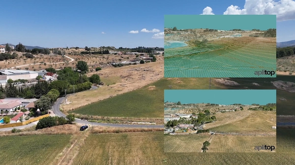
- Digital Terrain Modeling (DTM): Advanced functions for creating, editing, and analyzing digital terrain models, generating contour lines, and working with surfaces, including tools for subgrades and slope analysis.
- Earthworks and Volume Calculation: Features for defining project cross-sections (platforms, ditches, slopes, pavement layers), calculating cut and fill volumes, and generating detailed area and volume reports.
- Network Design: Tools for drawing and designing water, sewerage, and rainwater networks, including representation in top view, profile, and cross-sections.
- Setting-Out: Comprehensive tools for setting-out roads and isolated points, generating lists of platform vertices, slopes, etc.
- BIM and GIS Integration: Supports integration into OpenBIM workflows through the exchange of industry-standard files like IFC and LandXML. It also allows for importing and exporting GIS data and web map services.
- Visualization and Reporting: Features include a virtual tour with export to video, and generation of detailed measurement reports, quantity take-offs, and budgets.
- CAD Integration: Its functionality is seamlessly integrated within the user’s chosen CAD environment.
The software is suitable for a wide array of projects, such as roads, urban developments, quarries, mining, and environmental projects.


Reviews
There are no reviews yet.