


Solução Perfeita para obtenção de resultados únicos – O seu projeto nunca esteve em melhores mãos!

DJI Zenmuse L3
New DJI Zenmuse L3
High-precision LiDAR and RGB camera payload designed for DJI’s enterprise drones, offering real-time 3D data capture and mapping for surveying, construction, and environmental applications
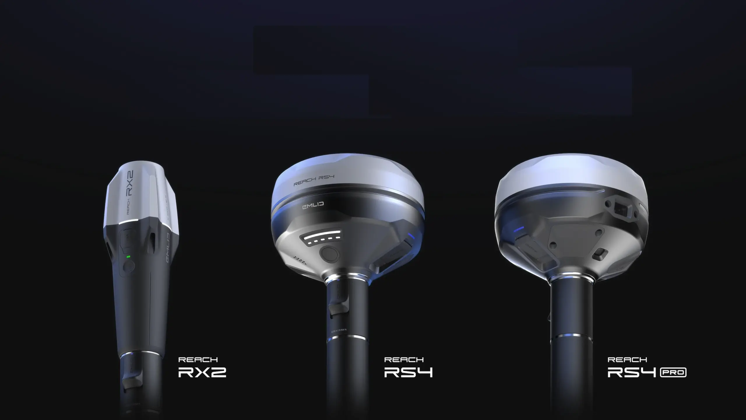
Emlid RX2, RS4 & RS4 Pro
Emlid just launched Emlid RX2, RS4 and RS4 Pro!
Emlid has launched the RX2, RS4, and RS4 Pro—a new generation of all-band RTK GNSS receivers featuring faster IMU tilt compensation and rugged designs, with the flagship RS4 Pro adding dual cameras for AR stakeout and image-based measurements.
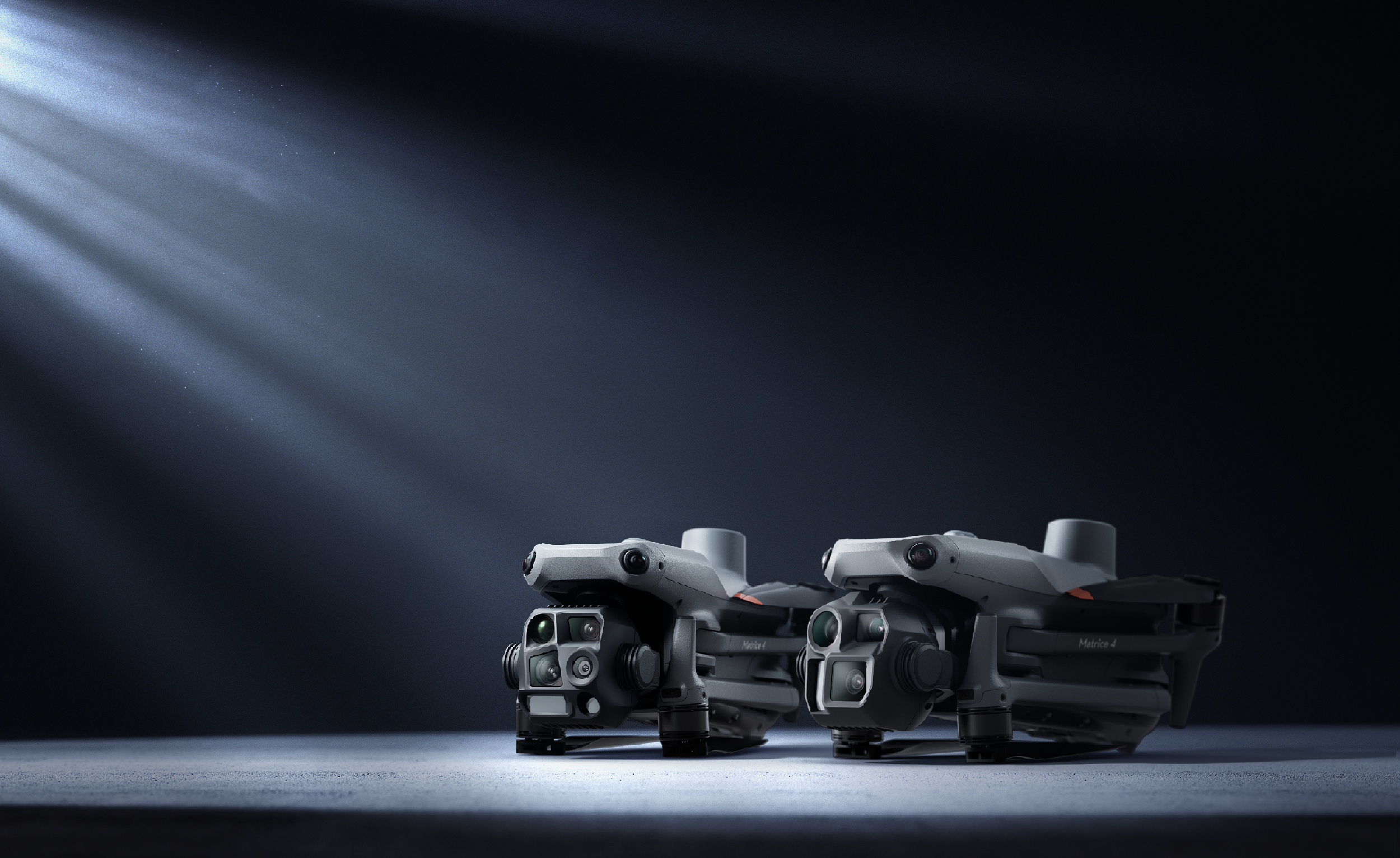
DJI Matrice 4E&4T
New DJI Matrice 4E and 4T
Matrice 4T and multi-sensor specialist for public safety and inspection, while the 4E is the precision workhorse optimized for mapping and surveying with its mechanical shutter
DJI Authorized Dealer
Ghostysky is an Authorized Dealer!
Ghostysky is officially an Authorized Dealer of DJI Enterprise products, for drones and accessories in series like Matrice 30, Matrice 350 or Mavic 3.
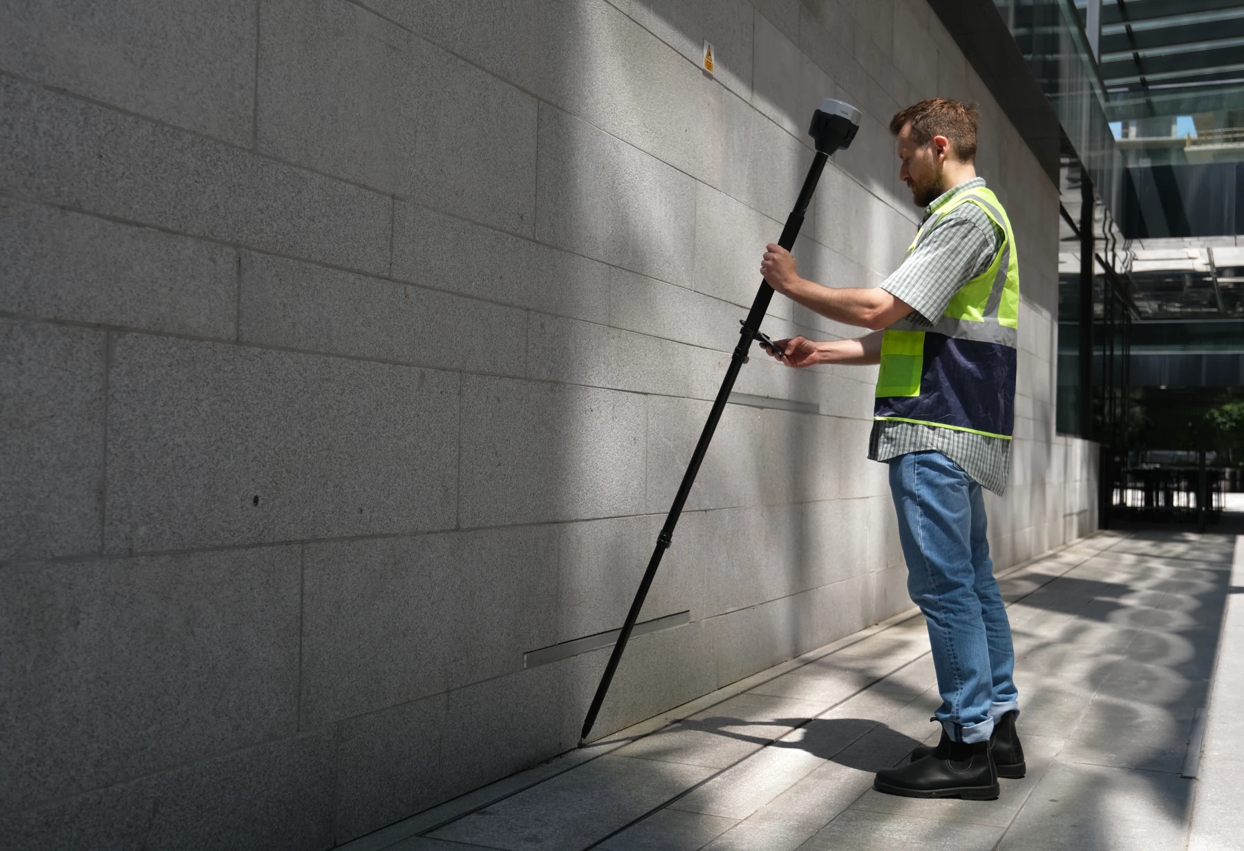
Emlid RS3
Launch of new Reach RS3
RTK GNSS receiver with tilt compensation. Survey grade precision,even in hard-to-reach spots.
News
November 23, 2025
October 15, 2025
September 24, 2024
September 23, 2024
September 21, 2024
February 23, 2024
February 19, 2024

Services
Ghostysky offers complete drone services capabilities for your project and daily operational needs as easily as reaching out by phone or email. From urban and agricultural areas to industrial locations, we provide the drone capabilities you require.
Trusted Company
Ghostysky services overall provides a wide range of drones, sensors, data analysis, payloads and pilots. We are a trusted company recognized by our suppliers, partners and clients known by our dedication and professionalism.

Quality
We deliver high-quality solutions quickly, safely and at competitive rates. Ghostysky Services is dedicated to deliver 100% customer satisfaction by maintaining top-flight professionalism and equipment in every environment.
DRONES
Welcome to cutting-edge aerial technology!
We deliver high quality aerial drone services
We’re a passionate company dedicated on providing drone services safely, reliably and effectively-on demand.
OUR VALUE PROPOSITION
We aim to provide best drone based solutions for our clients
Services and consulting
We provide drone services and consulting for your projects. Our aim is to share the benefits of adding drones to your business, providing it with best solutions.
Online Shop
Ghostysky is a certified reseller and partner for local drone based solutions. The selling process includes the delivery of products, local support, training sessions and process implementation.
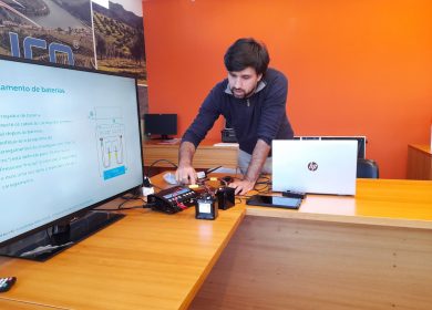
Post-Processing
Aerial data collected with the drones must be processed in order to be ready for analysis. We provide solutions and processes for the post-processing stage of your projects.
Ghostysky's CONTINUOUS CONSULTING PLAN (CCP)
1. Drone and accessories selection
Our professionals suggest drones and accessories that fits best the requirements of the client’s project.
2. Digital transation process plan
Based on the client’s project, a process plan is made for the digital transition and shared with the client.
3. Training sessions
Ghostysky provides training sessions for new drone pilots, but also for the use of other products like post-processing software.
4. Implementation support
Ghostysky help and support the implementation of the new processes with drones and accessories on client side.
5. Continuous follow-up
After new drone processes in place, Ghostysky will proceed with a continuous follow-up with clients in order to validate their good execution and evaluate possible improvements.
6. Project update, new requirements
On the continuous follow-up it’s possible to find new needs for the project. It’s also possible to have new needs based on new requirements.
Drones for all industries
Implementing drone technology in several industries
Aerial Photography & Videography
Allow for remarkably nimble flying, capturing images and giving access to areas that were not possible before.
Inspection
Allow inspection teams to stay on the ground and inspect assets from the drone's controller.
Spraying drones
Allow to automate the dispersal of agrochemicals with a high degree of accuracy, digitizing agriculture and smarter farming.
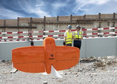
Surveying & Mapping
Using sensors, such as RGB or multispectral cameras, or LiDAR payloads, drones can capture quickly a huge amount of data.
Emergency Response
Can assist teams on site in managing the impact of a disaster/crisis both during and after the event.
Drone Light Show
Illuminated, synchronized, and choreographed groups of drones that arrange themselves into various aerial formations.
DATA
Significant
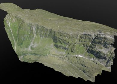
Photogrammetry
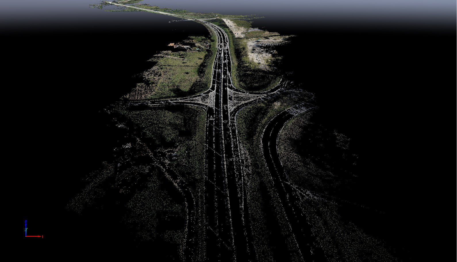
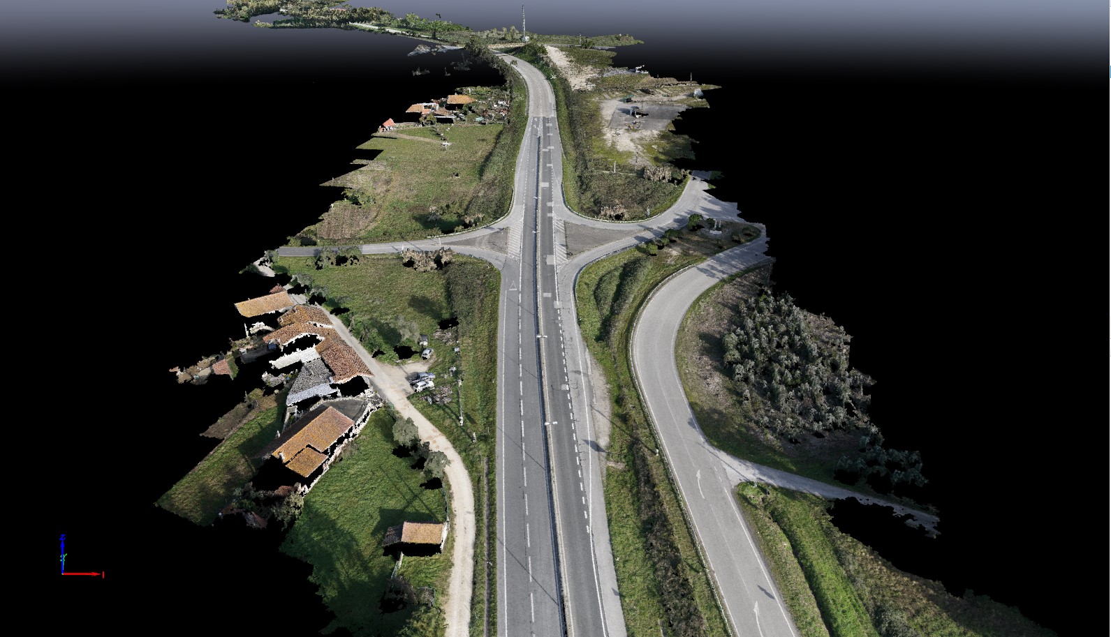
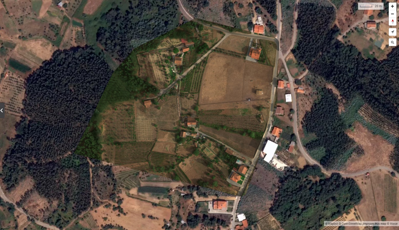
Photogrammetry cloud points, Orthomosaic, DTM or DSM are some outputs used in the visualization, monitoring and analysis of the project phases, being part of the core decision-making process.
Multispectral
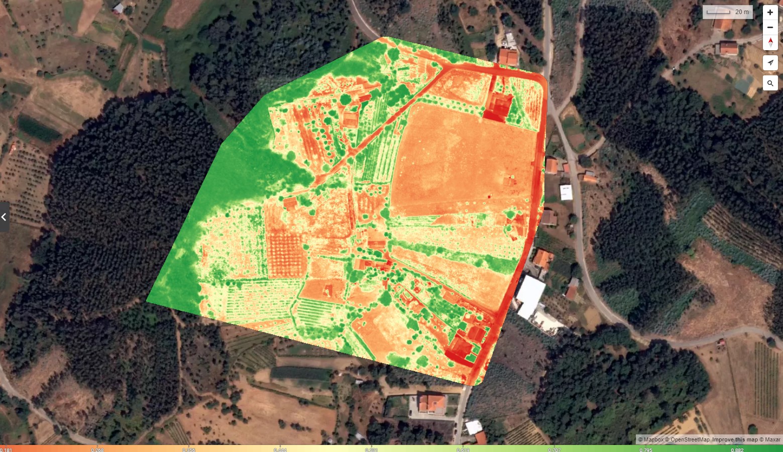
NDVI, NDRE or Chlorophyll map are some filters among otthers used in precision agriculture for the analysis and management of cultures. With data it’s possible to make decisions in order to mitigate future damages in cultures and increase plant ROI.
Lidar
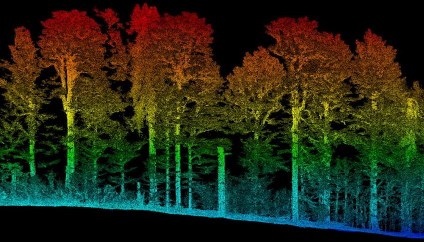
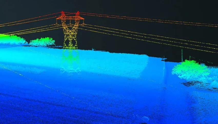
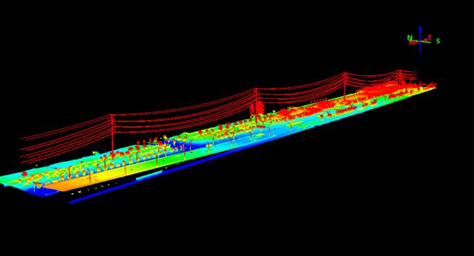
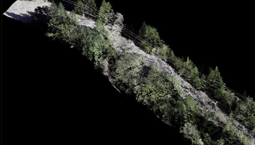
LiDAR can be used to create detailed maps of terrain, buildings, and other objects. This data can be used for a variety of purposes, such as planning construction projects, assessing damage from natural disasters, and monitoring environmental changes. Among the output data we could find Point clouds, DTMs, DSMs, Intensity images and Color images.
ROBOTS
Experience the future of productivity with our cutting-edge robotic solutions!
Humanoid Robots (Bipedal Mobility)
Robots designed to mimic human size and agility, leveraging powerful proprietary joint motors and advanced perception systems.
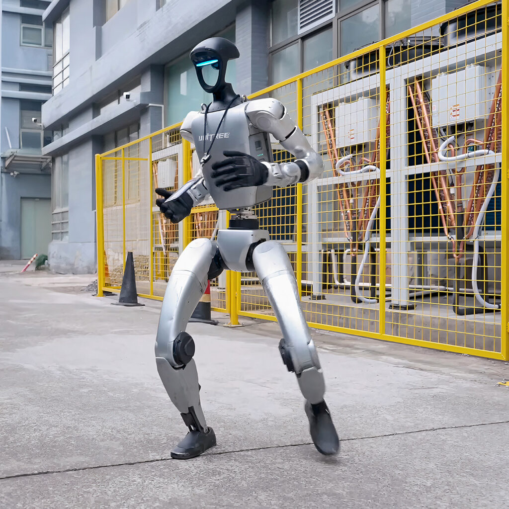
Designed to perform tasks and interact within environments built for humans.
Performing repetitive or physically demanding tasks in factories and warehouses, such as moving components or packing products.
Assisting with patient care, rehabilitation, performing routine checkups, and even surgical assistance
Used as platforms to study human biomechanics and cognition, or for missions in hazardous or distant environments like space exploration
Serving as customer service representatives in retail or hotels, or as educational assistants and companions in homes
Operating in conditions unsafe for humans, such as disaster relief or chemical plants
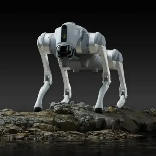
Robot dogs or quadruped robots
Robot dogs incorporate advanced technology to navigate and interact with their surroundings effectively.
From simple companion toys to sophisticated industrial tools!
In disaster zones (e.g., after earthquakes or building collapses), they can navigate unstable debris to locate survivors using thermal imaging and other sensors, relaying critical information to rescue teams
They can be deployed in dangerous or hard-to-reach areas like nuclear power plants, oil rigs, and mines to monitor infrastructure, detect gas leaks, and collect data, reducing risk to human workers
Used for autonomous patrolling, surveillance, and reconnaissance in military and law enforcement operations, helping to assess hazardous situations remotely and mark minefields
Consumer models provide companionship and emotional support, especially for the elderly or individuals who cannot own a real pet due to allergies or living situations
Used as platforms in academic and research settings to study robotics, AI, and biomechanics
Unmanned Ground Vehicles (UGVs)
Robotic systems that operate while in contact with the ground without a human operator physically on board.
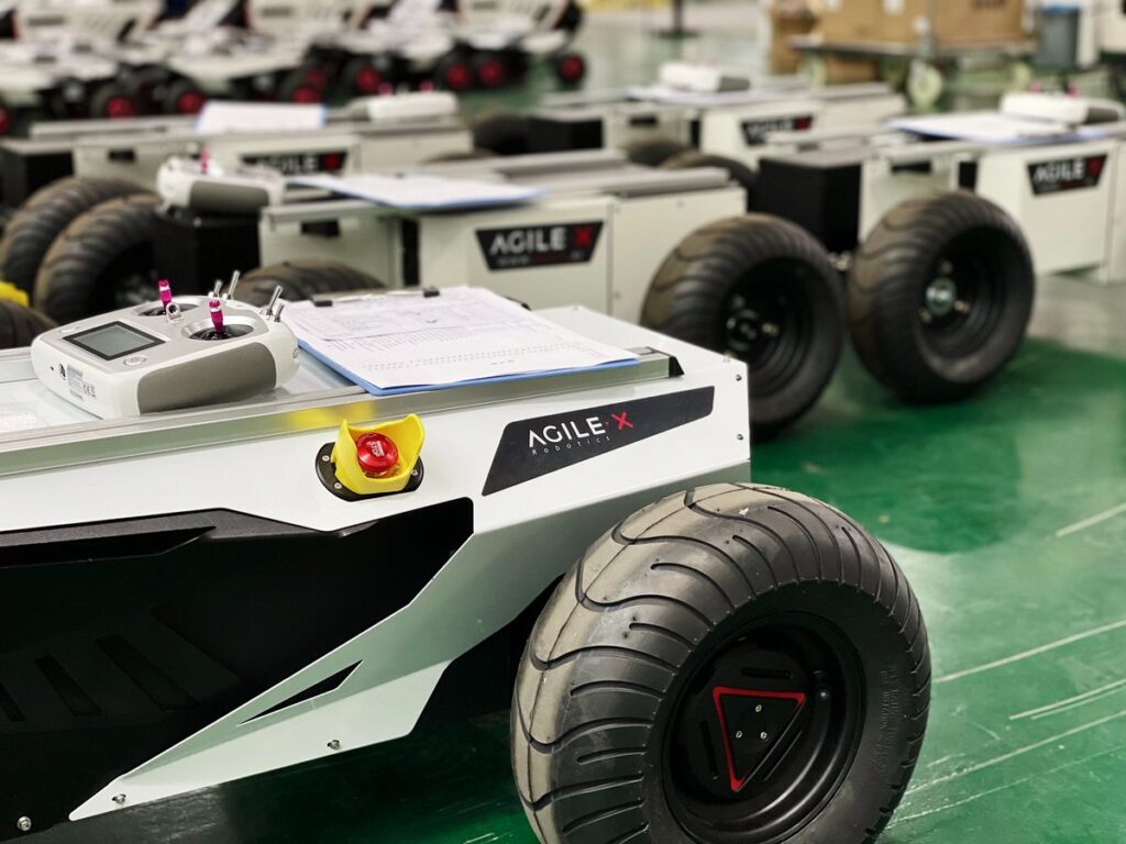
UGVs integrate several high-tech components to function effectively in diverse and challenging environments
Used in hazardous industrial environments like nuclear plants, mines, and oil rigs to monitor infrastructure and detect issues
Unmanned tractors and smaller robots are used for crop monitoring, spraying, and harvesting, operating around the clock to improve efficiency
Deployed in disaster zones (e.g., collapsed buildings, Fukushima nuclear accident site) to search for survivors and assess structural damage
Automated guided vehicles (AGVs) are extensively used to move goods and manage inventory in warehouses and manufacturing facilities
