

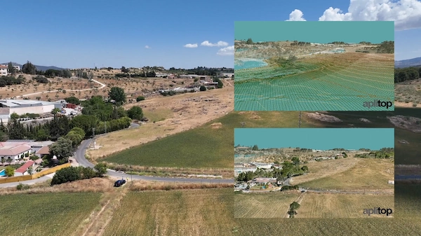
Key functionalities
- Generating contour lines
- Drawing longitudinal and transverse profiles
- Calculating volumes
- 3D visualization
- Creating slope maps
- GIS import and export
- Tools for working with parcels and various utilities
The included Surveying module enhances this package, offering specialized tools for topographic calculations and processing total station observations. This is highly beneficial for:
- Calculating point coordinates
- Compensating traverses and networks
- Performing coordinate transformations
This combined package is suitable for various projects such as roads, urbanizations, and quarries, and facilitates integration into OpenBIM workflows through file exchanges like IFC and LandXML.


Reviews
There are no reviews yet.