
Key Features
tcpMDT Standard: Digital Terrain Modeling & Analysis
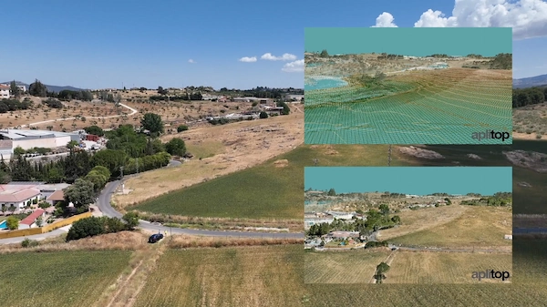
- Terrain Modeling: Create accurate Digital Terrain Models (DTMs) from diverse data sources, including total stations, GNSS receivers, file imports, and web services.
- Visualization & Contours: Generate detailed contour lines, create slope/height maps, and visualize the terrain realistically in 3D.
- Profiles & Volumes: Automatically draw longitudinal and transverse profiles and calculate cut and fill volumes for earthworks and quarry projects.
- CAD Integration: Functions as a powerful plug-in for major CAD platforms like AutoCAD, BricsCAD, GstarCAD, and ZWCAD, ensuring a familiar and efficient workflow.
- Data Exchange: Includes utilities for working with plots, as well as GIS import/export and OpenBIM integration via IFC and LandXML files.
Surveying Module: Advanced Topographic Calculations
- Observation Processing: Specialized tools for processing and managing total station observations.
- Coordinate Calculations: Efficiently calculate point coordinates and perform advanced topographic calculations.
- Network Compensation: Compensate traverses and geodetic networks for increased accuracy.
- Coordinate Transformations: Perform global and local coordinate transformations using the included EPSG database of reference systems.
NETWORK License: Flexibility & Collaboration
- The NETWORK license allows multiple users within an organization to share licenses, providing flexibility and cost-efficiency for project teams.
Ideal For
Surveying projects, Digital Terrain Modeling (DTM), contour line generation, volume calculations, earthwork analysis, plot management, and precise topographic data processing.


Reviews
There are no reviews yet.