

Key Features
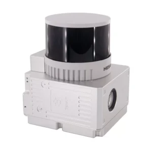
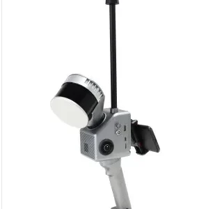
- Lightweight and Compact Design: With a weight of approximately 1.7kg (with battery), the GS-130G is designed for easy portability and flexible installation.
- High Accuracy: It boasts a point cloud accuracy of 5cm at 100m without control points and a range accuracy of cm.
- Versatile Operation: The system supports multi-platform and multi-mode operation, including handheld, backpack, multi-rotor (drone), and vehicle mounting, allowing for seamless indoor and outdoor mapping.
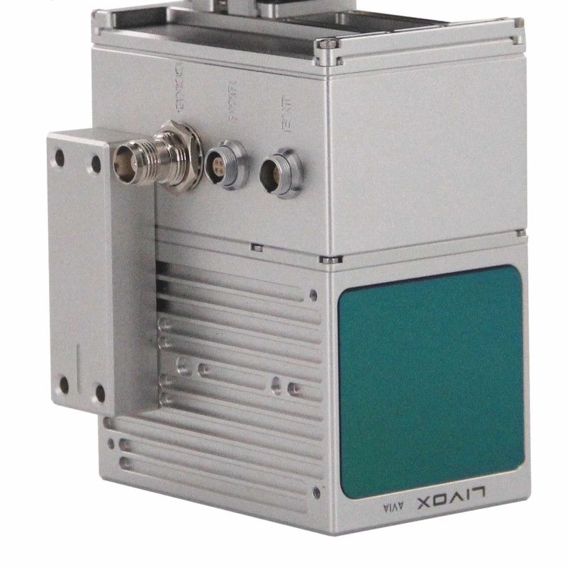
- Integrated Sensors: It combines a Hesai XT32 32-channel laser scanner, a Geosun gSpin 210 POS (GNSS + IMU) system, and a 2×20 MP built-in camera (or 3x5MP depending on the specific variant/series).
- Extensive GNSS Support: The POS unit supports multiple GNSS signals including GPS L1/L2/L5, GLONASS L1/L2, BDS B1C/B1/B2/B2a/B2b/B3, and GALILEO E1/E5b/E5a.
- High Point Rate: It can capture up to 1,920,000 points per second (triple echo), providing dense and detailed point clouds.
- Wide Field of View: The laser scanner offers a 360° horizontal FOV and 270° vertical FOV.
- Comprehensive Software: Includes Geosun’s self-developed gAirHawk Post-processing software (perpetual license) for trajectory processing and point cloud data output in LAS or custom TXT formats.
- Durable Build: Packaged in a suit case with EVA material liner, suitable for air and sea shipment.
Applications
The Geosun GS-130G is widely used for acquiring 3D spatial information in various fields, including:
- Surveying and Mapping: Topographic mapping, land surveying, and general 3D data collection.
- Digital City Construction: Creating detailed 3D models of urban environments.
- Forestry and Agriculture: Vegetation analysis, biomass estimation, and precision agriculture.
- Mining: Mine surveying and tunnel mapping.
- Power Line Patrol: Inspection and modeling of power infrastructure.
- Building Surveying: Capturing detailed interior and exterior building data.
- Stockpile Measurement: Calculating volumes of material stockpiles.
- Cultural Heritage Preservation: Digital modeling of historical sites and artifacts.
This video from Geosun Navigation introduces a lightweight backpack solution for the GS-100G/120G/130G LiDAR scanners, demonstrating its portability and ease of use in fieldwork.


Reviews
There are no reviews yet.