


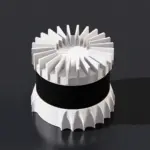
Product Overview
The XT32M1X belongs to Hesai’s “XT” (Extended) series, which utilizes proprietary ASIC (Application-Specific Integrated Circuit) technology. This design streamlines the internal hardware, significantly reducing weight and power consumption while improving reliability and data quality compared to traditional 16 or 32-channel sensors.
Its standout feature is the “Zero Blind Zone” capability, allowing it to detect objects even when they are in direct contact with the sensor’s housing—a critical advantage for indoor robotics and docking maneuvers.
Key Features
-
High Laser Density: Features 32 laser channels, providing double the vertical resolution of standard mid-range sensors.
-
Zero Minimum Range: Capable of valid detections from 0m to 120m, eliminating the typical 0.5m blind spot found in many competitors.
-
Survey-Grade Precision: Offers a range precision of 0.5 cm ($1\sigma$) and an overall accuracy of ±1 cm, making it suitable for high-fidelity 3D modeling.
-
Robustness: IP6K7 and IP6K9K rated for protection against water and dust, with a tested operational life exceeding 30,000 hours.
Technical Specifications
| Feature | Specification |
| Laser Channels | 32 |
| Detection Range | 0.05 m to 120 m (80 m @ 10% reflectivity) |
| Range Accuracy | ±1 cm |
| Range Precision | 0.5 cm ($1\sigma$) |
| Horizontal FOV | 360° |
| Vertical FOV | 31° or 40.3° (depending on specific model variant) |
| Angular Resolution | 0.18° (Horizontal) x 1.0° (Vertical) |
| Point Rate | 640,000 points/sec (Single Return) |
| Data Returns | Up to 2 (Single/Dual) |
| Power Consumption | ~10 W |
| Weight | ~800 g |
Common Applications
-
UAV Mapping & Surveying: Integrated into systems like the Inertial Labs RESEPI for creating topographic maps and infrastructure inspections.
-
Autonomous Mobile Robots (AMR): Used in logistics and service robots for navigation and obstacle avoidance in tight spaces.
-
Industrial Automation: Volume measurement for stockpiles or cargo, and safety monitoring in smart factories.
-
Smart Cities: Mounted on utility vehicles or stationary poles for traffic and pedestrian flow monitoring.
Note: If you are looking for the longer-range version, you may be interested in the XT32M2X, which extends the detection range up to 300 meters and is frequently used for high-altitude drone mapping.


Reviews
There are no reviews yet.