

Temos o prazer de anunciar o lançamento do DJI Zenmuse L3, um sistema LiDAR aéreo revolucionário que está prestes a redefinir a eficiência e a precisão em operações geoespaciais profissionais. Combinando um poderoso módulo LiDAR de longo alcance, duas câmeras RGB de alta resolução e um sistema de posicionamento proprietário de alta precisão, o Zenmuse L3 oferece uma solução completa e integrada para mapeamento de alta precisão em ambientes vastos e complexos.
Visão geral do produto: Precisão aliada à eficiência
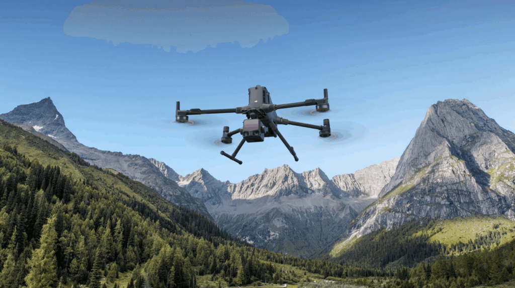
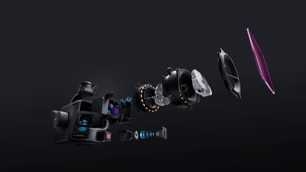
A Zenmuse L3 representa um grande salto tecnológico, integrando um LiDAR de 1535 nm de última geração e duas câmeras RGB de 100 MP em uma única carga útil compacta. Projetado para o DJI Matrice 400 e compatível com outras plataformas como o Matrice 350 RTK, o L3 amplia drasticamente o alcance operacional e a captura de detalhes.
-
Alcance sem precedentes: Obtenha um alcance máximo de detecção de 950 metros (Com refletividade de 10%), mais que o dobro de seu antecessor, permitindo voos mais seguros em altitudes mais elevadas, que ainda capturam detalhes excepcionais.
-
Câmeras duplas de 100MP: Os sensores CMOS RGB 4/3 duplos com obturador mecânico capturam imagens de altíssima resolução (até 12K), permitindo a geração de nuvens de pontos impressionantes e com cores reais, além de produtos fotogramétricos de alta qualidade, como mapas ortofotográficos digitais (DOM).
-
Penetração superior: Com uma posição de liderança no setor 16 retornos por pulso de laser e uma frequência máxima de emissão de pulso de 2 milhões de pontos por segundoO L3 proporciona uma densidade de pontos no solo incomparável sob vegetação densa, crucial para o mapeamento preciso do terreno em áreas florestais.
-
Fluxo de trabalho integrado: O L3 integra-se perfeitamente ao ecossistema da DJI, incluindo o D-RTK 3, o DJI Pilot 2 e o software de pós-processamento. DJI Terra e Modificar DJI, simplificando todo o fluxo de trabalho, desde o planejamento da missão até a entrega final dos dados.
Especificações técnicas (principais destaques)
| Recurso | Especificações | Impacto |
| Alcance de detecção do LiDAR (máx.) | 950 m (@ 100 kHz, refletividade 10%) | Permite voos mais altos, mais rápidos e mais seguros sobre grandes áreas. |
| Comprimento de onda do LiDAR | 1535 nm | Desempenho avançado de longo alcance e detecção aprimorada. |
| Frequência cardíaca máxima / Retornos | 2.000.000 pontos/s / Até 16 retornos | Excelente penetração no solo sob densa vegetação e captura de alto nível de detalhes. |
| Divergência do feixe LiDAR | 0,25 mrad (1/e²) | Tamanho de ponto muito pequeno para detecção precisa de objetos finos, como linhas de energia. |
| Precisão vertical | $ ≤ 3 cm $ (@ 120m de altitude, 1$\sigma$) | Oferece suporte a projetos de mapeamento profissional em escalas como 1:500. |
| Sistema de câmera RGB | Câmera dupla de 100 MP (sensor CMOS 4/3, obturador mecânico) | Captura simultaneamente imagens de alta resolução para nuvens de pontos em cores reais e ortofotos. |
| Campo de visão da câmera (horizontal) | 107° Ultra-amplo | Abrange uma área maior por disparo, aumentando significativamente a eficiência. |
| Cobertura diária máxima | Até $100 km²$ (com Matrice 400 a 300m de altitude) | Produtividade sem precedentes para projetos de grande escala. |
| Modos de digitalização | Linear, em forma de estrela, não repetitivo | Versatilidade para diferentes terrenos e requisitos de projeto (ex.: formato de estrela para penetração equilibrada). |
| Compatibilidade com drones | DJI Matrice 400, Matrice 350 RTK (e outros via SkyPort) | Integração com as plataformas de drones empresariais mais avançadas da DJI. |
Principais casos de uso: Transformando indústrias
O Zenmuse L3 foi projetado para atender às exigências rigorosas das aplicações empresariais modernas, oferecendo vantagens significativas em relação aos métodos tradicionais:
-
Levantamento topográfico e mapeamento em grande escala: Obtenha precisão de nível topográfico para Modelos Digitais de Elevação (MDE) e geração de curvas de nível, permitindo projetos de mapeamento em escalas de 1:500 a 1:2000 com velocidade e cobertura muito maiores.
-
Gestão Florestal e da Vegetação: A penetração superior e os até 16 retornos permitem a modelagem precisa do terreno oculto sob densas copas florestais, essencial para cálculos de volume, análise de espécies e monitoramento ambiental.
-
Inspeção de Energia e Infraestrutura: O pequeno tamanho do ponto do laser e o longo alcance são ideais para inspeção detalhada e modelagem 3D de ativos complexos, como linhas de energia, torres de transmissão, ferrovias e barragens, suportando inclusive recursos avançados como Modo de seguimento da linha de energia em grandes altitudes.
-
Monitoramento de Obras e Modelagem Urbana: Gere rapidamente modelos 3D altamente detalhados de canteiros de obras e áreas urbanas, fornecendo dados precisos para acompanhamento do progresso, medição de volume e planejamento urbano.
-
Resposta a emergências e gestão de desastres: Crie rapidamente reconstruções precisas de cenas em 3D e dados de terreno para investigação de acidentes e análises pós-desastre, fornecendo informações práticas mais rapidamente do que nunca.
Pronto para aprimorar suas operações geoespaciais?
O DJI Zenmuse L3 é mais do que um sensor; é um sistema integrado de inteligência aérea projetado para oferecer aos profissionais de topografia, engenharia e infraestrutura a ferramenta definitiva para eficiência e precisão.


