Principais recursos e capacidades
- Offline Functionality: The main advantage of this version is its ability to operate completely offline once the license has been activated and bound to the device. This makes it ideal for remote field operations, secure locations, or areas with poor network infrastructure.
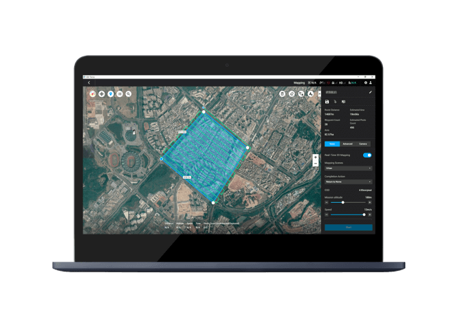
- High-Precision Reconstruction: DJI Terra uses advanced photogrammetry and reconstruction technologies, including 3D Gaussian Splatting, to create highly detailed and realistic 3D models, point clouds, and 2D orthomosaic maps from drone-captured imagery.
- Versatile Data Processing: The software supports a wide range of data types, including:
- Visible Light Imagery: Rapidly generates high-precision 3D models, point clouds, digital orthophoto maps (TDOM), and digital surface models (DSM).
- LiDAR Data: Integrates seamlessly with DJI LiDAR payloads to produce high-precision point clouds, 2D maps, and 3D mesh models from a single acquisition.
- Multispectral Data: Processes multispectral data from drones like the DJI Mavic 3 Multispectral to generate vegetation index maps (NDVI, NDRE) for agriculture and remote sensing research.
- Integrated Workflow: As a key component of the DJI Enterprise ecosystem, DJI Terra works in synergy with DJI drones and payloads to provide a complete solution for data acquisition, processing, and application, streamlining aerial surveying and mapping workflows.
- Analysis and Measurement Tools: Users can perform various measurements and analyses on their reconstructed models and maps, including linear, area, and volumetric measurements.
- Secure and Controlled Environment: By operating offline, this license provides enhanced data control, which is critical for sensitive projects in government, defense, or other secure sectors.
Ideal Use Cases
- Topografia e Mapeamento: Creating accurate maps and models for construction sites, infrastructure projects, and land surveys in remote areas.
- Inspeção de Infraestrutura: Generating detailed 3D models for inspecting power lines, bridges, and other critical infrastructure.
- Agricultura: Analyzing vegetation health and growth through multispectral data to optimize crop management.
- Public Safety: Providing quick, on-site 2D and 3D mapping for emergency response and search and rescue missions.
- Cultural Heritage: Creating precise digital twins of historical sites and artifacts for preservation and study.
Considerações importantes
- License Binding: The license is bound to a single computer’s hardware, and changing the motherboard, CPU, or hard drive will invalidate the license.
- Activation Process: While the software runs offline, the initial license exchange and activation require a temporary internet connection on a computer to generate and import the authorization file.
- Limited Online Features: Certain online features, such as unlocking GEO zones, map loading, and location searching, are not available in the offline mode.






Avaliações
Não existem opiniões ainda.