

Key Features and Capabilities:
- Comprehensive Point Cloud Management: Import point clouds and associated images from the most common industry formats (e.g., LAS, E57, TXT, RCS, PTS, etc.). Manage points based on attributes like color, intensity, time, and category. Apply transformations, rotations, and register multiple clouds using control points.
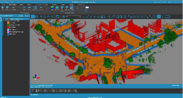
- AI-Powered Classification and Advanced Filtering: Utilize Artificial Intelligence models to automatically classify points in indoor and outdoor scenes (terrain, objects, etc.). Employ advanced filtering tools for noise removal, selection by geometry (window, polyline, sphere), and filtering by attributes.
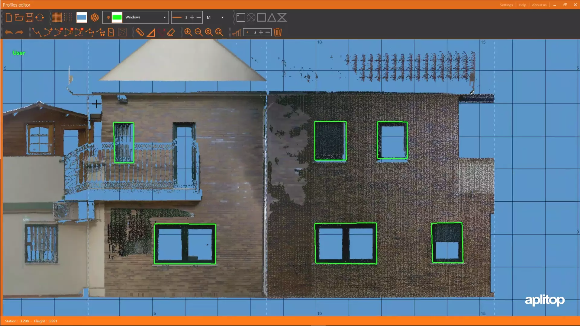
- Measurement, Drawing, and Vectorization: Measure and draw comfortably and precisely in 3D directly on the point cloud or 360º panoramic images using the built-in simple CAD environment. Optimize productivity with tools for automatic vectorization and the automatic extraction of entities.
- Digital Model Generation: Easily generate 3D surfaces, meshes (triangulation), and contour lines from the point cloud. Edit meshes interactively and apply symbology based on elevation, slope, orientation, or orthophotos.
- Profiles and Volume Calculations: Create quick profiles, longitudinal profiles, and cross-sections along alignments. Calculate volumes for stockpiles or determine cut and fill volumes between different models.
- CAD/BIM/GIS Compatibility & Sharing: Ensure seamless workflow integration by importing and exporting data in industry-standard formats such as DWG, DXF, LandXML, IFC, and GeoTIFF. Share your projects securely by publishing them to the cloud for viewing and inspection via a web viewer on any device.
- Synchronization: Optionally synchronize your work in real-time with leading CAD platforms like AutoCAD®, BricsCAD®, GstarCAD®, and ZWCAD®.
Tcp PointCloud Editor transforms raw point cloud data into actionable engineering insights, offering precision, efficiency, and flexibility for complex projects.


Reviews
There are no reviews yet.