


Key Features and Applications
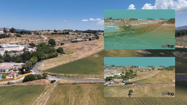
- Digital Terrain Modeling (DTM): Create and analyze DTMs using points measured by total stations, GNSS receivers, imported files, or web services.
- Topographic Analysis: Generate contour lines, draw longitudinal and transverse profiles, visualize terrain in 3D, and create slope maps.
- Volume Calculation: Calculate volumes for cut and fill (excavations and embankments) for various projects like roads, quarries, and urbanizations.
- Data Processing: Import and process data from a wide range of surveying instruments. The specialized TcpMDT Surveying module includes tools for coordinate transformations and processing total station observations.
- Civil Engineering Design (Professional Version): Includes advanced tools for:
- Designing horizontal and vertical alignments (roads, canals, etc.).
- Drawing project templates and cross-sections.
- Generating area and volume reports.
- Stakeout and setting-out reports.
- Designing water, sewerage, and rainwater networks.
- GIS Integration: Import and export GIS files for enhanced project context.
- OpenBIM Workflow: Easily integrates into OpenBIM workflows through the exchange of industry-standard files like IFC and LandXML.
Benefits:
- Increased Productivity: Streamline workflows from field data to final design and reporting.
- Flexibility: Modular structure allows users to choose the necessary options for their specific work.
- Compatibility: Functions as a robust plug-in on major CAD platforms.
- Versatility: Suitable for all types of surveying projects, including roads, urban developments, and mining/quarry operations.
In essence, Aplitop tcpMDT Surveying empowers surveyors and civil engineers with the advanced functionality needed to accurately model terrain, design infrastructure, and manage project data within a familiar CAD environment.


Reviews
There are no reviews yet.