Key Features and Capabilities
- Offline Functionality: Once the license is activated, all key mapping and modeling functions can be used without a continuous internet connection. This makes it ideal for remote work sites, secure environments, or situations where internet access is unavailable or unreliable. Note that some online-dependent features, such as unlocking GEO zones or map loading, are not available in this mode.
- Permanent License: Unlike subscription-based models, this is a one-time purchase that grants a permanent license for the software. This ensures business continuity and a single, long-term investment without recurring fees.
- High-Precision 2D and 3D Reconstruction: The software supports the rapid and accurate generation of:
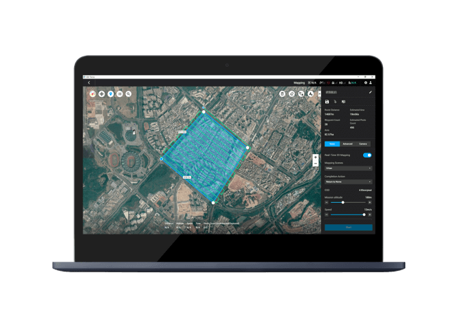
- 2D Orthomosaics: Create high-resolution 2D maps for detailed inspections, surveying, and planning.
- 3D Mesh Models: Generate detailed 3D models of buildings, terrain, and infrastructure from visible light imagery.
- LiDAR Point Cloud Processing: It can process and integrate data from DJI’s Zenmuse LiDAR systems (e.g., L1, L2) to produce highly accurate point clouds, 2D maps, and 3D models, enabling precise mapping for various industries.
- Multispectral Reconstruction: For agricultural and environmental applications, the software can process multispectral data from drones like the DJI Mavic 3M and Phantom 4 Multispectral to generate vegetation index maps (NDVI, NDRE) and reflectance maps for crop health analysis and research.
- Seamless Hardware Integration: DJI Terra works seamlessly with a range of DJI Enterprise drones and payloads, including the Matrice 300 RTK, Matrice 350 RTK, Matrice 3E, Matrice 3M, Matrice 4E, Zenmuse P1, and Zenmuse L2. This provides a unified and efficient hardware-software solution for data acquisition and processing.
- Versatile Applications: The software is a one-stop solution for a wide range of industries, including surveying, construction, agriculture, energy, infrastructure inspection, and cultural heritage preservation.
System Requirements:
- Operating System: Windows 10 or later (64-bit).
- RAM: 32 GB of RAM or more is recommended for optimal performance.
- GPU: An NVIDIA graphics card with at least 4 GB of GPU memory and a compute capability of 6.1 or higher is required.
The DJI Terra Standard Permanent (Offline) license is the ideal choice for professionals who need a reliable, secure, and self-contained mapping and modeling solution for long-term projects and operations in challenging or sensitive environments.



Reviews
There are no reviews yet.