
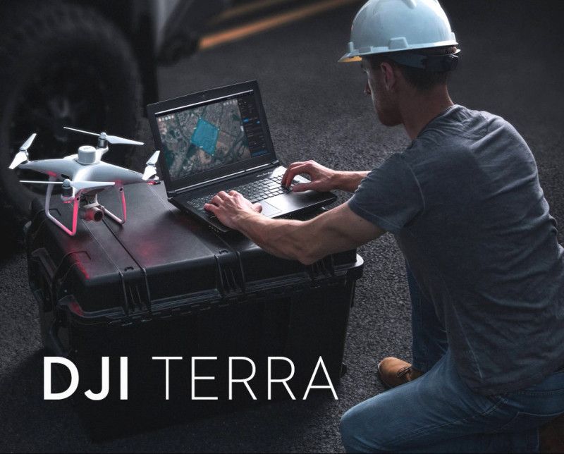
Key Features and Capabilities:
Permanent Offline License: A one-time purchase granting a perpetual (permanent) license. Once activated via an offline exchange process, the software’s full capabilities can be utilized without any ongoing internet connection, ensuring data security and operational continuity in the field.
- Flagship-Level Features: Provides the most comprehensive set of tools within the DJI Terra ecosystem, including:
- Photorealistic Gaussian Splatting: Utilizes next-generation reconstruction technology to quickly generate incredibly detailed and realistic 3D models from drone photos, accurately restoring complex elements like fine structures, transparent/reflective objects, and vegetation.
- LiDAR Point Cloud Reconstruction: Processes and integrates data from DJI LiDAR payloads (e.g., Zenmuse L1/L2) to generate high-precision point clouds, 2D maps, and 3D mesh models from a single acquisition.
- LiDAR + Photogrammetry Fusion: Seamlessly combines LiDAR point clouds with visible light data for the most accurate and rich 3D models.
- Electricity Module: Includes specialized functions and tools for the inspection and modeling of power and infrastructure assets.
- Multi-Device Management/Cluster Processing: The Flagship version supports connectivity and distributed processing across multiple devices (up to 10 devices are often cited) for superior efficiency and the ability to handle massive, city-scale projects.
- Multispectral Reconstruction: Processes data from multispectral drones (e.g., Mavic 3 Multispectral) to generate vegetation index maps (NDVI, NDRE) and reflectance maps for precision agriculture and environmental analysis.
- High-Fidelity Mapping and Modeling: Rapidly generates high-precision outputs including:
- 2D Orthomosaic Maps (TDOM)
- Digital Surface Models (DSM) and Terrain Output
- High-Precision 3D Mesh Models
- Point Clouds
- Seamless DJI Ecosystem Integration: Works in conjunction with a wide range of DJI Enterprise drones and payloads (such as Matrice series, Zenmuse P1, Zenmuse L2) to provide an efficient, unified hardware and software solution for data acquisition and processing.
- Centimeter-Level Accuracy: Achieve survey-grade accuracy, often meeting 1:500 mapping standards, especially when utilizing DJI RTK-enabled drones.
Ideal For:
Professionals in surveying, construction, mining, public safety, and energy who require a secure, reliable, and powerful mapping solution for long-term projects in environments with no or restricted network access.


Avaliações
Não existem opiniões ainda.