

Global Mapper Pro is a powerful tool that can be used for a wide range of applications, including:
- Surveying and mapping: Global Mapper Pro can be used to create accurate maps and surveys from a variety of data sources, including imagery, LiDAR, and GPS.
- 3D modeling: Global Mapper Pro can be used to create 3D models of terrain, buildings, and other features.
- Site planning and analysis: Global Mapper Pro can be used to analyze terrain, identify potential hazards, and plan development projects.
- Environmental monitoring: Global Mapper Pro can be used to monitor changes in the environment over time.
If you are a geospatial professional who needs advanced tools for working with imagery, terrain, and LiDAR data, then Global Mapper Pro is a great option.
Global Mapper Pro
All the great features of standard plus…
 Terrain painting Breakline calculation Advanced querying, editing, segmenting, and filtering of lidar and 3D point clouds Automatic classification of point cloud data including ground, vegetation, buildings, power lines, and poles Vector feature extraction from classified point cloud data Lidar noise identification and removal Variography and Kriging Point cloud thinning and vertical and horizontal rectification of point cloud data Automatic alignment of overlapping point clouds Visual analysis of point cloud data, including by local density, height above ground, intensity, and classification Point cloud profiling Pixels to Points® – Drone/UAV imagery processing to create 3D point clouds, orthoimage, and 3D model Advanced automated vectorization of imagery and terrain Support for RTK devices and display of satellite constellation Built-in editor for Global Mapper scripts Support for Python scripting Script Builder tool to record actions in Global Mapper Script Streamlined mobile data merging
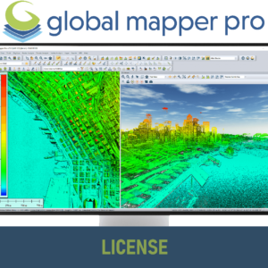


Reviews
There are no reviews yet.