


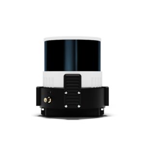
- High-Resolution Imaging: The Wingtra RG61 camera features an impressive 61-megapixel image sensor, delivering unparalleled image clarity and detail. With this high resolution, professionals can capture data with exceptional accuracy, enabling precise mapping, inspections, and topographic surveys.
- Advanced Sensor Technology: Equipped with advanced sensor technology, the RG61 camera ensures superior image quality and color accuracy. It captures vibrant, true-to-life colors and faithfully represents the subtle details of the environment, providing users with accurate and realistic imagery.
- Seamless Integration: The RG61 camera seamlessly integrates with the WingtraOne drone platform, offering a comprehensive aerial mapping solution. The camera and drone work in perfect harmony, providing stability, synchronization, and optimized performance for reliable data capture.
- Powerful Data Processing: Wingtra’s robust data processing software complements the RG61 camera, streamlining the workflow from image capture to final outputs. Users can efficiently generate high-quality orthomosaics, 3D models, and point clouds, enabling detailed analysis and insights.
- Versatility and Application Flexibility: The RG61 camera caters to a wide range of professional applications, including land surveying, infrastructure inspection, environmental monitoring, and more. Its versatility empowers users to tackle diverse projects with precision and confidence.
- Reliable and Trusted Solution: Wingtra is renowned for providing reliable and accurate aerial mapping solutions. The RG61 camera upholds this reputation, offering professionals a dependable tool for their mapping and surveying needs, backed by Wingtra’s commitment to excellence.
The Wingtra RG61 camera is a game-changing solution for professionals seeking exceptional image quality and precise data capture in their aerial mapping projects. With its high-resolution imaging, advanced sensor technology, seamless integration with the WingtraOne platform, and powerful data processing capabilities, the RG61 camera empowers users to elevate their aerial mapping workflows and achieve unprecedented results.
SPECS
Sensor type -> Full-frame
GSD range* -> 0.7 – 11 cm/px
Coverage at lowest GSD -> 110 ha at 45 m altitude
Resolution -> 61 MP
Best absolute accuracy** -> 1 cm / 3cm horizontal / vertical
Coverage at 120 m -> 310 ha at 1.9 cm/px GSD*
Faster mission
Limited project time? RGB61 is customized to cut your field time. All of this with the same ultra-high accuracy Wingtra customers have grown to depend on.
| 30% faster missions than RX1R II* |
Larger area mapped
Big projects are no match for the RGB61, which covers more ground on one set of charged batteries.
| 1.4 x more coverage than RX1R II* |
Lighter data load
Cut your processing time dramatically. Each photo taken by the RGB61 is larger, so the drone flies fewer lines, taking fewer images to cover the same area.
| 40% data load than RX1R II* |
* Wingtra’s previous leading-edge payload, at the same height and overlap settings.
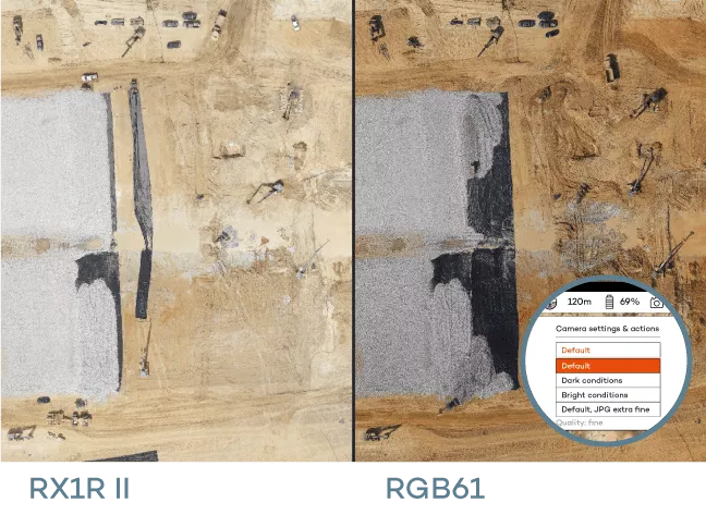
Intuitive in-app light settings
On sunny or cloudy days, choose RGB61 lighting levels right in the app. Plus, its high-quality lens enables better color saturation and contrast for sharp details.


Reviews
There are no reviews yet.