
Images
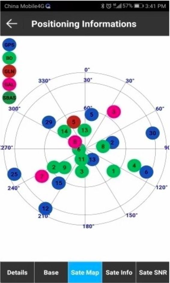
Support GPS, Glonass, Galileo, BeiDou, QZSS and SBAS
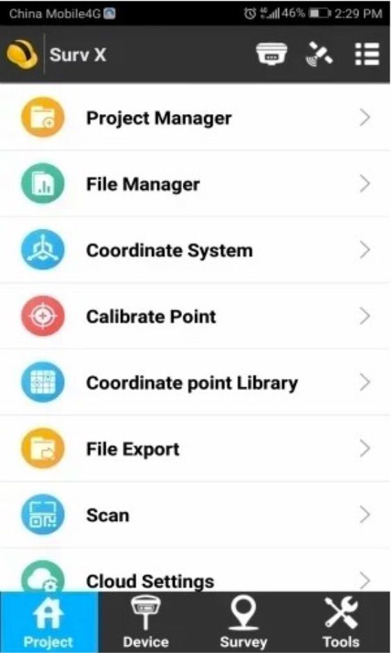
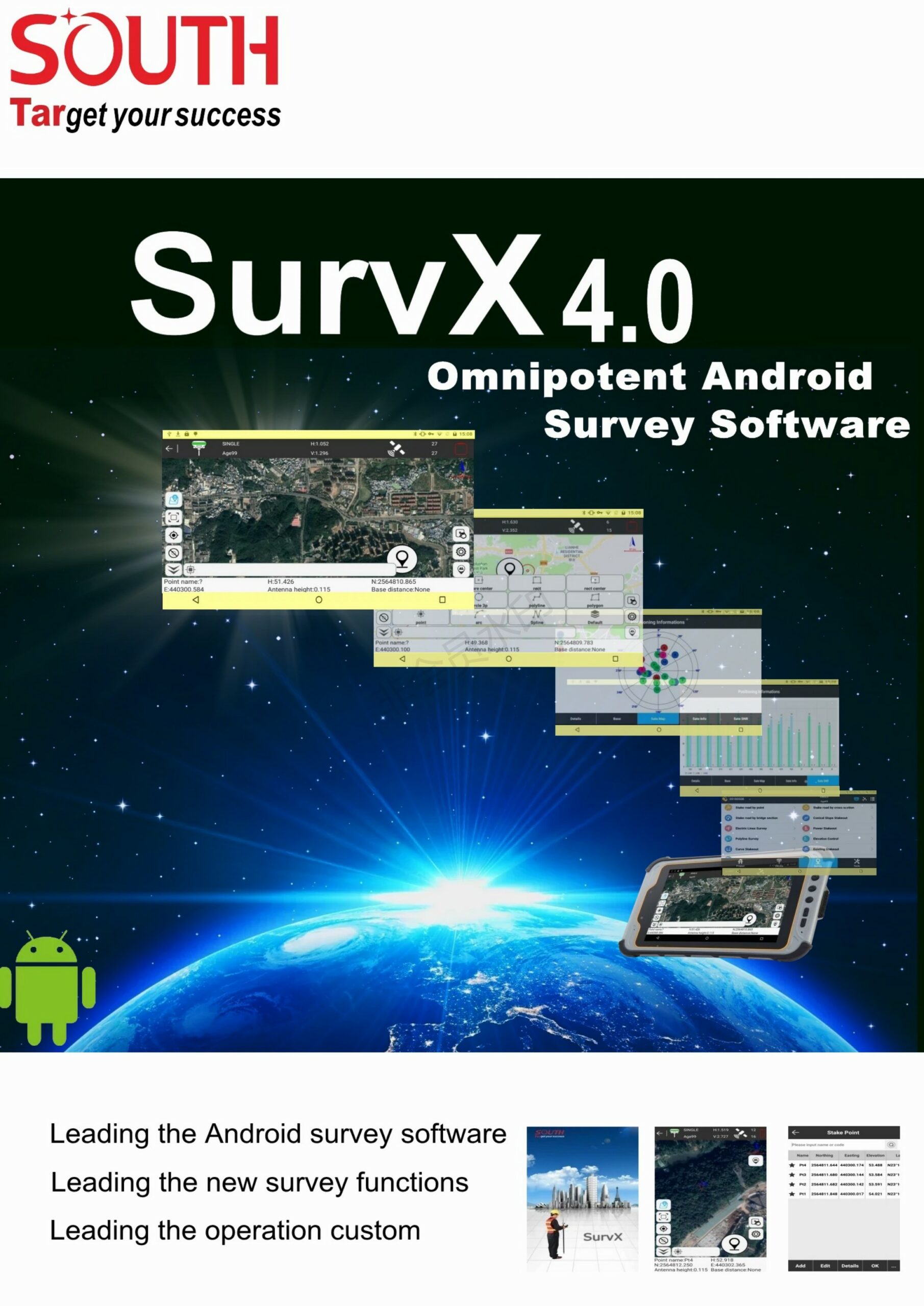
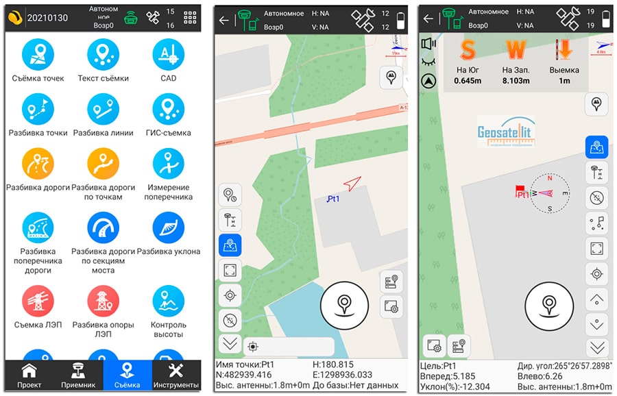
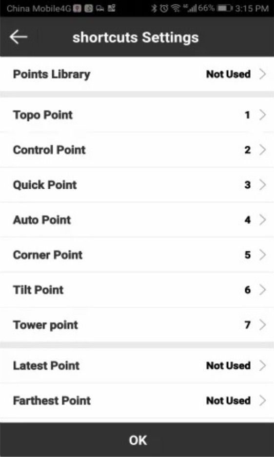
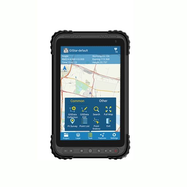
Simple interface makes it an easy to use application for everyone
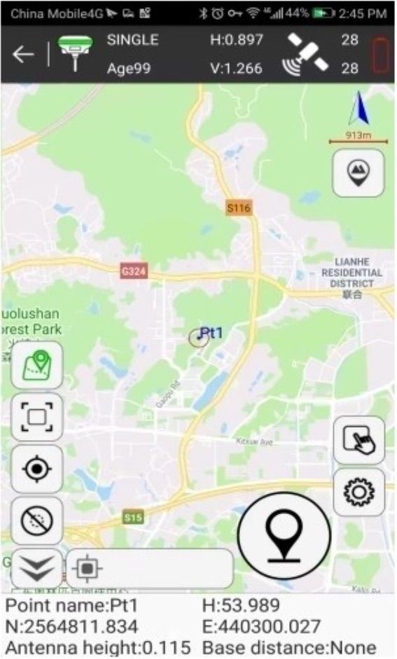
Supports the well known Google Maps as a background layer
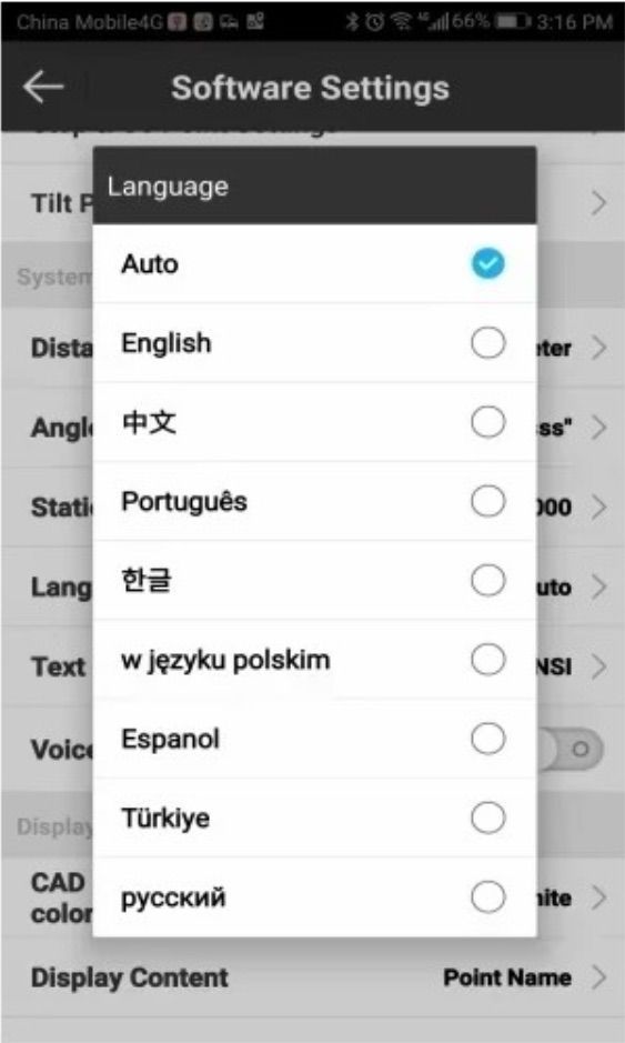
Most international languages are supported with SurvX
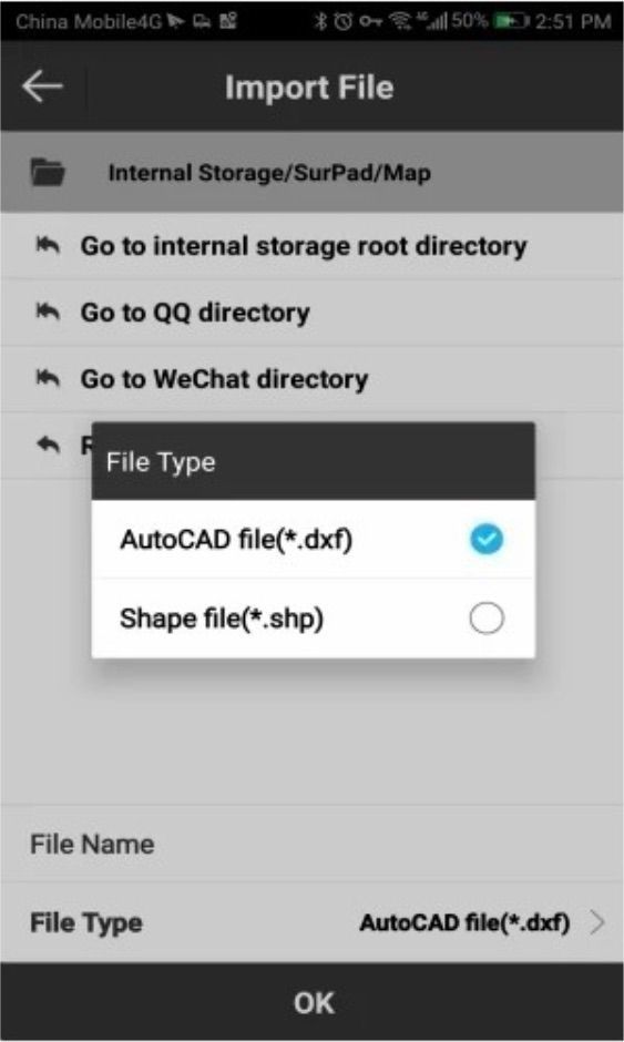
Import .DXF and .SHP files for easy stakeout and point collection
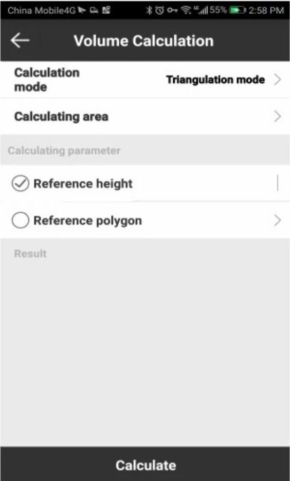
On-The-Go calculations whenever you need to calculate something
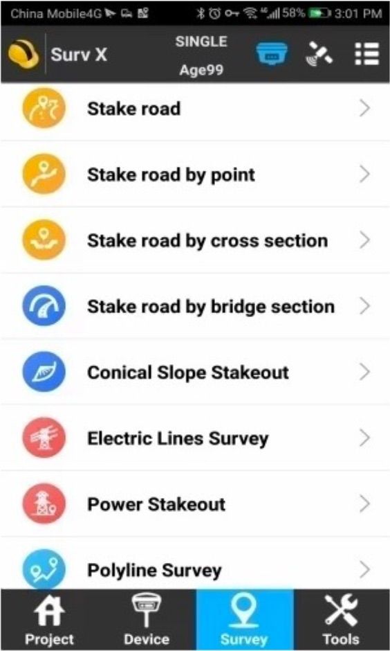
A stakeout function for any type of job. making it easy for you.


Reviews
There are no reviews yet.