


Key Features & Benefits
- Ultimate Versatility (Sky-to-Ground Integration): The lightweight and compact design allows for seamless operation across multiple platforms:
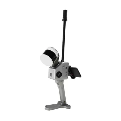
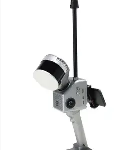
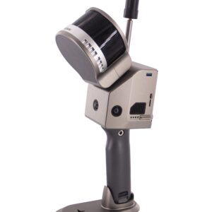
- Handheld: Perfect for rapid indoor, tunnel, and close-range outdoor mapping.
- UAV/Drone: Easily mountable on multi-rotor platforms for large-scale aerial surveys.
- Backpack/Vehicle: Adaptable for mobile mapping in complex urban or industrial areas
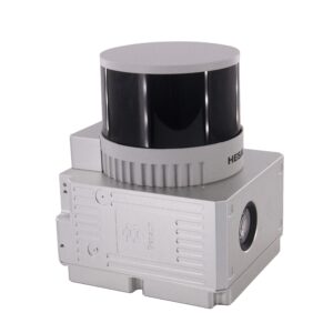
- High-Density Data Capture: Equipped with a 32-channel laser unit (Hesai XT32), the GS-130G captures up to 1,920,000 points per second (triple echo), ensuring dense, reliable, and high-resolution 3D point cloud data.
- Centimeter-Level Accuracy: Features a sophisticated GNSS/INS (gSpin 210 POS Unit) fusion algorithm combined with advanced SLAM algorithms, achieving high absolute position accuracy:
- Range Accuracy: 1 cm
- Horizontal Position Accuracy: 0.02 m
- Extended Range: Offers a powerful detection range of up to 300 meters, providing efficient coverage for large projects, power line inspection, and mining surveys.
- Seamless Operation: The system features a 360° Horizontal and 270° Vertical Field of View (FOV), ensuring comprehensive data collection without blind spots, regardless of the operating environment (indoor, outdoor, or underground).
- Intuitive Workflow: Supports real-time preview via an accompanying mobile application and comes packaged with Geosun’s specialized post-processing software (like gAirHawk), simplifying trajectory calculation and point cloud optimization.
Technical Specifications Summary
| Component | Specification |
| Laser Sensor | HESAI XT32 (32 Channels) |
| Point Rate | Up to 1,920,000 Points/Sec (Triple Echo) |
| Max Range | 300 meters |
| Range Accuracy | 1 cm |
| Weight | Approx. 1.7 kg (with battery) |
| Positioning System | GNSS+INS (gSpin 210) |
| Carrying Platforms | Handheld, Multi-rotor UAV, Vehicle, Backpack |
| Data Storage | 128GB (Support up to 256GB microSD) |
The Geosun GS-130G is the professional choice for organizations requiring high-precision 3D digital modeling, including Topographic Surveying, Mining Tunnel Survey, Digital City Construction, Power Line Patrol, and Building Surveying.


Reviews
There are no reviews yet.