
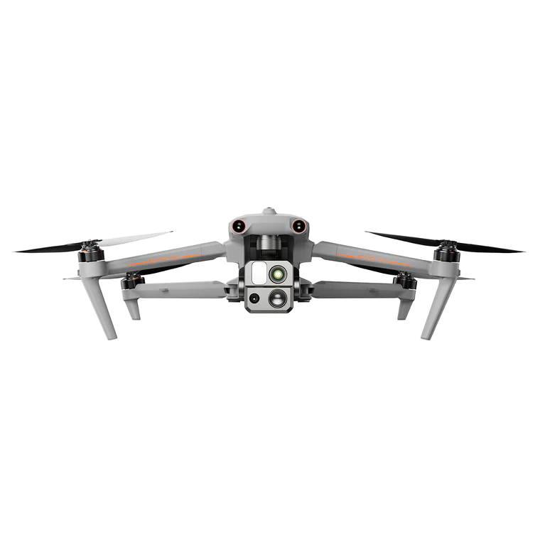
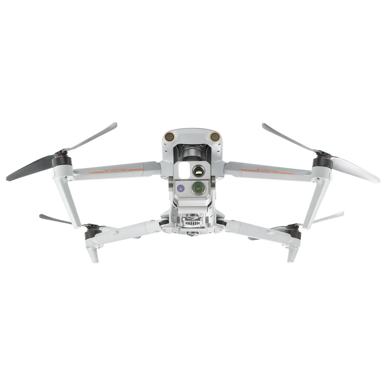
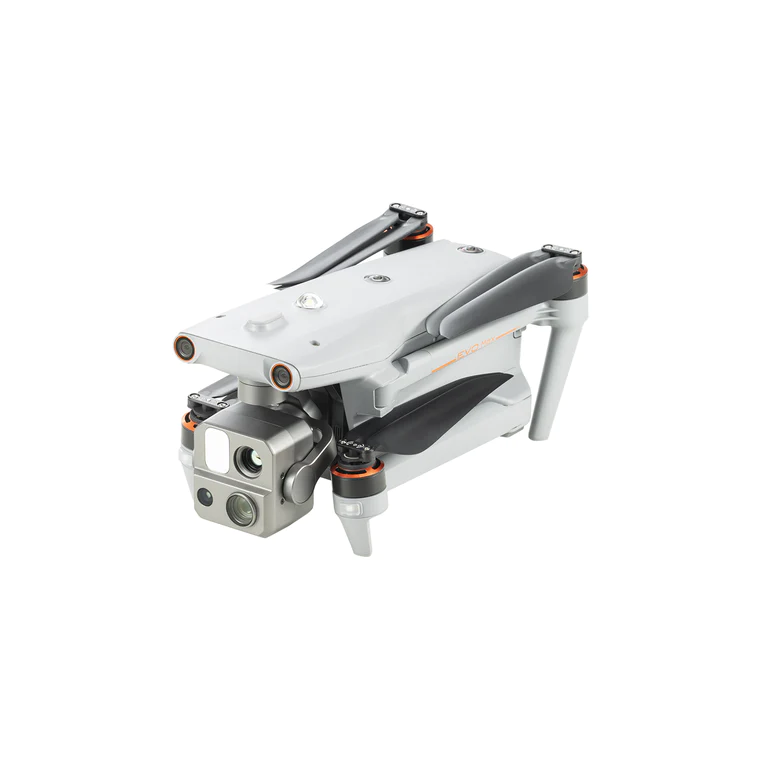
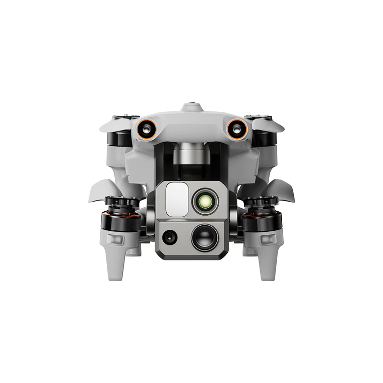
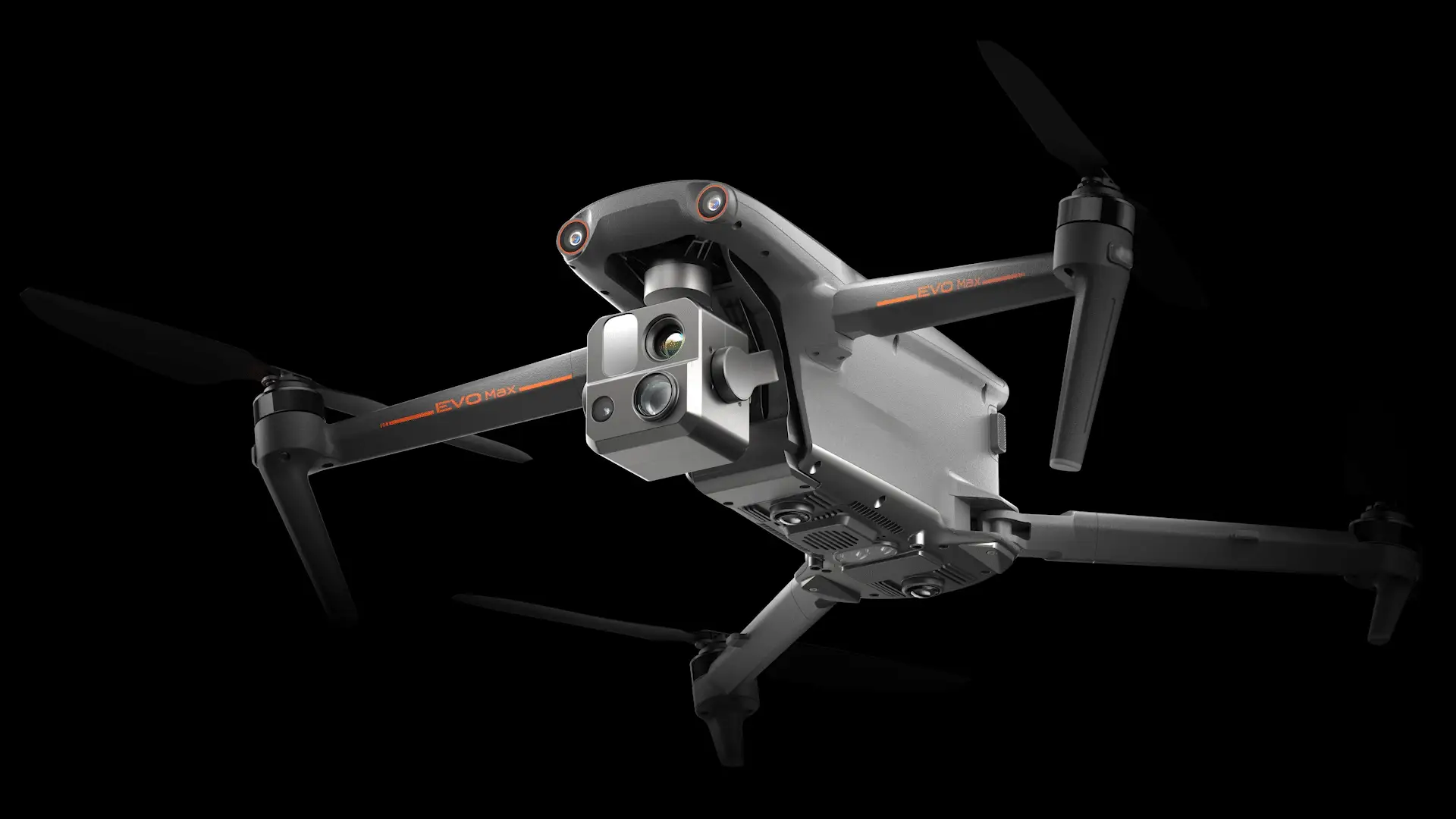
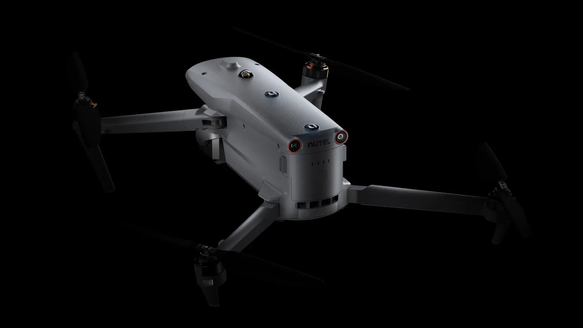
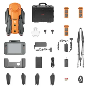
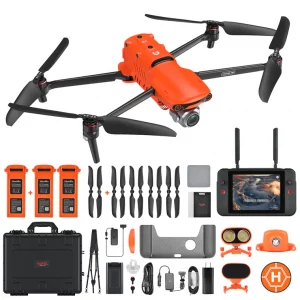
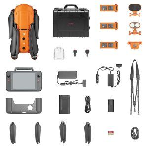
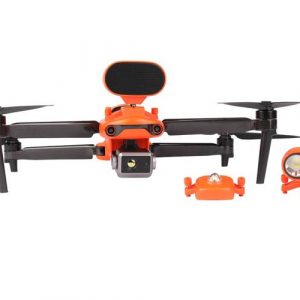
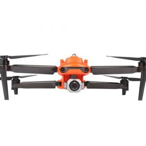
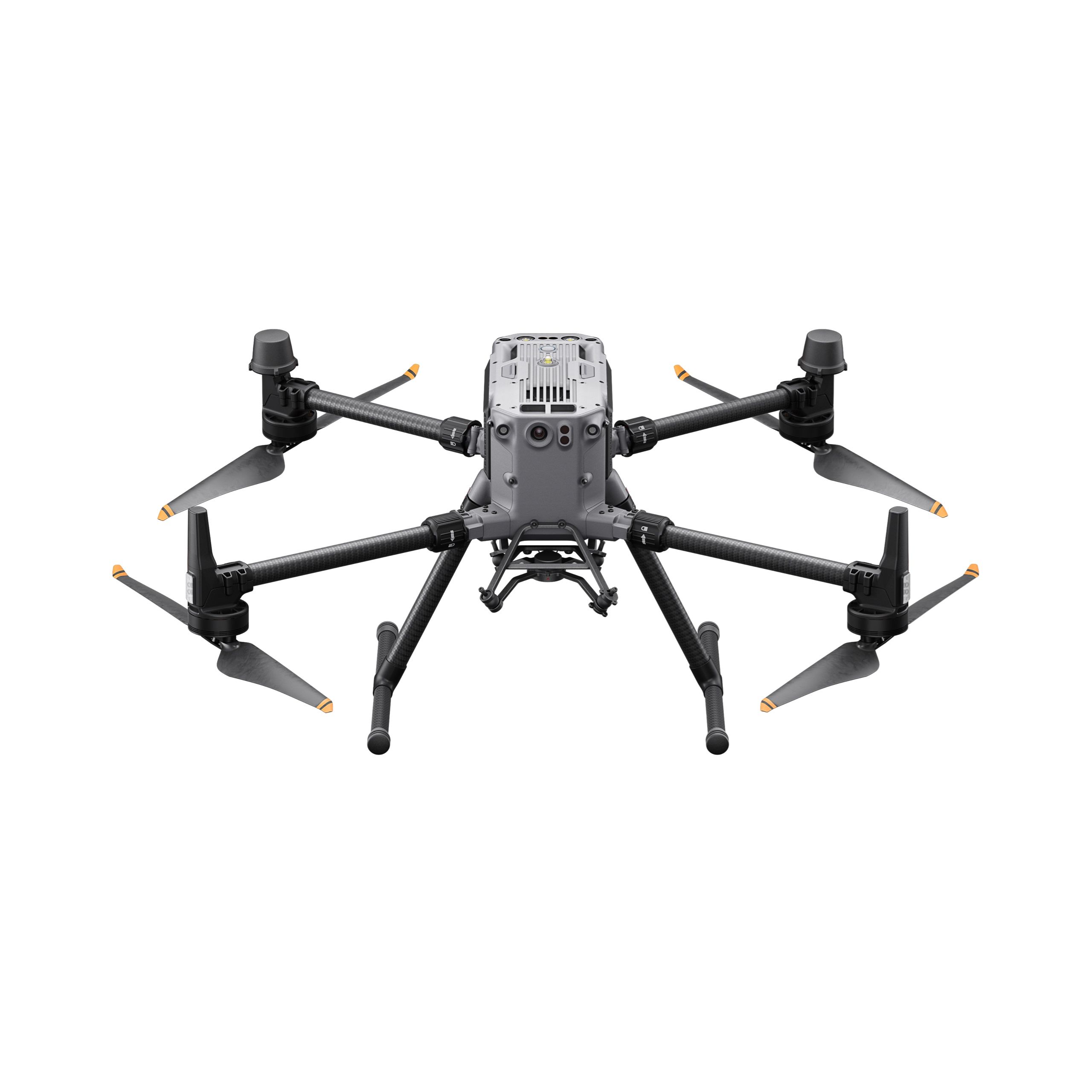
AUTEL EVO MAX 4T
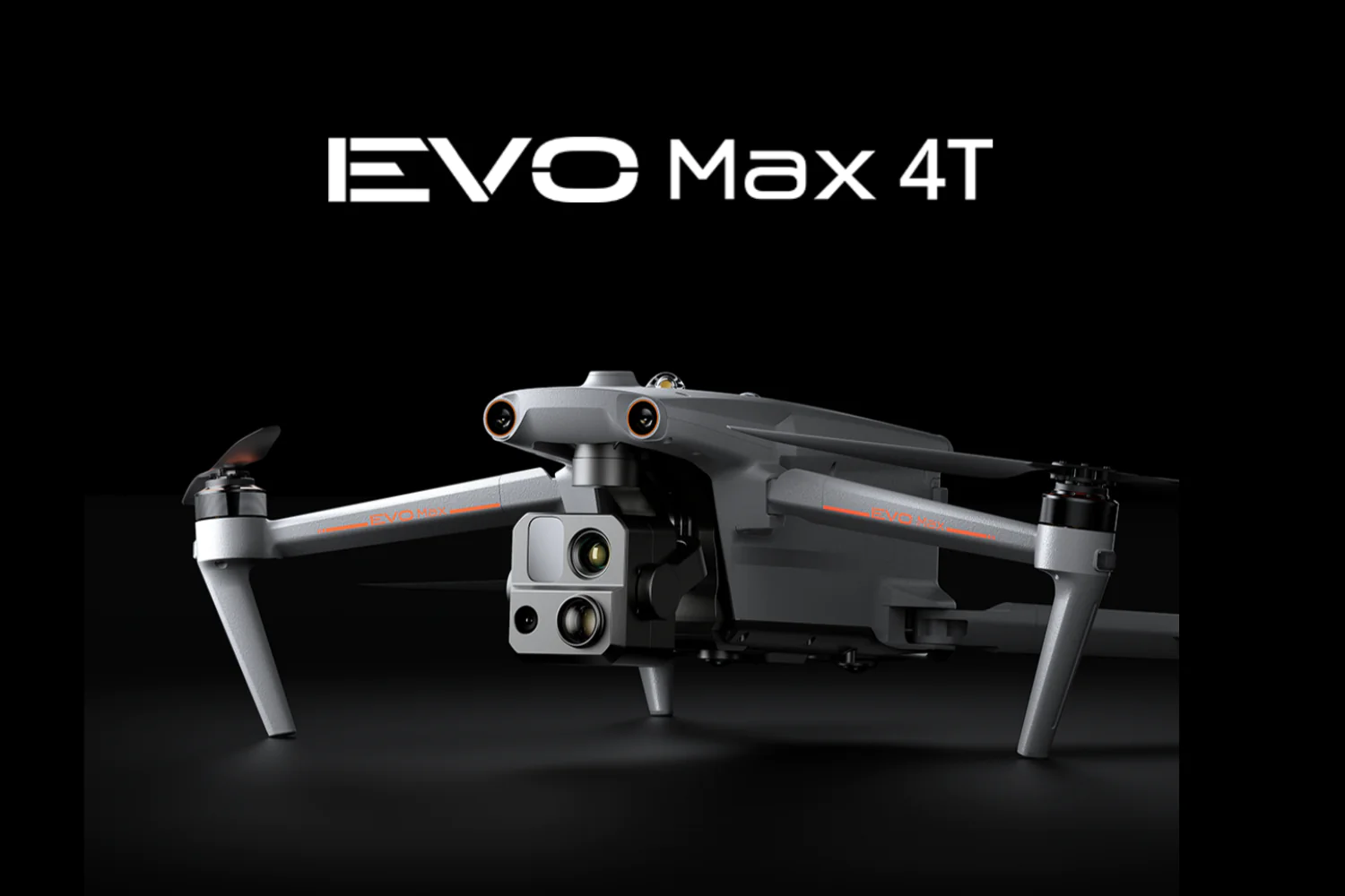
EVO MAX 4T –A Leader of Drone Intelligence
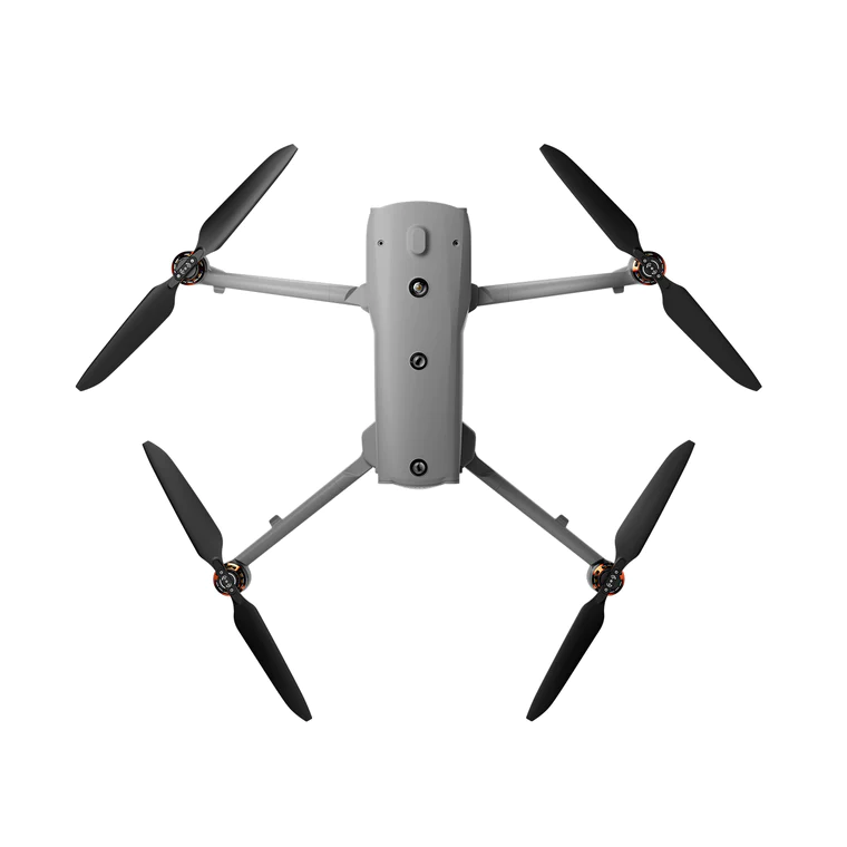
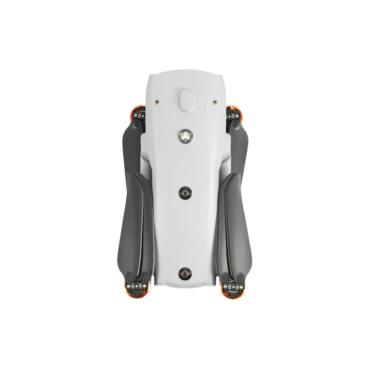
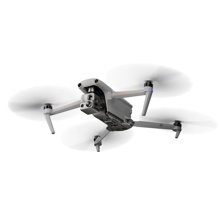
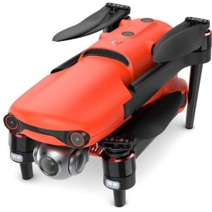
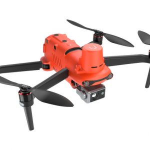
The EVO Max 4T brings powerful technologies and advanced autonomy to users. EVO Max 4T assesses complex environments to create real-time 3D flight paths for unparalleled obstacle avoidance.Advanced sensors make flight in GPS unavailable areas possible and the incredible new thermal payload unlocks new object identification and tracking scenarios.With a foldable, weather-resistant design, the EVO Max 4T is as portable as it is capable.
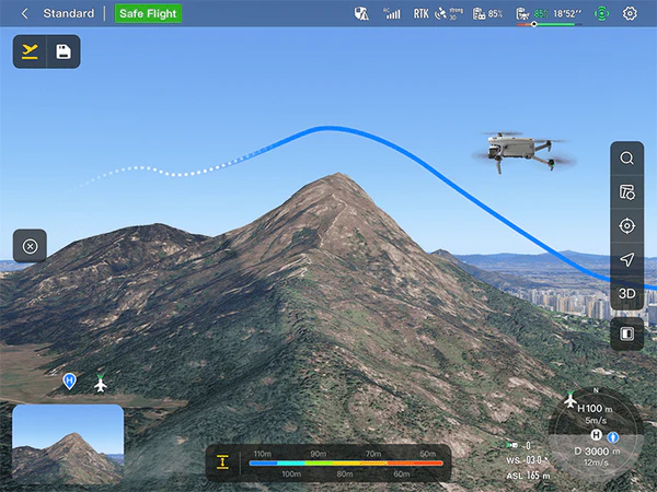
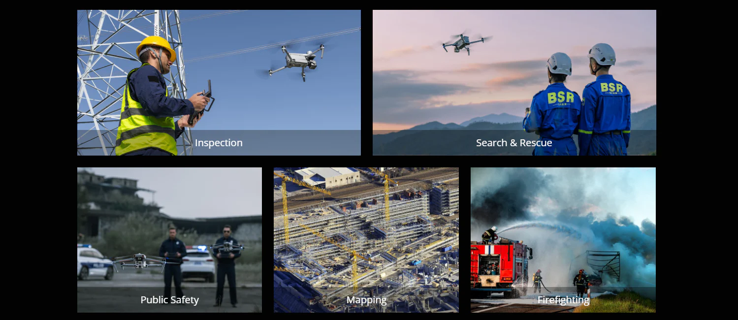
Autonomous Path Finding:Autel’s Autonomy Engine collects surrounding environmental data and plans 3D flight paths through complex environments such as mountains, forests, and buildings. Use cases include rapid 3D scene reconstruction, public safety overwatch, industrial inspection, and land surveying.
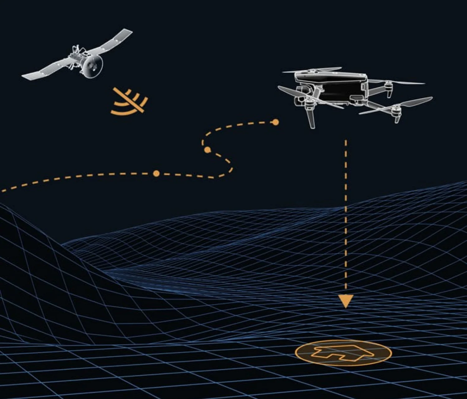
Navigation in GPS Denied Environment: Advanced sensors allow the EVO Max 4T to navigate within hardened structures, underground, or in environments without GPS.
Accurate Object Identification and Tracking : Based on Autel’s AI recognition technology, the EVO Max 4T can automatically identify and lock onto different types of targets such as heat sources, moving people, or vehicles and achieve high-altitude tracking and data collection for law enforcement.
![]()
No Blind Spots-Ultimate Obstacle Avoidance
EVO Max 4T is the only commercial drone that combines traditional binocular vision systems with millimeter wave radar technology. This allows the EVO Max 4T’s onboard Autel Autonomy Engine to perceive objects down to 0.5 inch, eliminating blind spots and enabling operation in low light or rainy conditions.
Anti Jam-Anti Interference
The EVO Max 4T uses advanced flight control modules and algorithms specially designed to counter RFI, EMI, and GPS spoofing. This enables the EVO Max 4T to fly confidently near power lines, critical structures, and in complex areas.
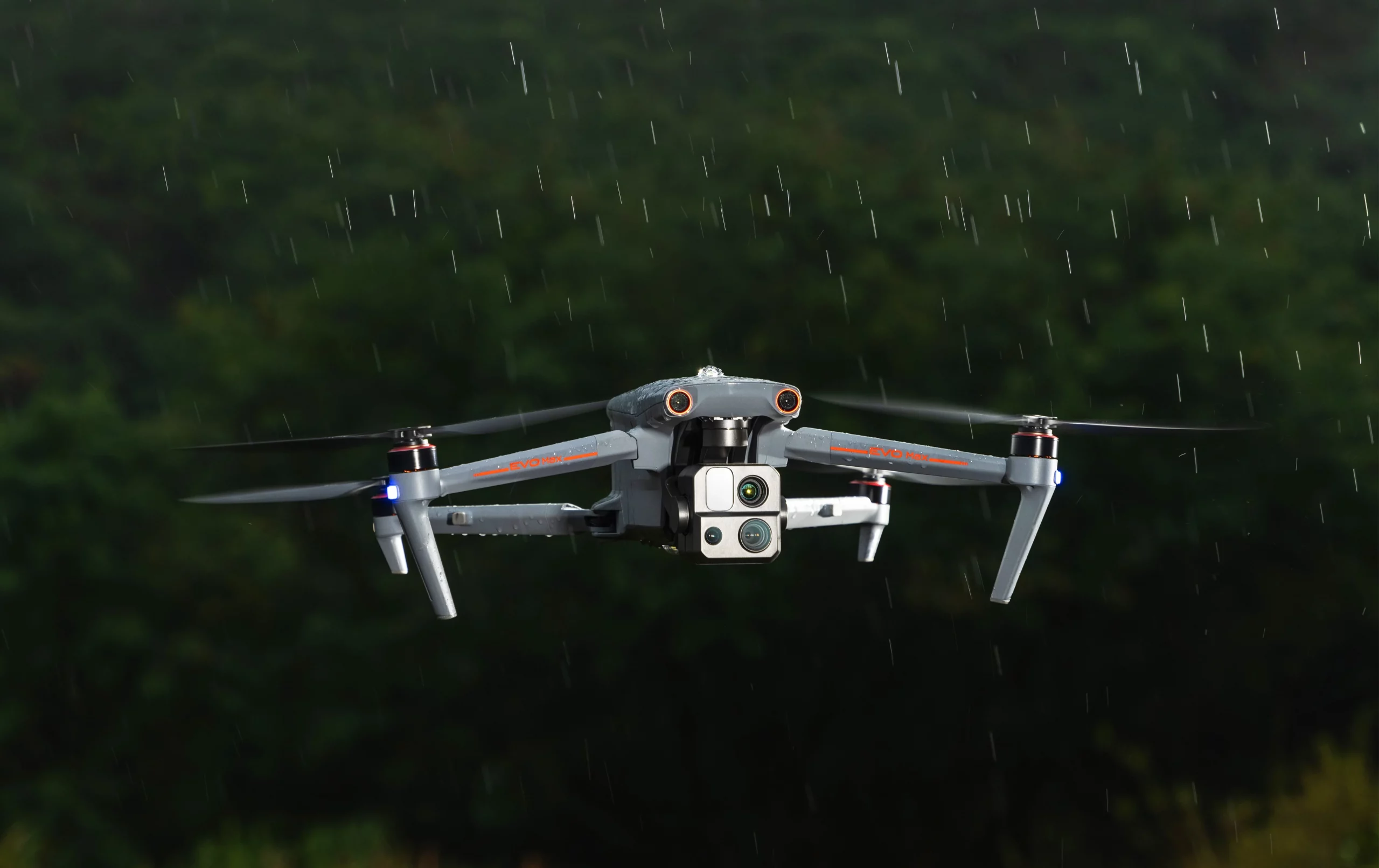
Weather Rating-IP43
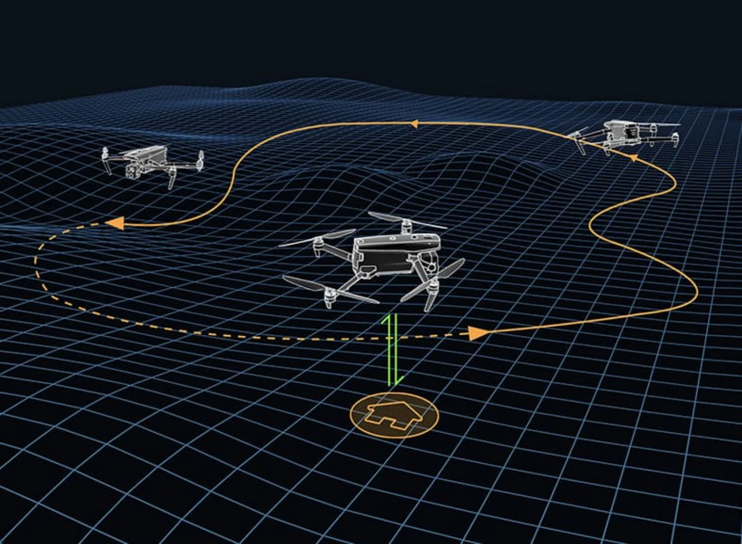
A-Mesh 1.0 – The Drone Industry’s First Mesh Networking Technolog
EVO Max 4T features the new A-Mesh system, enabling drone-to-drone autonomous communication, connection, and collaboration.
Strong Anti-Interference: The EVO Max 4T can communicate seamlessly with other drones in the vicinity, unlike a traditional chain structure. If a single drone fails or exits unexpectedly, the entire system will independently self-organize and continue to relay critical information.
Beyond-Line-of-Sight Applications: With A-Mesh, multiple aircrafts in the vicinity can act as relay points to greatly improve BVLOS operation effectiveness
Full-Fleet Control:Multiple drones can be controlled autonomously by 1 pilot or by a group of pilots simultaneously with or without LTE coverage.
Enhanced Range: Communication nodes can be placed statically on hills or poles to provide full coverage to an area, or a swarm of drones can provide mobile communication points to extend the coverage of the entire group.
Autel SkyLink 3.0
The EVO Max 4T SkyLink 3.0 system comes with 6 antennas, 4 frequency bands, AES-256 encryption*, and optional 4G integration* to provide users with the most advanced flight capabilities ever in an EVO.
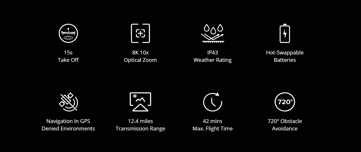
12.4 miles: Image Transmission Distance 1080p/60fps: Real-Time Image Quality
900MHz/2.4GHz/5.2GHz/5.8GHz** : Frequency Bands <150ms Latency
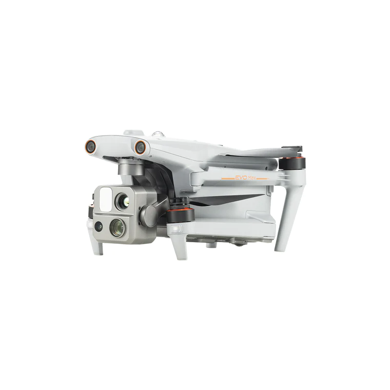
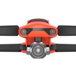
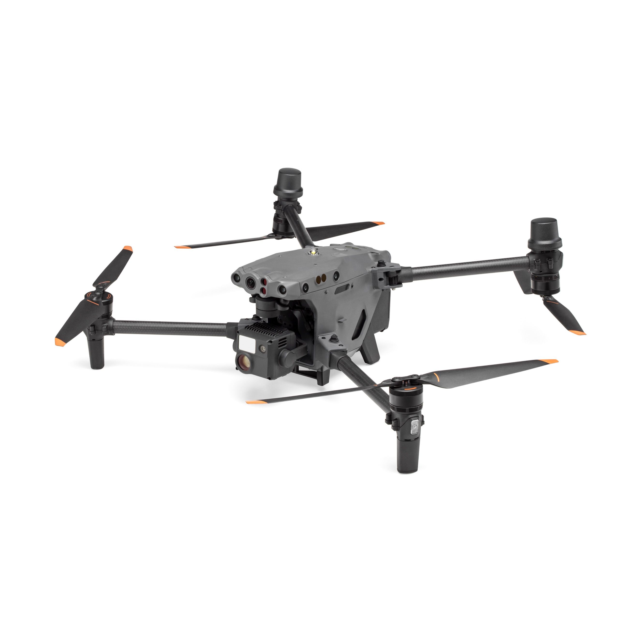
Mission Ready Payload
The payload integrates wide-angle camera, zoom camera, thermal camera and a laser rangefinder for all data capture needs and critical decision making.
Wide Camera: 50MP 1/1.28″ CMOS Aperture: f/1.9 DFVO: 85° Equivalent: 23 mm
Zoom Camera: 48MP 8K 10x Optical Zoom 160x Max. Hybrid Zoom
Aperture: f/2.8-f/4.8
Thermal Camera: 640×512 Aperture: 13mm 16x Digital Zoom
Temperature Measurement Range: -20°C to 550°C
Laser Rangefinder: Measuring Range: 5 – 1200m
Measurement Accuracy: +1m
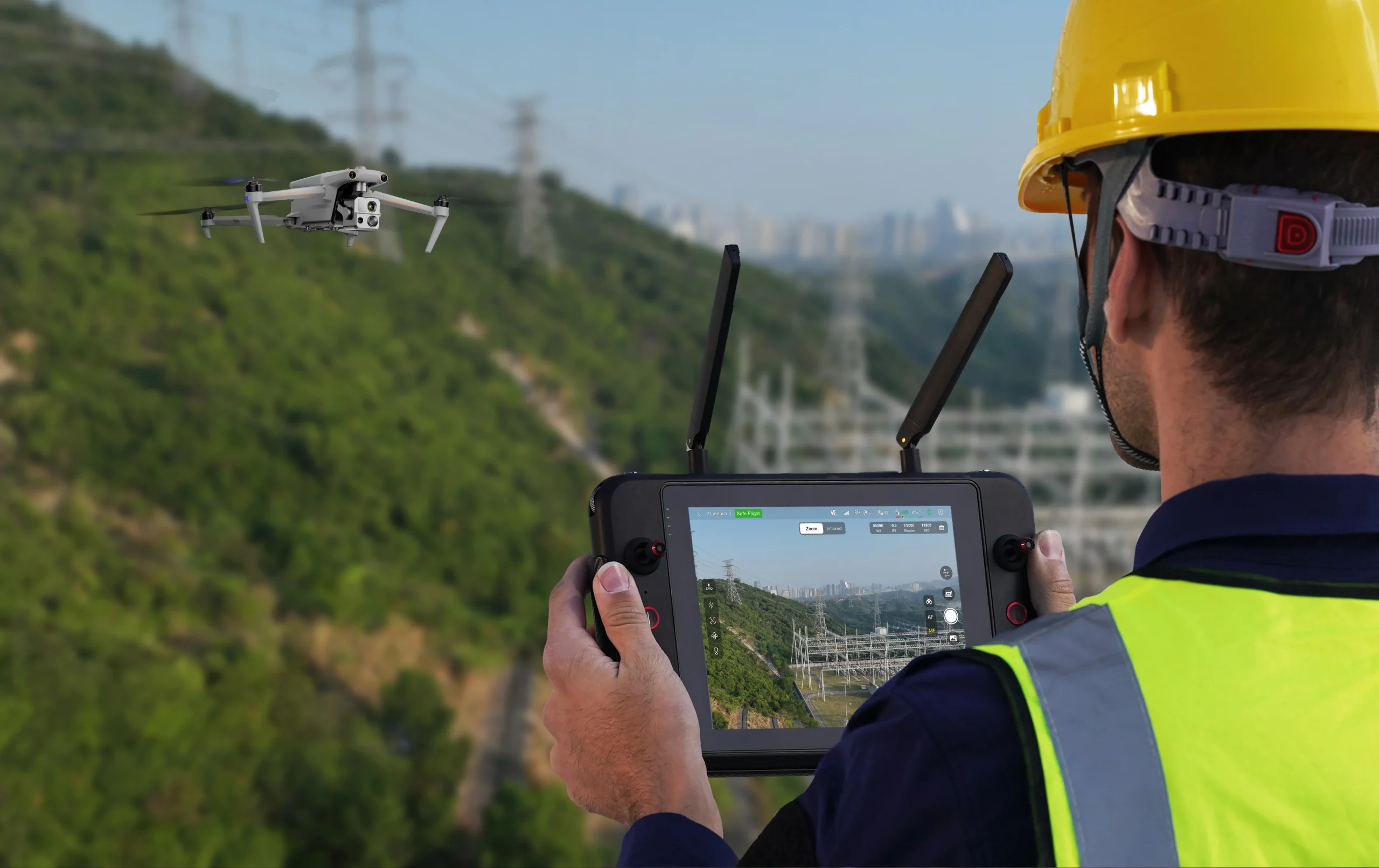
Autel Enterprise App Platform
The Autel Enterprise App is built from the ground up for industrial applications and features a brand-new interface for simple, efficient operation. Additional features and semi-autonomous modes maximize the EVO Max 4T’s mission capability.
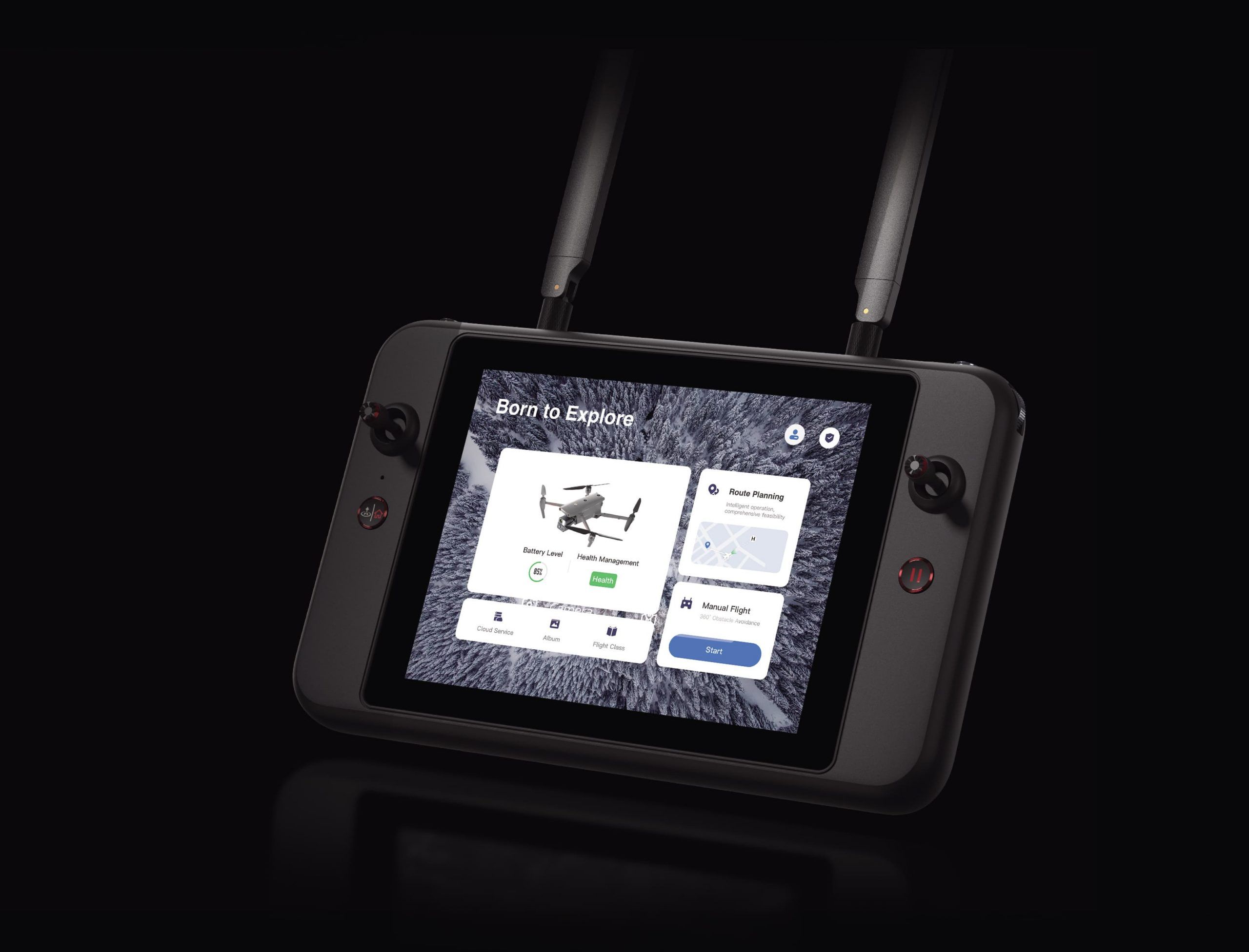
Smart Features
3D Map Planning: Plan, create, and execute 3D waypoint mission plan on a 3D map.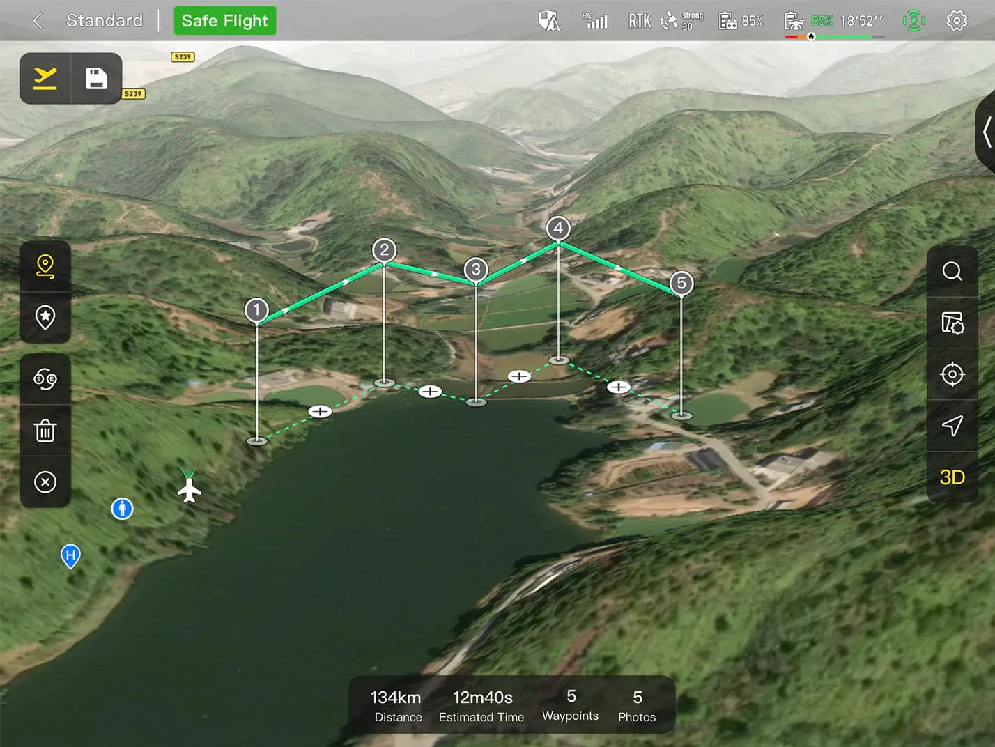
Quick Mission: Temporary quick missions can be created while executing other missions, and multiple sub-missions can be stacked for enhanced flexibility.
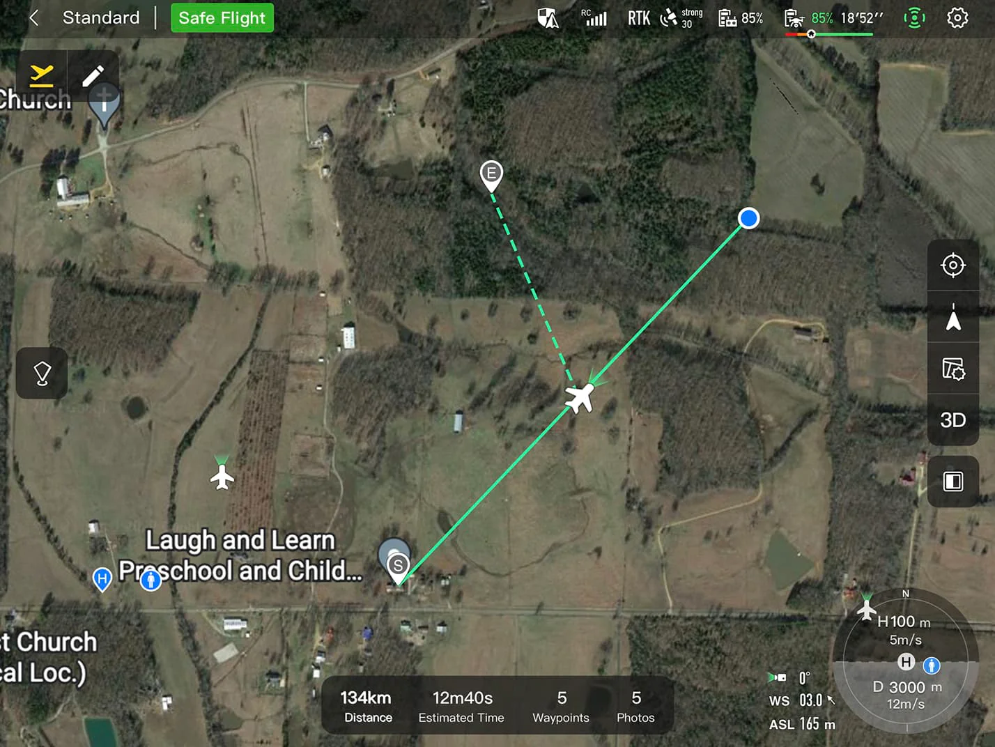
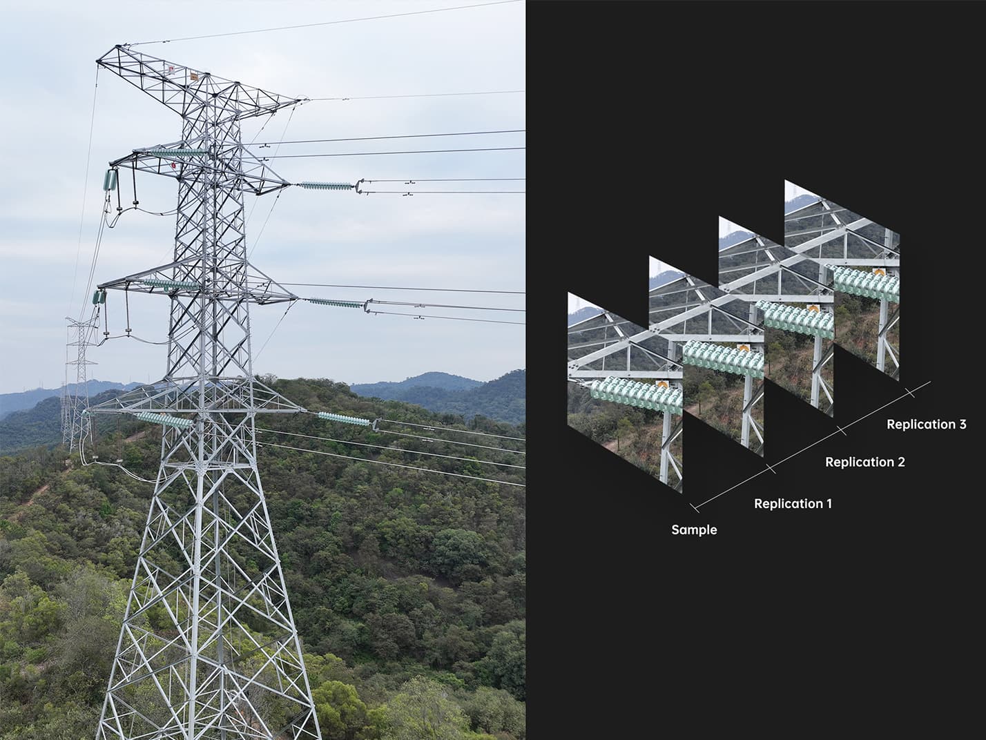
Mission Reproduction: With this feature activated, fly a manual or semi-autonomous mission, or string multiple missions together. The EVO Max4T will automatically record the camera angles and replicate the mission you just flew.
Multiple Mission Types
The Enterprise App provides various autonomous and semi autonomous mission planning for public safety, inspection, and surveying.
Terrain Follow: Maintain relatively constant altitude from the ground for uneven or sloped terrain. Rectangular Mission: One-click automatic generation of a rectangular flight area.
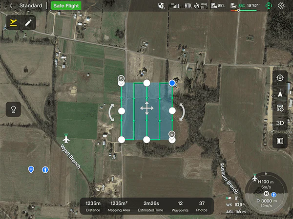
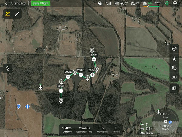
Automatic Mission Generation And Data Capture:Automatically produce routes by adding regional boundary points through dots or importing KML files. Waypoint Missions :Users can add waypointsfor flexible, non-structured flight paths.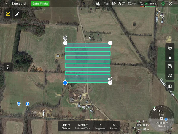
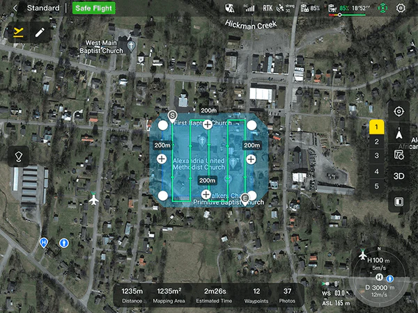
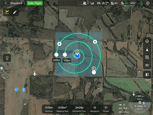
Oblique Photography:Automatically plan 5 groups of routes (1 ortho + 4 oblique) according to the flight area set by the user. Spiral Mission:Supports helical flight search in a designated area for SAR.
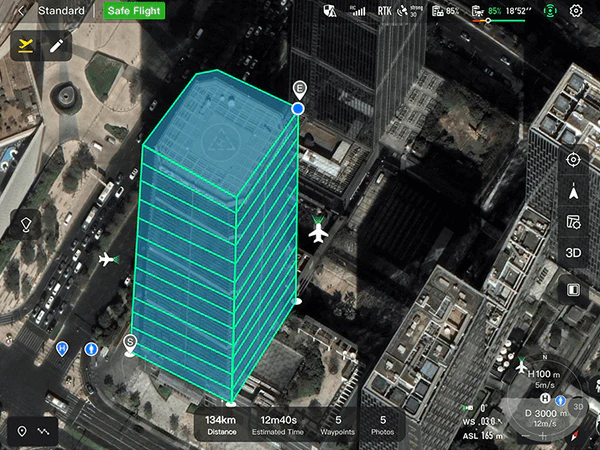
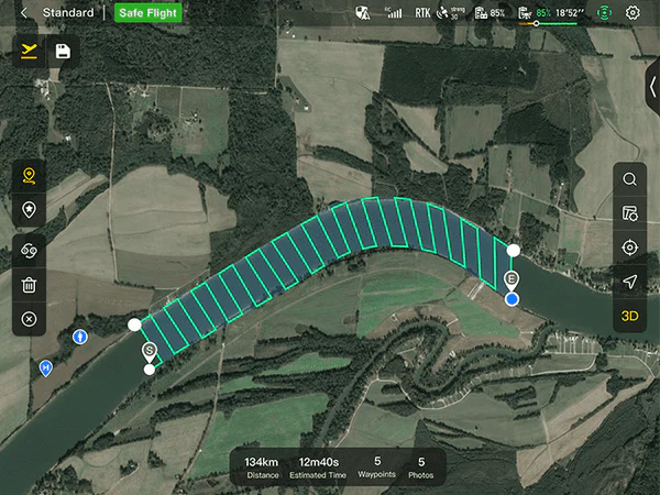
Vertical Scan:Perform vertical surveys for building facades, open pit walls, and towers. Corridor Mission:Supports intuitive and effective corridor mission planning for roads, rivers, pipelines, power lines and other narrow,large-scale terrain.
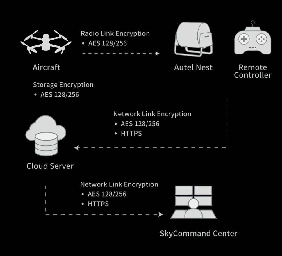
Data Security
Privacy Protection: Data involving user and aircraft information, including flight logs, locations,and account information can only be physically accessed via the aircraft locally.
Encrypted Data Storage: Supports AES-256 encryption for photos, videos, and flight logs, are password-protected.
Enhanced Live-View
Multi-channel Projection Screen:Supports simultaneous output of RGB, infrared, night vision, and wide-angle images.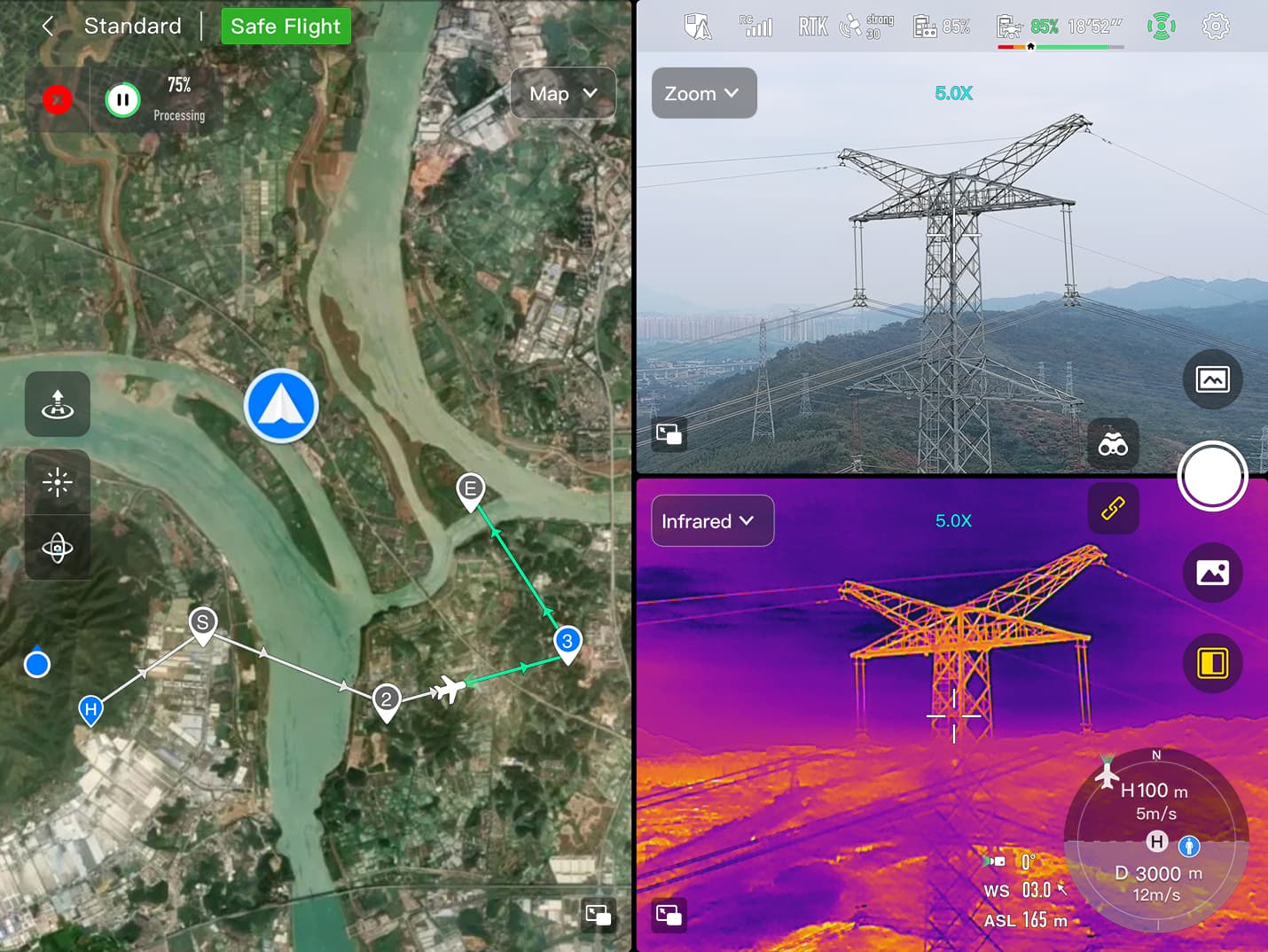
AR Scene:Geo-location data and other aircraft location info detected by ADS-B can overlay on real-time map, which is convenient for users to confirm the drone’s location and avoid airborne risks.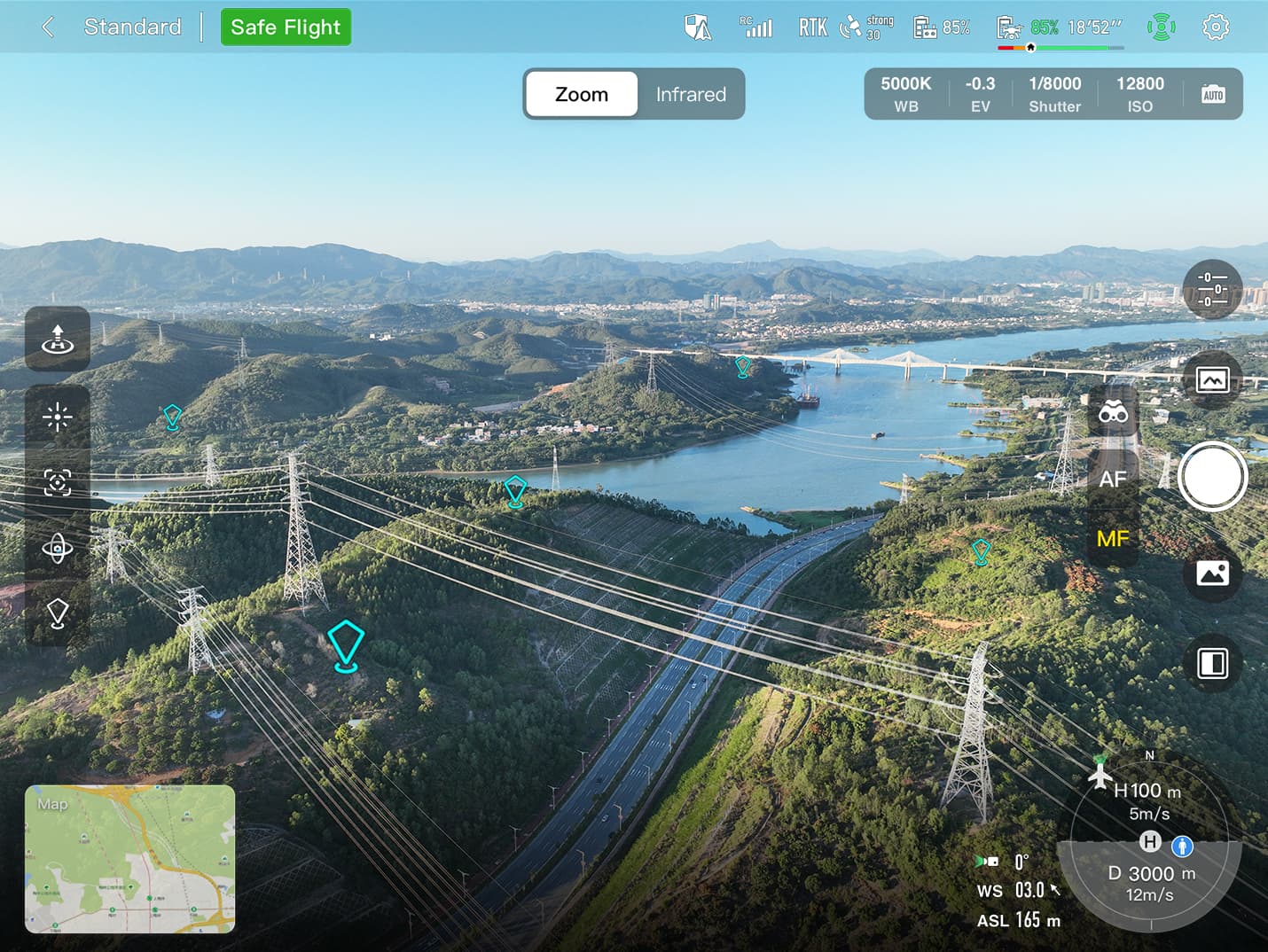
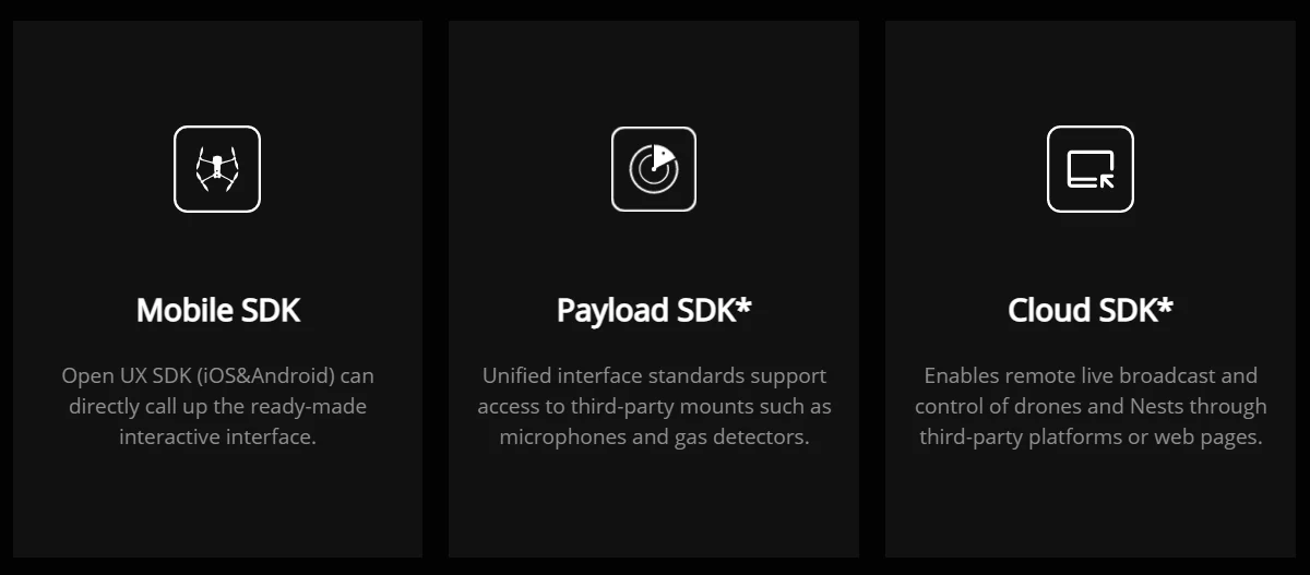
Autel SDK
The Autel SDK is open to the world, helping developers and partners reduce software and hardware development costs and jointly create a new industry ecosystem.
Widely Application


Reviews
There are no reviews yet.