

Key Features & Performance
-
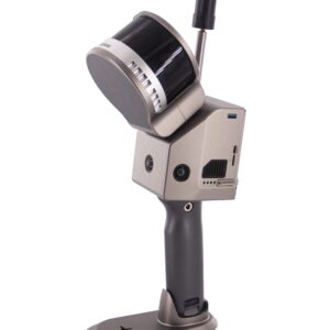
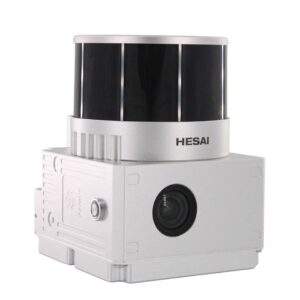
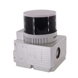
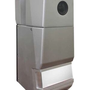
Survey-Grade Precision: Powered by a RIEGL VUX-1LR (or similar high-end sensor), it offers a range accuracy of 15 mm, ensuring that even the smallest topographical details are captured.
-
Extreme Long Range: With a measuring range of up to 1,845 meters, this system allows for high-altitude flight, which increases safety in mountainous terrain and covers more ground per flight.
-
Superior Penetration: Utilizing multi-target capability (echo digitization), it can penetrate thick vegetation to provide accurate Ground Digital Elevation Models (DEMs).
-
Integrated Imaging: Comes equipped with a built-in 45 MP full-frame camera, allowing for the generation of high-resolution, true-color 3D point clouds.
-
Industrial POS System: Features a high-precision IMU (gSpin 410) and GNSS unit, providing stable attitude and positioning data with a horizontal accuracy of 0.02 m.
Technical Specifications
| Feature | Specification |
| Laser Sensor | RIEGL Laser Sensor |
| Measuring Range | Up to 1,845 m |
| Range Accuracy | 15 mm |
| Scanning Frequency | 10 Hz – 200 Hz |
| Field of View (FOV) | 360° |
| Camera Resolution | 45 Megapixel (Full-frame) |
| System Weight | 4.5 kg |
| Storage | 512 GB Internal SSD |
| Power Consumption | 75 W |
| Supported Platforms | DJI M300/M350, VTOL Fixed-wing, Vehicles |
Applications
-
Power Line Inspection: Detailed mapping of wire sag and pylon structures with high point density.
-
Forestry Management: Measuring canopy height and underlying terrain through dense foliage.
-
Mine Surveying: Rapid volume calculations and safety monitoring of open-pit mines.
-
Topographic Mapping: Large-scale 1:500 or 1:1000 scale mapping for urban planning and construction.
Software Ecosystem
The system includes gAirHawk 5.0 (or the latest version) for pre-processing. This software simplifies the workflow by:
-
Integrating GNSS and IMU data to calculate trajectories.
-
Merging trajectory data with LiDAR raw scans.
-
Applying RGB colorization from the internal camera to the point cloud for a “digital twin” result.


Reviews
There are no reviews yet.