

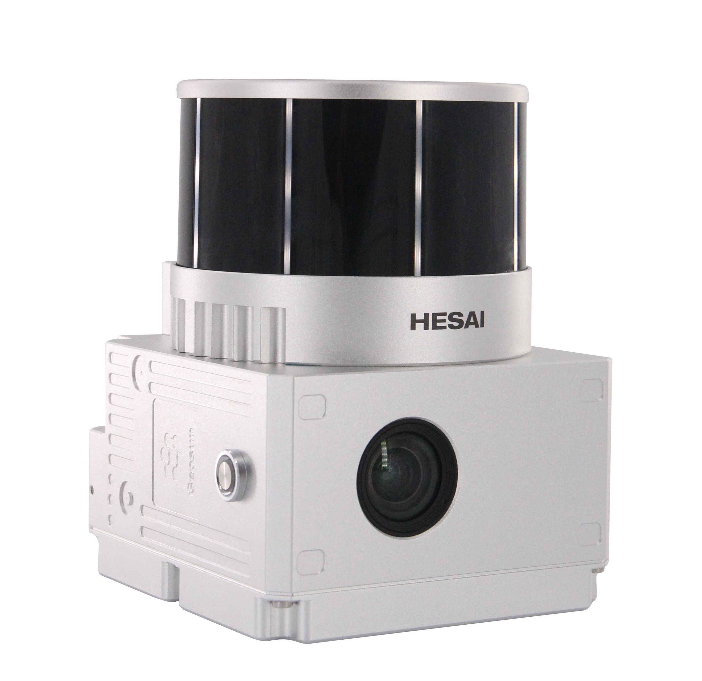
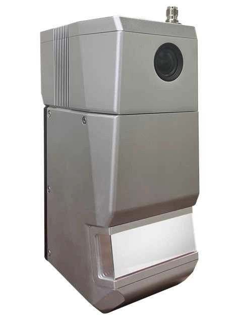
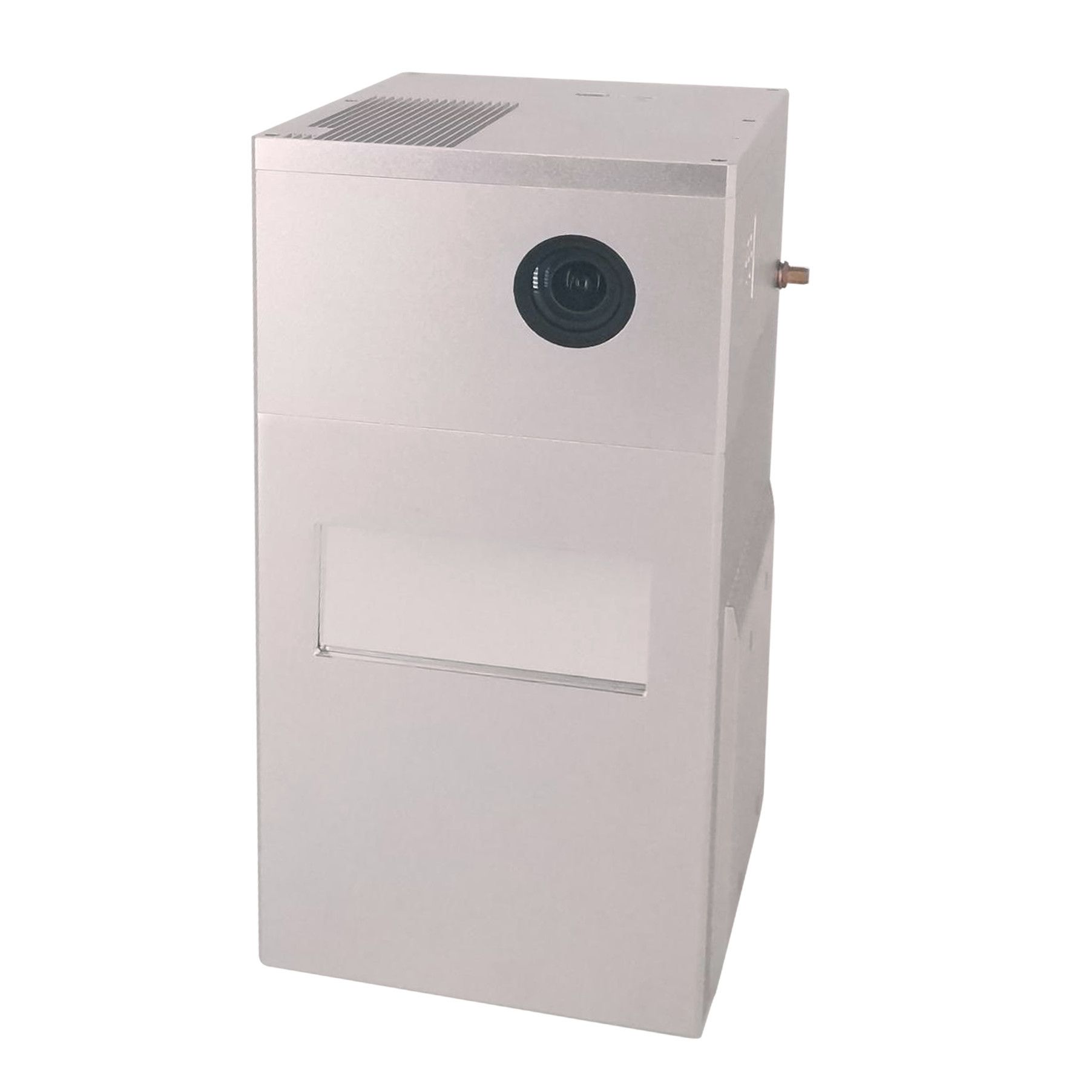
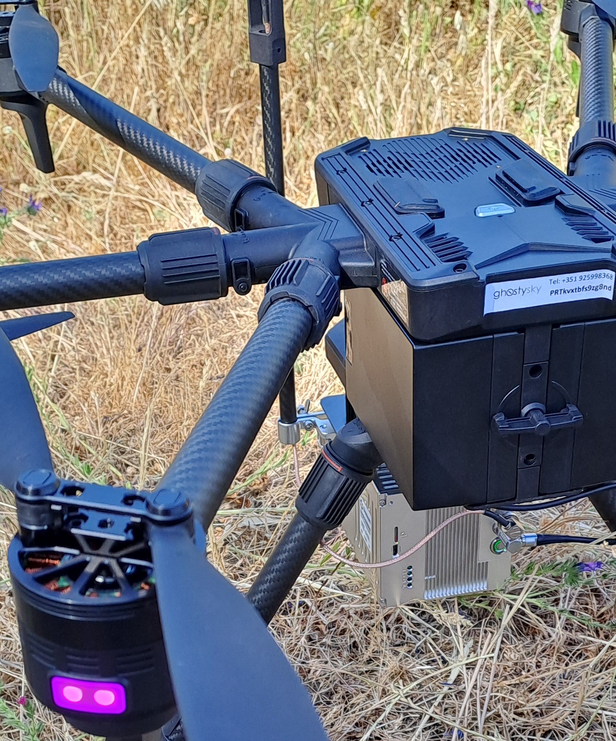
LiDAR Scanning System
gAirHawk GS-300T is a kind of Mid-range, compact LiDAR point cloud data acquisition system, integrated Livox Tele-15 laser scanner, GNSS and IMU positioning and attitude determination system, and storage control unit, is able to real-time, dynamically, massively collect high-precision point cloud data and rich image information. It is widely used in the acquisition of 3D spatial information in surveying, electricity, forestry, agriculture, land planning.
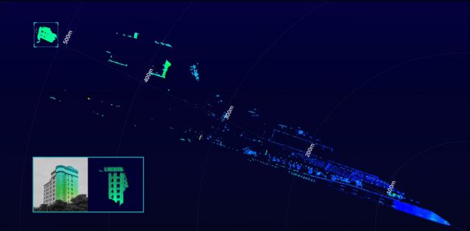
Long Range
The Tele-15 uses a large-diameter double-aspheric lens and solves common defocusing facula problems in long focus optical design, offering a detection range of up to 500m. Even when target object reflectivity is as low as 10%, it can still reach a detection range of up to 320m. Tele-15 supports customized firmware to increase the detectable range limit to 1000 meters.

Specification
| gAirHawk GS-300T | ||
| Item Name | System Parameters | |
|
GS-300T Parameters |
Weight | 2.15 kg |
| Working temperature | -20℃~55℃ | |
| Power range | 12 V | |
| Consumption | 20 W | |
| Carrier | VTOL Fixed Wing drone | |
| Storage | 64 GB storage, maximum support 128GB TF card | |
| OD | 16 X 12.5 X 13.5 cm | |
|
Lidar Unit
|
Measuring Range | 320m@10% Reflectivity, 500m@50% Reflectivity, |
| Laser class | 905nm Class1 (IEC 60825-1:2014) | |
| Laser line number | 128 beam | |
| Range Accuracy | 2 cm | |
| Pulse Frequency | 240 KHz | |
| Beam Divergence | 0.02° * 0.12° | |
| Data Rate | Double echo 480,000 Points/Sec | |
| FOV | 14.5° * 16.2° | |
| Laser sensor | Livox Tele-15 | |
| POS Unit | Update frequency | 200HZ |
| Heading accuracy | 0.017° | |
| Pitch accuracy | 0.005° | |
| Rolling accuracy | 0.005° | |
| Position accuracy | ≤0.05m | |
| GNSS signal type | GPSL1/L2 GLONASSL1/L2 BDS B1/B2a/B3 | |
| GNSS Motherboard | OEM 719 | |
| IMU | AGS 303 | |
| Pre-processing software | POS software | Output information: position, speed, attitude |
| Point cloud software | Output point cloud data format: LAS format, custom TXT format | |
Package
It is packed by suit case with EVA material liner inside, then covered by hard carton box. It is suitable for air shipment and sea shipment.


Reviews
There are no reviews yet.