
Applications
- Precision agriculture: Crop health monitoring, pest and disease detection, optimizing resource usage.
- Forestry monitoring: Assessing tree health, deforestation detection, and forest resource management.
- Environmental monitoring: Water quality tracking, pollution level monitoring, land cover change assessment.
- Target recognition: Object and material identification based on spectral signatures.
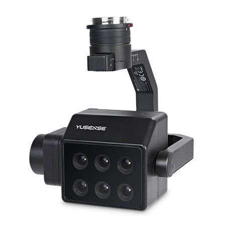
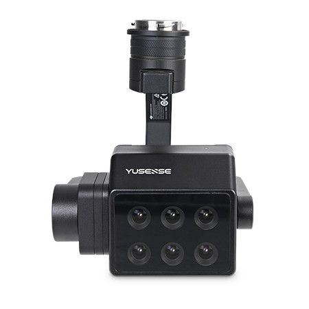
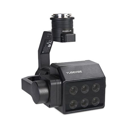
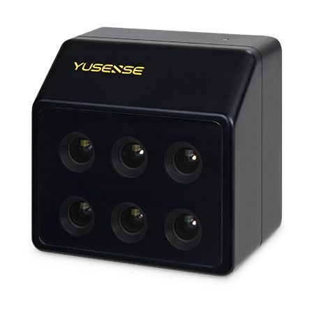
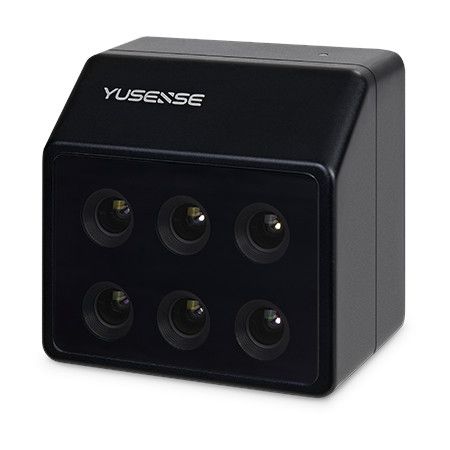
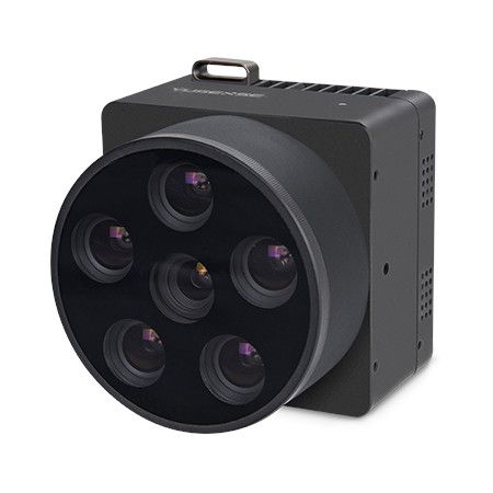
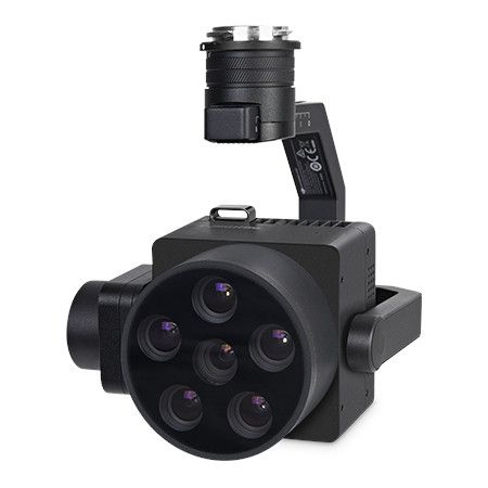
Key features of the MS600 Pro:
- Six 1.2MP multispectral channels: Capture data in specific bands (450nm, 555nm, 660nm, 720nm, 750nm, 840nm) for detailed analysis.
- Sapphire optical window: Ensures high light transmittance and image quality.
- Large aperture and low distortion: Delivers sharp and accurate images.
- Broadband transmission: Enables capturing a wider range of light information.
- All-glass lens and aluminum body: Provides durability for various environments.
- Large dynamic range and intelligent dimming: Captures clear images in diverse lighting conditions.
- Fastest 1s synchronous imaging: Ensures consistent data capture across all channels.
- Standard downlink light sensor (DLS): Measures ambient light for accurate data correction.
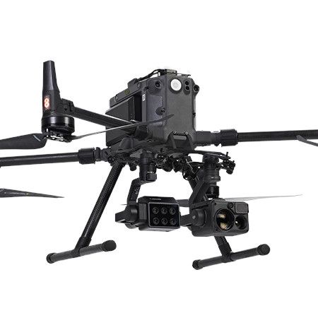
- DJI X-Port interface: Seamless integration with compatible drones.
Overall, the Yusense MS600 Pro is a powerful multispectral camera offering versatility and accuracy for various applications requiring detailed spectral information.
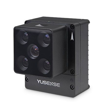
Product features
- 6 multispectral bands
- 1.2 Megapixel
- 12bit global shutter
- DJI X-Port control
- On-camera real-time reflectance calculation
- Synchronized imaging of all channels in as little as 1s
- Downlink Light Sensor (DLS) standard
- DJI X-Port power supply, 64G TF card
- Timing, overlap rate multiple trigger modes
- DJI M300/M350 RTK drone customization, plug and play
Technical Parameters
- Configuration: 6 multi-spectral channels
- Target surface size: 1/3″
- Effective pixel: 1.2Mpx
- Shutter type: Global
- Quantization bit: 12bit
- Field of View: 49.5°×38.1°
- Ground resolution: 8.65cm@h120m
- Coverage width: 110m×83m@h120m
- Spectral channel [1] 450nm@30nm,555nm@27nm, 660nm@22nm,720nm@10nm,7 50nm@10nm, 840nm@30nm
- Optical Window: Sapphire Optical Glass Window
- Main unit size: ≤130mm×160mm×150mm (optical axis vertical to ground)
- Weight: ≤670g
- Mounting interface: X-Port
- Power supply: X-Port
- Power Consumption
- Picture format: 16bit raw TIFF & 8bit reflectivity JPEG (including GPS, ambient light information)
- Video Format:
- Storage Media Standard: 64G, maximum support 128G capacity (transfer speed U3 and above rating) micro SD card
- Processing Software: Yusense Map/Yusense Map Plus
- Parameter Settings: DJI Pilot
- Shooting Trigger: Overlap Rate Trigger, Timing Trigger
- Shooting frequency: 1Hz (related to the actual read/write speed of the storage media)
- Working environment temperature: -10℃~+50℃(relative wind speed≥1m/s)
- Storage Ambient Temperature: -30℃~+70℃
- Ambient Humidity: RH(%)≤85%(non-condensing)
- Product Certification: CE, FCC, RoHS
Applications
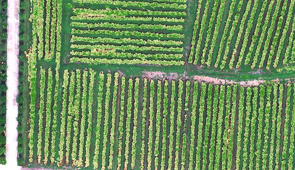
Vegetation growth assessment
Using NDVI, LAI and other vegetation factors, we quantitatively describe the consistency of the vegetation canopy state at different spatial scales, assist the characteristic spectra of vegetation in different health states, quantitatively assess the vegetation’s longevity, and provide data support for irrigation, fertilizer application, plant protection, and yield assessment.
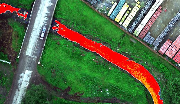
Monitoring of black-odor water bodies
With reference to the evaluation standard of surface black smelly water bodies, we use characteristic spectra to construct classification indexes, realize graded inversion and spatial information statistics of black smelly water bodies, assist in analyzing the impact of domestic sewage and industrial wastewater on the surrounding water bodies, and help in the investigation of pollution sources and assessment of the water environment.
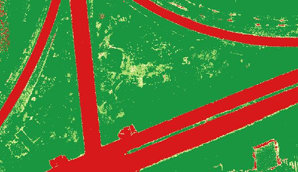
Coverage Assessment
Based on the fingerprint spectrum of vegetation to construct vegetation index, complete the spatial distribution and area statistics of the target vegetation in the designated area, and provide quantitative data on vegetation cover for scientific research and production in agriculture, forestry and grassland, ecology and other fields.
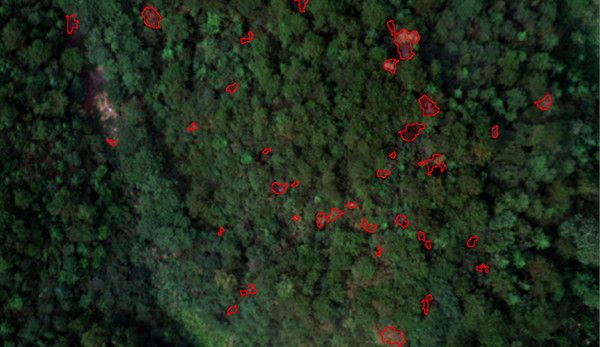
Monitoring of pine discolored standing trees
Comprehensively utilizing spectral and texture information to realize efficient suppression of environmental backgrounds such as soil, dead grass and high-precision identification of discolored standing trees, accurately extracting information on the location, spatial distribution and canopy area of the discolored standing trees, and providing data support for the management of infected trees.


Reviews
There are no reviews yet.