


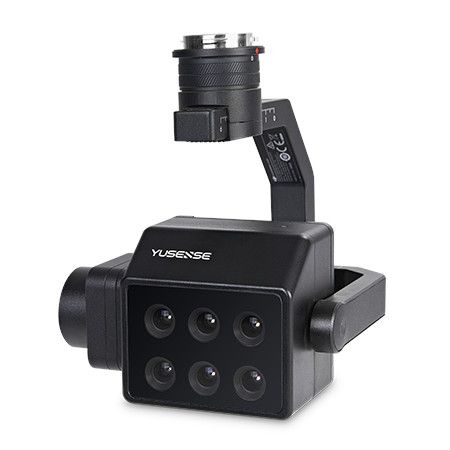
Product Features
- Network port/TTL serial port
- On-board real-time reflectivity calculations
- Standard Downlink Light Sensor (DLS)
- Synchronous exposure of cascading application scenarios
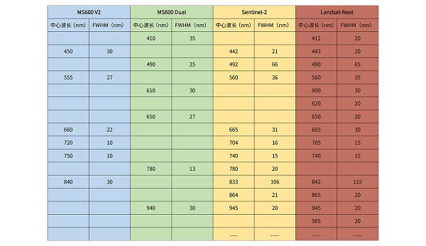
- The band design continues the composition of mainstream satellite bands.
- Integrated Skyport interface for cascading application scenarios
- Carrying platform: Small multi-rotor UAV, Small fixed-wing UAV
Technical Specifications
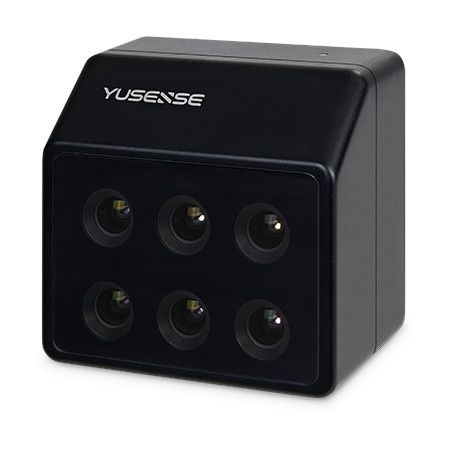
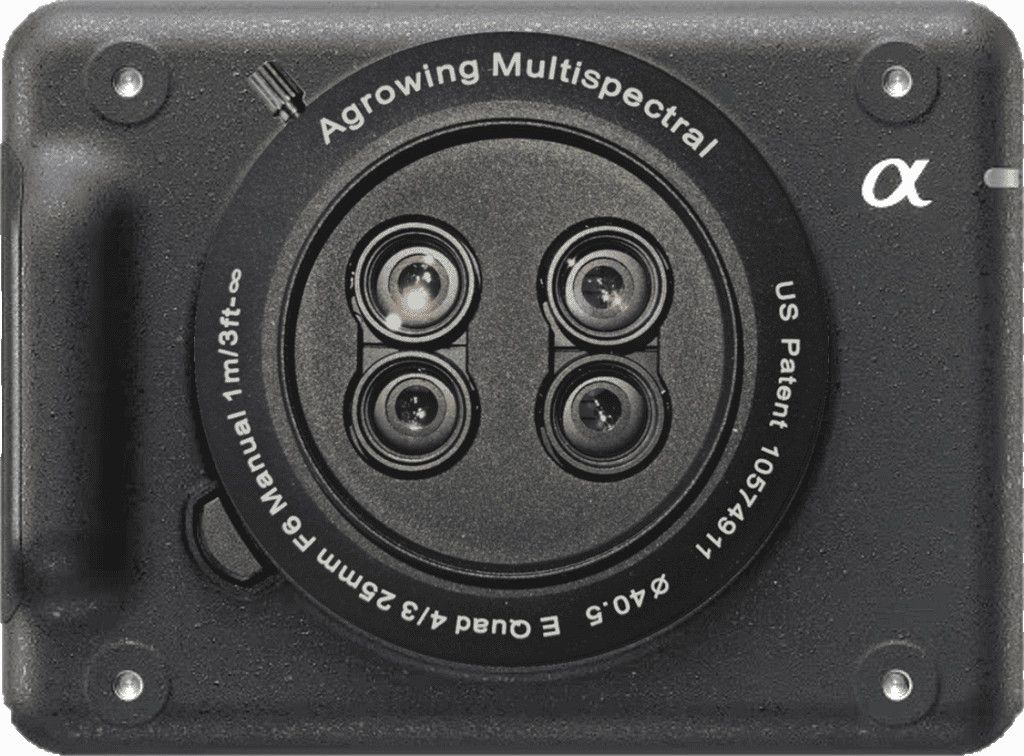
- Combination Method: 6 multispectral channels
- Target Size: 1/3”
- Effective Pixels: 1.2Mpx
- Shutter Type: Overall situation (Global)
- Number of Quantization Bits: 12bit
- FOV (field of view): 49.5°×38.1°
- Ground Resolution: 8.65cm@h120m
- Coverage Width: 110m×83m@h120m
- Spectral Channel: 10nm@35nm, 490nm@25nm, 610nm@30nm, 650nm@27nm, 780nm@13nm, 940nm@30nm
- Optical Window: Sapphire optical glass window
- Host Size (LxWxH): ≤80mm×75mm×55mm
- Host Weight: ≤280g
- Installation Interface: 4×M3, Cascade application Skyport
- Powered by: 12V (please contact our team for power supply with other voltages)
- Power Consumption: ≤10W@12V
- Image Format: 16bit original TIFF & 8bit reflectivity JPEG (including GPS, ambient light information)
- Video Format: N/A
- Storage Media: Standard 64GB, maximum support 128GB capacity (transmission speed U3 and above rating) micro SD card
- Processing Software: Yusense Map/Yusense Map Plus
- Parameter Settings: Wi-Fi (WEB interface access)/UART
- Shooting Trigger: External trigger, timing trigger, overlap rate trigger, cascade trigger
- Shooting Frequency: 1Hz (related to the actual reading and writing speed of the storage medium)
- Working Temperature: -10℃ to +50℃ (relative wind speed ≥1m/s)
- Storage Environment Temperature: -30℃ to +70℃
- Environment Humidity: RH(%) ≤85%(non-condensation)
- Certified Product: CE, FCC, RoHS
Applications
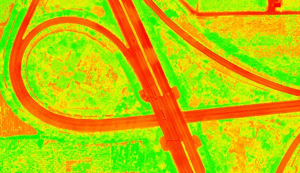
 Satellite remote sensing data verification
MS600 Dual and MS600 V2 are cascaded and mounted to form a 12-band data acquisition equipment, which is consistent with the spectral band design of the current mainstream Sentinel-2, Landsat8 and Landsat-Next satellites, and ensures to the maximum extent that the researchers and scholars in the fields of agriculture, forestry and grassland, ecology and environment will have the unified information of the satellite and airborne optical coupling data, which is convenient for carrying out the special studies such as data validation and information comparison. Data validation, information comparison and other specialized research.
Inversion of vegetation physiological parameters
The MS600 Dual complements the MS600 V2 multispectral camera in the near-infrared band, and when used in cascade with the MS600 V2, it can dig out more vegetation canopy information and construct more spectral factors, thus improving the accuracy of canopy physiological parameter inversion for crops, forests and grasses, and other pan-vegetation scenarios.

Quantitative inversion of water quality parameters
The MS600 Dual expands the number of blue-green light bands to provide more refined data information for water body detection, especially for total nitrogen, total phosphorus, ammonia nitrogen, COD and other parameters, which provides more information data to help improve the accuracy of water quality chemical parameter inversion.


Reviews
There are no reviews yet.