
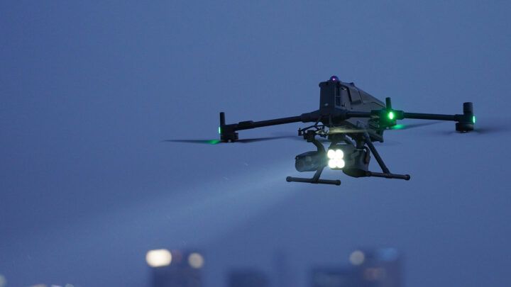
Oeiras, Lisbon, Portugal – June 19, 2025 – DJI, the world leader in civilian drones and creative camera technology, has officially unveiled its new enterprise flagship drone platform: the DJI Matrice 400 (M400). This groundbreaking drone sets a new standard for intelligent, efficient, and long-endurance aerial missions, designed to empower professionals across various industries, from emergency response and power line inspection to large-scale mapping and construction.
The M400 is not just an evolution; it’s a revolution in enterprise drone technology, offering a significant leap forward in payload capacity, flight time, obstacle avoidance, and intelligent features.
Unparalleled Performance and Versatility
The DJI Matrice 400 is engineered for the most demanding tasks, boasting an impressive suite of technical specifications and features:
Technical Specifications:
- Max Takeoff Weight: 15.8 kg
- Max Payload Capacity: Up to 6 kg (13.2 lbs)
- Max Flight Time: Up to 59 minutes (with Zenmuse H30T payload, in forward flight, no wind)
- Max Horizontal Speed: 25 m/s
- IP Rating: IP55 (for reliable operation in harsh environments and extreme temperatures from -20°C to 50°C)
- Dimensions (Unfolded): 980×760×480 mm (L×W×H) (with landing gear)
- Propeller Size: 25 inches
- GNSS: GPS + Galileo + BeiDou + GLONASS*
- Battery: TB100 Intelligent Flight Battery (20,254 mAh capacity, 977 Wh energy)
- Charging: Fast charging with BS100 Intelligent Battery Station (approx. 45 minutes at 220V, 70 minutes at 110V)
- Video Transmission: O4 Enterprise Enhanced Video Transmission, offering up to 40 km range (with relay) and dual cellular dongle support for enhanced signal stability.
- Obstacle Sensing: Omnidirectional binocular vision system, horizontal rotating LiDAR, upper LiDAR, downward 3D infrared range sensor, and six-direction mmWave radar. This advanced system enables power-line-level obstacle detection, even in low-light conditions.
- Gimbal Ports: Supports free switching between single and dual downward gimbals, and features a third gimbal connector for ultimate payload versatility.
- E-Port V2 Ports: Four external E-Port V2 ports, allowing up to seven payloads to be mounted simultaneously.
Key Features
- Extended Endurance & All-Weather Operation: With nearly an hour of flight time and an IP55 rating, the M400 is built for long-duration missions in challenging conditions. It can even take off from stationary vessels and land on moving ships for offshore operations.
- Power-Line-Level Obstacle Avoidance: The integrated LiDAR and mmWave radar, combined with full-color low-light fisheye vision sensors, provide unparalleled obstacle detection, including the ability to identify thin wires at high speeds, ensuring safer flights in complex environments like mountainous terrain or around power lines.
- Robust Video Transmission: The O4 Enterprise Enhanced Video Transmission system, with its 10-antenna design and built-in video transmission relay module, ensures reliable and extended operational range, even in obstructed areas.
- Ultra Intelligent, Ultra Efficient Automated Operations: The M400 introduces new intelligent features such as Smart Detection (for discerning vehicles, vessels, and subjects in visual and thermal modes), Smart AR Projection (for real-time visualization of maps, power lines, and return paths on the remote controller), Real-Time Terrain Follow (manual and route-based), Cruise Mode, and Smart Track, significantly boosting operational efficiency.
- Versatile Payload Compatibility: The M400 is compatible with a wide range of DJI and third-party payloads, including the Zenmuse H30 Series, L2, P1, S1 Spotlight, V1 Speaker, and Manifold 3, allowing it to adapt to diverse mission requirements.
- Enhanced Data Security & Privacy: DJI continues its commitment to data security with comprehensive privacy controls, including user opt-in for data sharing and Local Data Mode to sever internet connections for sensitive operations.
DJI Matrice 400 VS Matrice 350
The DJI Matrice 400 (M400) represents a significant leap forward from its predecessor, the DJI Matrice 350 RTK (M350 RTK), building upon its robust foundation with substantial upgrades across key performance metrics, safety features, intelligence, and payload capabilities. Here’s a comprehensive breakdown of the upgrades:
Enhanced Flight Performance and Endurance
- Longer Flight Time: The M400 boasts a remarkable maximum flight time of 59 minutes (with a single H30T payload), a substantial increase from the M350 RTK’s 42-55 minutes. This extended endurance is crucial for covering larger areas and conducting longer missions with fewer battery swaps, improving operational efficiency for tasks like large-area mapping, corridor inspections, and emergency response.
- Increased Speed: The M400 offers superior speed across all metrics:
- Max Horizontal Speed: 25 m/s (90 km/h) compared to the M350 RTK’s 23 m/s (82.8 km/h).
- Max Ascent Speed: 10 m/s vs. the M350 RTK’s 6 m/s.
- Max Descent Speed: 8 m/s vs. the M350 RTK’s 5 m/s. This translates to faster mission completion and quicker response times in time-sensitive situations.
- New Battery System: The M400 introduces the TB100 batteries, offering a much larger capacity (20,254 mAh / 977 Wh) compared to the M350’s TB65 batteries (5,880 mAh / 263.2 Wh). This higher energy reserve directly contributes to longer flight times and better performance in demanding tasks.
- Faster Charging: The M400’s new BS100 Intelligent Battery Station supports fast charging, significantly reducing downtime. It can charge from 0-100% in 45 minutes at 220V, compared to the M350’s 60 minutes at 220V.
Superior Payload Capability and Versatility
- Increased Max Payload: The M400 supports a maximum payload of 6 kg, more than double the M350 RTK’s 2.7 kg. This allows for heavier and more diverse payload configurations.
- More Simultaneous Payloads: The M400 can accommodate up to 7 simultaneous mounted payloads, a significant upgrade from the M350 RTK’s 3. This is facilitated by 4 external E-Port V2 interfaces, with the E4 port expandable into 4 additional ports, greatly increasing multi-payload capability.
- Enhanced Payload Compatibility: The M400 introduces compatibility with newer, more advanced payloads like the Zenmuse H30/H30T, Zenmuse S1 Spotlight, Zenmuse V1 Speaker, and Manifold 3, expanding its application possibilities for public safety, inspection, and more.
Advanced Safety and Reliability
- Revolutionary Obstacle Avoidance: The M400 significantly enhances obstacle avoidance through a fusion of multiple advanced sensors:
- Rotating LiDAR: Provides high-precision 3D depth information for accurate environmental modeling, even in challenging lighting. It can detect fine obstacles like overhead power lines (21.6 mm steel-core aluminum conductors) even at high speeds (25 m/s).
- Six-direction mmWave Radar: Offers strong penetration in rain, fog, and snow, capturing both range and velocity information in real-time, enabling all-weather operational safety.
- Four Full-color Low-light Fisheye Vision Sensors: Capture rich visual features for full-color flight assist displays and enhanced situational awareness. This comprehensive sensing suite allows the M400 to detect and bypass obstacles at a much finer and more reliable level than the M350 RTK’s standard 6-direction binocular vision and infrared system.
- Rotating LiDAR: Provides high-precision 3D depth information for accurate environmental modeling, even in challenging lighting. It can detect fine obstacles like overhead power lines (21.6 mm steel-core aluminum conductors) even at high speeds (25 m/s).
- All-Weather Operation: Both models have an IP55 rating, but the M400’s enhanced sensing suite provides more robust all-weather operational capability, particularly in rain and fog.
- ADS-B In: The M400 features an integrated ADS-B In receiver with dual antennas, providing real-time awareness of nearby manned aircraft up to 20 km away, further enhancing safety in shared airspace.
Enhanced Video Transmission and Connectivity
- DJI O4 Enterprise Enhanced Transmission: The M400 is equipped with the new DJI O4 Enterprise transmission system, offering up to 40 km of range under FCC conditions, double that of the M350’s O3 Enterprise system (20 km FCC).
- Airborne Relay: The M400 supports airborne relay for signal extension across obstructed environments (e.g., over mountains), which the M350 did not.
- Dual 4G Dongles: The M400 supports dual 4G dongles for network redundancy, ensuring more reliable connectivity.
- Sub-2G Transmission Band: The M400 introduces support for a sub-2G transmission band (e.g., 900 MHz in some regions), enhancing signal stability in interference-prone or long-distance scenarios.
Advanced Intelligence and Automation
- AI Detection and AR Projection: The M400 introduces advanced intelligent features like AI object recognition and AR projection of maps, power lines, and return paths directly onto the remote controller display, significantly improving situational awareness and operational efficiency.
- Real-Time Manual Terrain Follow: The M400 offers more sophisticated terrain following capabilities.
- Ship Auto-Landing: A specialized feature for maritime operations, enabling takeoff and landing on moving vessels.
- Smarter Route Planning: Includes features like Power Line Follow with Zenmuse L2, Slope Route, and Geometric Route for optimized and automated inspections.
Areas of Application
Public Safety & Emergency Response
- Search and Rescue (SAR): The extended flight time, high-speed performance (up to 25 m/s), and advanced intelligent features like Smart Detection (identifying vehicles, vessels, and subjects in both visible and thermal modes) allow for rapid deployment and comprehensive scene analysis, crucial for locating individuals in distress.
- Firefighting: Long-duration flights and thermal imaging capabilities with payloads like the Zenmuse H30T provide critical situational awareness, helping firefighters assess fire progression and identify hotspots safely from a distance.
- Situational Awareness: For police and other emergency services, the drone’s ability to provide real-time AR projections (displaying building names, landmarks, and power lines on the remote controller) and robust video transmission up to 40 km significantly enhances tactical operations and decision-making.
Infrastructure Inspection & Maintenance
- Power Line Inspections: With its power-line-level obstacle avoidance, including rotating LiDAR and mmWave radar, the M400 can autonomously follow power line corridors, detect thin wires even at night, and generate live 3D point clouds for precise assessment of grid infrastructure. This reduces the need for dangerous manual inspections.
- Wind Turbine Inspections: The drone’s ability to safely take off from stationary vessels and land on moving ships makes it ideal for offshore wind farm assessments. Its stable flight near reflective surfaces and precise obstacle avoidance are invaluable for inspecting turbine blades.
- Bridge and Road Surveys: The increased payload capacity and compatibility with various sensors (like the Zenmuse P1 for photogrammetry or L2 for LiDAR) enable detailed structural modeling and efficient data capture for critical infrastructure.
- Oil and Gas Pipeline Monitoring: Long endurance and advanced sensing capabilities facilitate routine patrols and detection of potential issues along extensive pipeline networks.
Surveying & Geospatial Mapping
- Large-Scale Mapping: The Matrice 400’s extended flight endurance and support for high-precision payloads like the Zenmuse P1 (full-frame camera for photogrammetry) and Zenmuse L2 (frame-based LiDAR) make it an unparalleled tool for creating accurate 3D models and large-area maps.
- Construction Progress Monitoring: Regular, high-resolution aerial surveys allow construction teams to track progress, identify discrepancies, and ensure adherence to plans, leading to improved project management and cost efficiency.
- Facade Reconstruction and Slope Mapping: Intelligent flight modes like Slope Route and Geometric Route planning (via DJI Pilot 2 or DJI FlightHub 2) enable efficient data capture for complex structures and inclined surfaces.
Offshore & Maritime Operations
- Maritime Patrol: The Matrice 400’s specialized ship-based takeoff and landing capabilities, combined with its robust video transmission and Smart Detection for discerning vessels, make it perfect for monitoring maritime activities and supporting search operations at sea.
- Offshore Asset Inspection: Beyond wind turbines, the drone’s all-weather performance (IP55 rated, operating from -20°C to 50°C) and extended range are crucial for inspecting offshore platforms and other marine infrastructure.
Forestry & Environmental Management
- Habitat Monitoring: The M400’s robust obstacle avoidance and Real-Time Terrain Follow capabilities ensure precise and safe operations in complex natural environments, aiding in wildlife monitoring and ecological surveys.
- Environmental Impact Assessments: High-resolution imagery and multi-spectral data collection can be used to monitor deforestation, track pollution, and assess the health of ecosystems.
Conclusion
The DJI Matrice 400 is not just a drone; it’s a comprehensive aerial intelligence platform, designed to empower professionals across diverse industries with enhanced efficiency, safety, and data accuracy. With features like the O4 Enterprise Enhanced Video Transmission System, Airborne Relay Video Transmission, and advanced intelligent automation, the Matrice 400 redefines what’s possible in the world of industrial drones.
To learn more about how the DJI Matrice 400 can transform your operations, visit our shop or contact us directly for a personalized consultation.


