Solução Perfeita para obtenção de resultados únicos – O seu projeto nunca esteve em melhores mãos!
FAQ
Thanks for stopping by!
Frequently Asked Questions about GhostySky
For all your questions about drone services, surveying, photography and more, GhostySky is here to help you.
With experience in creating entertainment and explore drone peerless potential & capabilities in different fields, GhostySky has the know-how to help you learn more. If you regarding our services, check out our frequently asked questions below, or you may reach us via our contact page.

We deliver multiple services :
- Drone Light Show : offer large-scale aerial light shows using numerous colorful drones in custom formations. Our drone displays are the perfect tool for tailored branding of grand outdoor events.
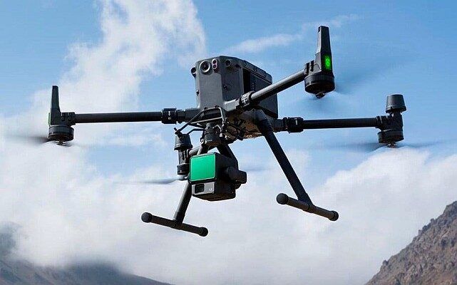
- Surveying & Mapping : our professional drones provide aerial surveying mapping and topographical surveys, with the best photogrammetric-grade cameras and lenses for specific applications, offering an absolute accuracy on cm level even on very large survey site.
- Marketplace : find information related to our professional drones that you can buy, rent for a determined period or even book a custom made drone training .
Surprisingly much less than you’d expect. The cost will depend on your type of project, duration, location and specific application. We guarantee the best professionals for your project with the focus of providing high-quality services for our clients.We also have specials for you to take advantage of. Contact us today to discuss your specific needs and to get a quote.
We are located in Figueiró dos Vinhos and Lisbon and we serve all Portuguese territory with the possibility of doing abroad (on request).
Yes, to give our clients peace of mind, all our services are insured.
We are unable to shoot in high winds or rain, as well as thunderstorms.
No, at this moment we don’t rent drones.
ANAC –Autoridade National da Aviação Civil : Portuguese Authority of Civil Aviation is the civil aviation regulating authority in Portugal and has developed a regulation laying down the rules applicable to the use of unmanned civil aircraft, commonly known as “drones”.
To publicize the new rules and promote awareness, the safe and responsible use of drones, ANAC has created the Voa na Boa Campaign (…) which invite users to visit this site to find the information they need when they fly a drone in Portugal.
Just go to the ANAC official website for more information.
Here are the current drone restrictions in Portugal :
- Our pilots must maintain a visual line of sight with the drone at all times.
- Flying must be done during daylight hours. Be aware of the weather, because a simple toast of wind can have unpredictable consequences.
- Do not perform flights 120 meters above the ground without ANAC authorization.
- Do not fly without ANAC authorization with drones weighing over 25 kg.
- Do not perform night flights or operations beyond the line of sight (BVLOS) or flights above 120 meters without ANAC authorization.
- We cannot fly over the heads of people. Avoid flying in crowded areas as the risk of injuring someone is very high if your drone falls. To fly over more than 12 people requires prior authorization from ANAC.
- Respect the restricted, prohibited, dangerous, reserved or temporarily reserved areas (Sovereign Bodies, embassies, military installations, force facilities and security services, prisons and educational centers.) In the Airspace Usage Guide you will be able to consult all the information regarding the national airspace. Download the Kmz file (“RPA_ver_5.0.kmz Regulation”) and install it. When you open Google Earth, you will know if you are in a free zone or are restricted by aeronautics.
- Do not fly above the defined heights in the operational protection areas of national airports without ANAC authorization. The use of drones in areas near airports may endanger air traffic. Violation of ANAC determinations, instructions or orders constitutes a serious or very serious civil aeronautical offense.
- Do not perform aerial photography and filming without first contacting the National Aeronautical Authority – Air Force. The rules for capturing images and making videos are regulated by their own legislation, requiring the authorization of the competent authority: AAN – Air Force
Check the android app for more information.
To protect people and property on the ground and other aircraft on the air, ANAC, has established mandatory safety rules. Before taking off carefully read the Airspace Drone Usage Regulations & Guide and follow the basic Drone Code safely rules. Remember that legal rules differ from country to country. If you would like to fly your drone abroad, please inform yourself about local legislation. If do not you may be subject to sanctions.
Yes. Since July 2018 in Portugal, drone with more than 250 grams need mandatory registration with ANAC, on behalf of the owner or legal representative.
You don’t need a personal license if you want to use and pilot your drone.
However we strongly recommend taking training sections to gain practice before fly your drone.
Contractual civil liability insurance is mandatory for all drones with more than 900 grams.
None. UAV stands for Unmanned Aerial Vehicle. UAS (which is the terminology the USA users) is Unmanned Aerial System. Quadcopter is a term that was popular several years ago when drones started becoming widely available. Drone is what regular people call them.
All drones are subject to legal and safety rules, even those sold in toy stores.
Depends on the drone type. On average, the commercial drone could last 15 to 30 minutes.
For professionals drones, the duration may increase.
For example the longest flight time was done by Quadcopter Condor. This drone can fly for a maximum flight time of 90 Minutes.
Drones can go up to the legal limit of 120 meters above the ground. Above this limit you need ANAC authorization.
You can fly anywhere it’s not prohibited.
- Avoid flying in crowded areas as the risk of injuring someone is very high if your drone falls.
- Respect the restricted, prohibited, dangerous, reserved or temporarily reserved areas (Sovereign Bodies, embassies, military installations, force facilities and security services, prisons and educational centers.)
- Download the Kmz file (“RPA_ver_5.0.kmz Regulation”) and install it. When you open Google Earth, you will know if you are in a free zone or are restricted by aeronautics.
- Do not fly above the defined heights in the operational protection areas of national airports without ANAC authorization. The use of drones in areas near airports may endanger air traffic. Violation of ANAC determinations, instructions or orders constitutes a serious or very serious civil aeronautical offense.
In the Airspace Usage Guide you will be able to consult all the information regarding the national airspace.
Depending on the drone, check the maximum wind speed on the specifications of it.
For example, if you’re flying with the wind it doesn’t really matter how fast it’s blowing. However, assuming you will need to turn around at some point the top speed of the Mavic Pro is 65 km/h, so if the wind speed is 73 km/h you’ll never make it back.
In general, if the winds are over 24 km/h we don’t recommend to fly your drone anywhere near structures or trees.
Just keep a close eye on your battery levels because fighting the wind will cause them to drain faster than normal.
Contact us
We will be glad to answer your questions. Please don’t hesitate to reach us on our contact form.
Documentation
ANAC authorization forms and other legal documentation will be available in the future.
Support
Our specialized and high skilled team is at your disposal.
Office Hours
Our office hours is : 9:00am to 6:00pm (working days)


