Emlid, an EU-based provider of geopositioning solutions, introduced three new all-band RTK GNSS receivers: Reach RX2, Reach RS4, and Reach RS4 Pro with AR and camera capabilities. Designed to deliver professional-grade precision with consumer-level simplicity, the receivers offer a scalable solution for teams and individual surveyors in construction, GIS, and other industries.
Emlid Reach RS4 and Reach RS4 Pro: powerful and future-ready!


The Reach RS4 and RS4 Pro receivers mark a major evolution from the previous Reach models. They offer uncompromised precision in any condition and quicker workflows than ever before. The Reach RS4 Pro stands out with its innovative camera-vision technology, which redefines traditional RTK and cuts down on survey time.
The key features include:
- All-band RTK reception (L1/L2/L5/L6) across all satellite systems for unparalleled performance in urban canyons, dense canopies, and other difficult conditions;
- Integrated antenna system with diversity LTE, dual-band Wi-Fi, and Bluetooth for a clean GNSS signal and stable fix solution wherever you go;
- Emlid multi-band radio system up to 2W, interoperable with third-party gear for sending and receiving corrections. The radio supports both licensed and license-free operations at 450 MHz and 915 MHz. This allows users to adapt to project needs while staying compliant with regulatory requirements;
- Next-generation IMU tilt compensation with up to 5 times faster initialization;
- Durability-first design with a magnesium alloy body, IP68 protection, and user-replaceable bumpers to secure the receiver from the scariest falls;
- Made for iPhone certification for compatibility with iOS apps, including Esri ArcGIS apps;
- Innovative quick release mount for a survey pole, ensuring accuracy and speed, even when tilted. Сompatible with standard 5/8” thread.

Building on the RS4 platform, the Reach RS4 Pro adds groundbreaking vision capabilities.
With dual, factory-calibrated full HD cameras, it delivers the new features:
- AR stakeout—an intuitive, augmented-reality guidance for fast and easy navigation to the points. Any geometry from the project can be projected in AR in the Emlid Flow app.
- Measurement from images—a new solution to capture inaccessible points safely and quickly, be it on a facade or in the middle of a highway. The images taken directly from the receiver’s camera are processed in Emlid Flow to provide accurate coordinates.
With its camera capabilities, the Reach RS4 Pro goes a step further than traditional RTK. This next-generation receiver greatly speeds up stakeout and saves time for total station setup when measuring in hard-to-reach or hazardous areas.
-
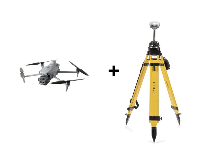
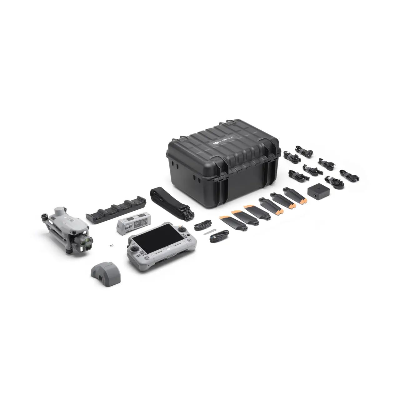
Emlid RS4 Pro and DJI Matrice 4E Base + Rover kit
Emlid 7.556,27 € Exc.VAT (7.556,27 € Inc. 23% VAT) -
Emlid Reach RX2: compact and reliable

The Reach RX2 is an ultra-portable RTK rover that is simple to use, with no settings to configure. Building on the strengths of the previous Reach RX, the new model is enhanced with greater performance in obstructed areas and new IMU tilt compensation.
The new features include:
- All-band RTK support (L1/L2/L5/L6) for greater reliability under canopy or in urban areas.
- Second-generation IMU tilt compensation for accurate, level-free measurements.
- The quick release mount for a fast and reliable setup in the field.
Pocket-sized and easy to deploy, the Reach RX2 is ideal for GIS, construction, and asset management in companies running multiple projects and teams. It integrates seamlessly with Esri ArcGIS apps for GIS data collection, and with the Pix4Dcatch app for mobile terrestrial scanning.
Designed to scale
Emlid receivers work straight out of the box with the ease of a consumer device while delivering uncompromising accuracy in any environment. This allows companies to assign surveying tasks to non-surveyor teams and effectively scale
operations, minimizing training time and reliance on dedicated surveyors.
Paired with the Emlid Flow app for data collection and the Emlid Flow 360 cloud platform for data management, the new product line offers a complete end-to-end solution for managers in GIS and construction to handle the field-to-office workflow faster and with less effort.
“Emlid receivers embody our philosophy of simplicity: they just work, no matter the conditions. We’ve built them to be reliable and future-ready, with features like AR positioning. This is precision without compromise, for everyone,” said Igor Vereninov, Co-founder & CEO of Emlid.
About Emlid
Emlid develops high-precision GNSS receivers and software that make professional-grade positioning accessible to everyone—from surveyors and GIS specialists to civil engineers and drone mapping experts.
Paired with the Emlid Flow app and Emlid Flow 360 cloud service, Emlid Reach receivers deliver centimeter- accurate results, speed up the entire field-to-office workflow, and integrate seamlessly with leading GIS and CAD software. All without unnecessary complexity.
Founded in 2014, Emlid has grown into a global brand trusted by professionals in over 100 countries. With offices in Lisbon, Portugal, and Budapest, Hungary, Emlid ships Reach receivers worldwide through its online store and network of official dealers.
Availability
The Reach RS4 Pro, Reach RS4, and Reach RX2 are available for pre-order.