


Solução Perfeita para obtenção de resultados únicos – O seu projeto nunca esteve em melhores mãos!

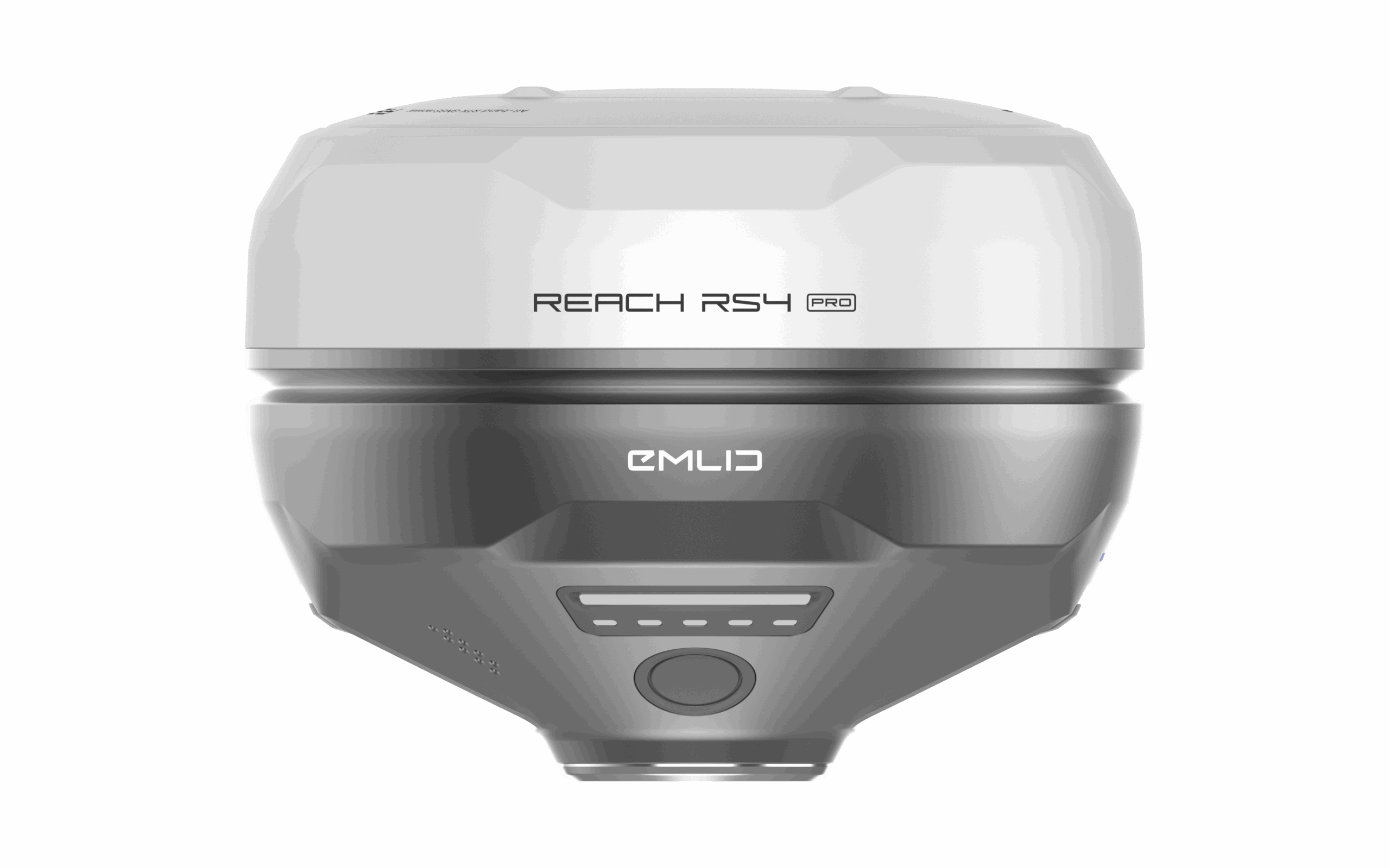
New Emlid RS4 Pro
New receiver includes all-band RTK support (L1/L2/L5/L6), a new generation IMU tilt compensation and AR stakeout.
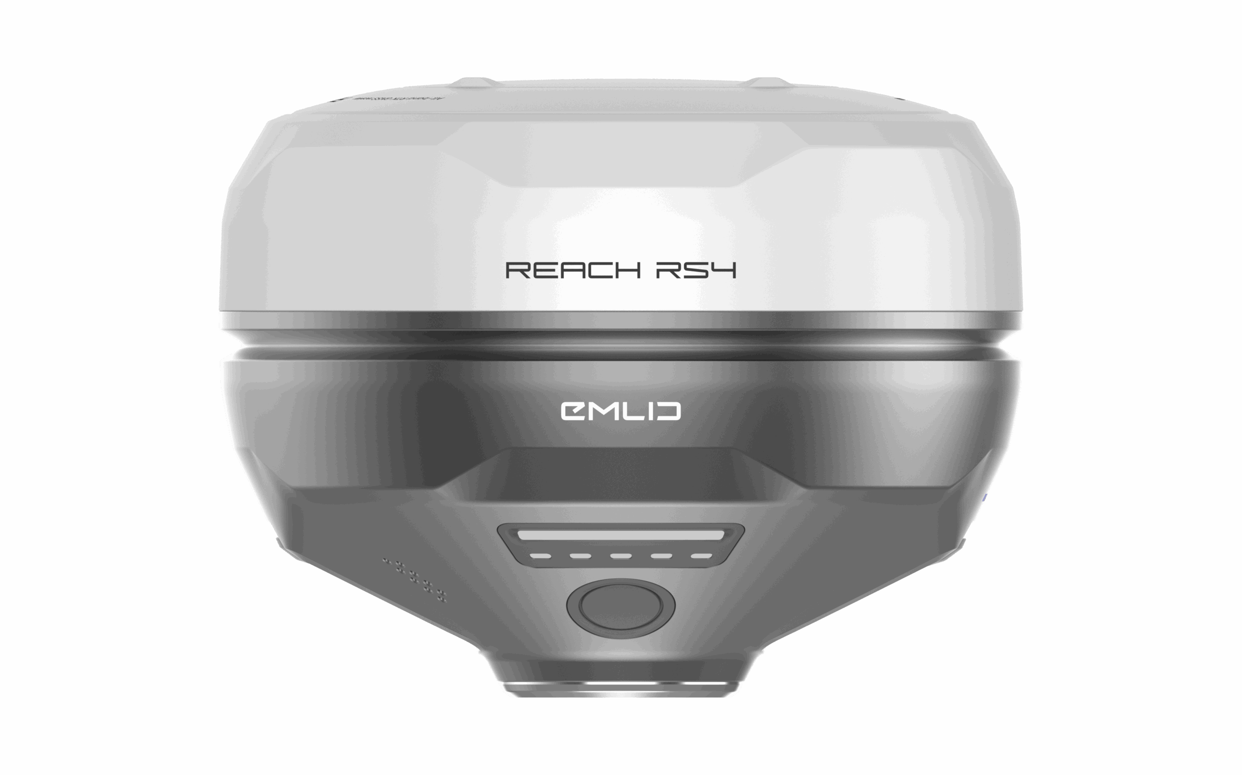
New Emlid RS4
New receiver includes all-band RTK support (L1/L2/L5/L6), a new generation IMU tilt compensation and Emlid multi-band radio system up to 2W.
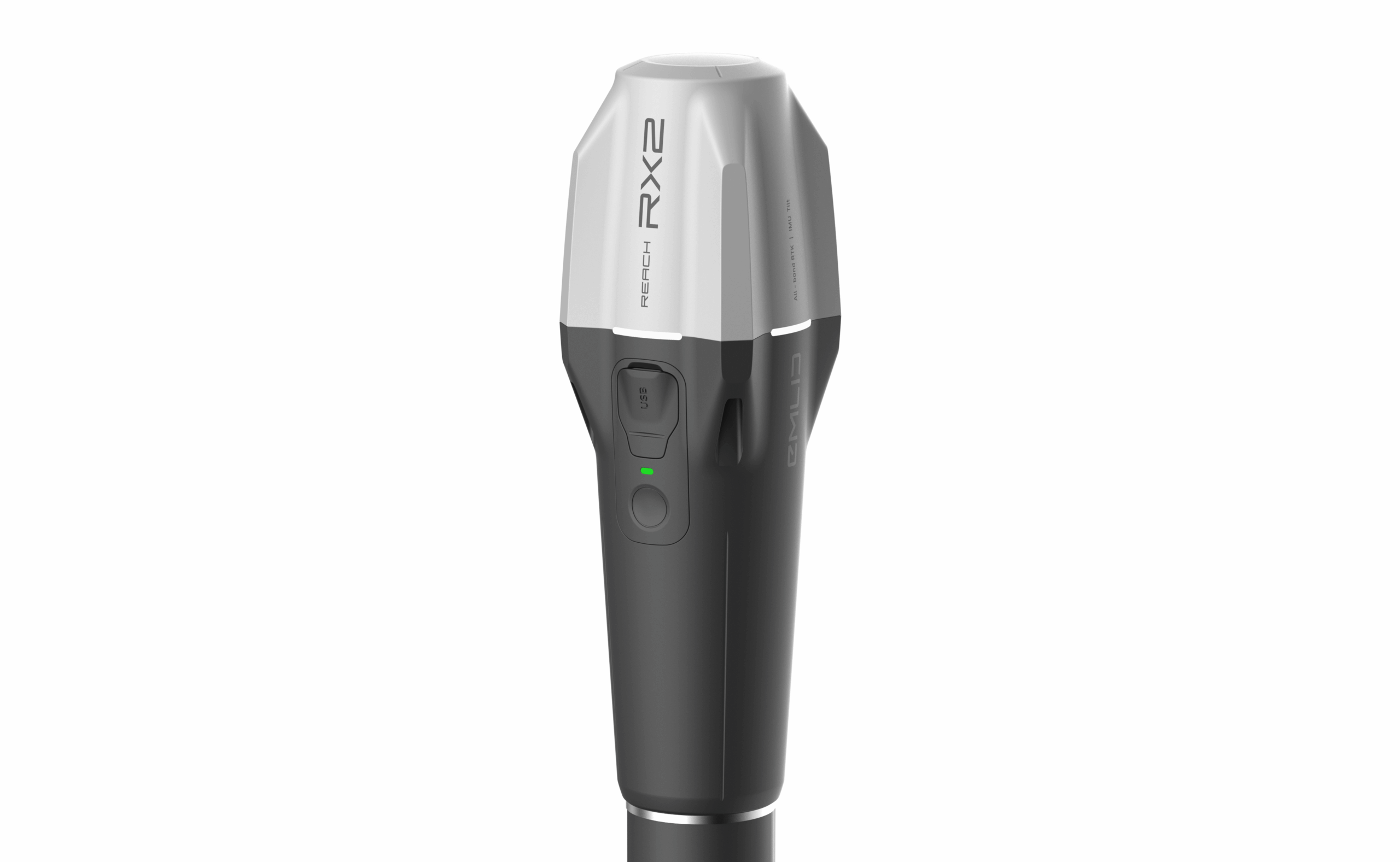
New Emlid RX2
New receiver includes all-band RTK support (L1/L2/L5/L6), a new generation IMU tilt compensation and quick release mount.

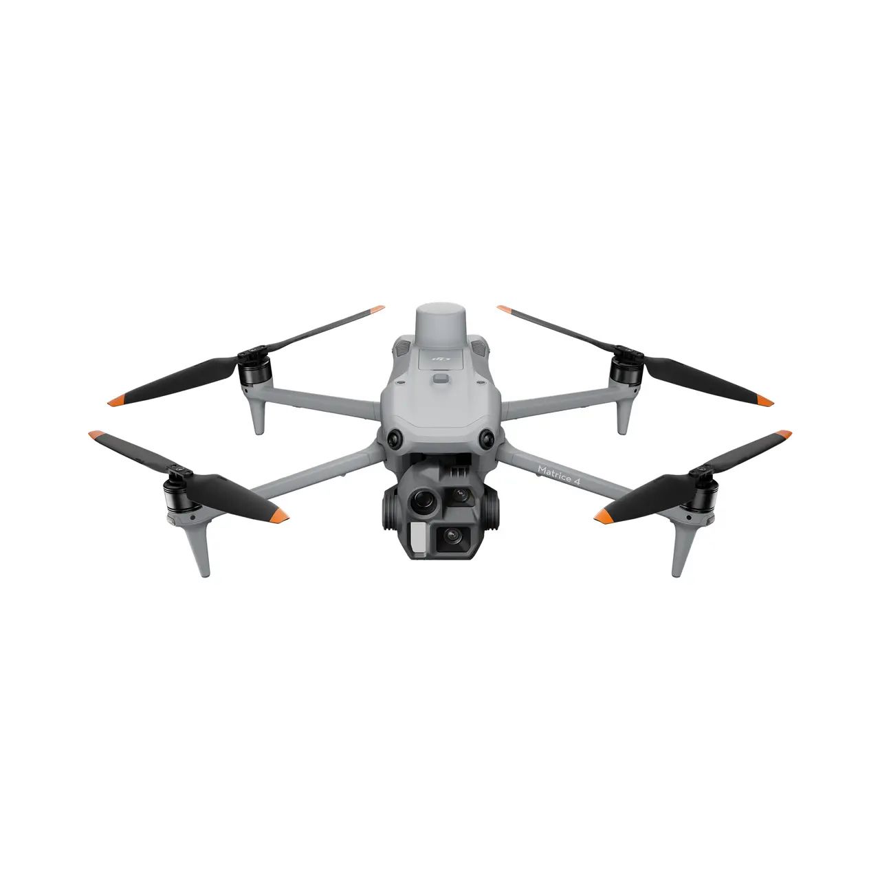
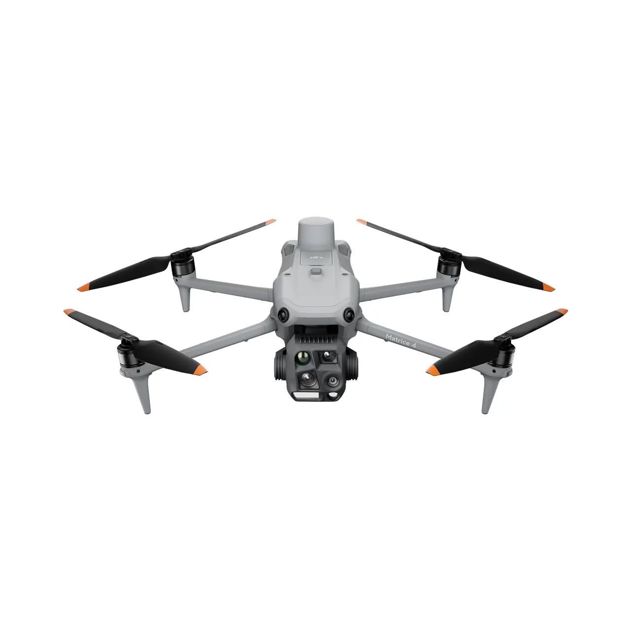
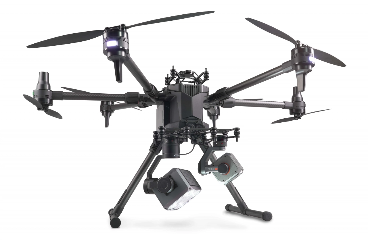
DJI Matrice 4E and 4T
The DJI Matrice 4E and Matrice 4T are both industrial-grade drones from DJI, designed specifically for professionals in fields like surveying, inspection, mapping and monitoring.

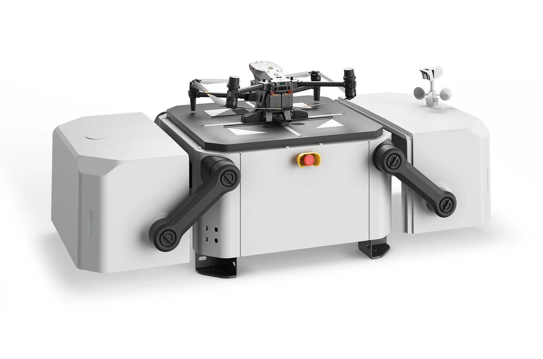
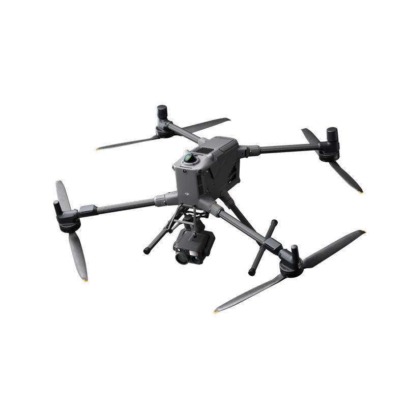
DJI Matrice 400
Designed for a wide range of industrial applications such as emergency response, power inspections, mapping, and architecture, engineering, and construction.

DJI Mini 5 Pro
The DJI Mini 5 Pro represents the pinnacle of portable aerial technology, packing a 1-inch sensor and omnidirectional LiDAR obstacle avoidance into a sub-250g frame.

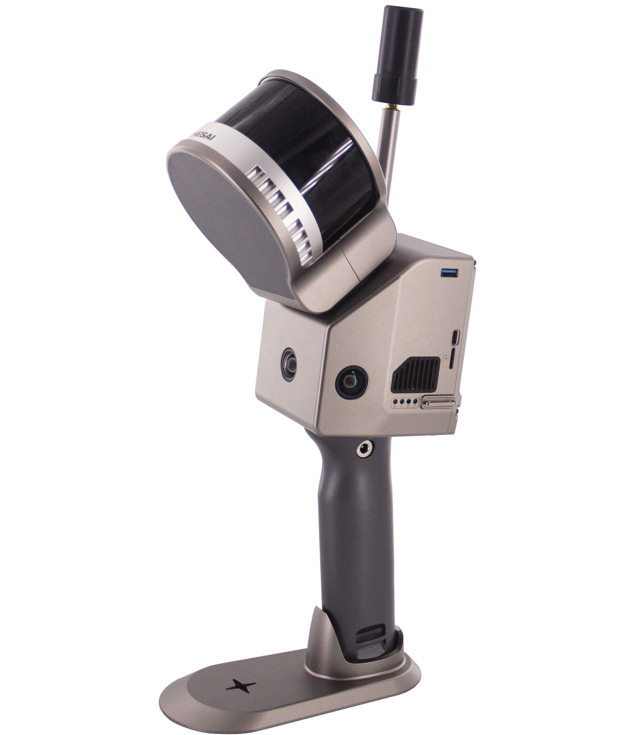
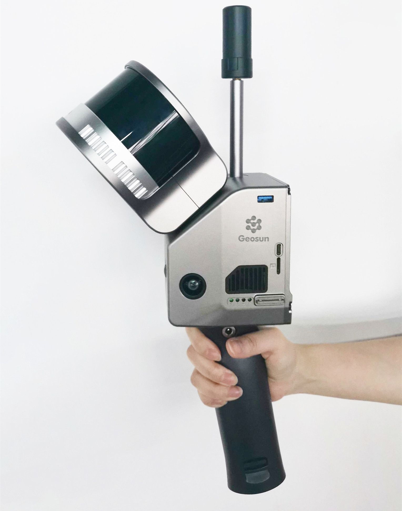
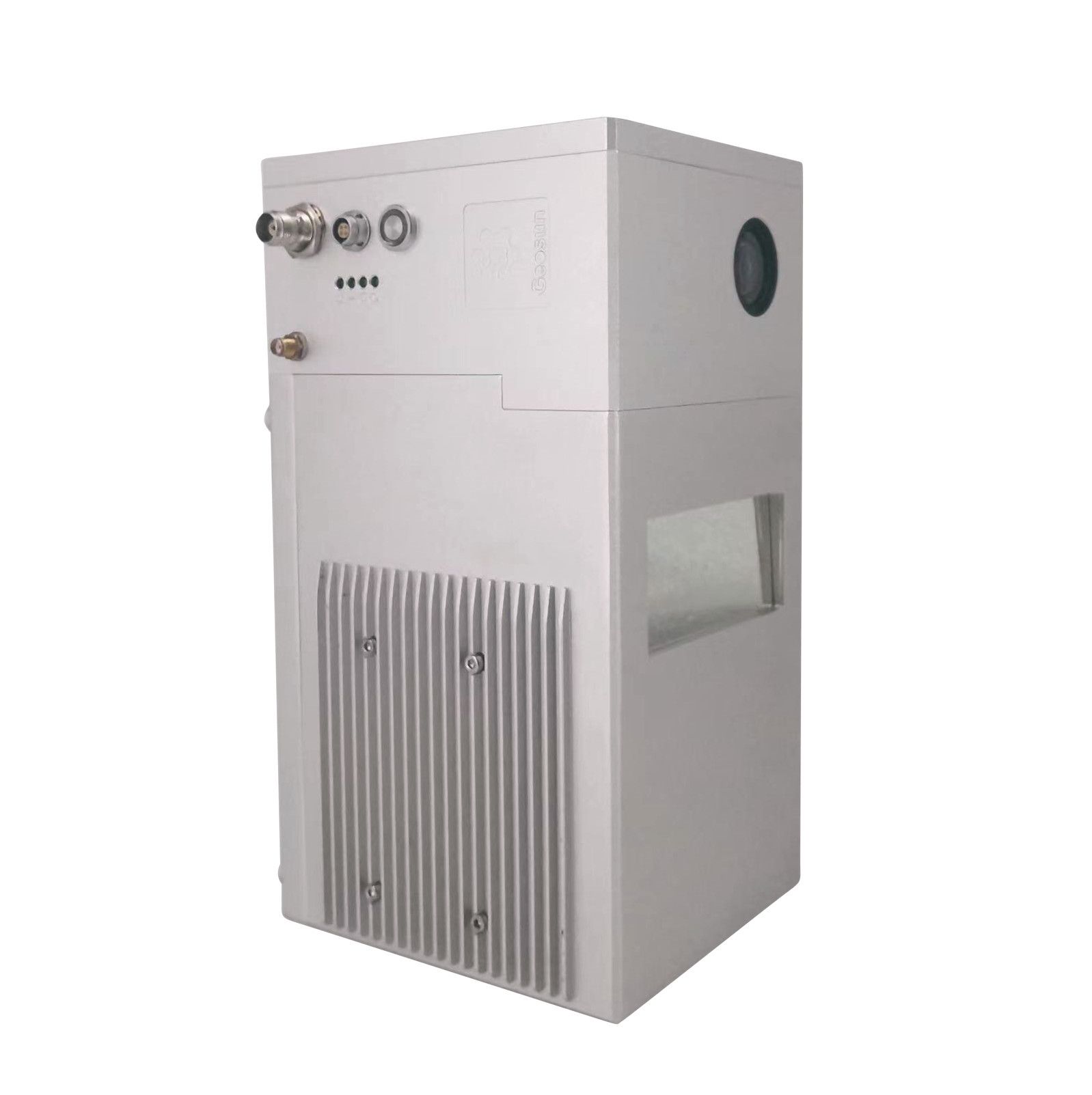
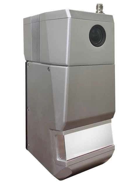
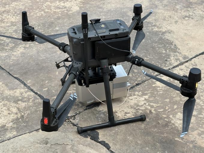
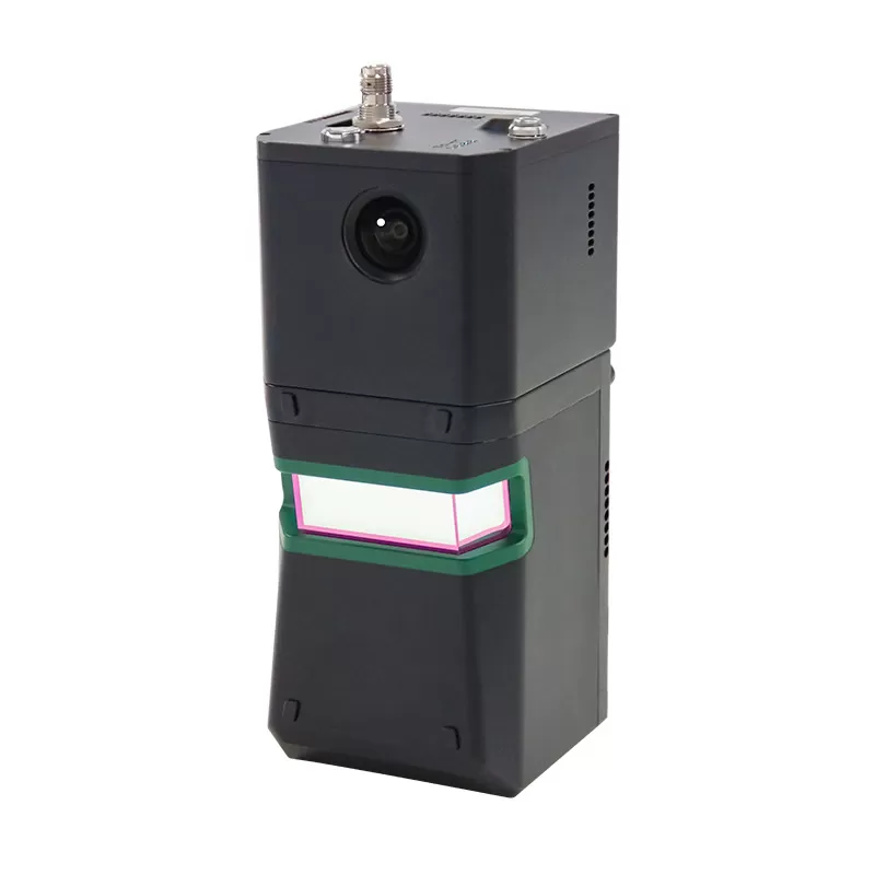
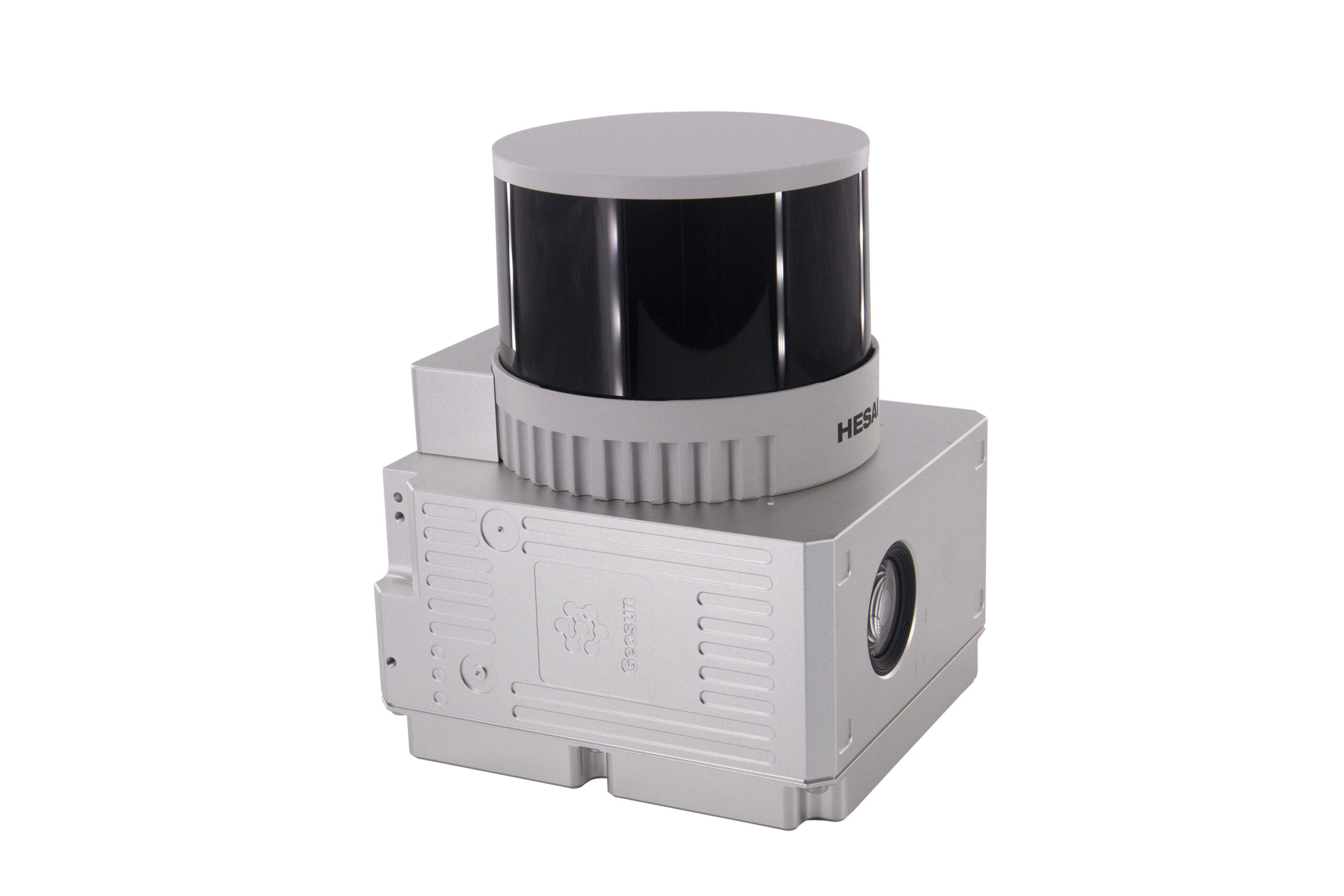
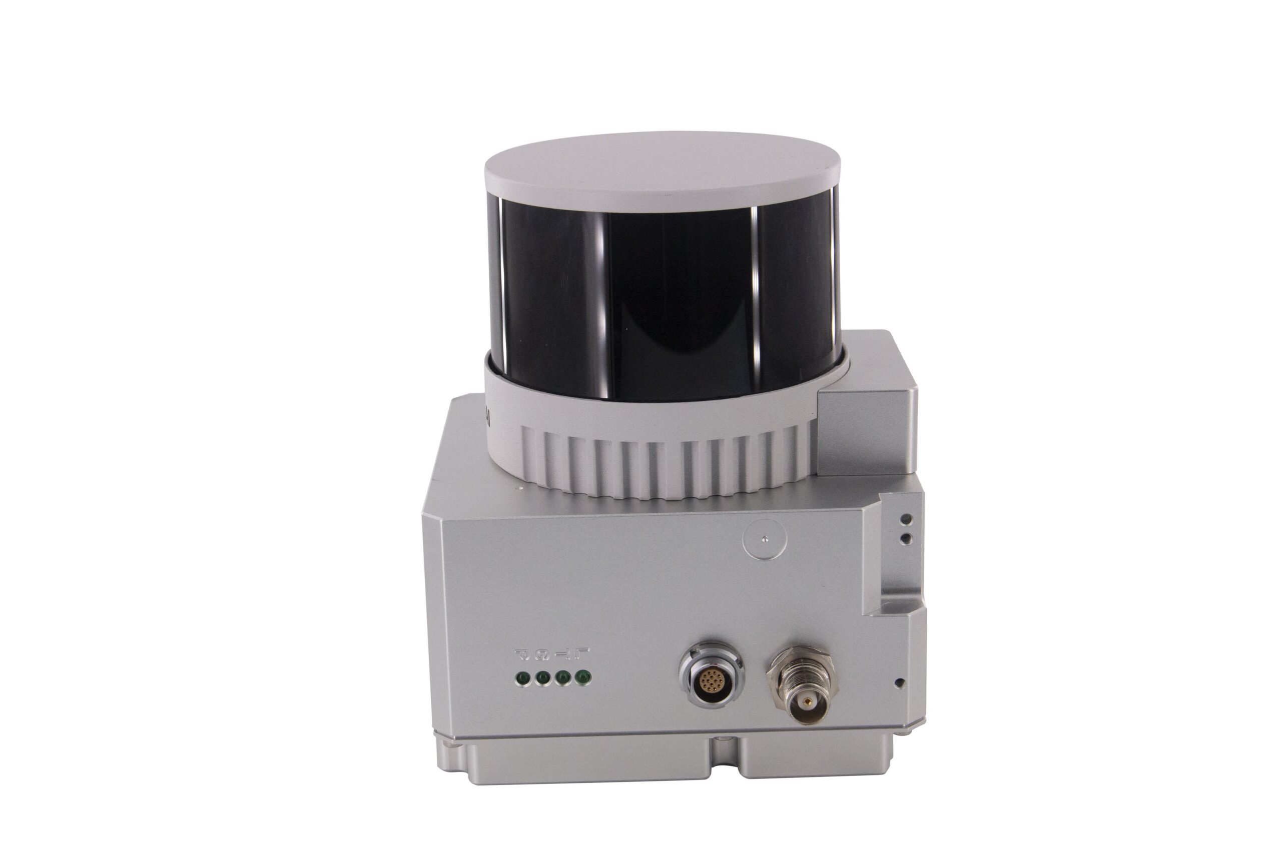
Geosun Lidars
Geosun LiDARs are a high-quality products that offers a combination of accuracy, speed, and efficiency.


New Wingtra LIDAR
Perfectly integrated with the WingtraOne GEN II drone to ensure a streamlined workflow.

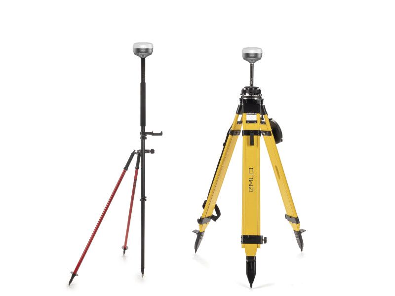
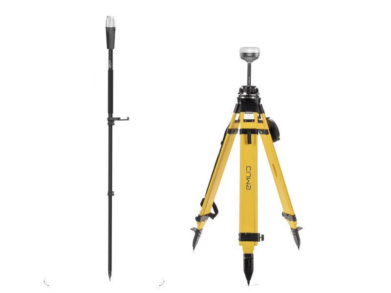
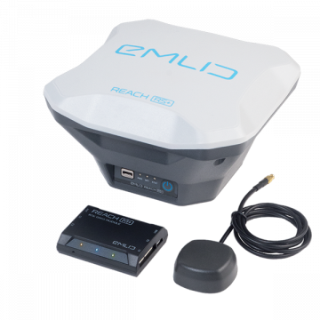
New Emlid Reach RS3
Multi-band base and rover
IMU tilt compensation
LTE modem
Dual-band radio
IMU tilt compensation
LTE modem
Dual-band radio

 Surveying & GIS
-
 Vista Rápida
 -
 Vista Rápida
 -
 Vista Rápida
 -
 Vista Rápida
 Mining & Quarries
-
 Vista Rápida
 -
Vista Rápida
-
Vista Rápida
-
Vista Rápida
-
Vista Rápida
 Construction
-
Vista Rápida
-
Vista Rápida
-
 Vista Rápida
 -
Vista Rápida
-
Vista Rápida
 Agriculture
-
Vista Rápida
-
Vista Rápida
-
Vista Rápida
-
Vista Rápida
-
Vista Rápida
 Environment monitoring
-
Vista Rápida
-
Vista Rápida
-
Vista Rápida
-
Vista Rápida
 Search & Rescue
-
Vista Rápida
-
Vista Rápida
-
Vista Rápida
 Other applications
-
 Vista Rápida
 -
 Vista Rápida
 -
 Vista Rápida
 -
 Vista Rápida
 -
 Vista Rápida
 -
Vista Rápida
-
Sale!
 Vista Rápida
 -
Sale!
 Vista Rápida
 -
 Vista Rápida
 -
 Vista Rápida


Showing 593–608 of 614 results
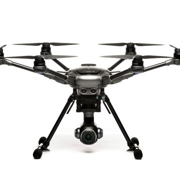

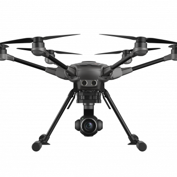
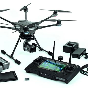
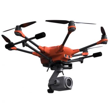
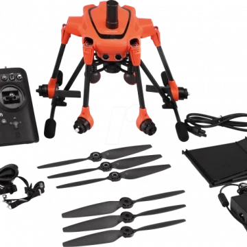
Yuneec Typhoon H Plus with Intel® RealSense™ and Backpack
THE POWER OF PRECISION Meet the next generation of Typhoon H - a hexacopter even more powerful than before and with an all new flight controller, based on PX4.
(Price on request)
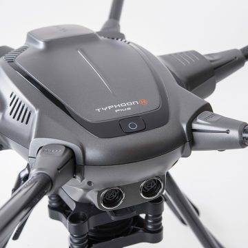
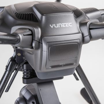
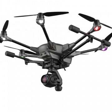
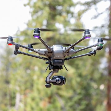
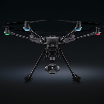
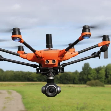
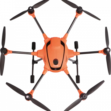
Yuneec Typhoon H Plus
THE POWER OF PRECISION Meet the next generation of Typhoon H - a hexacopter even more powerful than before and with an all new flight controller, based on PX4.
(Price on request)
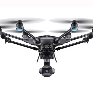
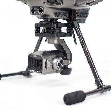
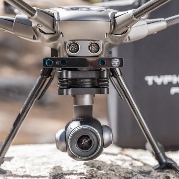
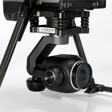
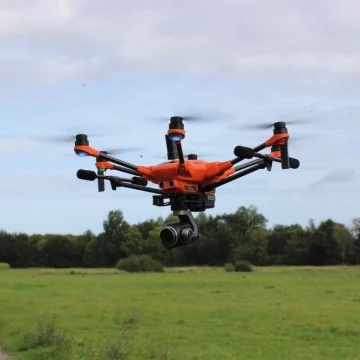
Yuneec Typhoon H3 w/ ION L1 Leica Camera
UNLIMITED PERSPECTIVES AND NEW, CREATIVE POSSIBILITIES With the Typhoon H3 and the ION L1 Pro camera developed in partnership with Leica, Yuneec and Leica Camera AG bring the best of their respective worlds together to bring Leica photography to the skies. The H3 has been specially developed for photographers and videographers who want to rediscover the world from above in a new look. Thanks to the use of high-quality materials and the implementation of a wide range of flight functions in combination with a 1” CMOS camera sensor, it offers you a sophisticated and perfectly coordinated overall system for you to realize your photographic ambitions. The safe and reliable hexacopter design featuring 6 rotors remains stable in the air – even when it’s windy outside. Furthermore, with the aid of the stabilized 3-axis gimbal, you can take perfectly stabilized and sharp 20 MP photos and up to 4K videos at
(Price on request)
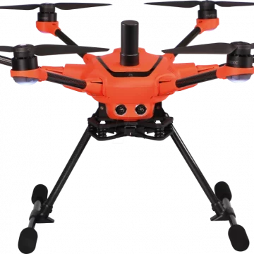
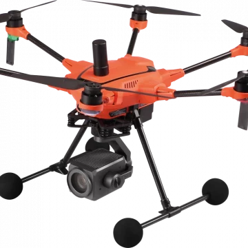
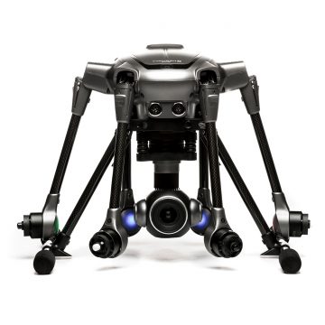
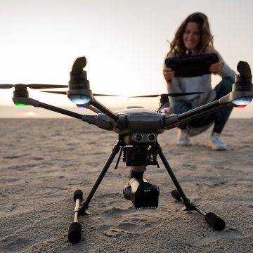
Yuneec H520E RTK
One of the fastest RTK systems in the world The commercial Hexacopter H520E receives one of the fastest and most reliable RTK systems in the world. Fully integrated into the H520E, it ensures the highest precision and the fastest possible operational readiness even under difficult GPS conditions like in cities, canyons or forests. Thanks to Real Time Kinematics satellite navigation the new H520E RTK will be able to stand in the air with centimeter accuracy, enabling extremely precise, repetitive photos, faster 3D mapping and more accurate, even automated, inspection flights.
4.732,30 € Exc.VAT (4.732,30 € Inc. 23% VAT)
Sale!
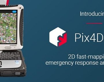
Pix4Dreact – Yearly License
Pix4DReact - Yearly Subscription license 2D fast-mapping for emergency response and public safety The mapping software for emergency response Get rapid and reliable situational awareness for quick decisions and collaboration in the field.
409,50 € Exc.VAT (409,50 € Inc. 23% VAT)
Sale!
Pix4DReact – Perpetual License
Pix4DReact - Perpetual License 2D fast-mapping for emergency response and public safety The mapping software for emergency response Get rapid and reliable situational awareness for quick decisions and collaboration in the field.
718,90 € Exc.VAT (718,90 € Inc. 23% VAT)
Sale!

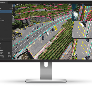
Pix4DSurvey – Yearly License
Pix4DSurvey - Yearly License Pix4Dsurvey is a software program designed to work with data captured from drones and laser scanners. It specifically focuses on the post-processing stage, after the images or point clouds have been captured.
1.820,00 € Exc.VAT (1.820,00 € Inc. 23% VAT)
Sale!

Pix4Dfields – Perpetual License
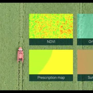
Pix4DFileds - Perpetual License Advanced agriculture mapping software for aerial crop analysis and digital farming. Precision agriculture mapping using images from drones and UAVs The only digital agriculture software focusing on reducing the processing time while incorporating the highest accuracy standards backed up with years of scientific research. Use Pix4Dfields to create prescription maps and maximize crop yields Create accurate field maps, generate insights and analyze field data in real time to increase crop productivity
3.185,00 € Exc.VAT (3.185,00 € Inc. 23% VAT)
Sale!
Pix4Dfields – Yearly License
Pix4Dfields - Yearly License Advanced agriculture mapping software for aerial crop analysis and digital farming. Precision agriculture mapping using images from drones and UAVs The only digital agriculture software focusing on reducing the processing time while incorporating the highest accuracy standards backed up with years of scientific research. Use Pix4Dfields to create prescription maps and maximize crop yields Create accurate field maps, generate insights and analyze field data in real time to increase crop productivity
1.319,50 € Exc.VAT (1.319,50 € Inc. 23% VAT)
Sale!
Pix4Dmapper Educational Classroom – Perpetual License
3.640,00 € Exc.VAT (3.640,00 € Inc. 23% VAT)
Pix4Dmapper Educational Classroom – Perpetual License
Pix4dMapper, Educational Classroom version – Perpetual License The power of photogrammetry software A unique environment connecting your original images to each point of the 3D reconstruction to visually verify and improve the accuracy of your project. Generate high resolution outputs for any project and use case Easily export your digital maps and models to industry-compatible formats for further analysis or reporting
3.640,00 € Exc.VAT (3.640,00 € Inc. 23% VAT)
Sale!
Pix4Dmapper Educational Professor – Yearly License
Pix4Dmapper Educational Professor - Yearly License The power of photogrammetry software A unique environment connecting your original images to each point of the 3D reconstruction to visually verify and improve the accuracy of your project. Generate high resolution outputs for any project and use case Easily export your digital maps and models to industry-compatible formats for further analysis or reporting
546,00 € Exc.VAT (546,00 € Inc. 23% VAT)
Sale!
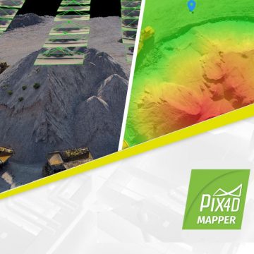
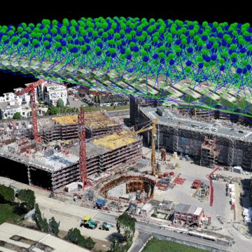
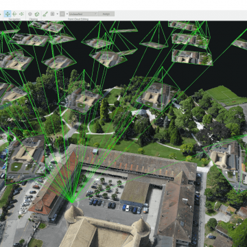
Pix4Dmapper – Yearly Subscription License
Pix4dMapper - Yearly Subscription License The power of photogrammetry software A unique environment connecting your original images to each point of the 3D reconstruction to visually verify and improve the accuracy of your project. Generate high resolution outputs for any project and use case Easily export your digital maps and models to industry-compatible formats for further analysis or reporting
2.639,00 € Exc.VAT (2.639,00 € Inc. 23% VAT)
Sale!
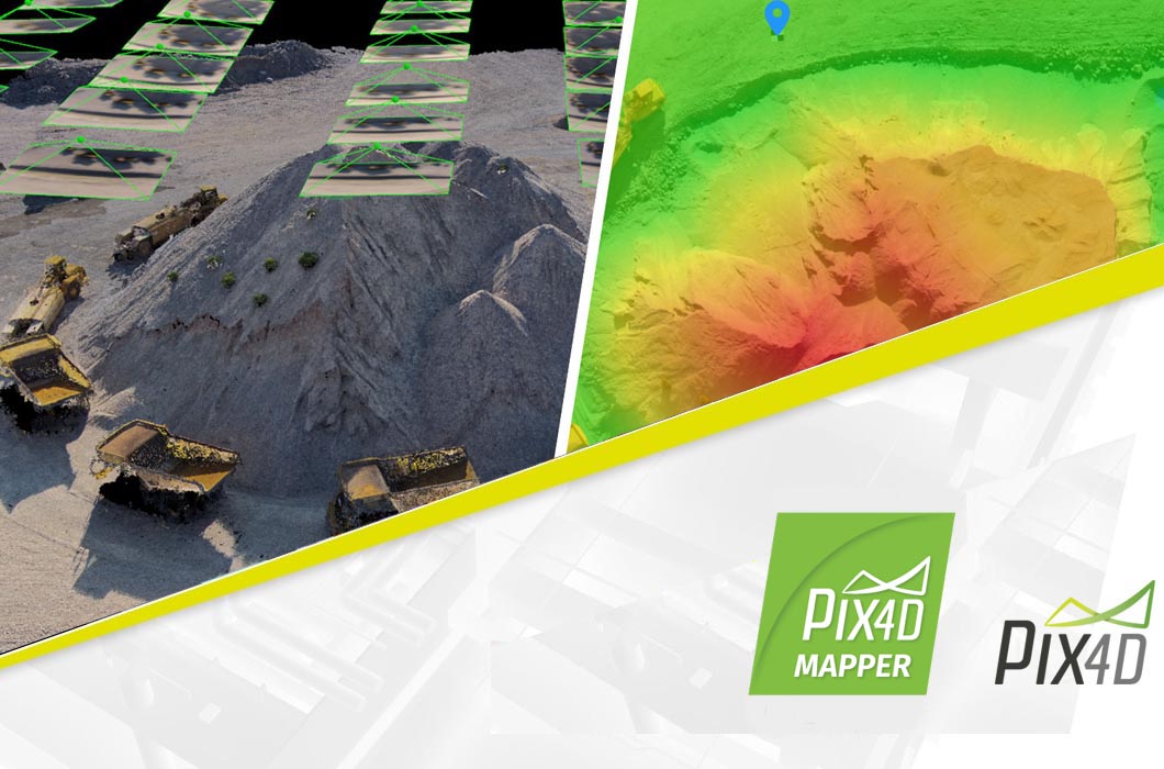
Pix4Dmapper – Perpetual License
Pix4dMapper - Perpetual License The power of photogrammetry software A unique environment connecting your original images to each point of the 3D reconstruction to visually verify and improve the accuracy of your project. Generate high resolution outputs for any project and use case Easily export your digital maps and models to industry-compatible formats for further analysis or reporting
4.267,90 € Exc.VAT (4.267,90 € Inc. 23% VAT)
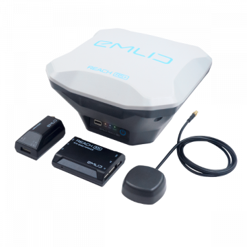
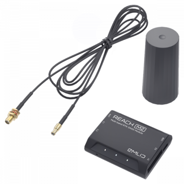
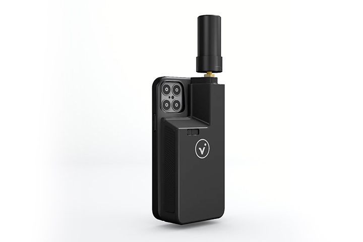
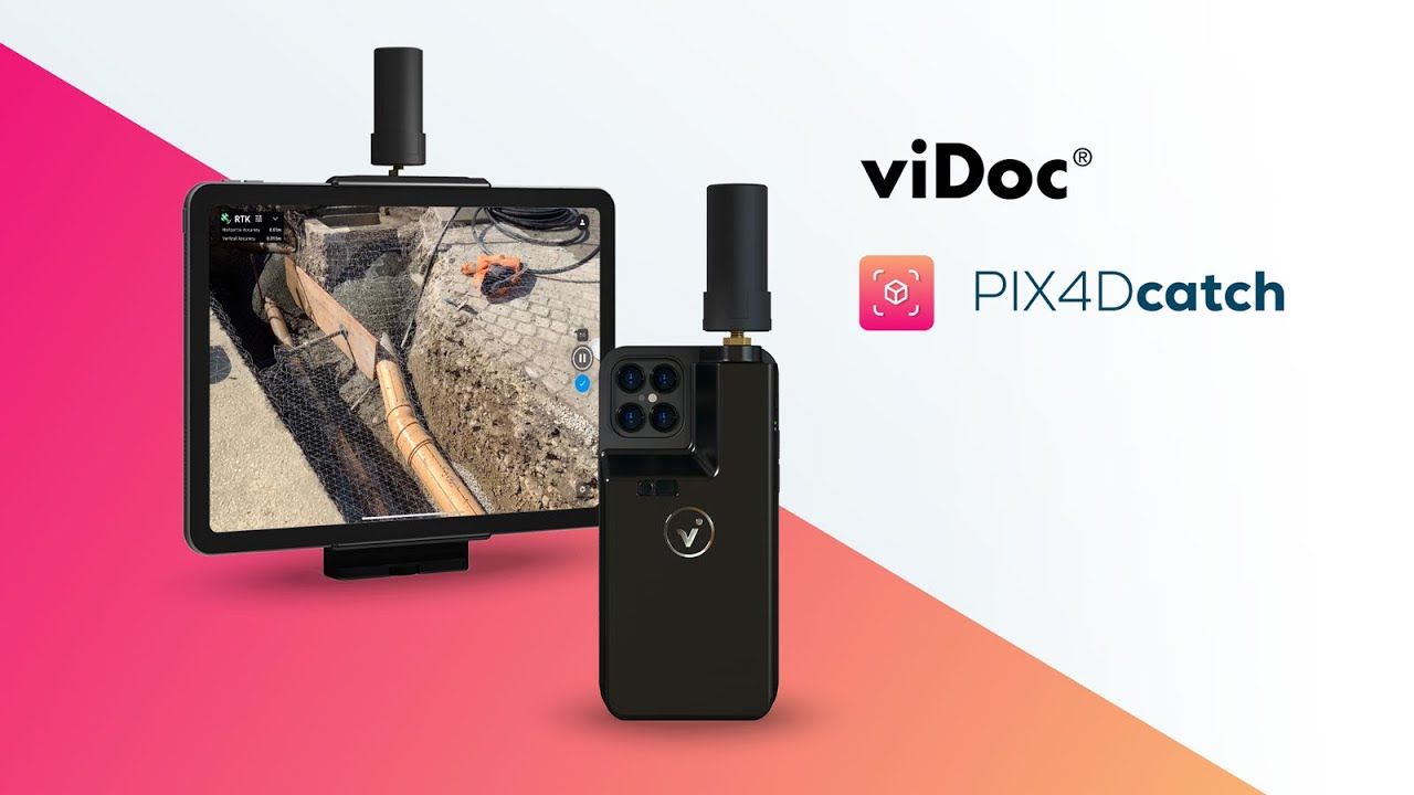
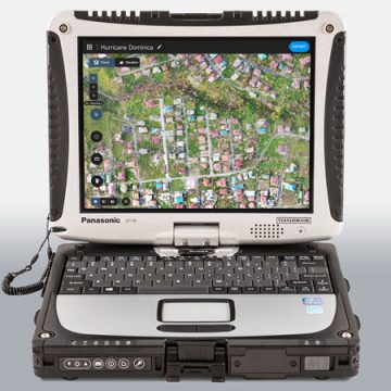
Emlid REACH M2 with Multi-band GNSS Antenna
EMLID Reach M2 witch Multi-band GNSS Antenna
(Price on request)

-
-
Sale!

 Vista Rápida
 -
-
-
-
Sale!

 Vista Rápida
 -
-
Sale!
 Vista Rápida

-
-
-
 Vista Rápida
DJI Care Enterprise Basic (DJI Matrice 3TD)
Accessories Dock2 48.365,00 € Exc.VAT (48.365,00 € Inc. 23% VAT) -
-
-
-
-
-
 Vista Rápida
DJI Mavic 3T (Thermal) – Worry-Free Plus Combo – 1 year
DJI 6.008,13 € Exc.VAT (6.008,13 € Inc. 23% VAT) -
-
Vista Rápida
DJI Mavic 3T (Thermal) – Worry-Free Basic Combo – 1 year
DJI 4.545,00 € Exc.VAT (4.545,00 € Inc. 23% VAT) -
 Vista Rápida
DJI Mavic 3E (Enterprise) Worry-Free Plus Combo – 1 Year
DJI 4.219,51 € Exc.VAT (4.219,51 € Inc. 23% VAT) -
Vista Rápida
DJI Mavic 3E (Enterprise) Worry-Free Plus Combo – 1 Year
DJI 4.219,51 € Exc.VAT (4.219,51 € Inc. 23% VAT) -
-
Vista Rápida
DJI Mavic 3M (Multispectral) – Free Basic Combo – 1 Year
DJI 3.727,64 € Exc.VAT (3.727,64 € Inc. 23% VAT) -
Vista Rápida
DJI Mavic 3E (Enterprise) Worry-Free Basic Combo – 1 Year
DJI 2.899,00 € Exc.VAT (2.899,00 € Inc. 23% VAT)
-
Sale!
 Vista Rápida
 -
Sale!Vista Rápida
-
 Vista Rápida
 -
Vista Rápida
-
Vista Rápida
Global Mapper Pro Single User – Floating License
Blue Marble 2.379,00 € Exc.VAT (2.379,00 € Inc. 23% VAT) -
Vista Rápida
Global Mapper Pro Single User – Node Locked
Blue Marble 1.599,00 € Exc.VAT (1.599,00 € Inc. 23% VAT) -
Vista Rápida
-
 Vista Rápida
Agisoft Metashape Standard, Node-Locked Educational license, Single
Agisoft 54,00 € Exc.VAT (54,00 € Inc. 23% VAT)
-
-
 Vista Rápida
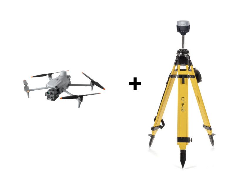
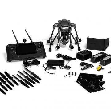
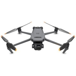
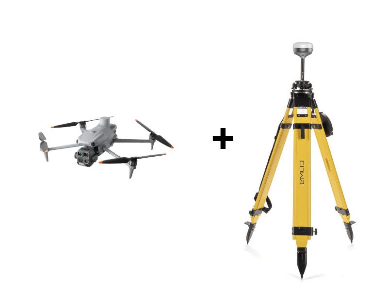
Emlid RS4 Pro and DJI Matrice 4E Base + Rover kit
Emlid 7.556,27 € Exc.VAT (7.556,27 € Inc. 23% VAT) -
-
Vista Rápida
-
Vista Rápida
