


Solução Perfeita para obtenção de resultados únicos – O seu projeto nunca esteve em melhores mãos!

DJI Matrice 400
Designed for a wide range of industrial applications such as emergency response, power inspections, mapping, and architecture, engineering, and construction.

DJI Matrice 4E and 4T
The DJI Matrice 4E and Matrice 4T are both industrial-grade drones from DJI, designed specifically for professionals in fields like surveying, inspection, mapping and monitoring.

Geosun Lidars
Geosun LiDARs are a high-quality products that offers a combination of accuracy, speed, and efficiency.


New Wingtra LIDAR
Perfectly integrated with the WingtraOne GEN II drone to ensure a streamlined workflow.

New Emlid Reach RS3
Multi-band base and rover
IMU tilt compensation
LTE modem
Dual-band radio
IMU tilt compensation
LTE modem
Dual-band radio

 Surveying & GIS
-
 Vista Rápida
 -
 Vista Rápida
 -
 Vista Rápida
 -
 Vista Rápida
 -
 Vista Rápida
 -
Sale!Vista Rápida
-
 Vista Rápida
 Mining & Quarries
-
Vista Rápida
-
Vista Rápida
-
Vista Rápida
-
Vista Rápida
-
 Vista Rápida
 -
Sale!Vista Rápida
-
Vista Rápida
-
Vista Rápida
 Construction
-
Sale!Vista Rápida
-
Vista Rápida
-
Vista Rápida
-
Vista Rápida
-
Vista Rápida
-
Vista Rápida
-
Vista Rápida
-
Vista Rápida
 Agriculture
-
Vista Rápida
-
Vista Rápida
-
Vista Rápida
-
Vista Rápida
-
Vista Rápida
-
Sale!Vista Rápida
-
Vista Rápida
-
Vista Rápida
 Environment monitoring
-
Vista Rápida
-
Vista Rápida
-
Vista Rápida
-
Vista Rápida
-
Sale!Vista Rápida
-
Vista Rápida
-
Vista Rápida
 Search & Rescue
-
Vista Rápida
-
Vista Rápida
-
Vista Rápida
-
Sale!Vista Rápida
-
Vista Rápida
-
Vista Rápida
 Other applications
-
 Vista Rápida
 -
Sale!
 Vista Rápida
 -
Sale!
 Vista Rápida
 -
 Vista Rápida
 -
 Vista Rápida
 -
Sale!
 Vista Rápida


- Sorry, this product cannot be purchased.
Showing 289–304 of 577 results
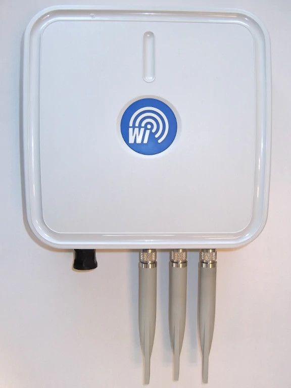
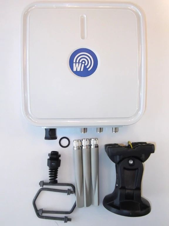
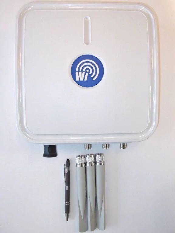
DroneScout DS230
DroneScout is a (direct/broadcast) Remote ID receiver that receives Remote ID signals. A receiver is also called sensor or radar. The EU and USA are planning new rules that make Remote ID mandatory for drones over 250 grams weight. Technically Remote ID is called Direct Remote ID (DRI) in the EU and Broadcast Remote ID in the USA.
939,00 € Exc.VAT (939,00 € Inc. 23% VAT)
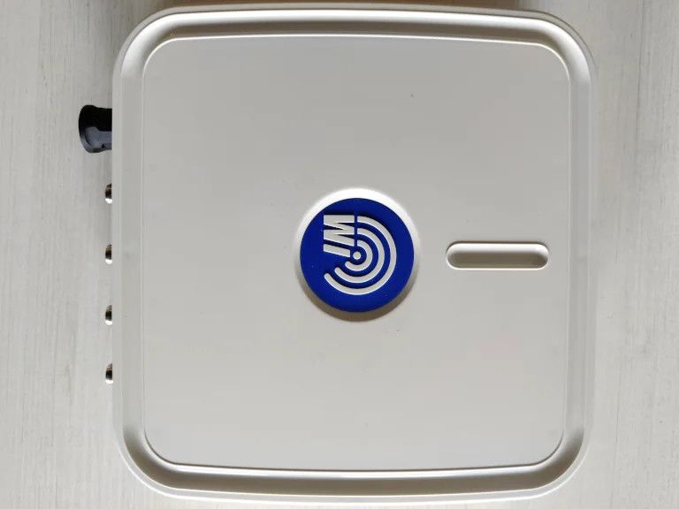
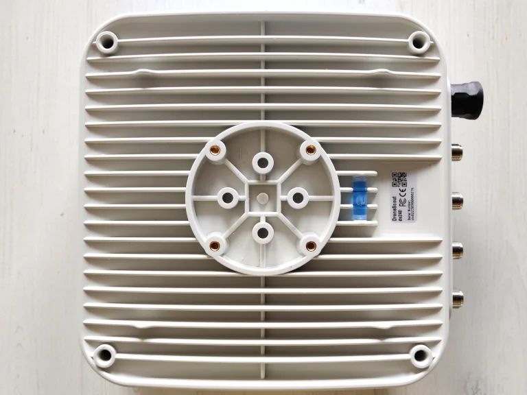
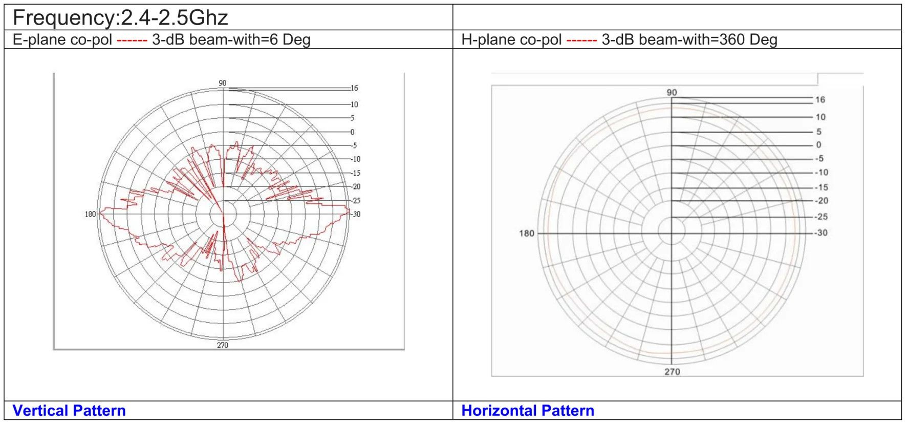
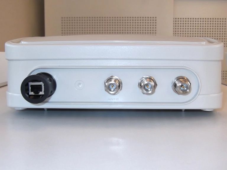
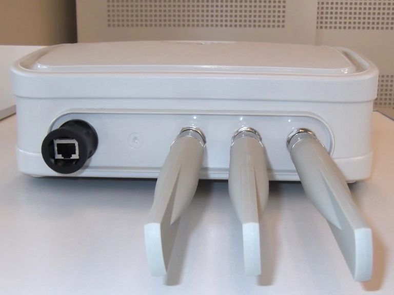
DroneScout DS240 Barebone
DroneScout is a (direct/broadcast) Remote ID receiver that receives Remote ID signals. A receiver is also called sensor or radar. The EU and USA are planning new rules that make Remote ID mandatory for drones over 250 grams weight. Technically Remote ID is called Direct Remote ID (DRI) in the EU and Broadcast Remote ID in the USA. The ds240 barebone is the ds240 receiver without antennas, surge protectors and antenna cables. You need to install use your own antennas!
1.219,00 € Exc.VAT (1.219,00 € Inc. 23% VAT)
Sale!
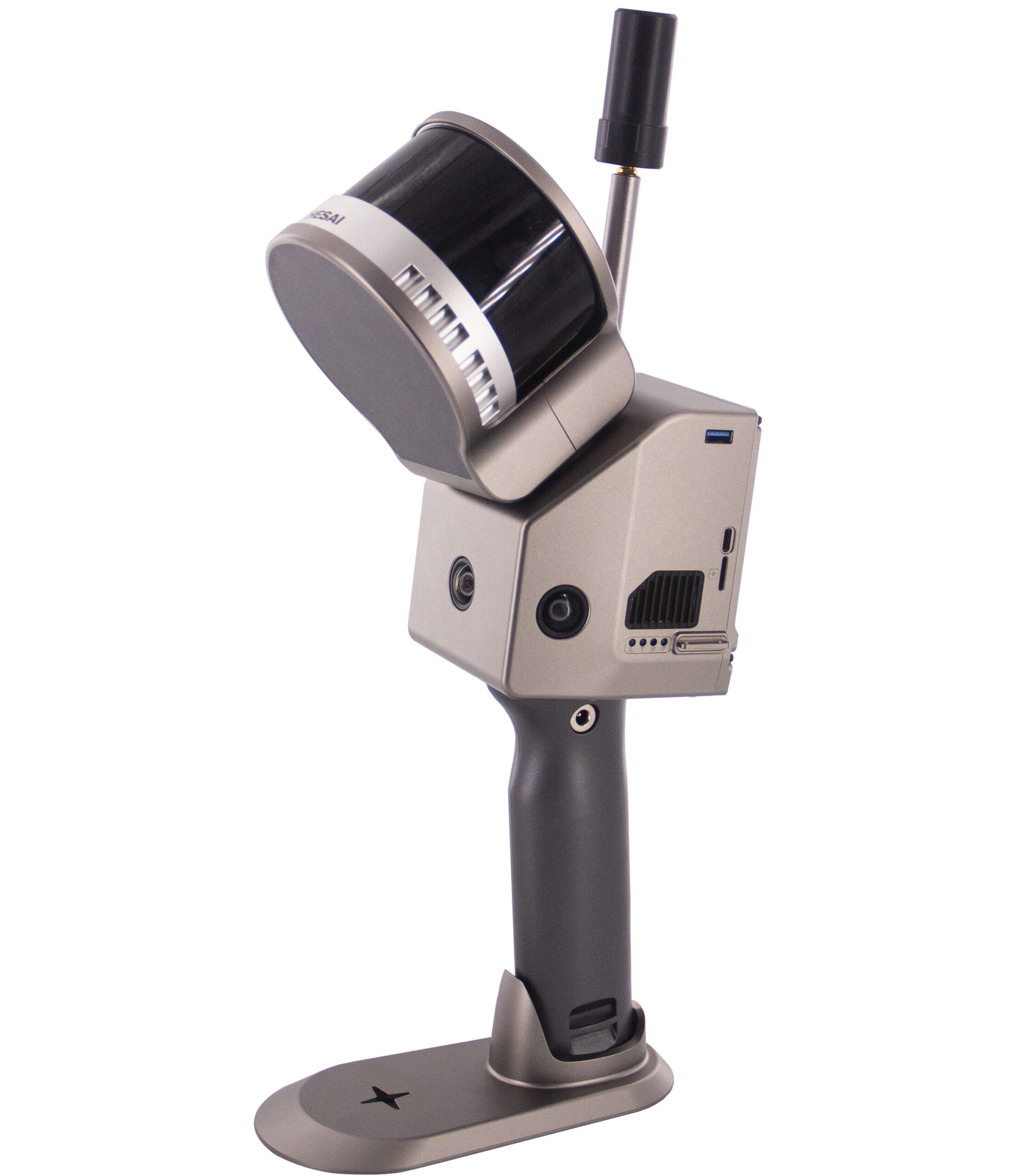
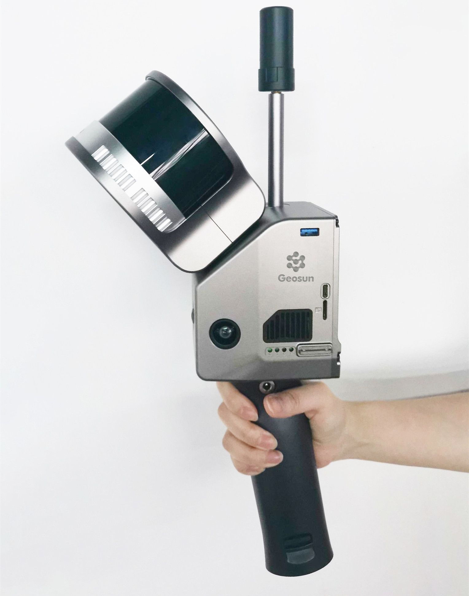
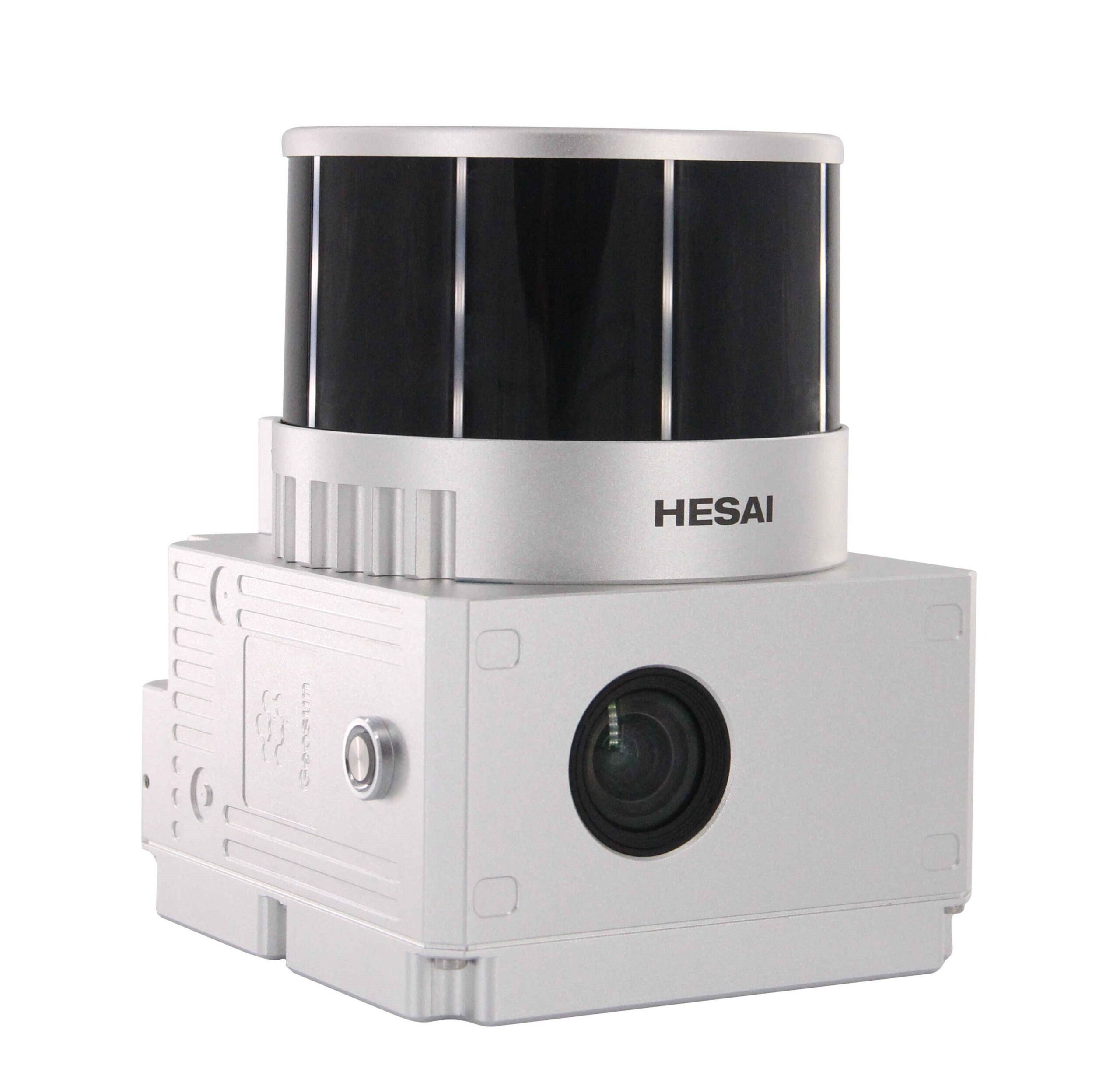
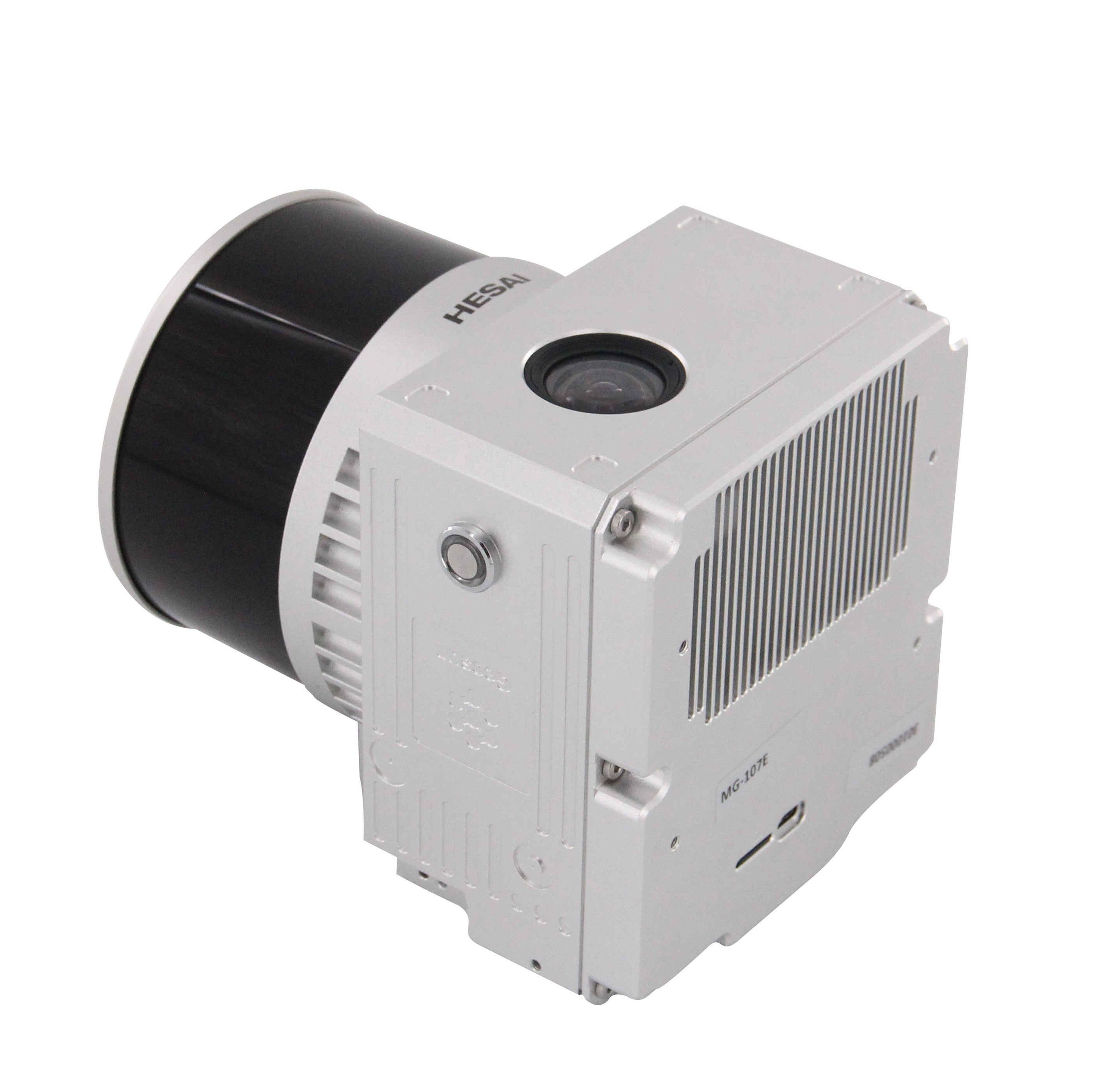
GS-100G handheld LiDAR
The Geosun GS-100G is a handheld LiDAR scanner designed for capturing high-resolution 3D data in various indoor and outdoor environments. It combines a compact and lightweight design with advanced LiDAR and positioning technology to provide accurate and efficient data acquisition. Key Features Lightweight and compact design Both GNSS and SLAM support Designed for outdoor and indoor uses Internal batteries and external power supply Included Laser sensor: Hesai XT-16 POS system: Geosun AGS 302 (GNSS + IMU) Camera: 3x5M Pixel RGB Cameras Software: PointCreator Post-processing software (Pepertual license)
7.149,00 € Exc.VAT (7.149,00 € Inc. 23% VAT)
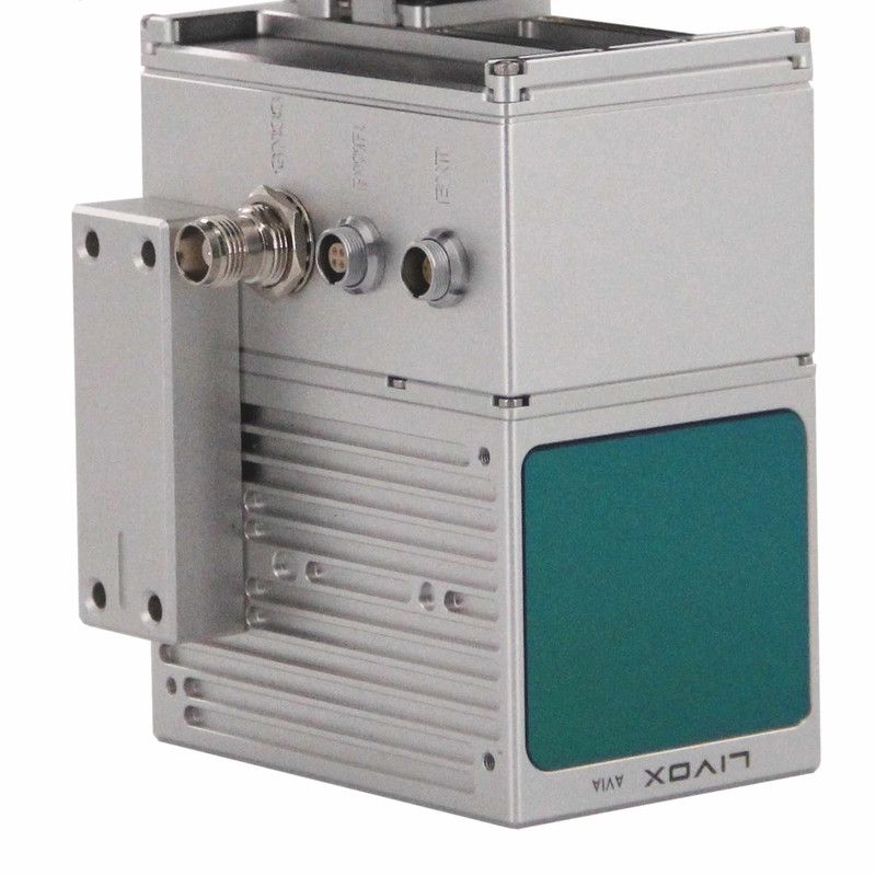
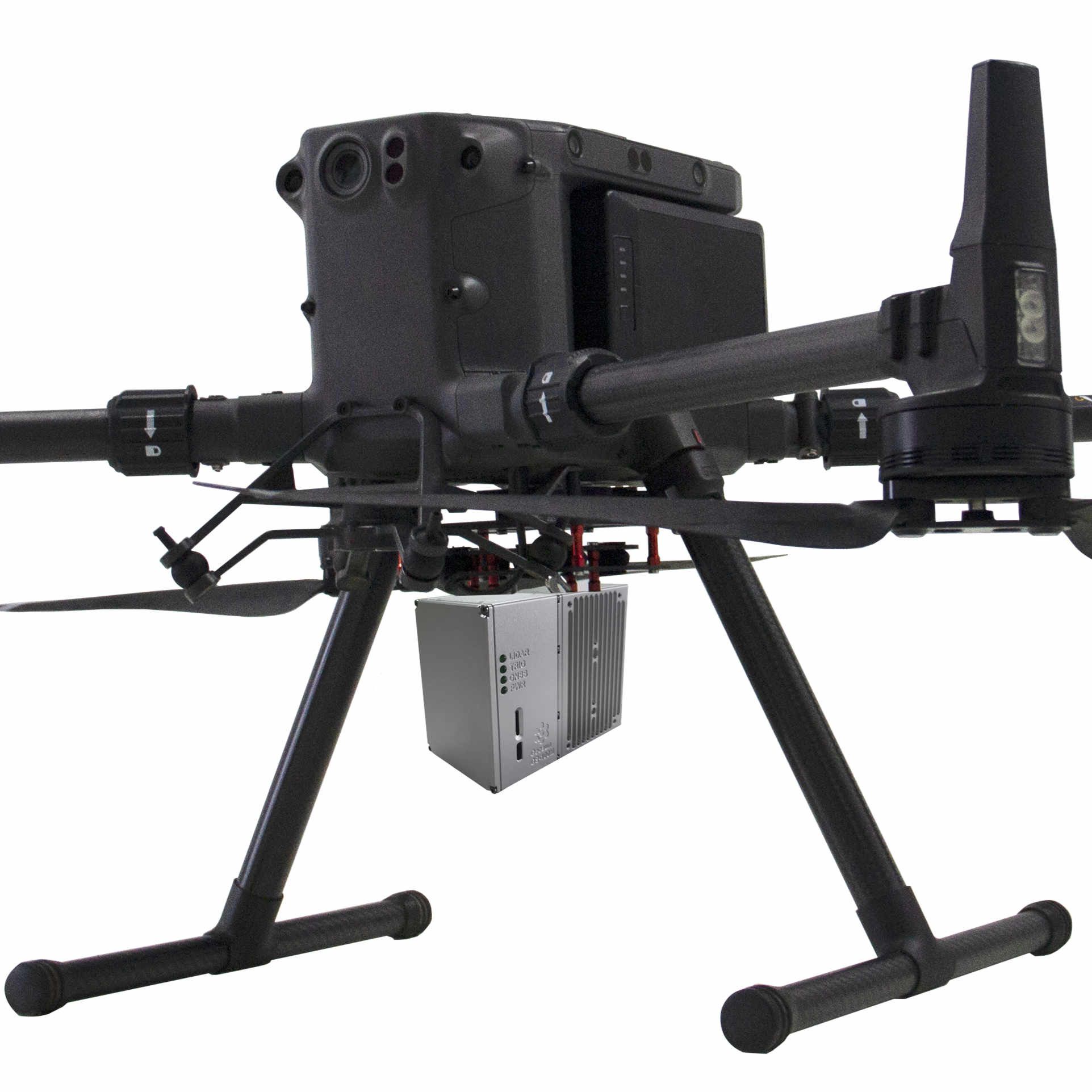
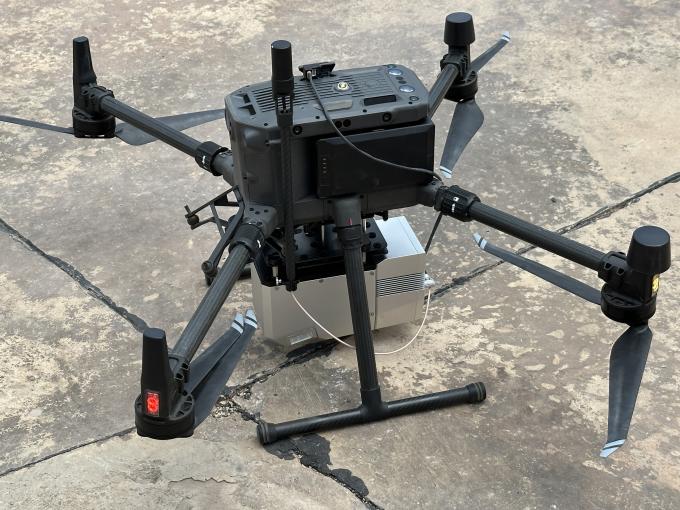
GS-100M+ Lidar
The Geosun GS-100M+ is a compact and lightweight UAV-mounted LiDAR scanning system designed for collecting detailed 3D data from aerial perspectives. It integrates a high-performance Livox Avia laser scanner with a GNSS and IMU positioning system, enabling real-time, high-precision mapping and surveying from drones. Compatibility: DJI Matrice 300/350 RTK and Yuneec H850RTK
6.199,00 € Exc.VAT (6.199,00 € Inc. 23% VAT)
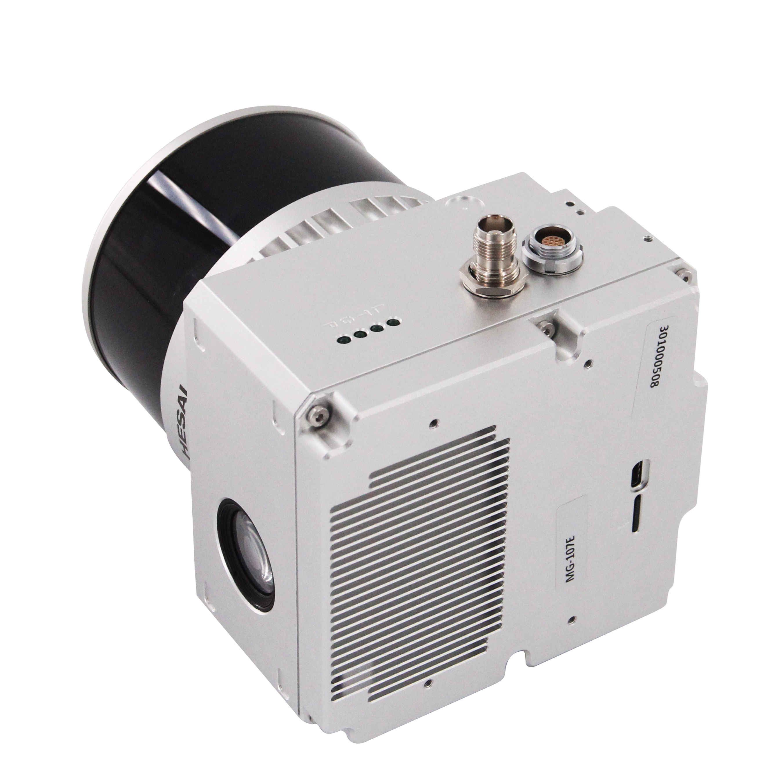
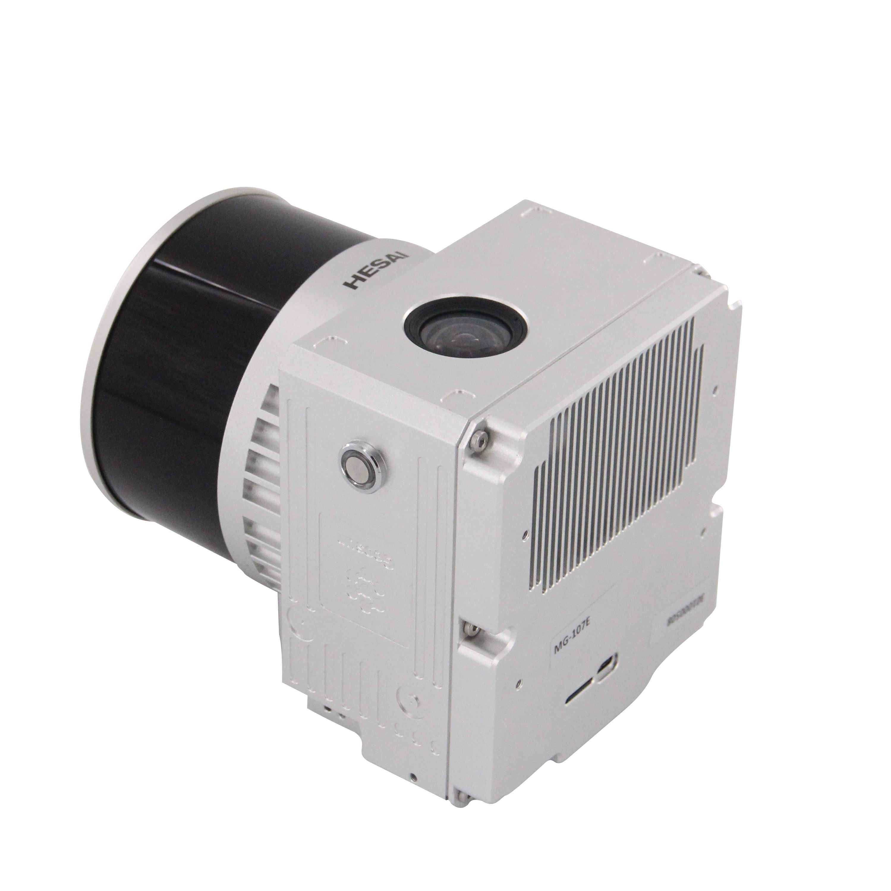
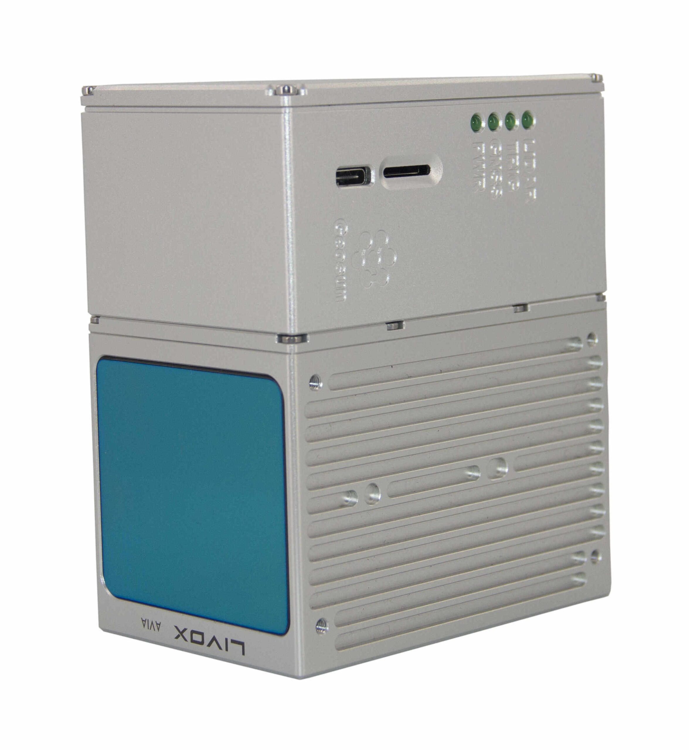
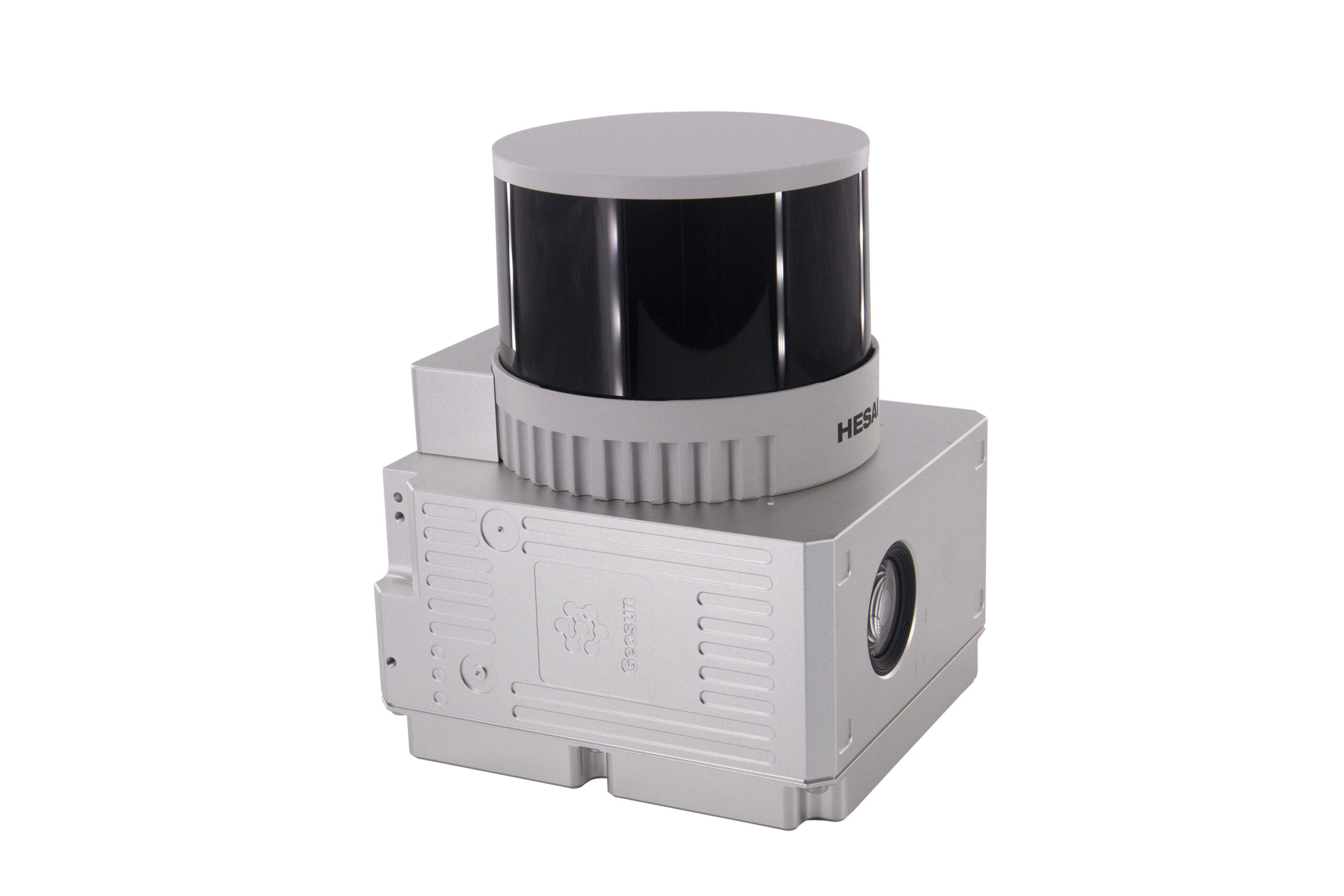
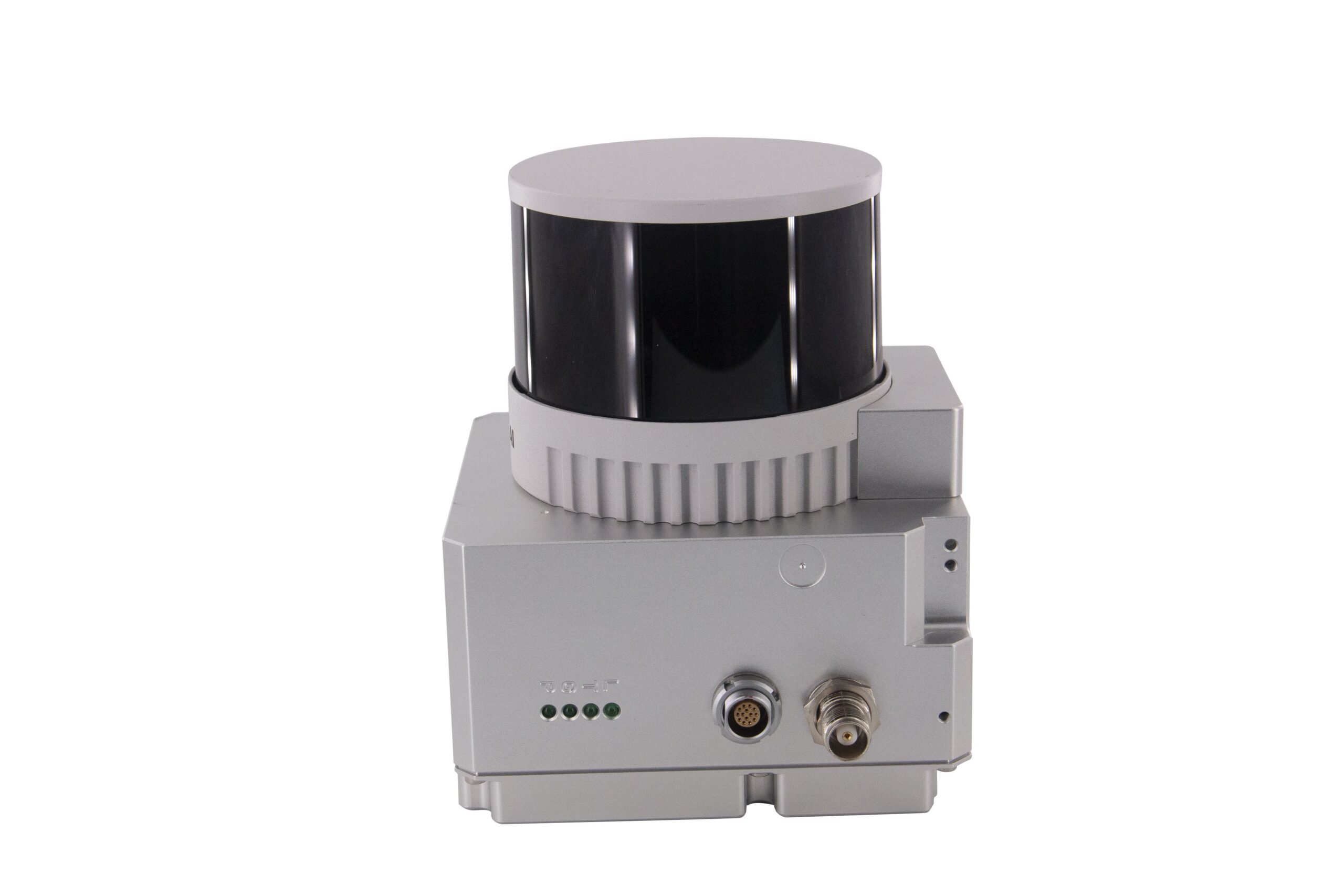
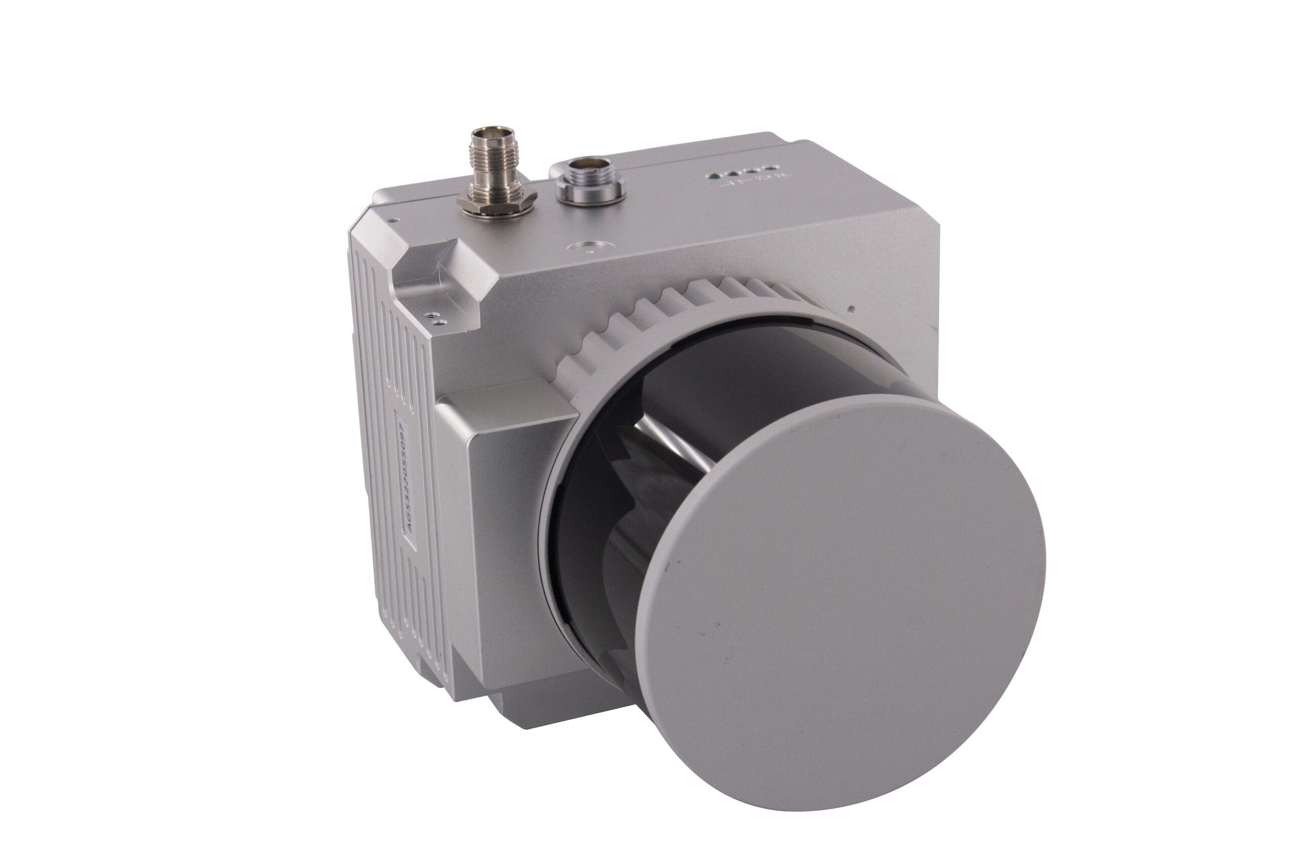
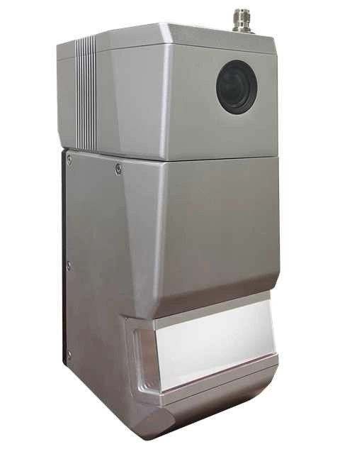
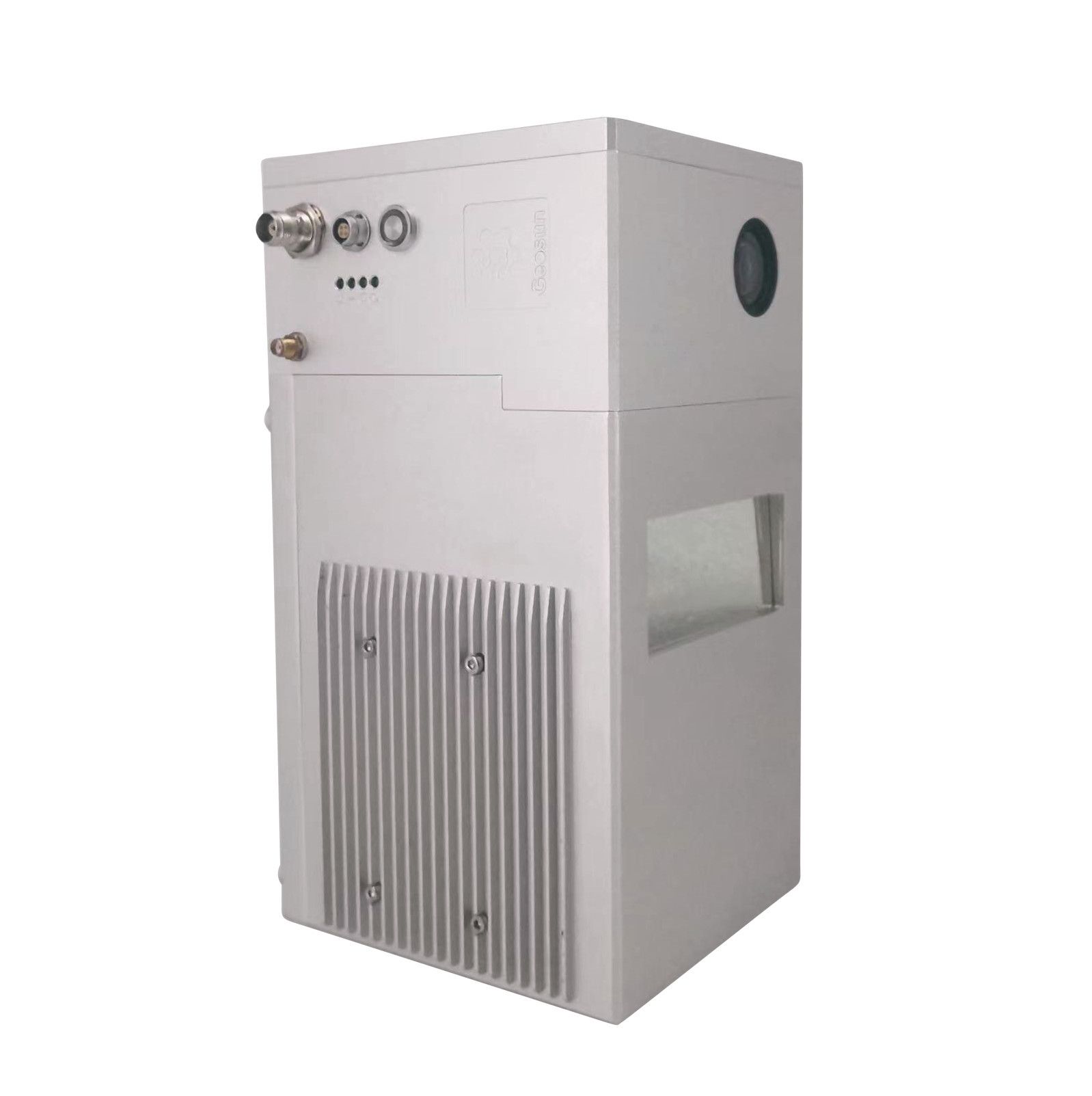
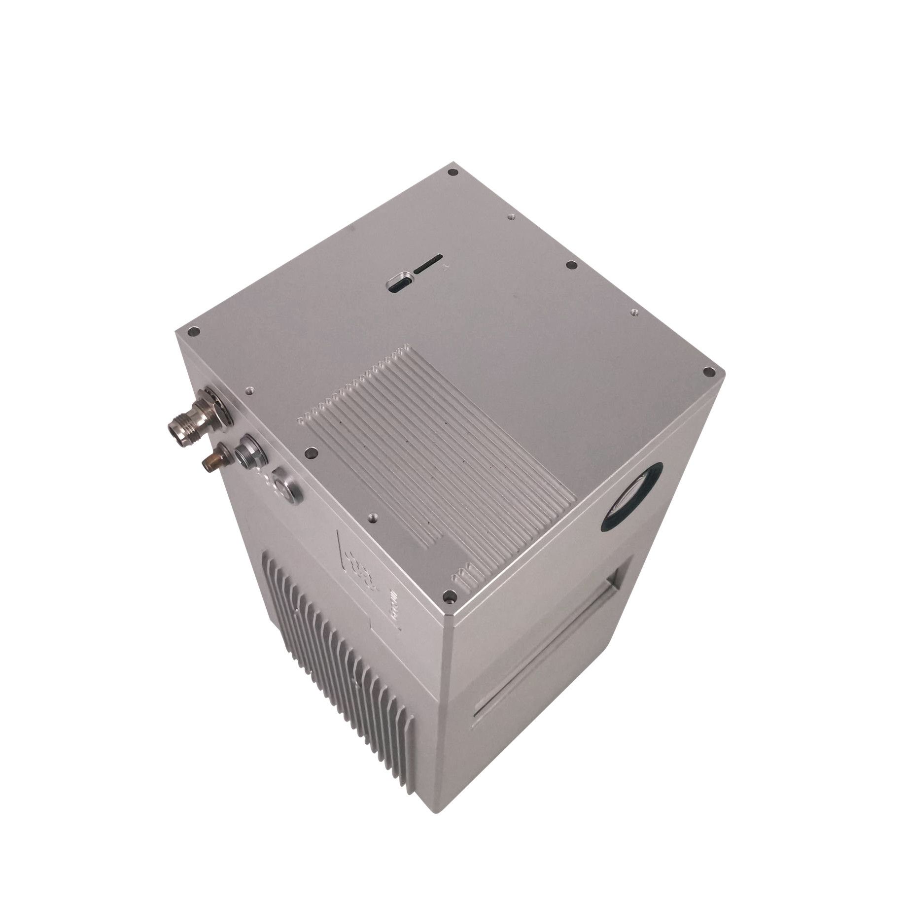
GS-100V Lidar
The Geosun GS-100V is a compact and lightweight high-precision 3D LiDAR scanning system that can be mounted on various platforms, including drones, vehicles, and handheld devices. It integrates a high-performance Hesai XT-16 laser scanner with a GNSS and IMU positioning system, enabling real-time, high-precision data acquisition and processing. Key Features Lightweight and compact design Both Mobile and Aerial Solution are available 360 degree FOV Up to 640,000 Points per second (Dual returns) Included Laser sensor: Hesai XT-16 POS system: Geosun AGS 302 (GNSS + IMU) Camera: 26M Pixel RGB Camera Software: gAirHawk Post-processing software (Pepertual license) Compatibility: DJI Matrice 300/350 RTK and Yuneec H850RTK
9.590,00 € Exc.VAT (9.590,00 € Inc. 23% VAT)


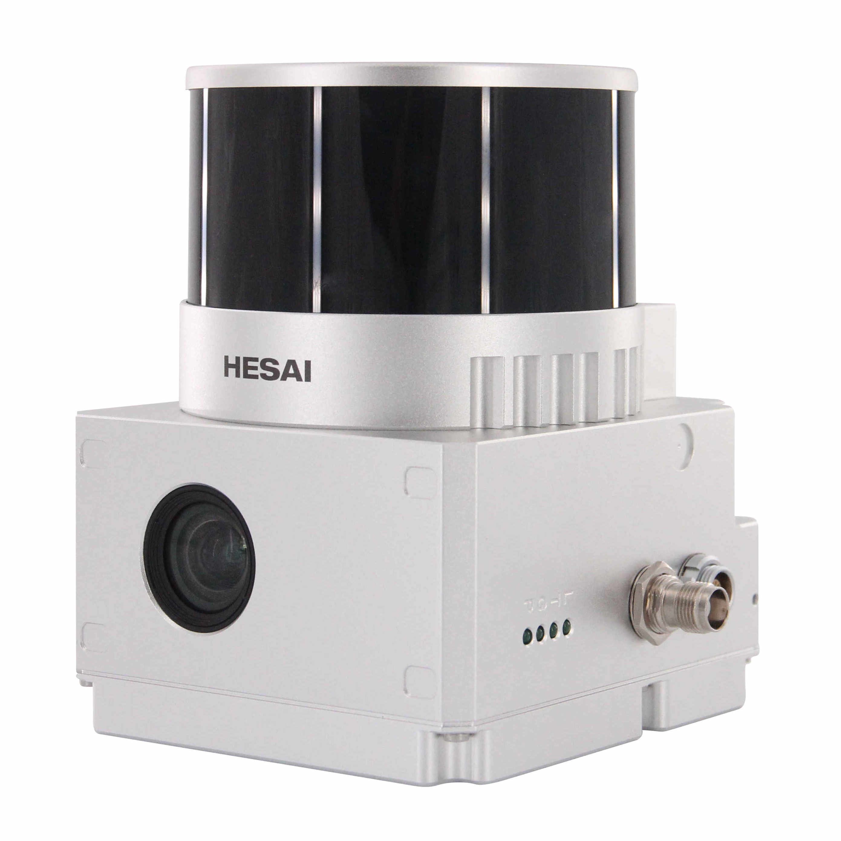
GS-130X Lidar (AGS302)
The Geosun GS-130X is a compact and lightweight UAV-mountable LiDAR scanning system designed for collecting detailed 3D data from aerial perspectives. It integrates a high-performance Hesai XT-32 laser scanner with a GNSS and IMU positioning system, enabling real-time, high-precision mapping and surveying from drones. Key Features Lightweight and compact design Both Mobile and Aerial Solution are available Up to 1,280,000 Points per second (Dual returns) 0.03°×0.03° beam divergence POS AGS302 Included Laser sensor: Hesai XT-32 POS system: Geosun AGS 302 (GNSS + IMU) Camera: 26M Pixel RGB Camera Software: gAirHawk Post-processing software (Pepertual license) Compatibility: DJI Matrice 300/350 RTK and Yuneec H850RTK
11.230,00 € Exc.VAT (11.230,00 € Inc. 23% VAT)
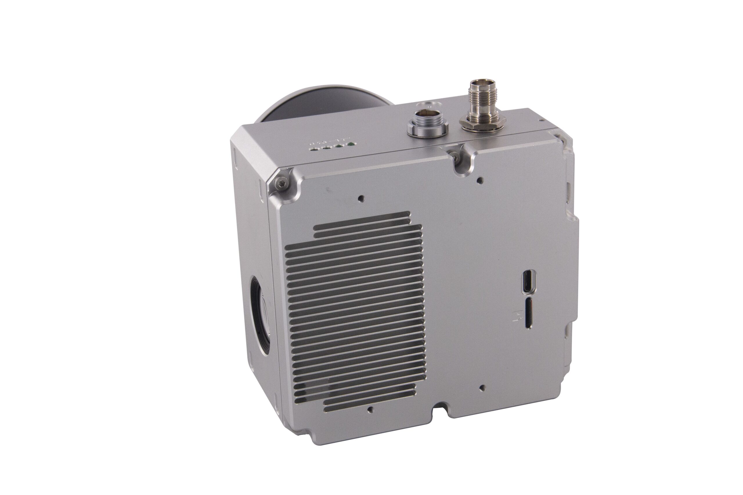
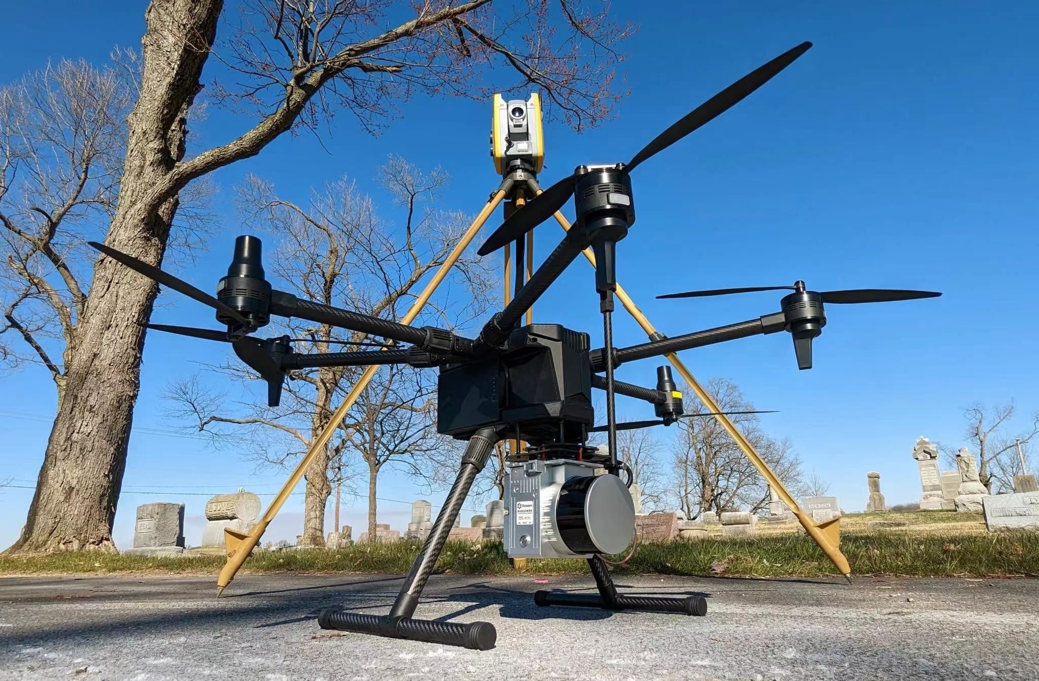
GS-260X Lidar
The Geosun GS-260X is a high-end LiDAR point cloud data acquisition system that is specifically designed for unmanned aerial vehicles (UAVs). It integrates a high-performance HESAI Pandar XT M2X laser scanner, a GNSS and IMU positioning system, and a storage control unit, enabling real-time, high-precision 3D data acquisition and processing. Key Features Lightweight and compact design 3 returns 300m detection range max Both Mobile and Aerial Solution are available Included Laser sensor: Hesai XT-M2X POS system: Geosun AGS 303 (GNSS + IMU) Camera: 26M Pixel RGB Camera Software: gAirHawk Post-processing software (Pepertual license) Compatibility: DJI Matrice 300/350 RTK and Yuneec H850RTK
16.990,00 € Exc.VAT (16.990,00 € Inc. 23% VAT)
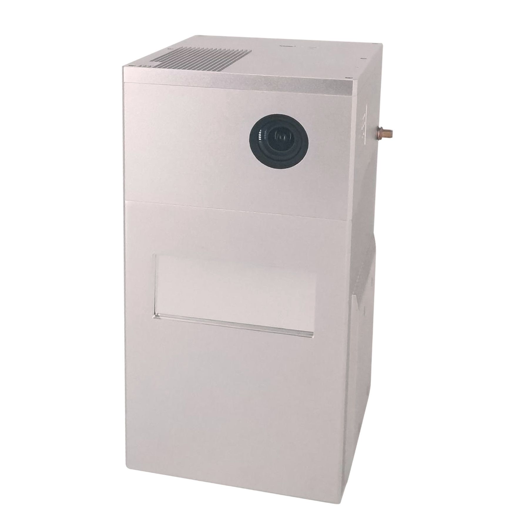
GS-1500N Lidar (AGS 303)
The Geosun GS-1500N, specifically configured with the Geosun AGS 303 (GNSS + IMU) positioning and attitude determination system, is a robust, long-range LiDAR scanning solution. Engineered for high-precision 3D data acquisition, it's particularly well-suited for UAV (Unmanned Aerial Vehicle) and manned aircraft applications, providing a comprehensive tool for detailed mapping and surveying across diverse industries.
44.750,00 € Exc.VAT (44.750,00 € Inc. 23% VAT)
GS-2000N Lidar
The Geosun GS-2000N is a high-end, long-range LiDAR point cloud data acquisition system specifically designed for long-distance mapping and surveying applications. It integrates a high-performance HESAI PandarXT M2 laser scanner, a GNSS and IMU positioning system, and a storage control unit, enabling real-time, high-precision 3D data acquisition and processing. Key Features 1,500m max detection range Up to 2,000KHz PRR 300 lines max For UAVs and manned aircrafts Included Laser sensor: LuoJiaYY 1500 POS system: Geosun AGS 304 (GNSS + IMU) Camera: 45M Pixel Full Frame RGB Camera Software: gAirHawk Post-processing software (Pepertual license) Compatibility: DJI Matrice 300/350 RTK and Yuneec H850RTK
89.990,00 € Exc.VAT (89.990,00 € Inc. 23% VAT)
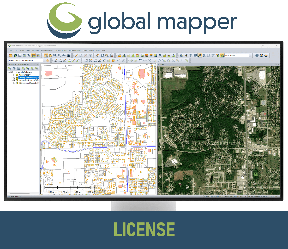
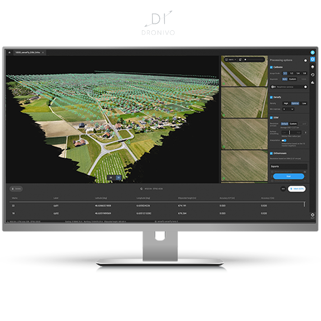
Global Mapper Single User – Node Locked
Global Mapper Standard is a user-friendly Geographic Information System (GIS) software designed for both beginners and experienced users. It offers a wide range of features for working with geospatial data, including: Importing and exporting over 300 different file formats Access to online data sources for imagery, basemaps, terrain, and vector data Vector drawing, editing, analysis, and spatial operations Attribute editing, joining, calculation, graphing, and querying -->> This license is node-locked to one computer and it cannot be access remotely. <<--
699,00 € Exc.VAT (699,00 € Inc. 23% VAT)
Global Mapper Single User – Floating License
Global Mapper Standard is a user-friendly Geographic Information System (GIS) software designed for both beginners and experienced users. It offers a wide range of features for working with geospatial data, including: Importing and exporting over 300 different file formats Access to online data sources for imagery, basemaps, terrain, and vector data Vector drawing, editing, analysis, and spatial operations Attribute editing, joining, calculation, graphing, and querying -->>The Single User Floating license is remote desktop enabled (RDP), which is convenient for users working between multiple locations. <<--
950,00 € Exc.VAT (950,00 € Inc. 23% VAT)
Global Mapper Network License
Global Mapper Standard is a user-friendly Geographic Information System (GIS) software designed for both beginners and experienced users. It offers a wide range of features for working with geospatial data, including: Importing and exporting over 300 different file formats Access to online data sources for imagery, basemaps, terrain, and vector data Vector drawing, editing, analysis, and spatial operations Attribute editing, joining, calculation, graphing, and querying -->> Server license starts at two concurrent/shared seats <<--
950,00 € Exc.VAT (950,00 € Inc. 23% VAT)
Global Mapper USB Dongle License
Global Mapper Standard is a user-friendly Geographic Information System (GIS) software designed for both beginners and experienced users. It offers a wide range of features for working with geospatial data, including: Importing and exporting over 300 different file formats Access to online data sources for imagery, basemaps, terrain, and vector data Vector drawing, editing, analysis, and spatial operations Attribute editing, joining, calculation, graphing, and querying -->> This license can be moved between unlimited machines via a USB dongle. <<--
950,00 € Exc.VAT (950,00 € Inc. 23% VAT)

Global Mapper Pro Single User – Node Locked
1.599,00 € Exc.VAT (1.599,00 € Inc. 23% VAT)
Global Mapper Pro Single User – Node Locked
Global Mapper Pro is an advanced geospatial software program designed for professionals who need more than the basic features of Global Mapper. It includes a wide range of tools for working with imagery, terrain, and LiDAR data. Some of the key features of Global Mapper Pro include: Pixels to Points: This tool allows you to create 3D point clouds, orthoimages, and 3D meshes from drone or UAV-collected images. Terrain Painting: This tool allows you to manually alter digital terrain models (DTMs). Generate Breaklines from Terrain Grid: This tool creates vector line features at distinct changes in elevation/slope. Vectorize Raster: This tool extracts and smooths vector areas from raster image and terrain layers. Advanced LiDAR Processing: Global Mapper Pro includes a number of tools for working with LiDAR data, such as point cloud classification, filtering, -->> This license is node-locked to one computer and it cannot be access remotely. <<--
1.599,00 € Exc.VAT (1.599,00 € Inc. 23% VAT)
Global Mapper Pro Single User – Floating License
2.379,00 € Exc.VAT (2.379,00 € Inc. 23% VAT)
Global Mapper Pro Single User – Floating License
Global Mapper Pro is an advanced geospatial software program designed for professionals who need more than the basic features of Global Mapper. It includes a wide range of tools for working with imagery, terrain, and LiDAR data. Some of the key features of Global Mapper Pro include: Pixels to Points: This tool allows you to create 3D point clouds, orthoimages, and 3D meshes from drone or UAV-collected images. Terrain Painting: This tool allows you to manually alter digital terrain models (DTMs). Generate Breaklines from Terrain Grid: This tool creates vector line features at distinct changes in elevation/slope. Vectorize Raster: This tool extracts and smooths vector areas from raster image and terrain layers. Advanced LiDAR Processing: Global Mapper Pro includes a number of tools for working with LiDAR data, such as point cloud classification, filtering, -->> The Single User Floating license is remote desktop enabled (RDP), which is convenient for users working between multiple locations. <<--
2.379,00 € Exc.VAT (2.379,00 € Inc. 23% VAT)
Global Mapper Pro Network License
Global Mapper Pro is an advanced geospatial software program designed for professionals who need more than the basic features of Global Mapper. It includes a wide range of tools for working with imagery, terrain, and LiDAR data. Some of the key features of Global Mapper Pro include: Pixels to Points: This tool allows you to create 3D point clouds, orthoimages, and 3D meshes from drone or UAV-collected images. Terrain Painting: This tool allows you to manually alter digital terrain models (DTMs). Generate Breaklines from Terrain Grid: This tool creates vector line features at distinct changes in elevation/slope. Vectorize Raster: This tool extracts and smooths vector areas from raster image and terrain layers. Advanced LiDAR Processing: Global Mapper Pro includes a number of tools for working with LiDAR data, such as point cloud classification, filtering, -->> Server license starts at two concurrent/shared seats <<--
2.379,00 € Exc.VAT (2.379,00 € Inc. 23% VAT)

-
-
Sale!

 Vista Rápida
 -
-
-
-
Sale!
 Vista Rápida
 -
Sale!
 Vista Rápida
 -
Sale!
 Vista Rápida

-
 Vista Rápida
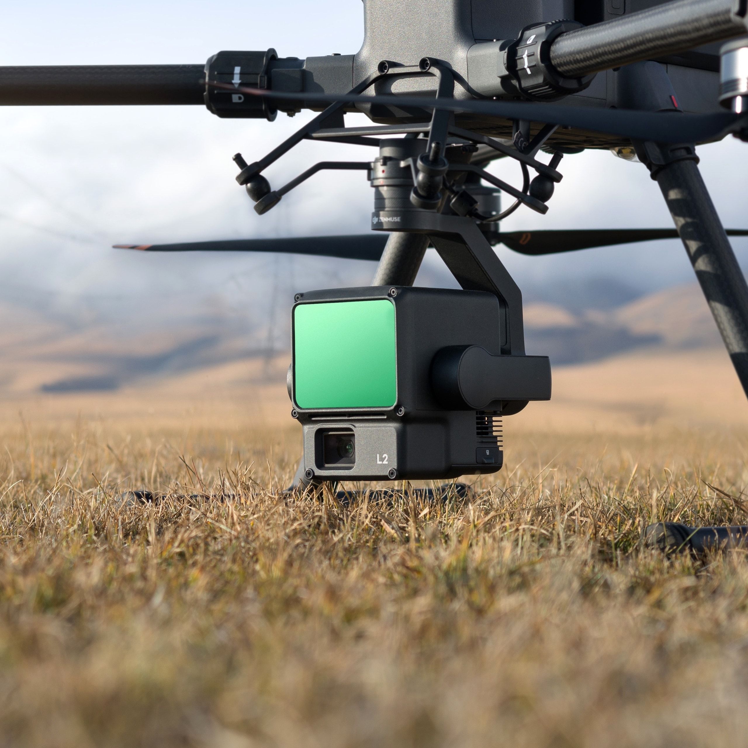
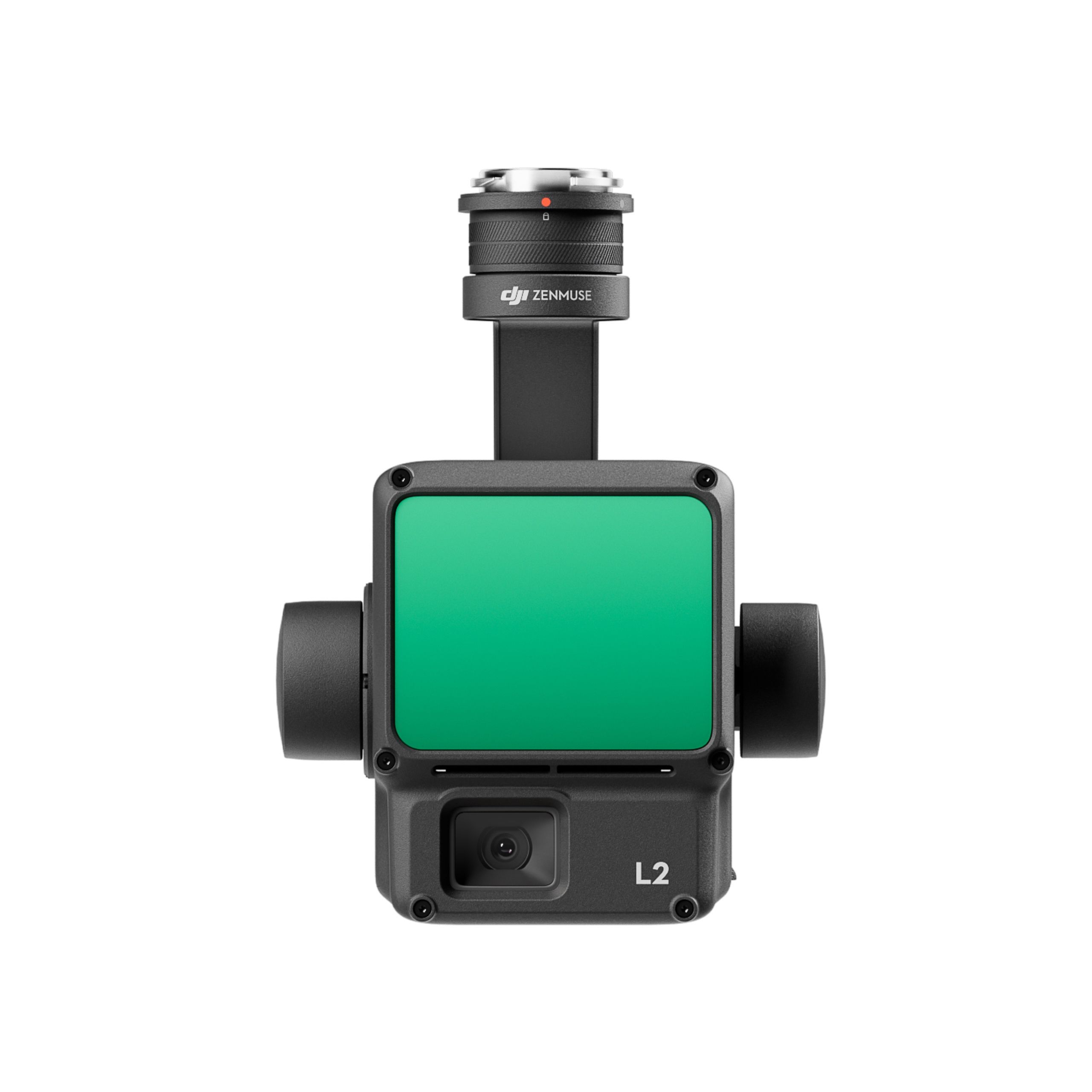
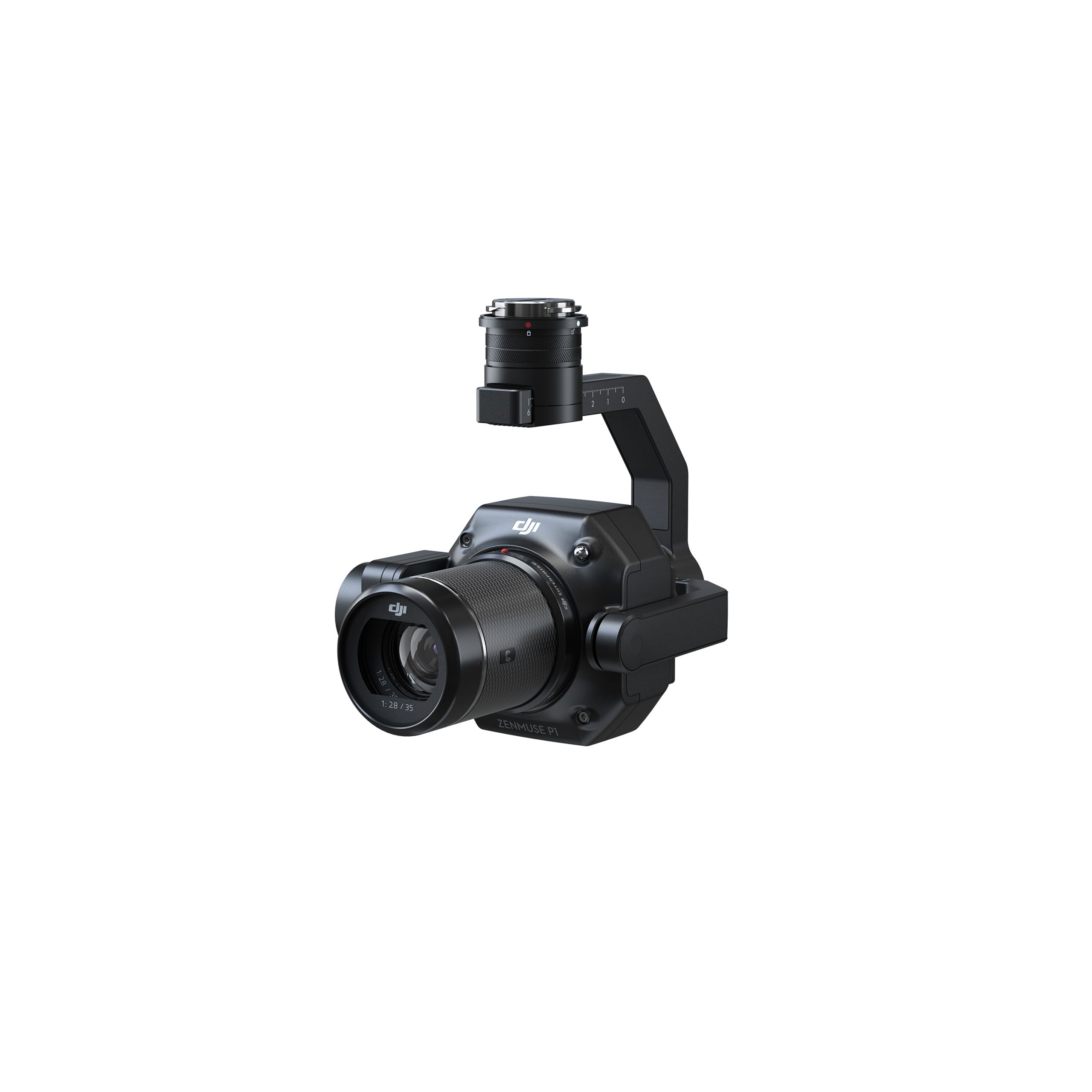
DJI Zenmuse L2 Worry-Free Basic Combo
Accessories DJI Matrice 350 RTK 10.813,01 € Exc.VAT (10.813,01 € Inc. 23% VAT) -
 Vista Rápida
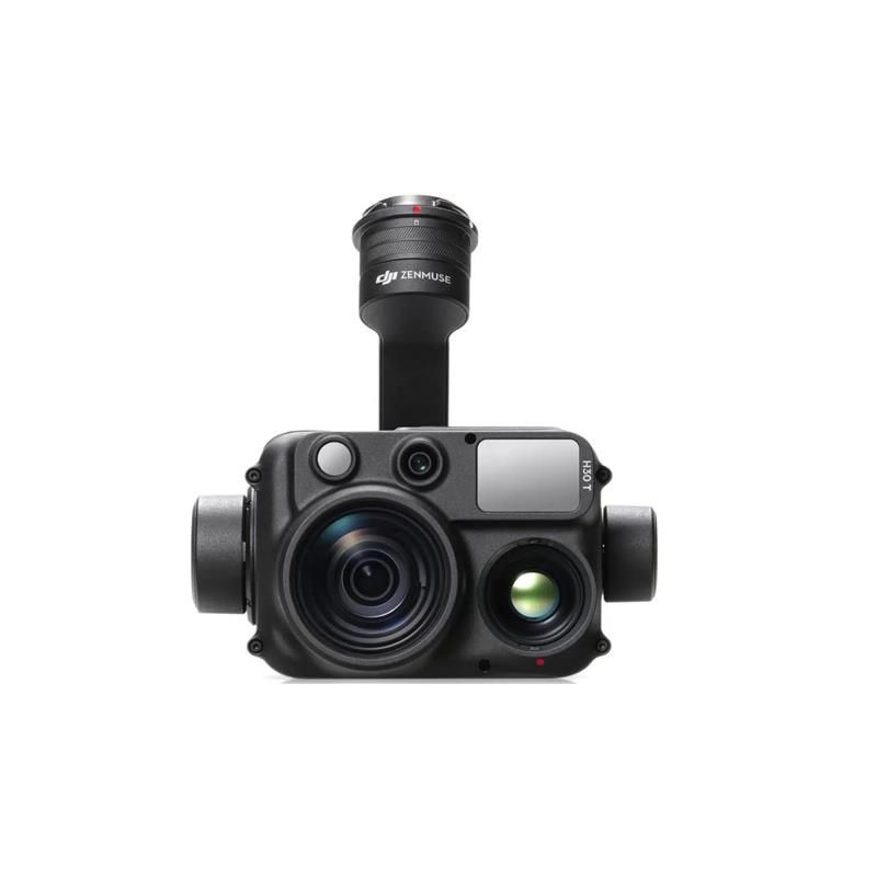
DJI Zenmuse H30T Worry-Free Basic Combo
Accessories DJI Matrice 300 RTK 10.608,94 € Exc.VAT (10.608,94 € Inc. 23% VAT) -
 Vista Rápida
 -
 Vista Rápida
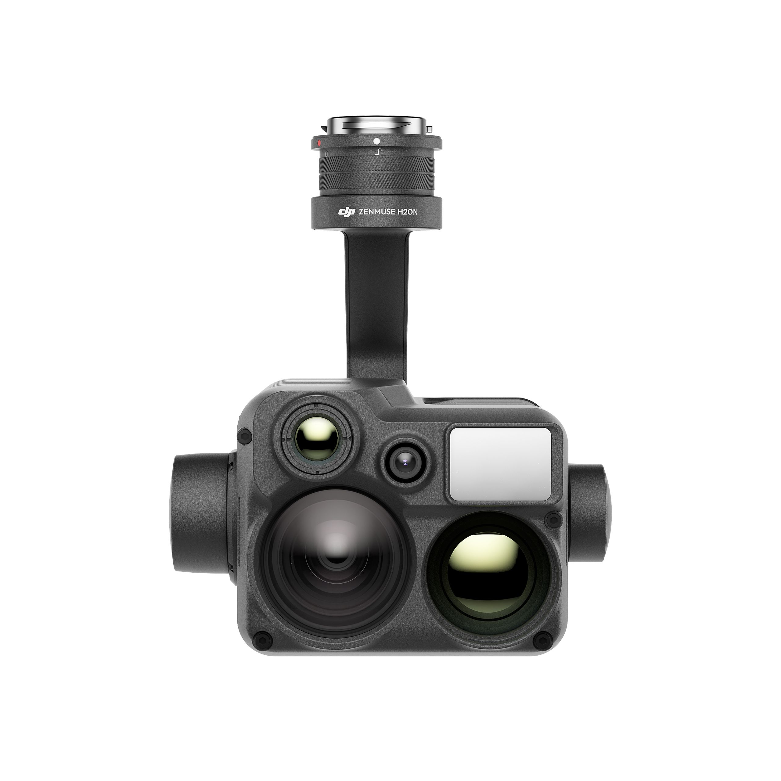
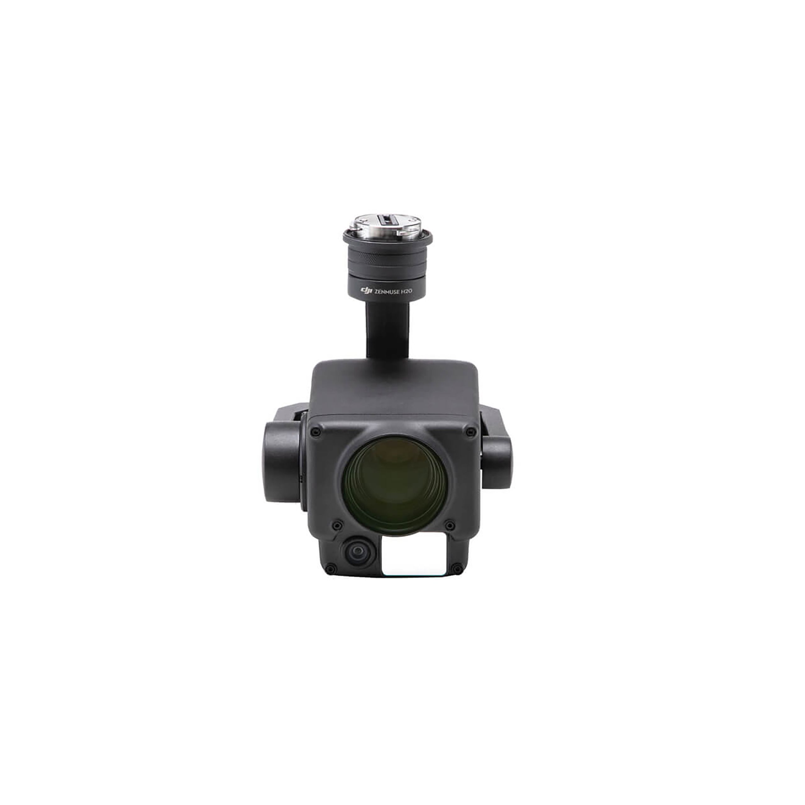
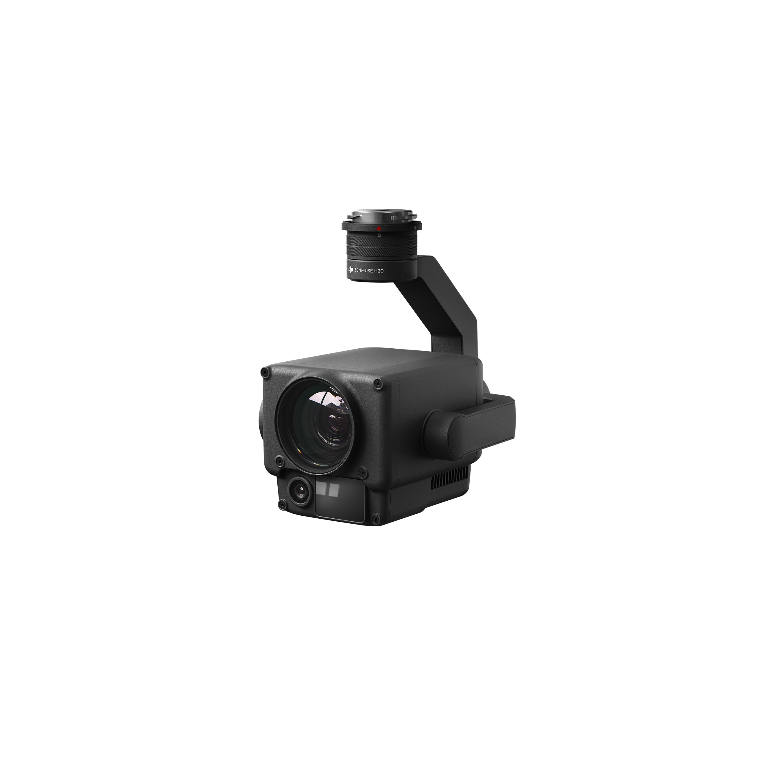
DJI Zenmuse H20N Worry-Free Basic Combo
Accessories DJI Matrice 350 RTK 9.987,80 € Exc.VAT (9.987,80 € Inc. 23% VAT) -
 Vista Rápida
 -
 Vista Rápida
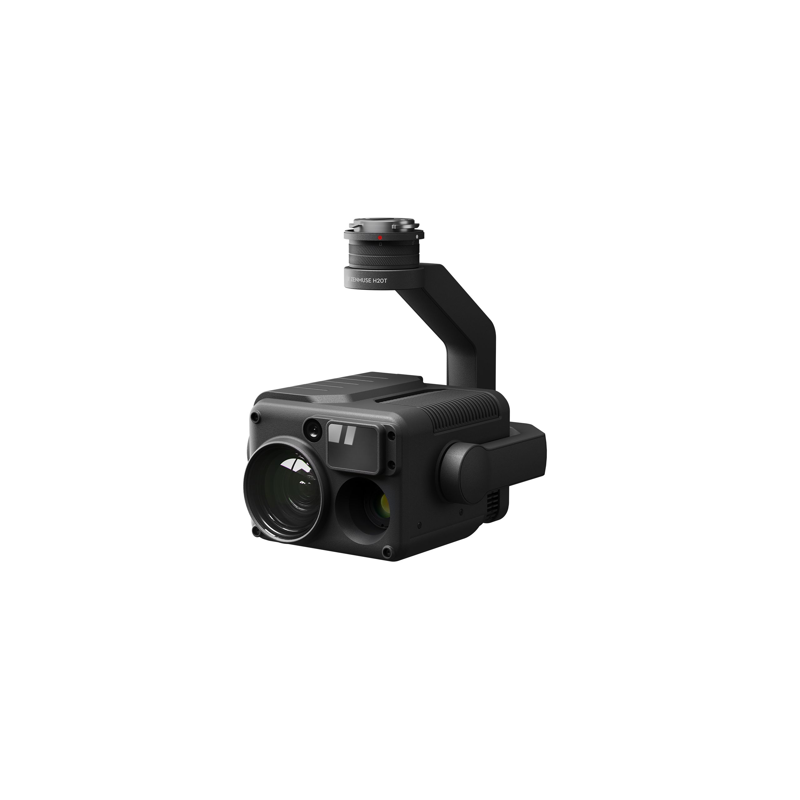
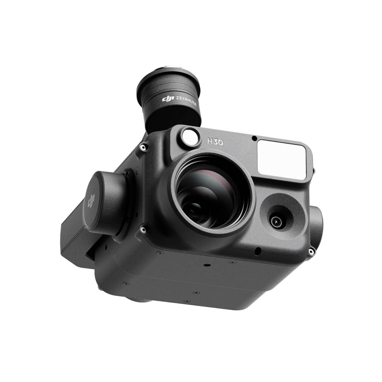
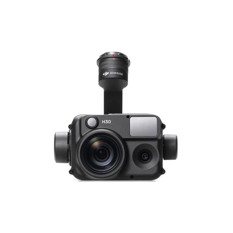
DJI Zenmuse H30 Worry-Free Plus Combo
Accessories DJI Matrice 350 RTK 4.382,11 € Exc.VAT (4.382,11 € Inc. 23% VAT) -
Vista Rápida
DJI Zenmuse H30 Worry-Free Basic Combo
Accessories DJI Matrice 350 RTK 4.045,53 € Exc.VAT (4.045,53 € Inc. 23% VAT) -
 Vista Rápida
-
Vista Rápida
DJI Matrice 350 RTK-Worry-Free Basic Combo
DJI Matrice 350 RTK 10.161,79 € Exc.VAT (10.161,79 € Inc. 23% VAT) -
-
-
-
-
Sale!
 Vista Rápida
 -
 Vista Rápida
DJI Mavic 3M (Multispectral) – Free Basic Combo – 1 Year
DJI 3.727,64 € Exc.VAT (3.727,64 € Inc. 23% VAT) -
Vista Rápida
-
Sale!
 Vista Rápida
 -
Sale!Vista Rápida
-
Vista Rápida
-
Vista Rápida
-
Vista Rápida
Global Mapper Pro Single User – Floating License
Blue Marble 2.379,00 € Exc.VAT (2.379,00 € Inc. 23% VAT) -
Vista Rápida
Global Mapper Pro Single User – Node Locked
Blue Marble 1.599,00 € Exc.VAT (1.599,00 € Inc. 23% VAT) -
Vista Rápida
-
 Vista Rápida
Agisoft Metashape Standard, Node-Locked Educational license, Single
Agisoft 54,00 € Exc.VAT (54,00 € Inc. 23% VAT)
