


EMLID PHOTO CONTEST

Geosun Lidars
Geosun LiDARs are a high-quality products that offers a combination of accuracy, speed, and efficiency.


New Wingtra LIDAR
Perfectly integrated with the WingtraOne GEN II drone to ensure a streamlined workflow.

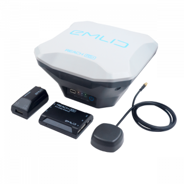
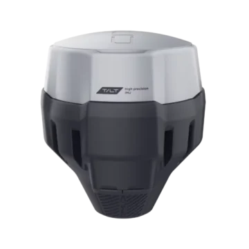
New Emlid Reach RS3
Multi-band base and rover
IMU tilt compensation
LTE modem
Dual-band radio
IMU tilt compensation
LTE modem
Dual-band radio

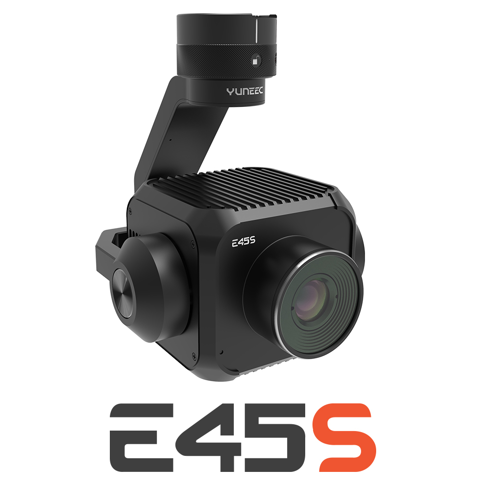
New Yuneec E45S for H510E and H850
Yuneec launched E45S 45MP full frame camera, ideal for professionals in survey and inspection industry!
New Swellpro Fisherman MAX
Launch of Fisherman Max is now available for pre-order and shipping starts on August 1st.


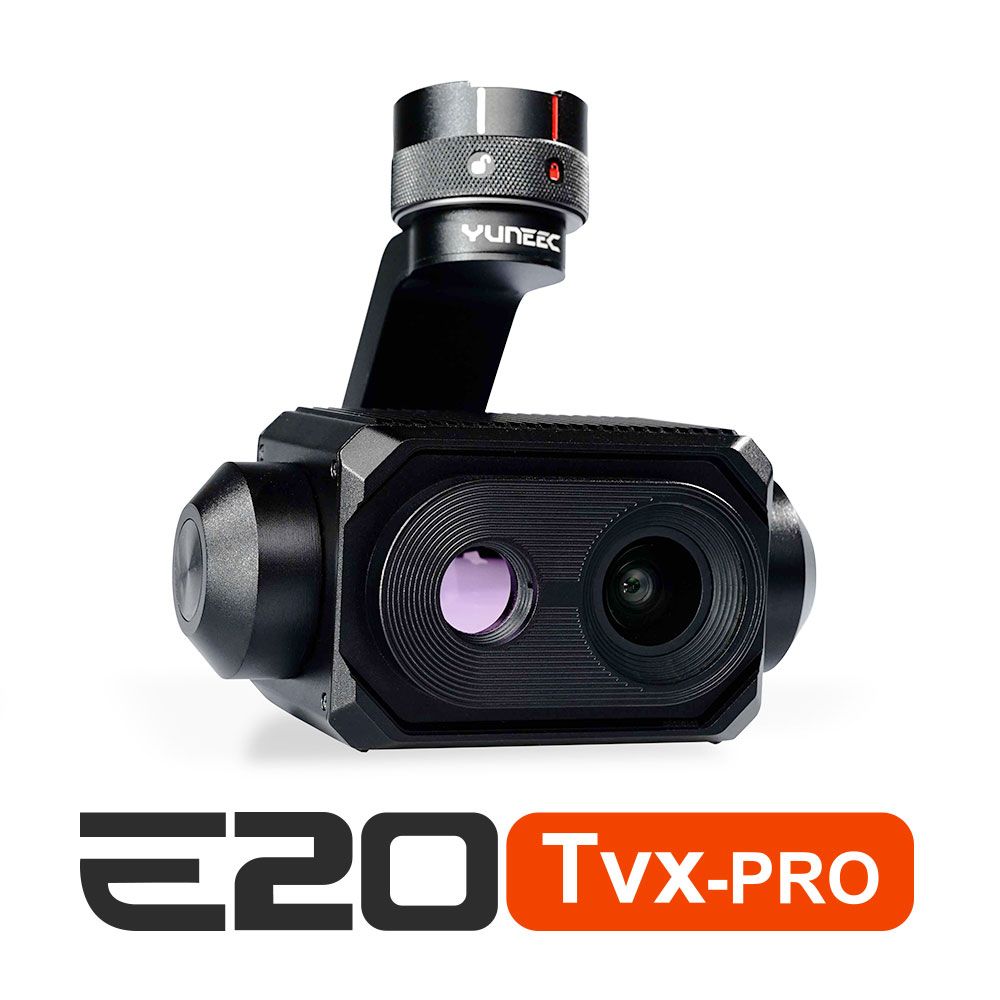
New E20TVX-PRO Thermal camera
Recommended camera for tasks related to Inspection (buildings, solar panels and powerlines), Search and Rescue, Firefighting and Law enforcement

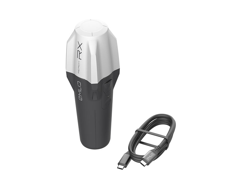
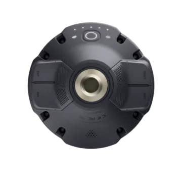
New Emlid Reach RX rover
Emlid Reach RX is a new pocket-sized, lightweight and easy-to-use receiver!

 Surveying & GIS
-
 Vista Rápida
 -
 Vista Rápida
 -
 Vista Rápida
 -
 Vista Rápida
 -
 Vista Rápida
 -
 Vista Rápida
 -
 Vista Rápida
 Mining & Quarries
-
Vista Rápida
-
Vista Rápida
-
Vista Rápida
-
Vista Rápida
-
Vista Rápida
-
Vista Rápida
-
Vista Rápida
 Construction
-
Vista Rápida
-
Vista Rápida
-
Vista Rápida
-
Vista Rápida
-
Vista Rápida
-
Vista Rápida
-
Vista Rápida
 Agriculture
-
Vista Rápida
-
Vista Rápida
-
Vista Rápida
-
Vista Rápida
-
Vista Rápida
-
 Vista Rápida
 -
Vista Rápida
 Environment monitoring
-
Vista Rápida
-
Vista Rápida
-
Vista Rápida
-
Vista Rápida
-
Vista Rápida
-
Vista Rápida
 Search & Rescue
-
Vista Rápida
-
Vista Rápida
-
Vista Rápida
-
Vista Rápida
-
Vista Rápida
-
Vista Rápida
 Other applications
-
 Vista Rápida
 -
Sale!
 Vista Rápida
 -
 Vista Rápida
 -
Sale!
 Vista Rápida
 -
Sale!
 Vista Rápida
 -
Sale!
 Vista Rápida


Showing 49–64 of 74 results
Carbon Pole for Reach RS2+ / RS2 / RS+
Carbon Pole for Reach RS2 / RS+ / RS in Meter & Feet
169,00 € Exc.VAT (207,87 € Inc. 23% VAT)
Emlid REACH M2 with Multi-band GNSS Antenna
EMLID Reach M2 witch Multi-band GNSS Antenna
(Price on request)
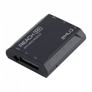
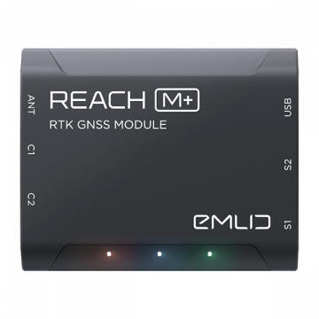
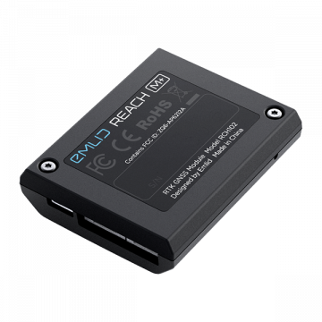
Emlid REACH M+
REACH M+ EMLID Reach M+ is a RTK GNSS module for precise navigation and UAV mapping without GCP which calculates real time coordinates with centimeter accuracy and streams them in NMEA or binary format to your device over UART, Bluetooth or WiFi.
329,00 € Exc.VAT (404,67 € Inc. 23% VAT)
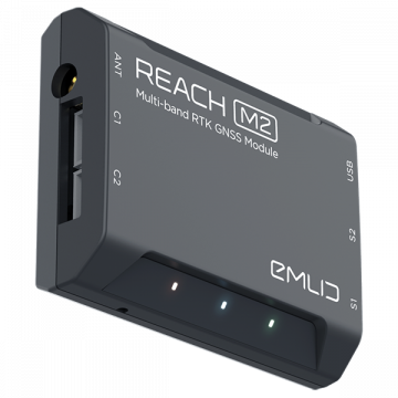
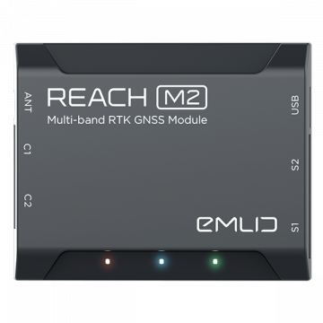
Emlid REACH M2
EMLID Reach M2 is a Multi-Band RTK GNSS module for precise navigation and UAV mapping without GCP which calculates real time coordinates with centimeter accuracy and streams them in NMEA or binary format to your device over UART, Bluetooth or WiFi.
649,00 € Exc.VAT (798,27 € Inc. 23% VAT)
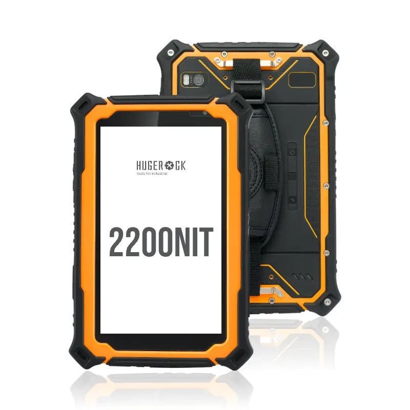
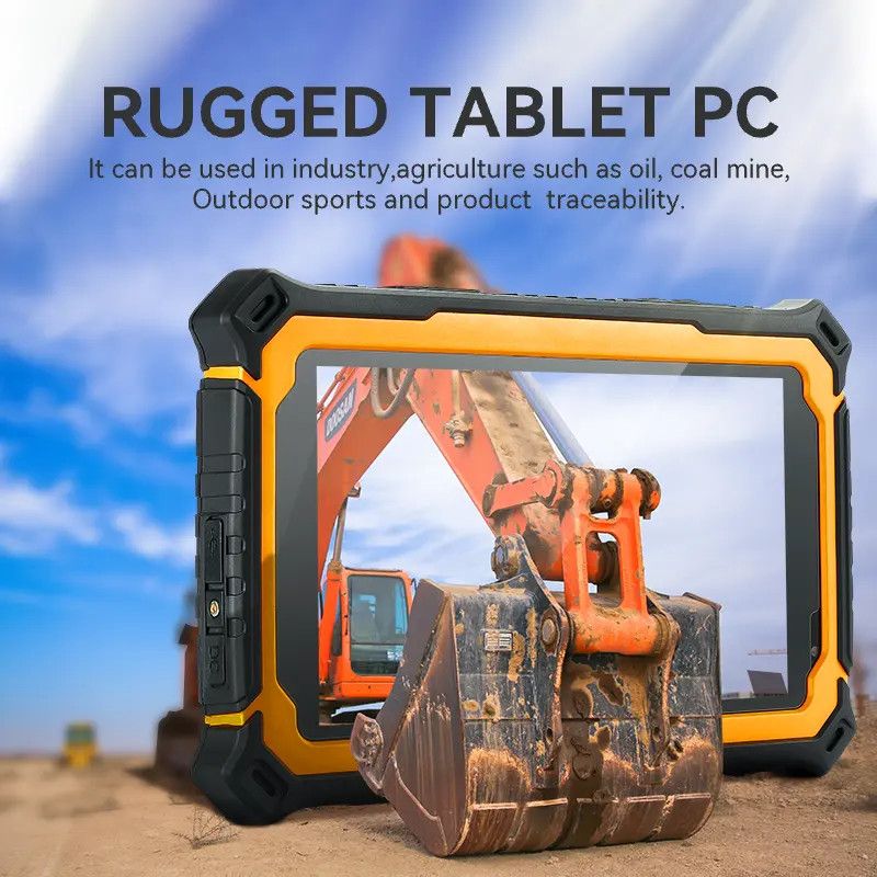
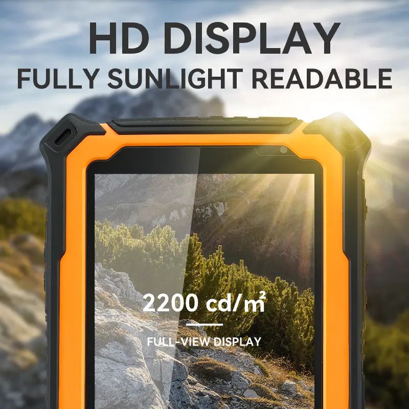
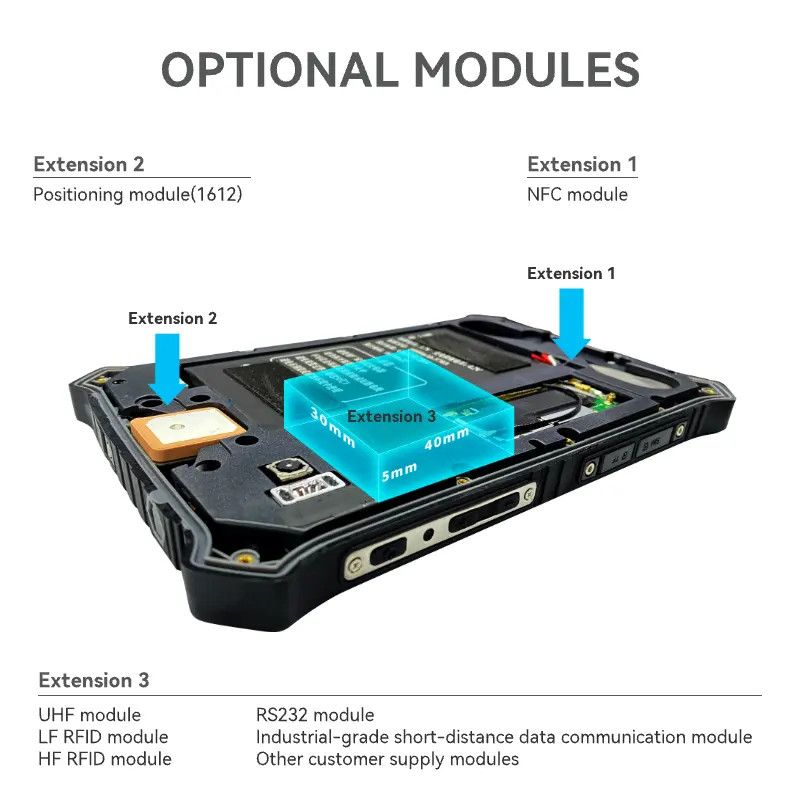
Hugerock T71
The Hugerock T71 is a rugged tablet designed for industrial use. It has a 7-inch display with a resolution of 1080x1920, and is powered by an octa-core processor. It runs Android 10 or 11 and comes with 8GB of RAM and 128GB of storage.
599,00 € Exc.VAT (736,77 € Inc. 23% VAT)
NewSale!
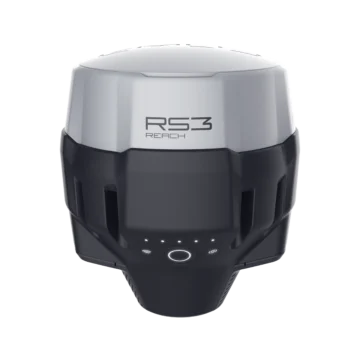
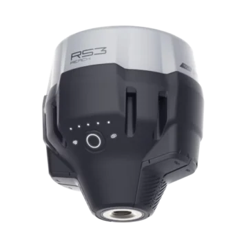
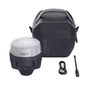
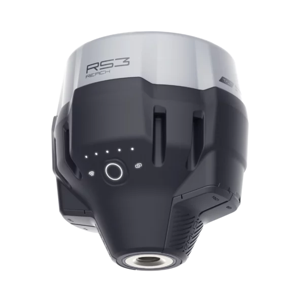
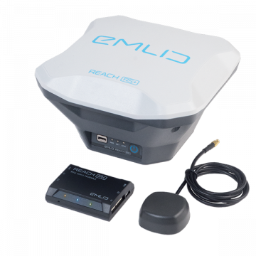
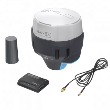
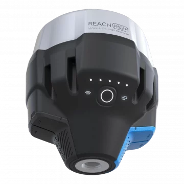
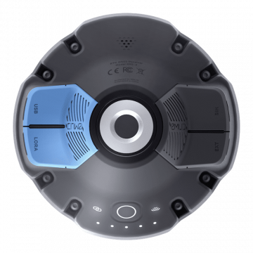
Emlid Reach RS3
Introducing the Emlid Reach RS3: Precision GNSS Receiver for Unparalleled Accuracy Unlock a new level of precision and reliability with the Emlid Reach RS3, the cutting-edge Global Navigation Satellite System (GNSS) receiver engineered to meet the demands of surveying, mapping, and geospatial professionals. Whether you're working in construction, agriculture, land surveying, or any field that relies on accurate positioning data, the Reach RS3 is your ultimate tool for achieving outstanding results. IMU 6DOF, RTK + 2 mm + 0.3 mm/° GNSS GPS/QZSS, GLONASS L1, L2; BeiDou B1, B2; Galileo E1, E5 Autonomy 18 hrs with tilt compensation Li-Ion battery, USB Type-C charging LTE and Wi-Fi To connect the device to the internet Dual-band radio 868/915 MHz LoRa to receive and transmit corrections 450 MHz UHF to receive corrections NTRIP and RTCM3 Supported protocols to send and receive corrections
2.299,00 € Exc.VAT (2.827,77 € Inc. 23% VAT)
Sale!

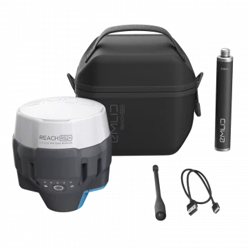
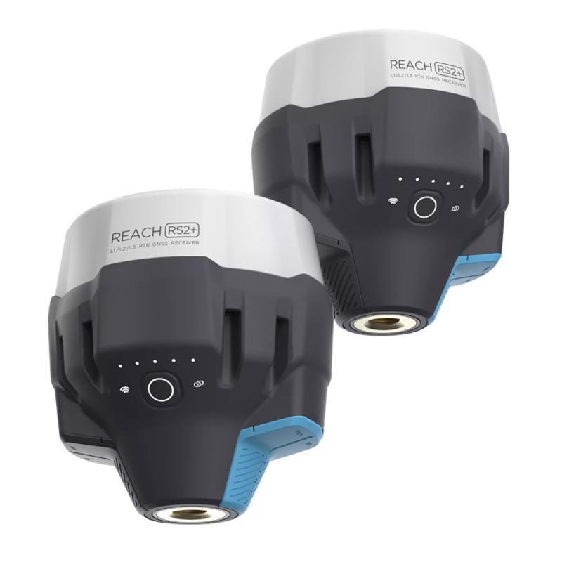
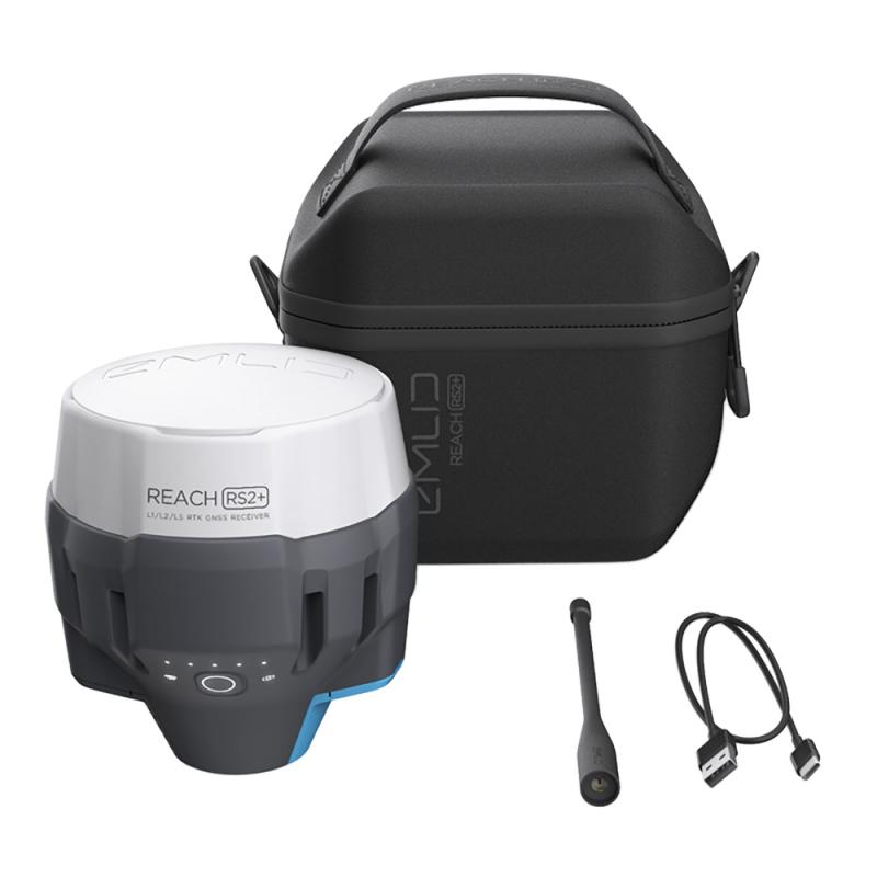
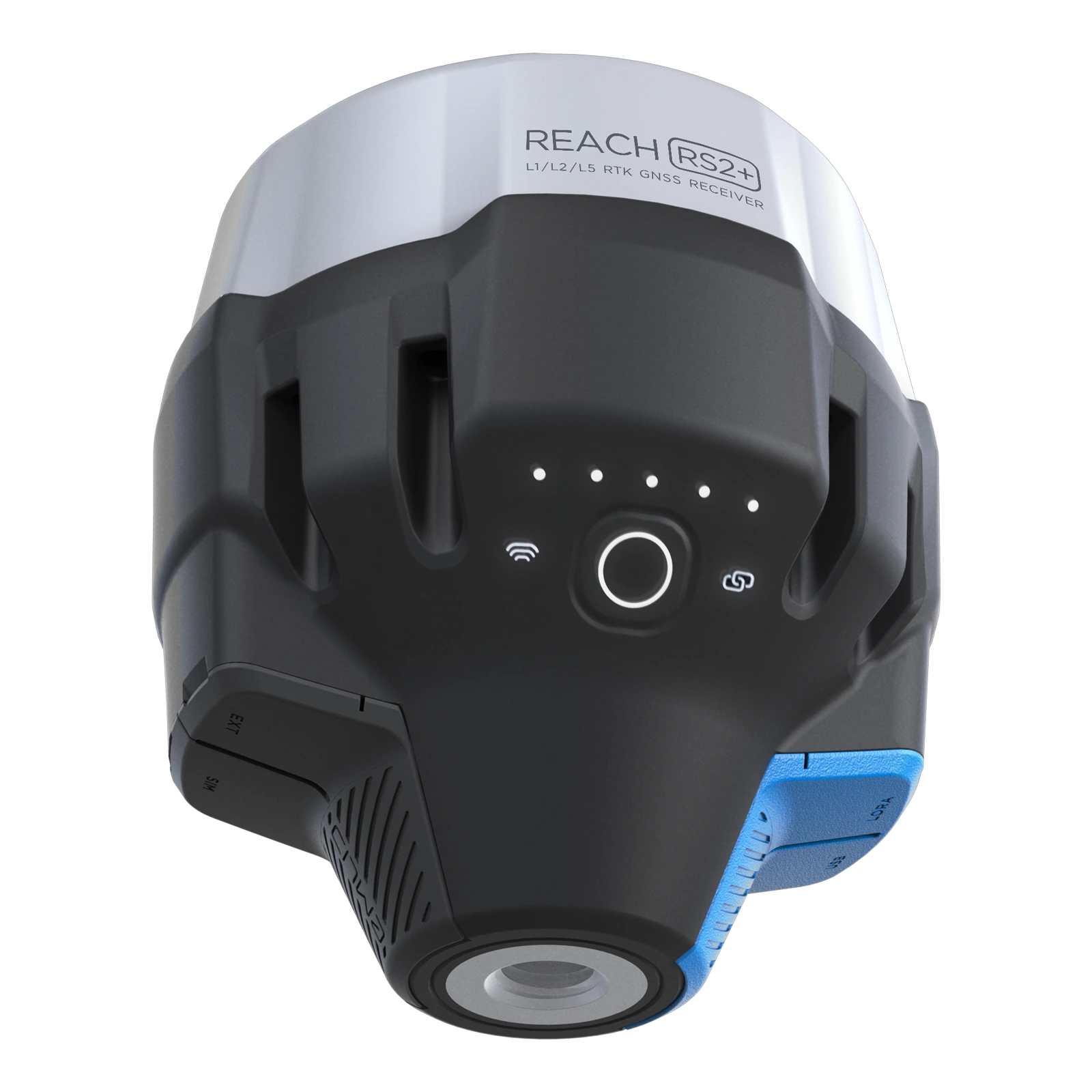
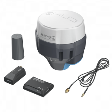
Emlid Reach RS2+ GNSS Receiver
Multi-band RTK GNSS receiver with centimeter precision For surveying, mapping and navigation. Comes with a mobile app, ReachView3. GNSS -GPS/QZSS, GLONASS L1, L2; BeiDou B1, B2; Galileo E1, E5 Long range radio - LoRa 868/915 MHz, range up to 8 km 16 hrs as LTE RTK rover - LiFePO4 battery, 6–40V input, USB Type-C charging Wi-Fi and Bluetooth - For connection with other devices
2.125,00 € Exc.VAT (2.613,75 € Inc. 23% VAT)
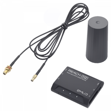
Emlid Reach M2/M+ SMA antenna adapter cable 0.5m
19,00 € Exc.VAT (23,37 € Inc. 23% VAT)
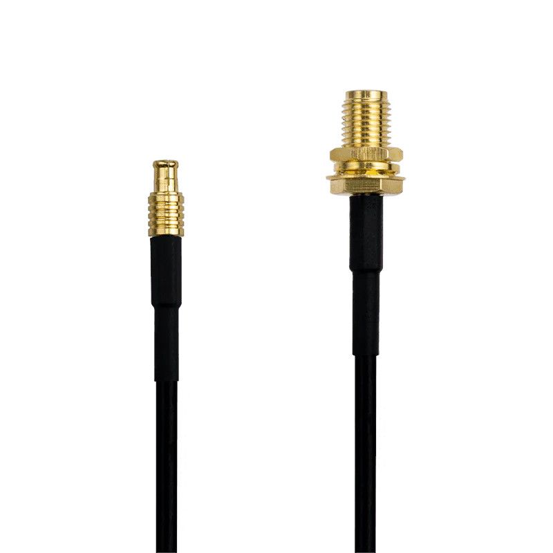
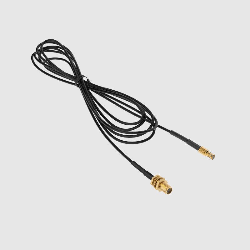
Emlid Reach M2/M+ SMA antenna adapter cable 0.5m
The Emlid Reach M2/M+ SMA antenna adapter cable is a 0.5 meter long cable that allows you to connect an external SMA antenna to your Emlid Reach M2 or M+ GNSS receiver. This can be helpful if you want to improve the performance of your GNSS receiver by using a higher gain or specialized antenna. The cable has an MCX connector on one end that plugs into your Reach M2 or M+ receiver, and an SMA connector on the other end that connects to your external antenna.
19,00 € Exc.VAT (23,37 € Inc. 23% VAT)
Emlid Multi-band GNSS antenna
The Emlid Multi-band GNSS antenna is an accessory for GNSS modules, specifically designed to work with Emlid Reach receivers. Multi-band helical GNSS antenna Tracks L1/L2 bands on GPS, GLONASS, BeiDou and E1/E5 on Galileo.
229,00 € Exc.VAT (281,67 € Inc. 23% VAT)


Pix4D & Emlid Scanning kit Advanced
The Pix4D & Emlid Scanning Kit Advanced is a mobile solution designed for capturing high-precision 3D models of objects and environments. It combines advanced photogrammetry software from Pix4D with the RTK (Real-Time Kinematic) GNSS precision of Emlid's Reach RX receiver. This combination allows you to quickly and easily create accurate 3D models for a variety of applications, including: Documenting utilities and as-builts Performing volumetric measurements Enriching aerial data with terrestrial scans
(Price on request)

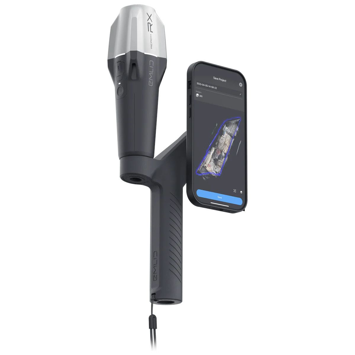
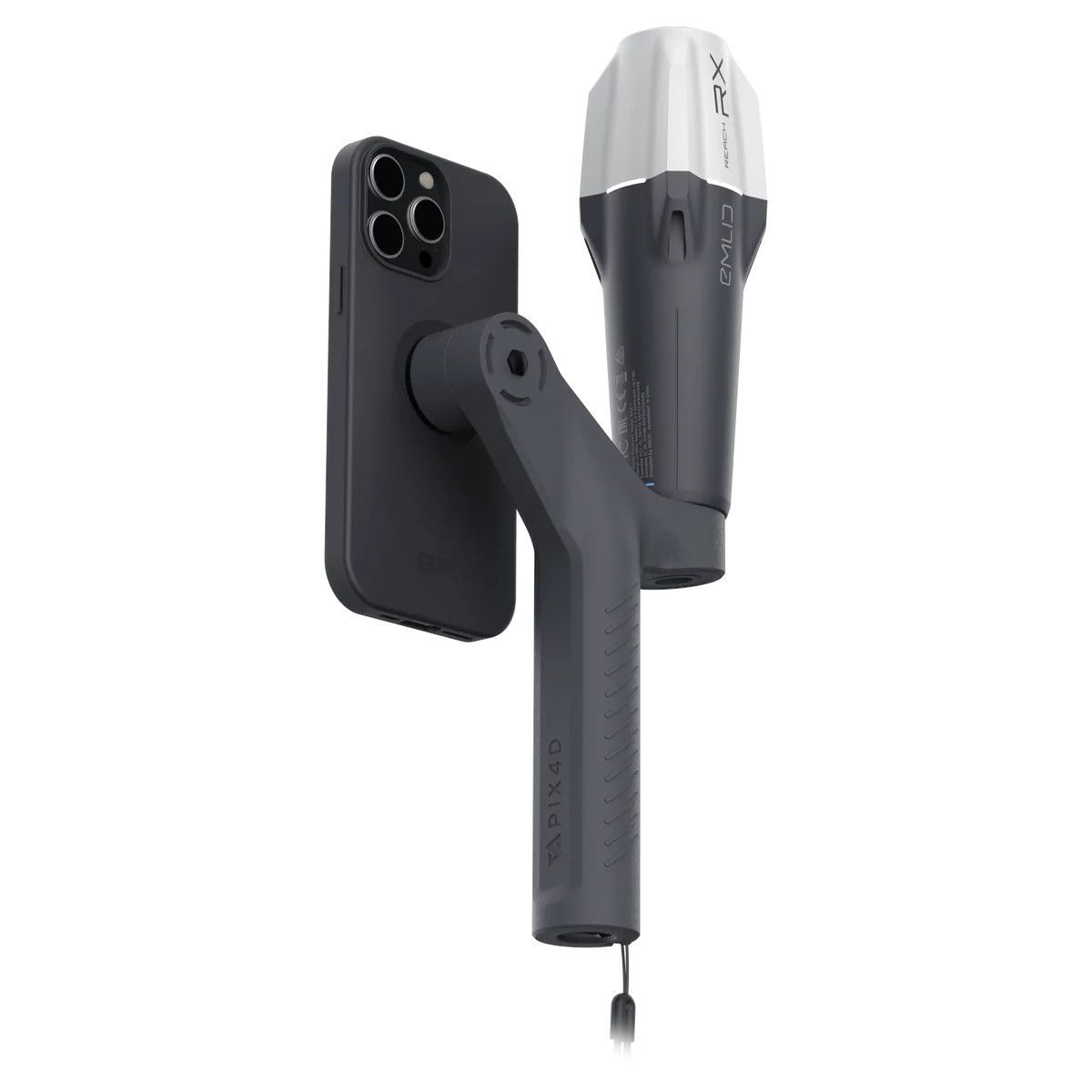
Pix4D & Emlid Scanning kit Standard
The Pix4D & Emlid Scanning Kit Standard is a mobile terrestrial scanning solution designed for creating high-accuracy 3D models of indoor and outdoor environments. It combines the Emlid Reach RX GNSS receiver with Pix4Dcatch mobile app to capture reality with centimeter-level precision.
(Price on request)
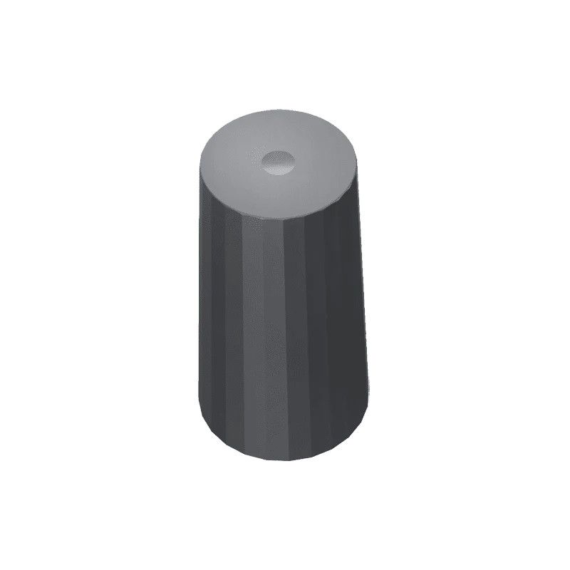
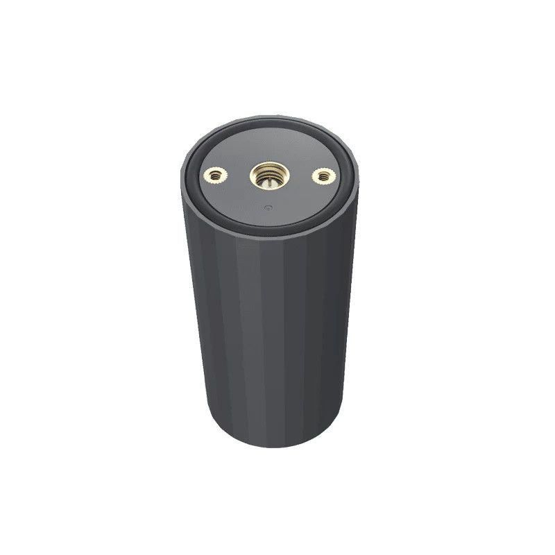
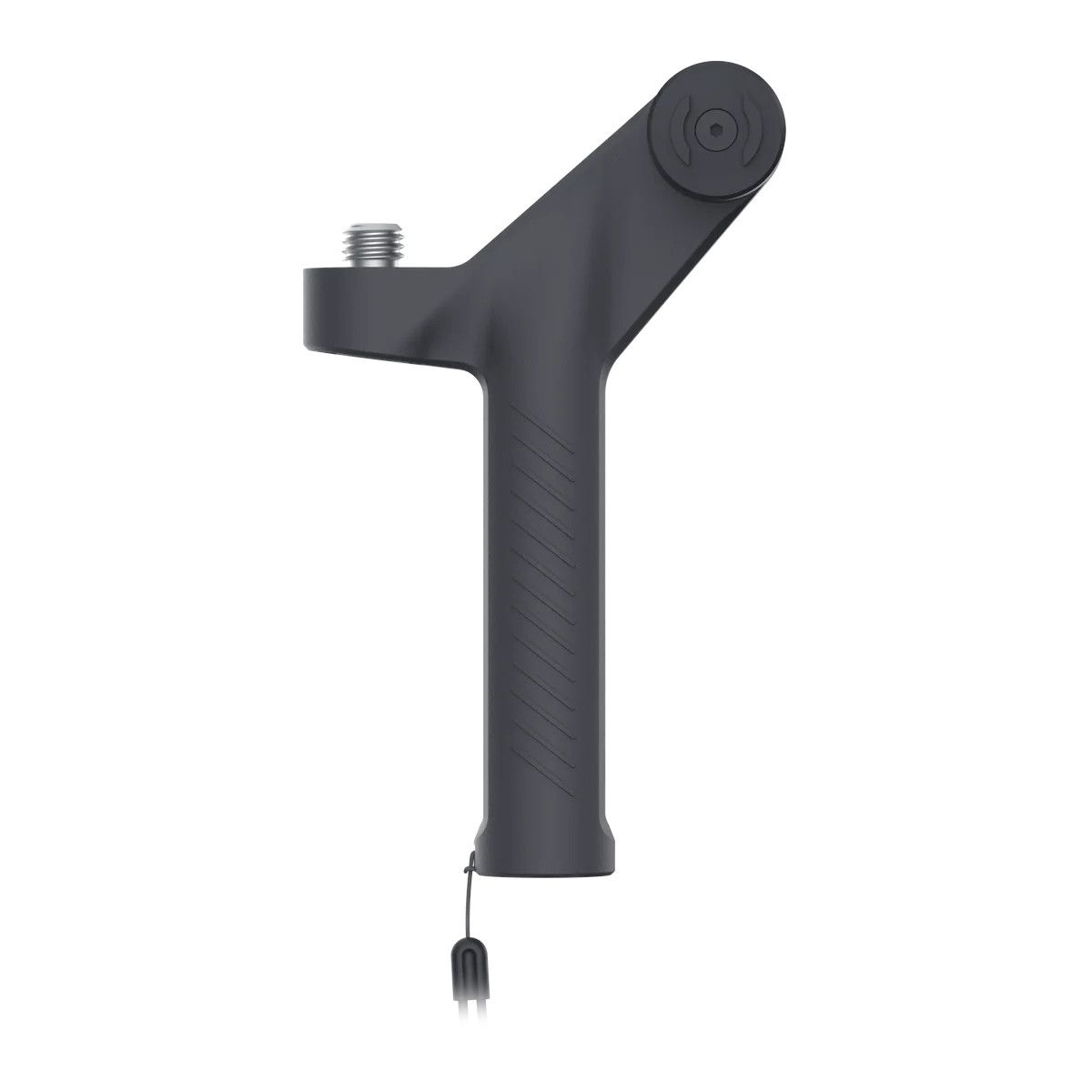
Pole Tripod
A tripod for poles, also known as a survey tripod or pole tripod, is a specialized tripod designed to hold a tall, slender pole upright. They are commonly used in surveying, construction, and other applications where precise measurements need to be taken.
174,00 € Exc.VAT (214,02 € Inc. 23% VAT)

-
-
-
-
-
-
-
Sale!
 Vista Rápida
 -
Sale!
 Vista Rápida
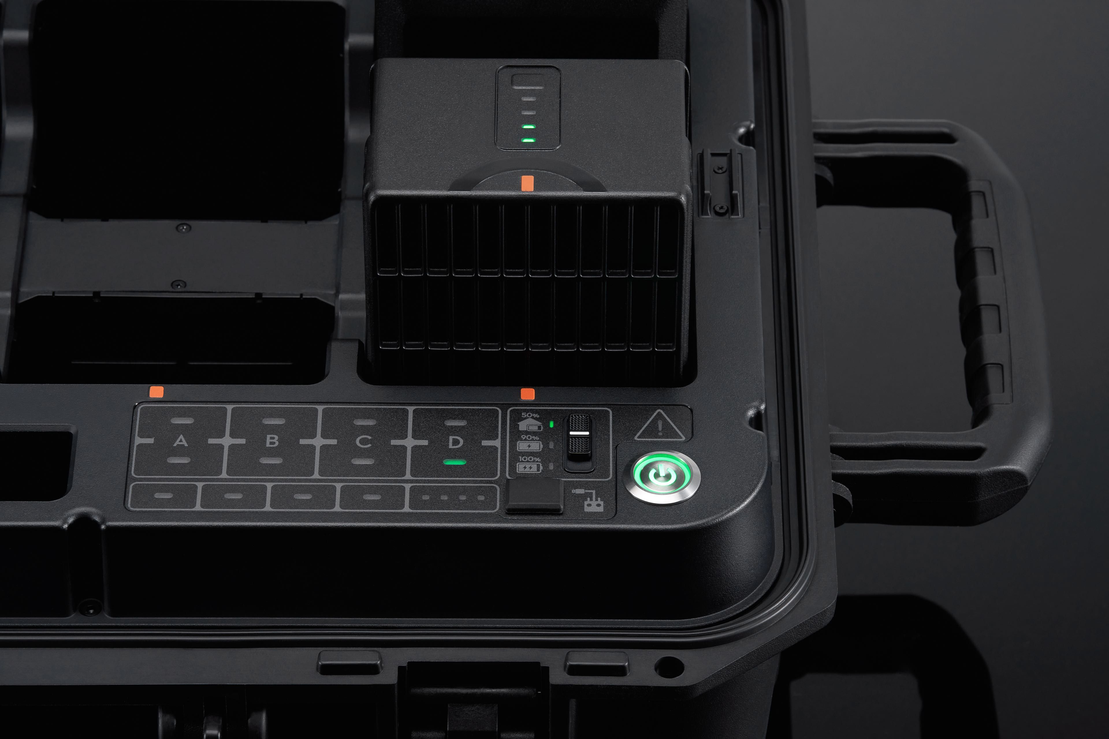
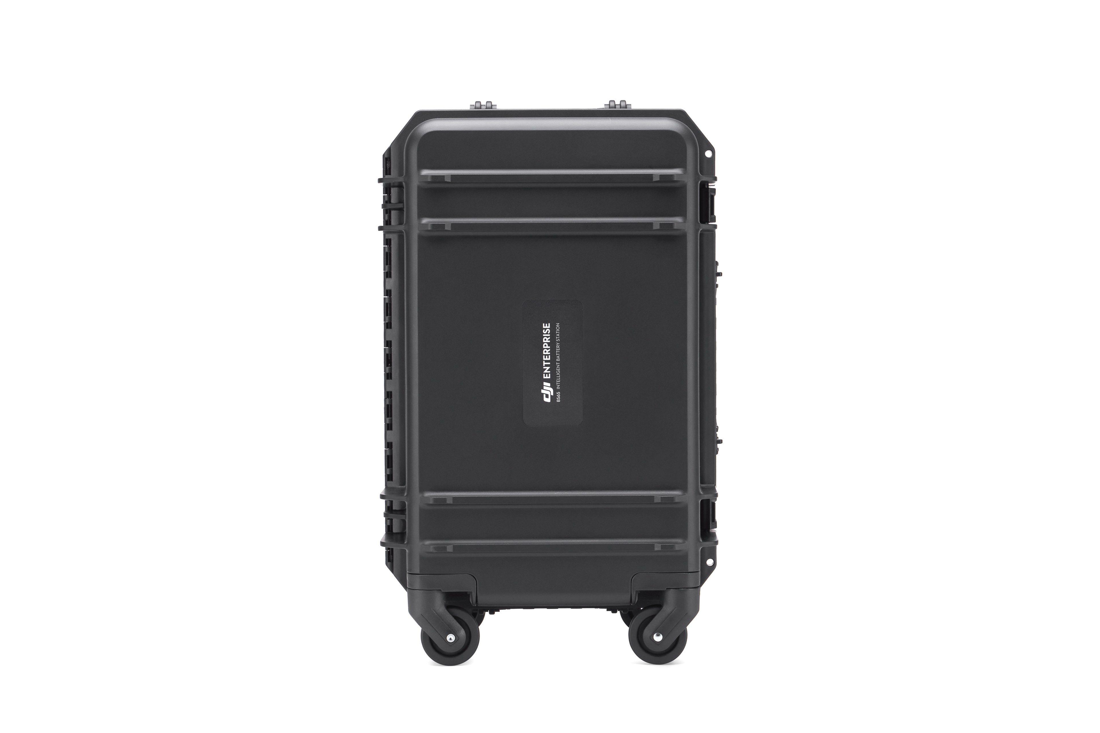
BS65 Intelligent Battery Station
Accessories DJI Matrice 350 RTK 999,00 € Exc.VAT (1.228,77 € Inc. 23% VAT)

-
 Vista Rápida
 -
Vista Rápida
-
 Vista Rápida
 -
-
-
-
-
-
Vista Rápida
DJI Matrice 350 RTK-Worry-Free Basic Combo
DJI Matrice 350 RTK 10.150,00 € Exc.VAT (12.484,50 € Inc. 23% VAT) -
-
-
-
-
 Vista Rápida
DJI Mavic 3M (Multispectral) – Free Basic Combo – 1 Year
DJI 3.889,00 € Exc.VAT (4.783,47 € Inc. 23% VAT) -
 Vista Rápida
DJI Mavic 3E (Enterprise) Worry-Free Basic Combo – 1 Year
DJI 2.899,00 € Exc.VAT (3.565,77 € Inc. 23% VAT) -
-
Vista Rápida
-
Vista Rápida
-
 Vista Rápida
Agisoft Metashape Standard, Node-Locked Educational license, Single
Agisoft 54,00 € Exc.VAT (66,42 € Inc. 23% VAT) -
-
-
-
-
