


EMLID PHOTO CONTEST

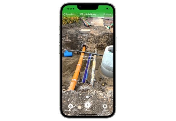
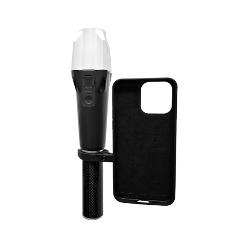
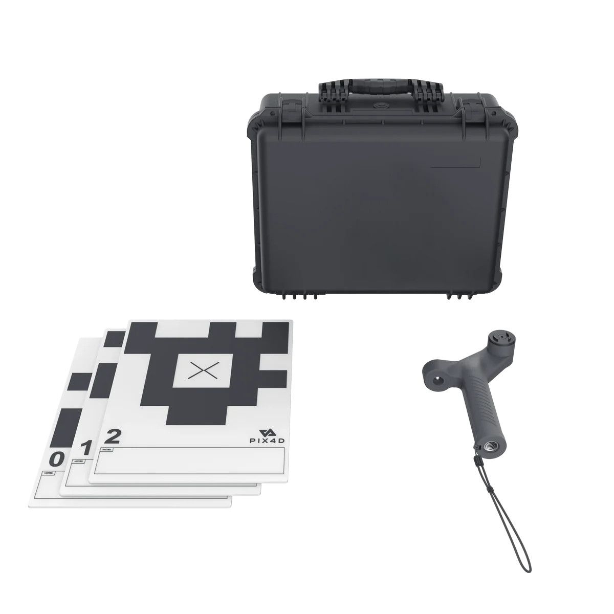
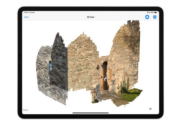
PIX4D & Emlid scanning kit
Solution for combining terrestrial and aerial scanning with RTK accuracy

Geosun Lidars
Geosun LiDARs are a high-quality products that offers a combination of accuracy, speed, and efficiency.


New Wingtra LIDAR
Perfectly integrated with the WingtraOne GEN II drone to ensure a streamlined workflow.

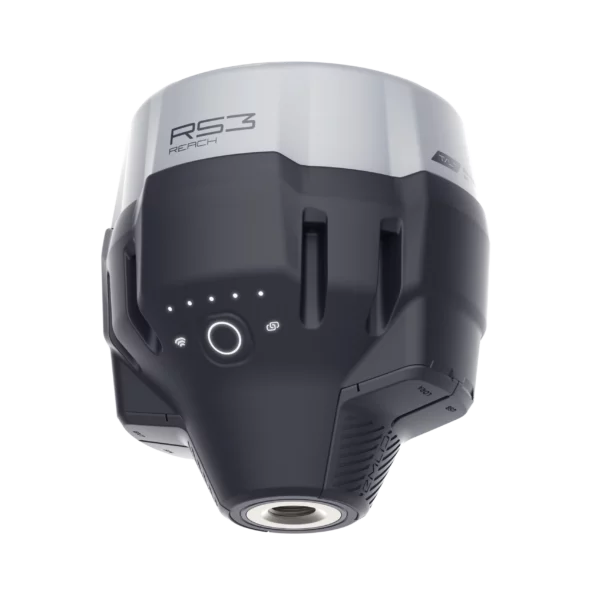
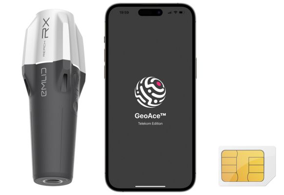
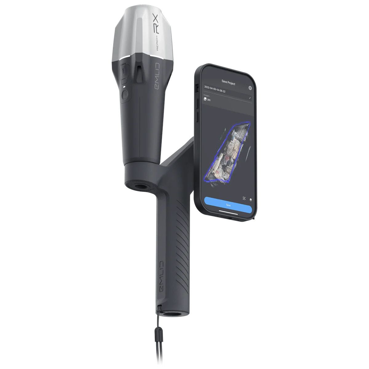
New Emlid Reach RS3
Multi-band base and rover
IMU tilt compensation
LTE modem
Dual-band radio
IMU tilt compensation
LTE modem
Dual-band radio

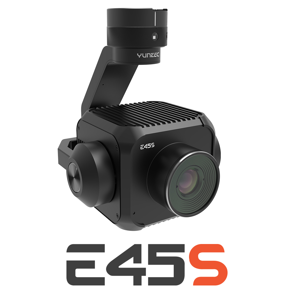
New Yuneec E45S for H510E and H850
Yuneec launched E45S 45MP full frame camera, ideal for professionals in survey and inspection industry!
New Swellpro Fisherman MAX
Launch of Fisherman Max is now available for pre-order and shipping starts on August 1st.


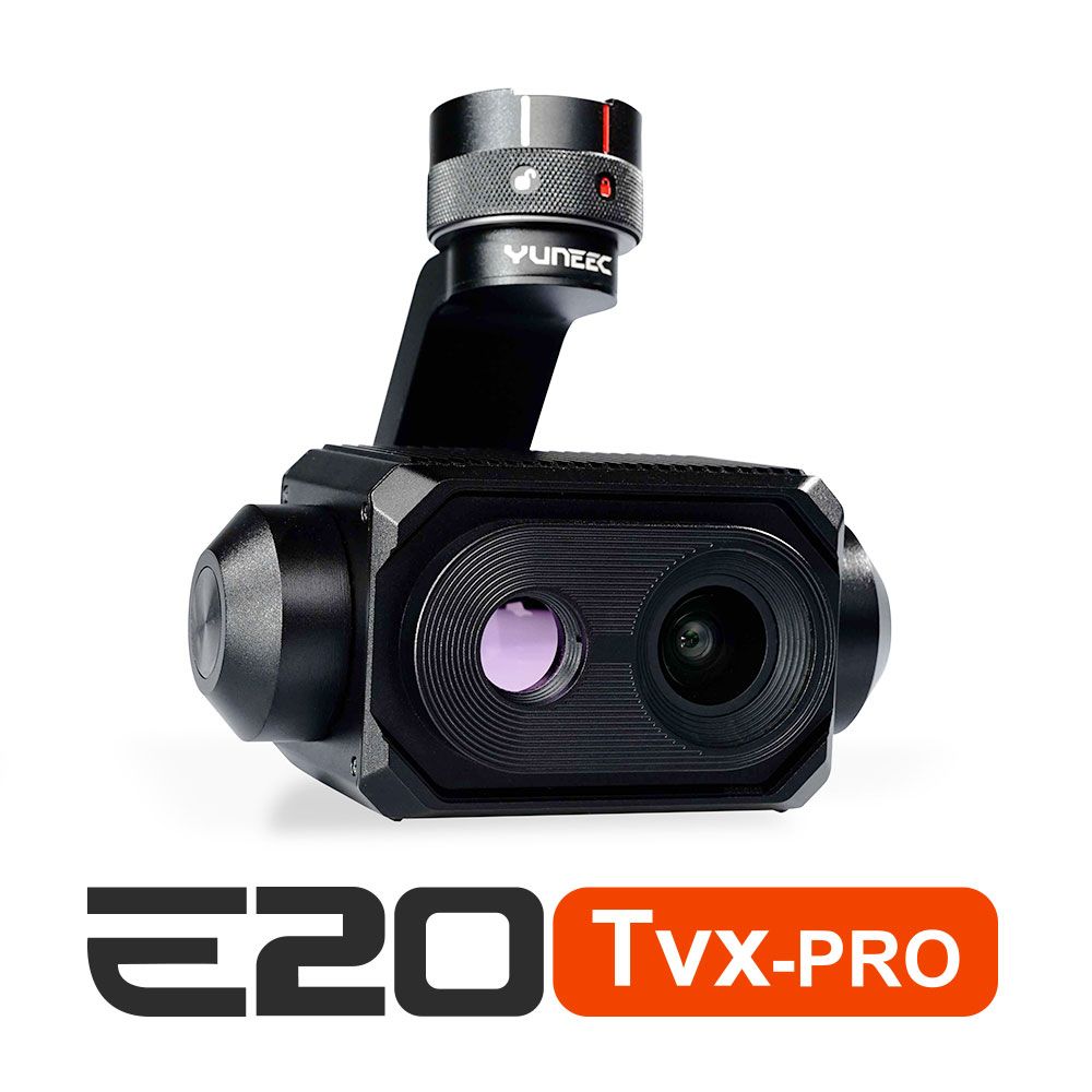
New E20TVX-PRO Thermal camera
Recommended camera for tasks related to Inspection (buildings, solar panels and powerlines), Search and Rescue, Firefighting and Law enforcement
 Surveying & GIS
-
 Vista Rápida
 -
 Vista Rápida
 -
 Vista Rápida
 -
 Vista Rápida
 -
 Vista Rápida
 -
 Vista Rápida
 -
 Vista Rápida
 Mining & Quarries
-
Vista Rápida
-
Vista Rápida
-
Vista Rápida
-
Vista Rápida
-
Vista Rápida
-
Vista Rápida
-
Vista Rápida
 Construction
-
Vista Rápida
-
Vista Rápida
-
Vista Rápida
-
Vista Rápida
-
Vista Rápida
-
Vista Rápida
-
Vista Rápida
 Agriculture
-
Vista Rápida
-
Vista Rápida
-
Vista Rápida
-
Vista Rápida
-
 Vista Rápida
 -
Vista Rápida
-
Vista Rápida
 Environment monitoring
-
Vista Rápida
-
Vista Rápida
-
Vista Rápida
-
Vista Rápida
-
Vista Rápida
-
Vista Rápida
 Search & Rescue
-
Vista Rápida
-
Vista Rápida
-
Vista Rápida
-
Vista Rápida
-
Vista Rápida
-
Vista Rápida
 Other applications
-
 Vista Rápida
 -
Sale!
 Vista Rápida
 -
Sale!
 Vista Rápida
 -
 Vista Rápida
 -
Sale!
 Vista Rápida
 -
Sale!
 Vista Rápida


Showing 465–480 of 516 results

Pix4Dfields Student Educational – Semester License
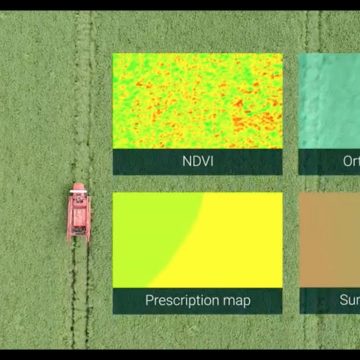
Pix4Dfields Student Educational - Semester License Advanced agriculture mapping software for aerial crop analysis and digital farming. Precision agriculture mapping using images from drones and UAVs The only digital agriculture software focusing on reducing the processing time while incorporating the highest accuracy standards backed up with years of scientific research. Use Pix4Dfields to create prescription maps and maximize crop yields Create accurate field maps, generate insights and analyze field data in real time to increase crop productivity
135,00 € Exc.VAT (166,05 € Inc. 23% VAT)
Pix4Dfields Professor Educational – Yearly License
Pix4Dfields Professor Educational - Yearly License Advanced agriculture mapping software for aerial crop analysis and digital farming. Precision agriculture mapping using images from drones and UAVs The only digital agriculture software focusing on reducing the processing time while incorporating the highest accuracy standards backed up with years of scientific research. Use Pix4Dfields to create prescription maps and maximize crop yields Create accurate field maps, generate insights and analyze field data in real time to increase crop productivity
329,00 € Exc.VAT (404,67 € Inc. 23% VAT)
Pix4Dfields Professor Educational – Perpetual License
1.299,00 € Exc.VAT (1.597,77 € Inc. 23% VAT)
Pix4Dfields Professor Educational – Perpetual License
Pix4Dfields Professor Educational - Perpetual License Advanced agriculture mapping software for aerial crop analysis and digital farming. Precision agriculture mapping using images from drones and UAVs The only digital agriculture software focusing on reducing the processing time while incorporating the highest accuracy standards backed up with years of scientific research. Use Pix4Dfields to create prescription maps and maximize crop yields Create accurate field maps, generate insights and analyze field data in real time to increase crop productivity
1.299,00 € Exc.VAT (1.597,77 € Inc. 23% VAT)
Pix4Dfields Professor Educational – 5-Year License
Pix4Dfields Professor Educational - 5-Year License Advanced agriculture mapping software for aerial crop analysis and digital farming. Precision agriculture mapping using images from drones and UAVs The only digital agriculture software focusing on reducing the processing time while incorporating the highest accuracy standards backed up with years of scientific research. Use Pix4Dfields to create prescription maps and maximize crop yields Create accurate field maps, generate insights and analyze field data in real time to increase crop productivity
649,00 € Exc.VAT (798,27 € Inc. 23% VAT)
Pix4Dfields Classroom Educational – Perpetual License
2.500,00 € Exc.VAT (3.075,00 € Inc. 23% VAT)
Pix4Dfields Classroom Educational – Perpetual License
Pix4Dfields Classroom Educational - Perpetual License Advanced agriculture mapping software for aerial crop analysis and digital farming. Precision agriculture mapping using images from drones and UAVs The only digital agriculture software focusing on reducing the processing time while incorporating the highest accuracy standards backed up with years of scientific research. Use Pix4Dfields to create prescription maps and maximize crop yields Create accurate field maps, generate insights and analyze field data in real time to increase crop productivity
2.500,00 € Exc.VAT (3.075,00 € Inc. 23% VAT)
PIX4DCloud Standard – Monthly Subscription
Pix4Dcloud is a web-based platform that utilizes cloud processing to turn drone and ground images into 2D and 3D deliverables. In simpler terms, it takes pictures captured by drones or even handheld cameras and turns them into useful products like maps, 3D models, and measurements.
59,00 € Exc.VAT (72,57 € Inc. 23% VAT)
PIX4DCloud Advanced – Monthly Subscription
Pix4Dcloud is a web-based platform that utilizes cloud processing to turn drone and ground images into 2D and 3D deliverables. In simpler terms, it takes pictures captured by drones or even handheld cameras and turns them into useful products like maps, 3D models, and measurements.
299,00 € Exc.VAT (367,77 € Inc. 23% VAT)
PIX4DCloud Standard – Yearly Subscription
Pix4Dcloud is a web-based platform that utilizes cloud processing to turn drone and ground images into 2D and 3D deliverables. In simpler terms, it takes pictures captured by drones or even handheld cameras and turns them into useful products like maps, 3D models, and measurements.
590,00 € Exc.VAT (725,70 € Inc. 23% VAT)
PIX4DCloud Advanced – Yearly Subscription
Pix4Dcloud is a web-based platform that utilizes cloud processing to turn drone and ground images into 2D and 3D deliverables. In simpler terms, it takes pictures captured by drones or even handheld cameras and turns them into useful products like maps, 3D models, and measurements.
2.990,00 € Exc.VAT (3.677,70 € Inc. 23% VAT)

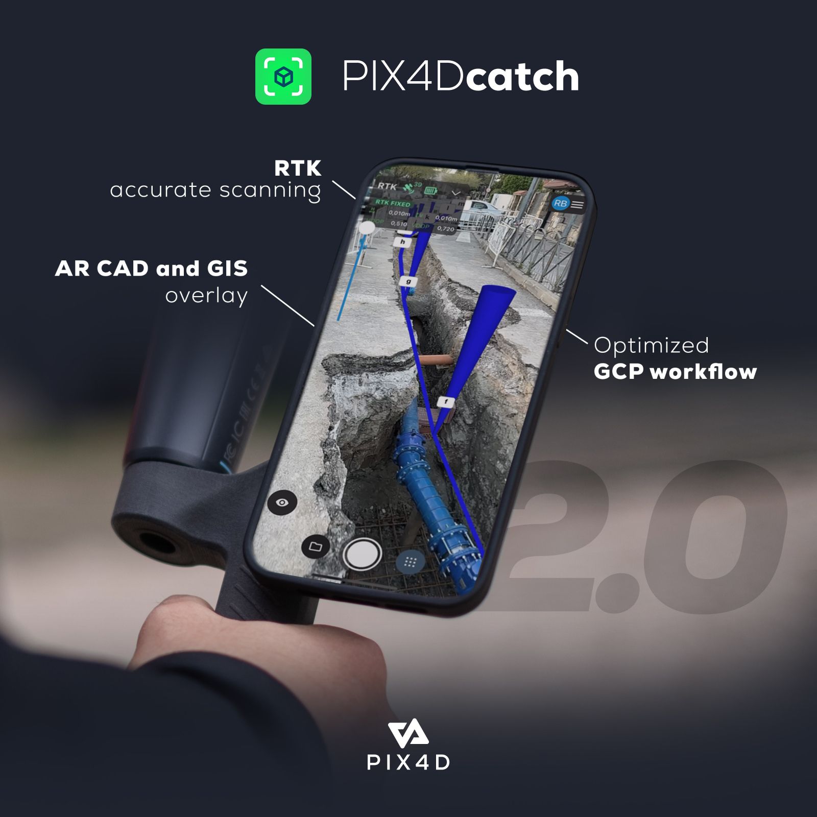
PIX4DCatch – 3-Year Subscription
PIX4Dcatch is a mobile app that lets you create 3D models of your surroundings using your smartphone. It uses a technique called photogrammetry to take multiple pictures of an object or scene and stitch them together to create a 3D model.
3.990,00 € Exc.VAT (4.907,70 € Inc. 23% VAT)
PIX4DCatch – Yearly Subscription
PIX4Dcatch is a mobile app that lets you create 3D models of your surroundings using your smartphone. It uses a technique called photogrammetry to take multiple pictures of an object or scene and stitch them together to create a 3D model.
1.590,00 € Exc.VAT (1.955,70 € Inc. 23% VAT)
PIX4DCatch – Monthly Subscription
PIX4Dcatch is a mobile app that lets you create 3D models of your surroundings using your smartphone. It uses a technique called photogrammetry to take multiple pictures of an object or scene and stitch them together to create a 3D model.
199,00 € Exc.VAT (244,77 € Inc. 23% VAT)
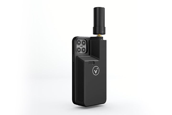
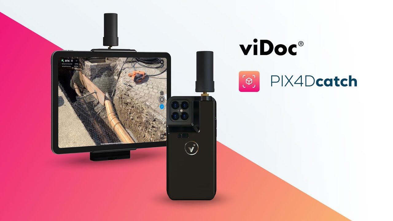
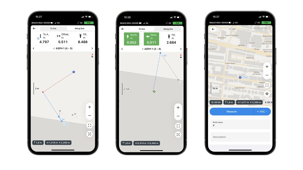
Pix4D viDoc
Pix4D viDoc is a mobile RTK (Real-Time Kinematic) rover designed to be used with Pix4Dcatch software to improve the accuracy of 3D models captured on the ground.
(Price on request)

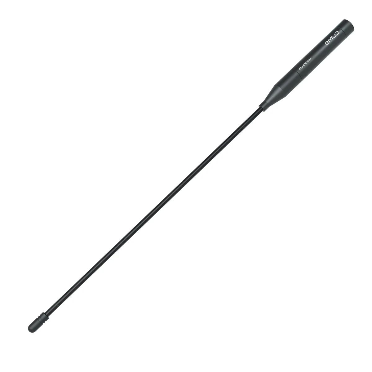
UHF antenna 410-470 MHz
Reach RS3 UHF antenna for receiving corrections over 410–470 MHz UHF radios
49,00 € Exc.VAT (60,27 € Inc. 23% VAT)
Sale!

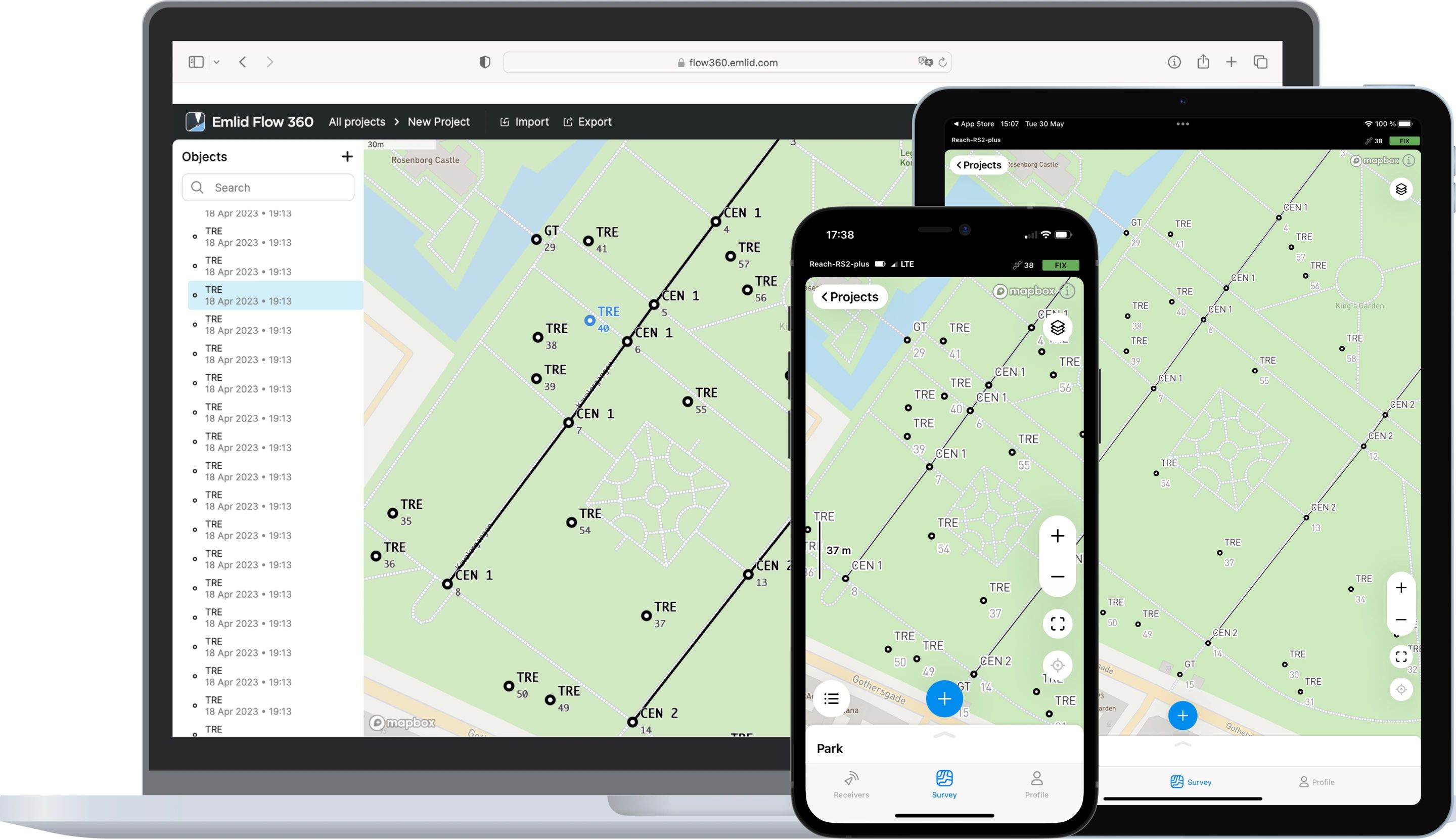
Emlid Flow Survey Plan (Yearly subscription)
The Emlid Flow Survey Plan is a subscription service that unlocks advanced features for land surveying on the Emlid Flow platform. It's designed for users who need more than just basic point collection.
229,00 € Exc.VAT (281,67 € Inc. 23% VAT)
Emlid Flow Survey Plan (Monthly subscription)
The Emlid Flow Survey Plan is a subscription service that unlocks advanced features for land surveying on the Emlid Flow platform. It's designed for users who need more than just basic point collection.
29,00 € Exc.VAT (35,67 € Inc. 23% VAT)

-
-
-
-
Sale!
 Vista Rápida
 -
-
-
-

-
-
-
 Vista Rápida
 -
-
Vista Rápida
-
 Vista Rápida
 -
-
-
Vista Rápida
DJI Matrice 350 RTK-Worry-Free Basic Combo
DJI Matrice 350 RTK 10.161,79 € Exc.VAT (12.499,00 € Inc. 23% VAT) -
-
-
-
-
 Vista Rápida
DJI Mavic 3M (Multispectral) – Free Basic Combo – 1 Year
DJI 3.889,00 € Exc.VAT (4.783,47 € Inc. 23% VAT) -
Vista Rápida
-
 Vista Rápida
DJI Mavic 3E (Enterprise) Worry-Free Basic Combo – 1 Year
DJI 2.899,00 € Exc.VAT (3.565,77 € Inc. 23% VAT)
-
-
 Vista Rápida
 -
Vista Rápida
-
Vista Rápida
-
Vista Rápida
-
 Vista Rápida
Agisoft Metashape Standard, Node-Locked Educational license, Single
Agisoft 54,00 € Exc.VAT (66,42 € Inc. 23% VAT) -
-
