


EMLID PHOTO CONTEST

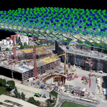
Geosun Lidars
Geosun LiDARs are a high-quality products that offers a combination of accuracy, speed, and efficiency.


New Wingtra LIDAR
Perfectly integrated with the WingtraOne GEN II drone to ensure a streamlined workflow.

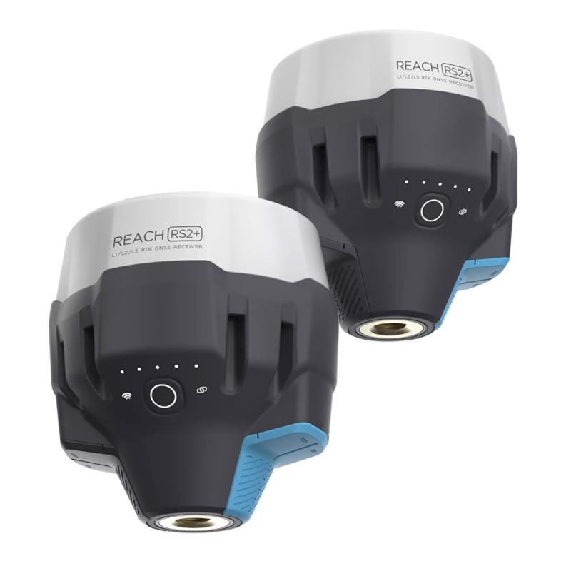
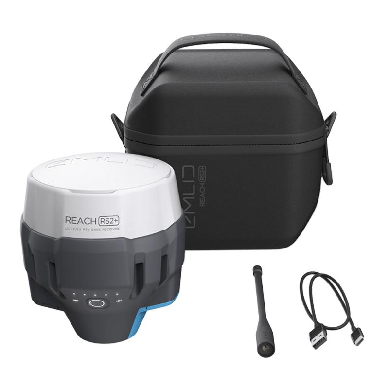
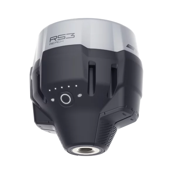
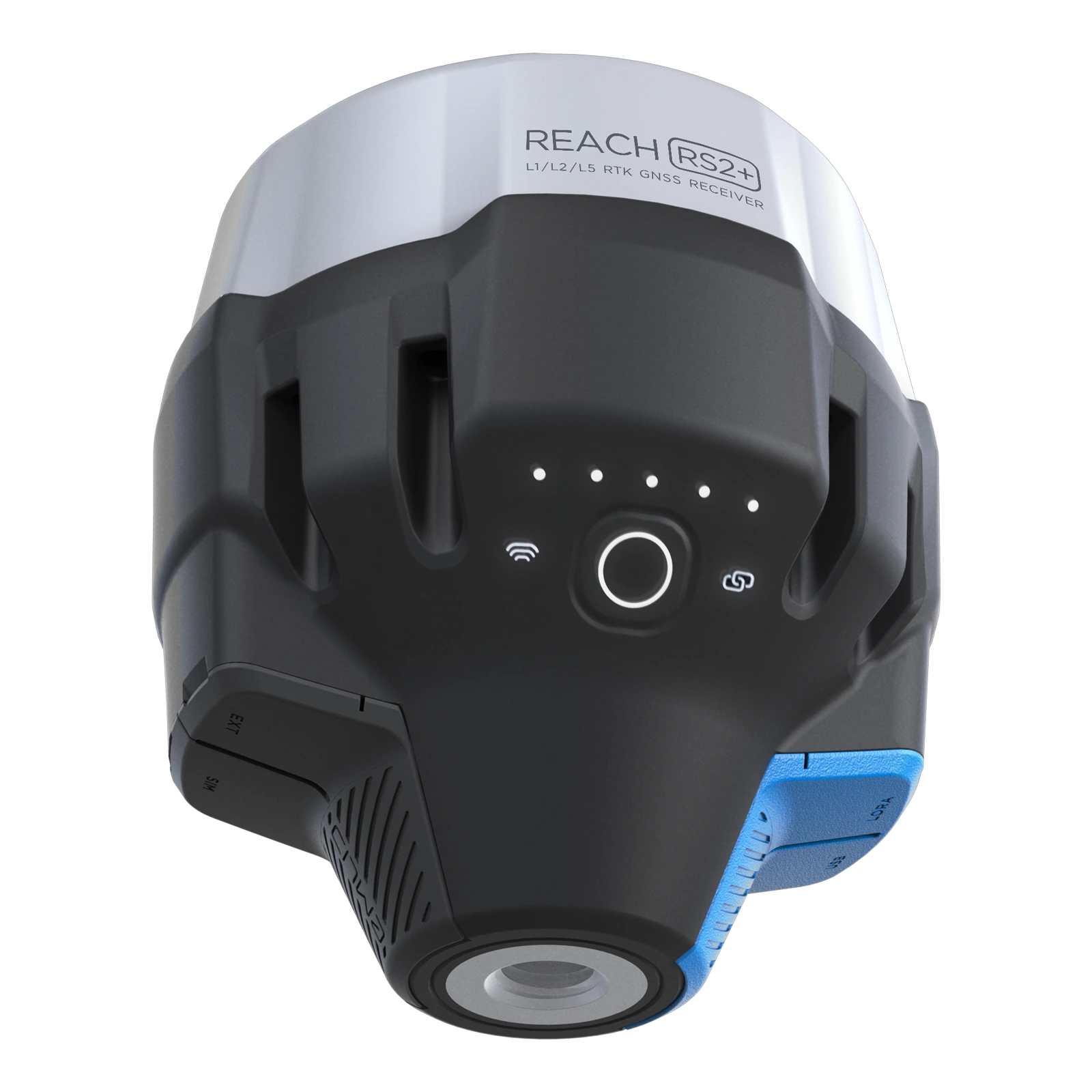
New Emlid Reach RS3
Multi-band base and rover
IMU tilt compensation
LTE modem
Dual-band radio
IMU tilt compensation
LTE modem
Dual-band radio

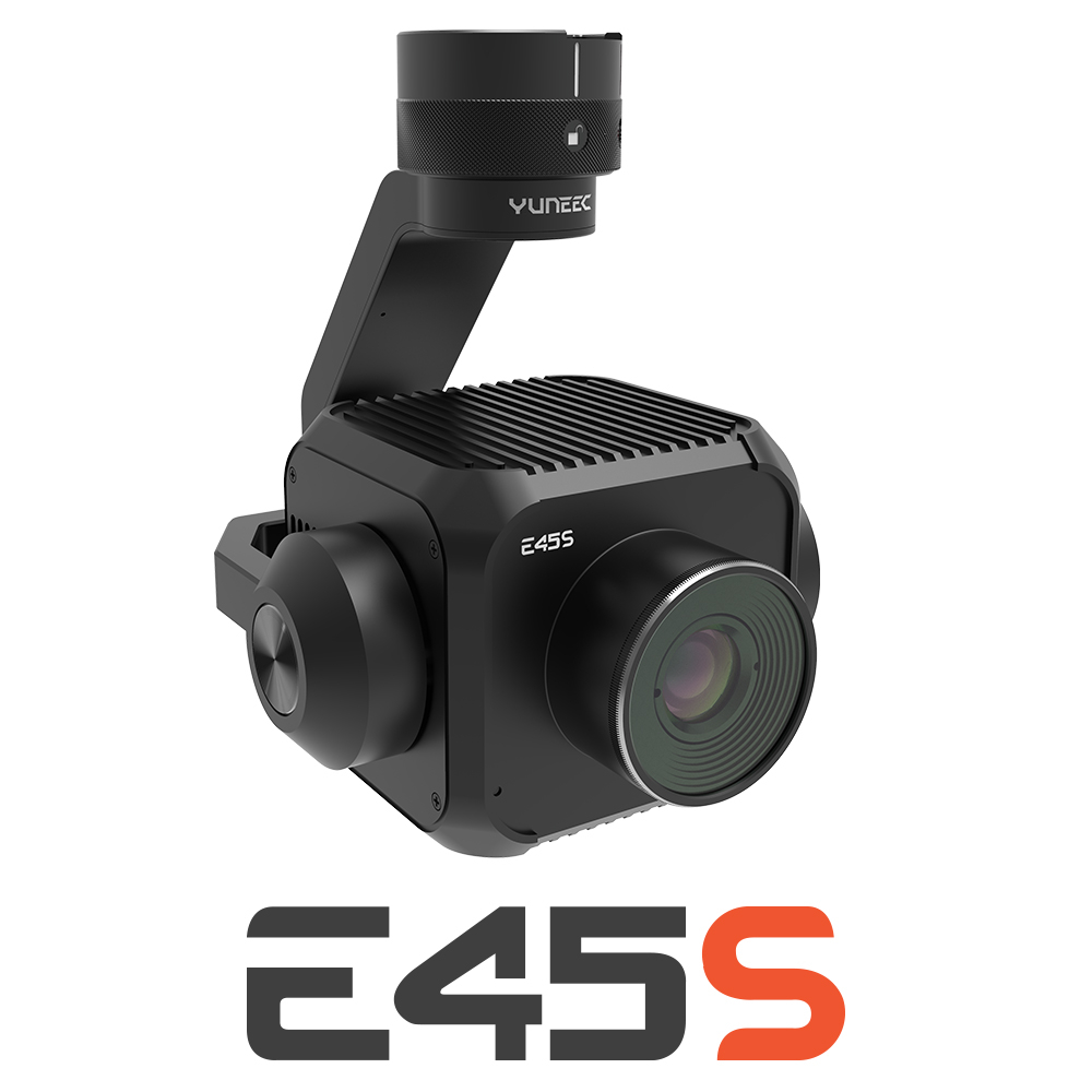
New Yuneec E45S for H510E and H850
Yuneec launched E45S 45MP full frame camera, ideal for professionals in survey and inspection industry!
New Swellpro Fisherman MAX
Launch of Fisherman Max is now available for pre-order and shipping starts on August 1st.


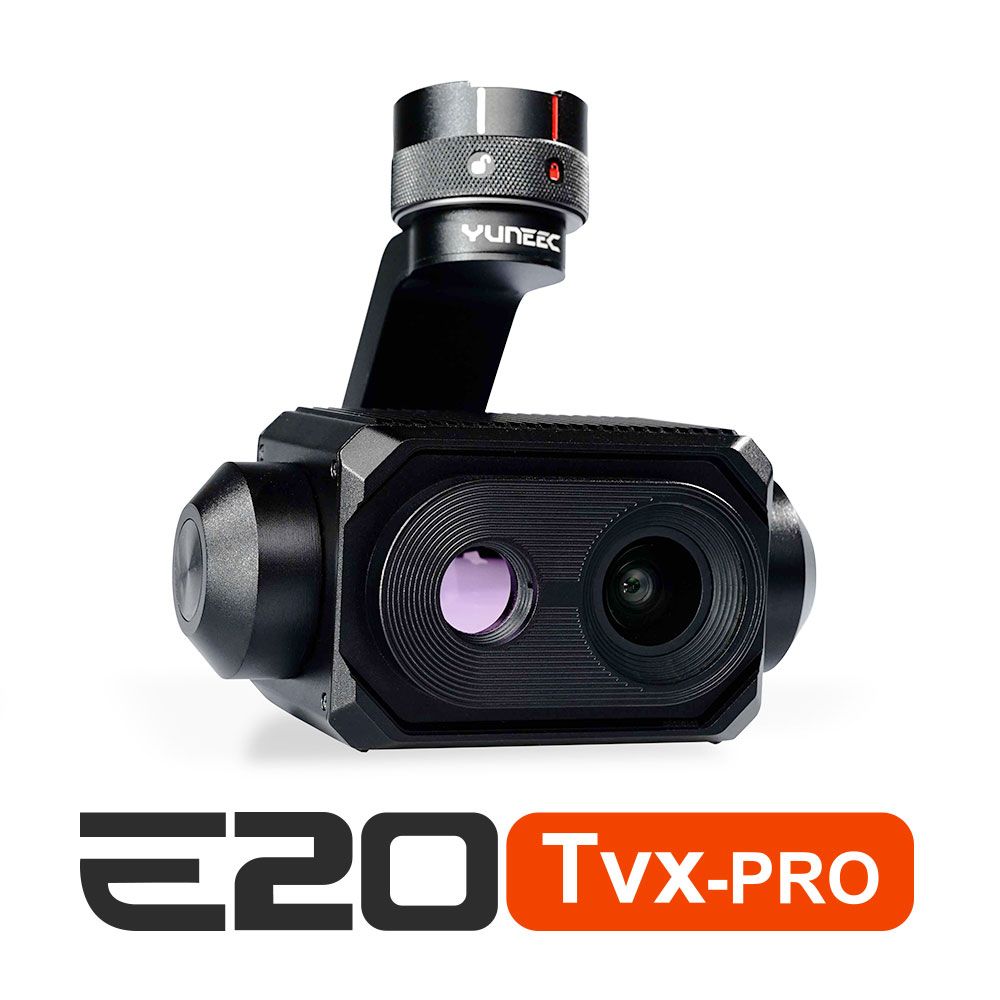
New E20TVX-PRO Thermal camera
Recommended camera for tasks related to Inspection (buildings, solar panels and powerlines), Search and Rescue, Firefighting and Law enforcement

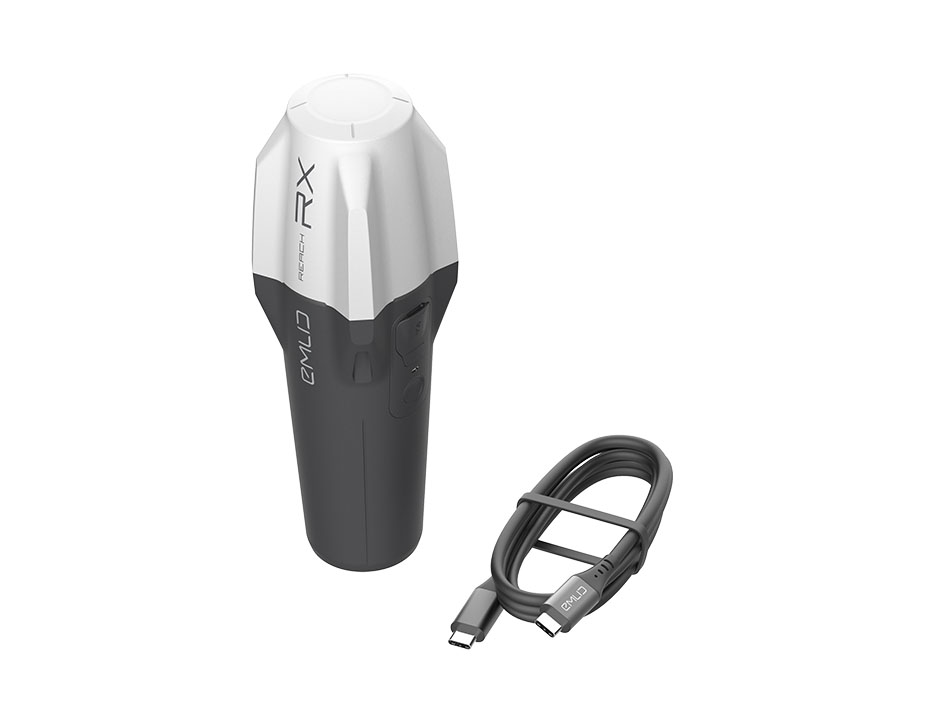
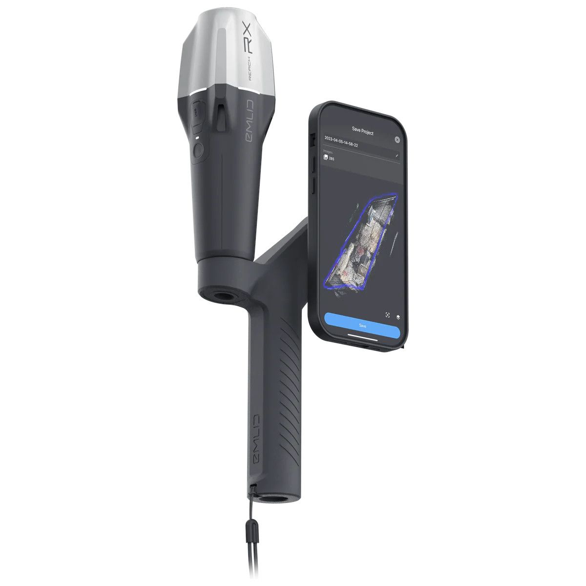
New Emlid Reach RX rover
Emlid Reach RX is a new pocket-sized, lightweight and easy-to-use receiver!

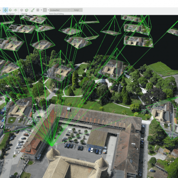
 Surveying & GIS
-
 Vista Rápida
 -
 Vista Rápida
 -
 Vista Rápida
 -
 Vista Rápida
 -
 Vista Rápida
 -
 Vista Rápida
 -
 Vista Rápida
 Mining & Quarries
-
Vista Rápida
-
Vista Rápida
-
Vista Rápida
-
Vista Rápida
-
Vista Rápida
-
Vista Rápida
-
Vista Rápida
 Construction
-
Vista Rápida
-
Vista Rápida
-
Vista Rápida
-
Vista Rápida
-
Vista Rápida
-
Vista Rápida
-
Vista Rápida
 Agriculture
-
Vista Rápida
-
Vista Rápida
-
Vista Rápida
-
Vista Rápida
-
 Vista Rápida
 -
Vista Rápida
-
Vista Rápida
 Environment monitoring
-
Vista Rápida
-
Vista Rápida
-
Vista Rápida
-
Vista Rápida
-
Vista Rápida
-
Vista Rápida
-
Vista Rápida
 Search & Rescue
-
Vista Rápida
-
Vista Rápida
-
Vista Rápida
-
Vista Rápida
-
Vista Rápida
-
Vista Rápida
 Other applications
-
Sale!
 Vista Rápida
 -
Sale!
 Vista Rápida
 -
 Vista Rápida
 -
Sale!
 Vista Rápida
 -
 Vista Rápida
 -
Sale!
 Vista Rápida


Showing 65–80 of 98 results
Agisoft Metashape Professional, Node-Locked license, Single
3.240,00 € Exc.VAT (3.985,20 € Inc. 23% VAT)
Agisoft Metashape Professional, Node-Locked license, Single
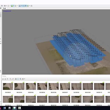
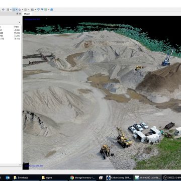
Agisoft Metashape Professional is software that maximizes the possibilities of photogrammetry. It incorporates machine learning technologies for analysis and post-processing to deliver the highest accuracy results. Perpetual license Desktop application with node locked license (1 device).
3.240,00 € Exc.VAT (3.985,20 € Inc. 23% VAT)
Pix4DMatic – Yearly Subscription
Pix4dMatic - Yearly Subscription Pix4Dmatic - Yearly Subscription Pix4Dmatic is the leading photogrammetry software for professional drone-based mapping. The software helps surveyors with mapping, companies with digitization and 3-D modeling or engineers with the collection and evaluation of thermal data with high-precision data supported by GNSS.
(Price on request)
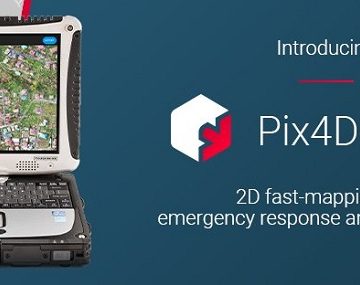
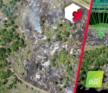
Pix4Dreact – Yearly Subscription license
Pix4DReact - Yearly Subscription license 2D fast-mapping for emergency response and public safety The mapping software for emergency response Get rapid and reliable situational awareness for quick decisions and collaboration in the field.
(Price on request)
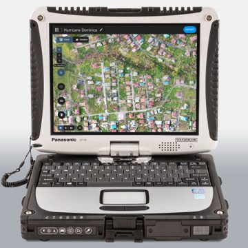
Pix4Dreact – Perpetual License
Pix4DReact - Perpetual License 2D fast-mapping for emergency response and public safety The mapping software for emergency response Get rapid and reliable situational awareness for quick decisions and collaboration in the field.
(Price on request)
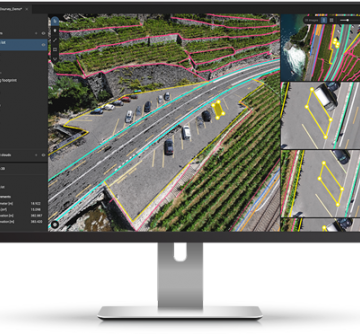
Pix4DSurvey – Yearly Subscription license
Pix4DSurvey - Yearly Subscription license Bridge the gap between photogrammetry and CAD!
(Price on request)
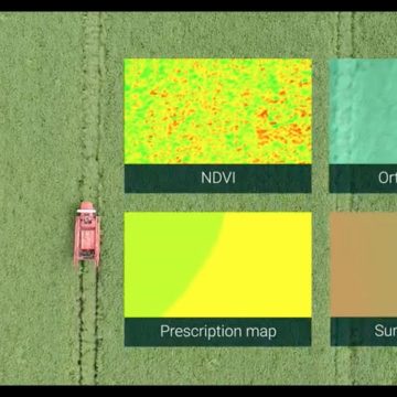

Pix4Dfields – Perpetual License
Pix4DFileds - Perpetual License Advanced agriculture mapping software for aerial crop analysis and digital farming. Precision agriculture mapping using images from drones and UAVs The only digital agriculture software focusing on reducing the processing time while incorporating the highest accuracy standards backed up with years of scientific research. Use Pix4Dfields to create prescription maps and maximize crop yields Create accurate field maps, generate insights and analyze field data in real time to increase crop productivity
(Price on request)
Pix4Dfields – Yearly Subscription license
Pix4Dfields - Yearly Subscription license Advanced agriculture mapping software for aerial crop analysis and digital farming. Precision agriculture mapping using images from drones and UAVs The only digital agriculture software focusing on reducing the processing time while incorporating the highest accuracy standards backed up with years of scientific research. Use Pix4Dfields to create prescription maps and maximize crop yields Create accurate field maps, generate insights and analyze field data in real time to increase crop productivity
(Price on request)
Pix4Dmapper Educational Classroom – Perpetual
Pix4dMapper, Educational Classroom version – Perpetual License The power of photogrammetry software A unique environment connecting your original images to each point of the 3D reconstruction to visually verify and improve the accuracy of your project. Generate high resolution outputs for any project and use case Easily export your digital maps and models to industry-compatible formats for further analysis or reporting
(Price on request)
Pix4Dmapper Educational Professor – Perpetual
Pix4dMapper, Educational Professor version – Perpetual License The power of photogrammetry software A unique environment connecting your original images to each point of the 3D reconstruction to visually verify and improve the accuracy of your project. Generate high resolution outputs for any project and use case Easily export your digital maps and models to industry-compatible formats for further analysis or reporting
(Price on request)
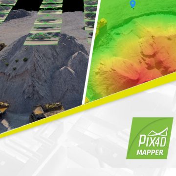
Pix4Dmapper – Yearly Subscription License
Pix4dMapper - Yearly Subscription License The power of photogrammetry software A unique environment connecting your original images to each point of the 3D reconstruction to visually verify and improve the accuracy of your project. Generate high resolution outputs for any project and use case Easily export your digital maps and models to industry-compatible formats for further analysis or reporting
(Price on request)
Agisoft Metashape Professional, Floating Educational license, 20 licenses pack
Agisoft Metashape Professional is software that maximizes the possibilities of photogrammetry. It incorporates machine learning technologies for analysis and post-processing to deliver the highest accuracy results. Perpetual license Desktop application with floating education license, 20 licenses pack.
(Price on request)
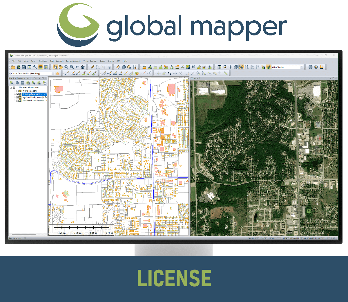
GM Network License
Global Mapper Standard is a user-friendly Geographic Information System (GIS) software designed for both beginners and experienced users. It offers a wide range of features for working with geospatial data, including: Importing and exporting over 300 different file formats Access to online data sources for imagery, basemaps, terrain, and vector data Vector drawing, editing, analysis, and spatial operations Attribute editing, joining, calculation, graphing, and querying -->> Server license starts at two concurrent/shared seats <<--
(Price on request)
GM Single User – Floating License
Global Mapper Standard is a user-friendly Geographic Information System (GIS) software designed for both beginners and experienced users. It offers a wide range of features for working with geospatial data, including: Importing and exporting over 300 different file formats Access to online data sources for imagery, basemaps, terrain, and vector data Vector drawing, editing, analysis, and spatial operations Attribute editing, joining, calculation, graphing, and querying -->>The Single User Floating license is remote desktop enabled (RDP), which is convenient for users working between multiple locations. <<--
873,00 € Exc.VAT (1.073,79 € Inc. 23% VAT)
GM Single User – Node Locked
Global Mapper Standard is a user-friendly Geographic Information System (GIS) software designed for both beginners and experienced users. It offers a wide range of features for working with geospatial data, including: Importing and exporting over 300 different file formats Access to online data sources for imagery, basemaps, terrain, and vector data Vector drawing, editing, analysis, and spatial operations Attribute editing, joining, calculation, graphing, and querying -->> This license is node-locked to one computer and it cannot be access remotely. <<--
582,00 € Exc.VAT (715,86 € Inc. 23% VAT)
Agisoft Metashape Standard, Node-Locked Educational license, 20 licenses pack
-Agisoft Metashape Standard, Educationl Edition is a stand-alone software product that performs photogrammetric processing of digital images and generates 3D spatial data to be used in GIS applications, cultural heritage documentation, and visual effects production as well as for indirect measurements of objects of various scales. Educational licenses (rehostable node-locked) and Educational Floating licenses are available exclusively to accredited educational institutions, their employees and students of such institutions. Software: Agisoft Metashape Standard, Node-Locked Educational license, 20 licenses pack.
(Price on request)
Agisoft Metashape Standard, Node-Locked Educational license, 10 licenses pack
-Agisoft Metashape Standard, Educationl Edition is a stand-alone software product that performs photogrammetric processing of digital images and generates 3D spatial data to be used in GIS applications, cultural heritage documentation, and visual effects production as well as for indirect measurements of objects of various scales. Educational licenses (rehostable node-locked) and Educational Floating licenses are available exclusively to accredited educational institutions, their employees and students of such institutions. Software: Agisoft Metashape Standard, Node-Locked Educational license, 10 licenses pack.
(Price on request)

-
-
-
-
-
-
-
Sale!
 Vista Rápida
 -
Sale!
 Vista Rápida
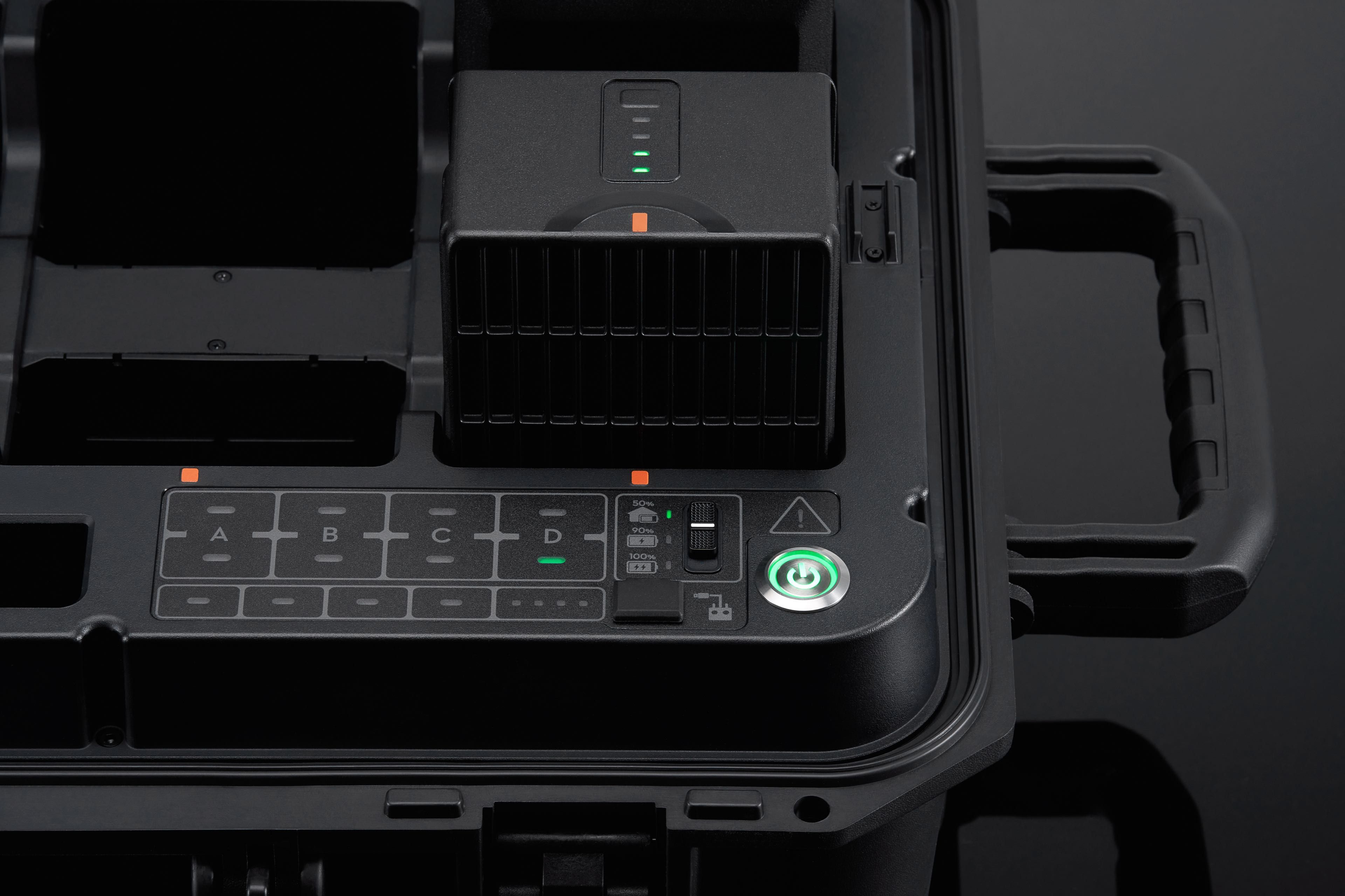
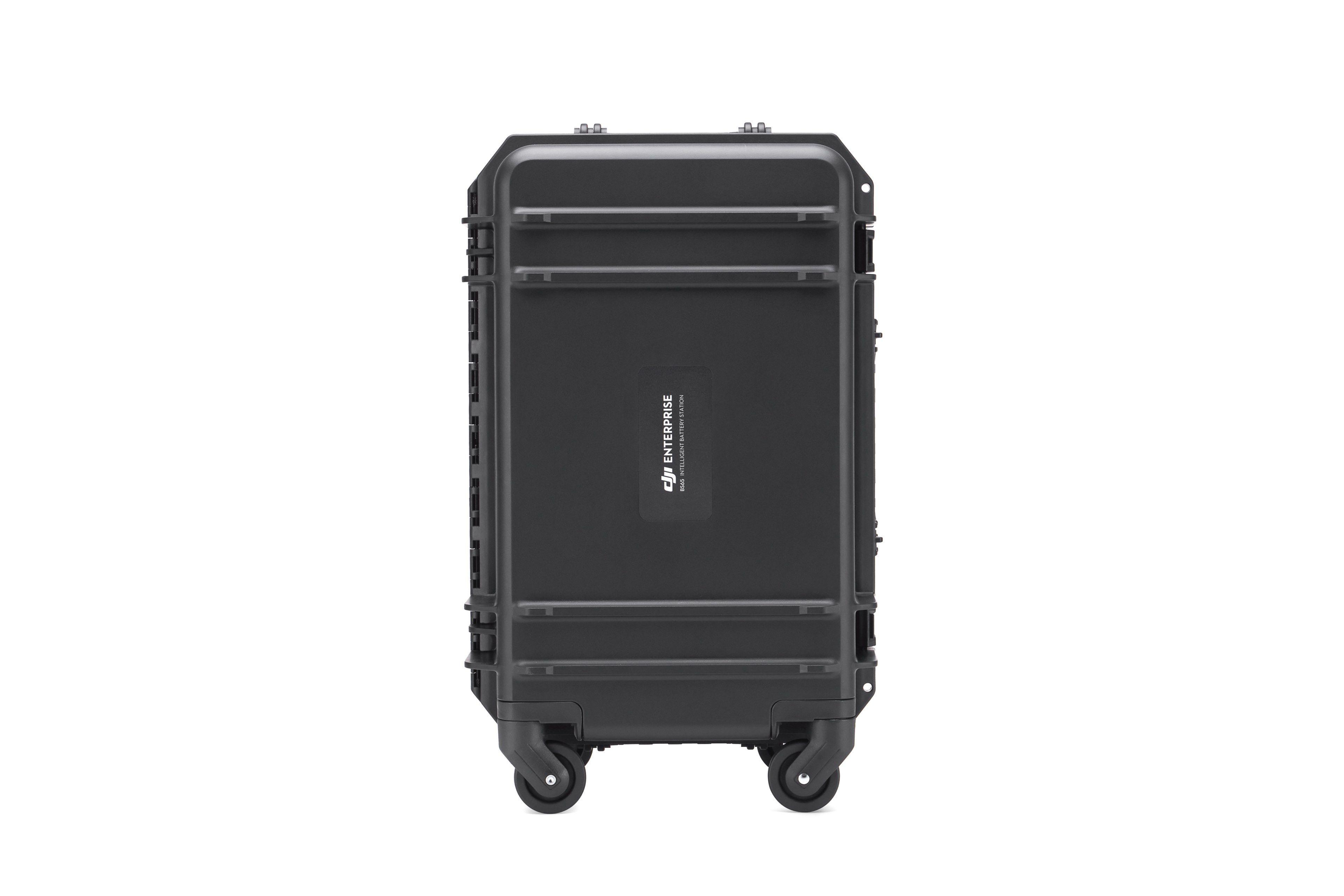
BS65 Intelligent Battery Station
Accessories DJI Matrice 350 RTK 999,00 € Exc.VAT (1.228,77 € Inc. 23% VAT)

-
 Vista Rápida
 -
Vista Rápida
-
Vista Rápida
-
-
-
-
-
-
Vista Rápida
DJI Matrice 350 RTK-Worry-Free Basic Combo
DJI Matrice 350 RTK 10.150,00 € Exc.VAT (12.484,50 € Inc. 23% VAT) -
-
-
-
-
 Vista Rápida
DJI Mavic 3M (Multispectral) – Free Basic Combo – 1 Year
DJI 3.889,00 € Exc.VAT (4.783,47 € Inc. 23% VAT) -
 Vista Rápida
DJI Mavic 3E (Enterprise) Worry-Free Basic Combo – 1 Year
DJI 2.899,00 € Exc.VAT (3.565,77 € Inc. 23% VAT) -
-
Vista Rápida
-
Vista Rápida
-
 Vista Rápida
Agisoft Metashape Standard, Node-Locked Educational license, Single
Agisoft 54,00 € Exc.VAT (66,42 € Inc. 23% VAT) -
-
-
-
-
