


Solução Perfeita para obtenção de resultados únicos – O seu projeto nunca esteve em melhores mãos!

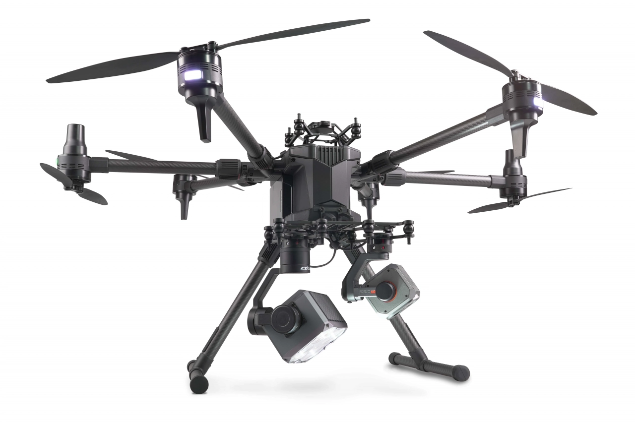
DJI Matrice 400
Designed for a wide range of industrial applications such as emergency response, power inspections, mapping, and architecture, engineering, and construction.

DJI Matrice 4E and 4T
The DJI Matrice 4E and Matrice 4T are both industrial-grade drones from DJI, designed specifically for professionals in fields like surveying, inspection, mapping and monitoring.

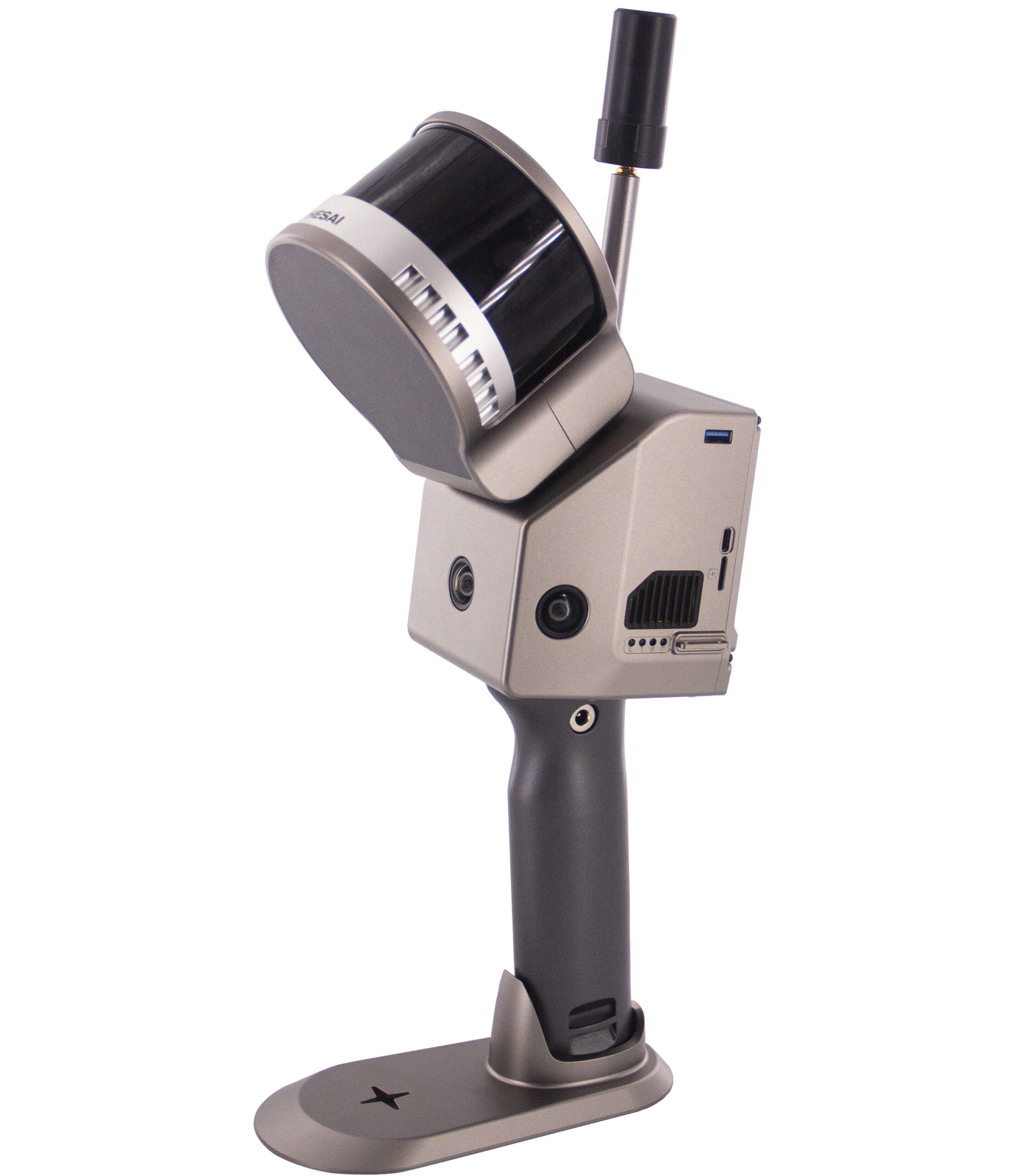
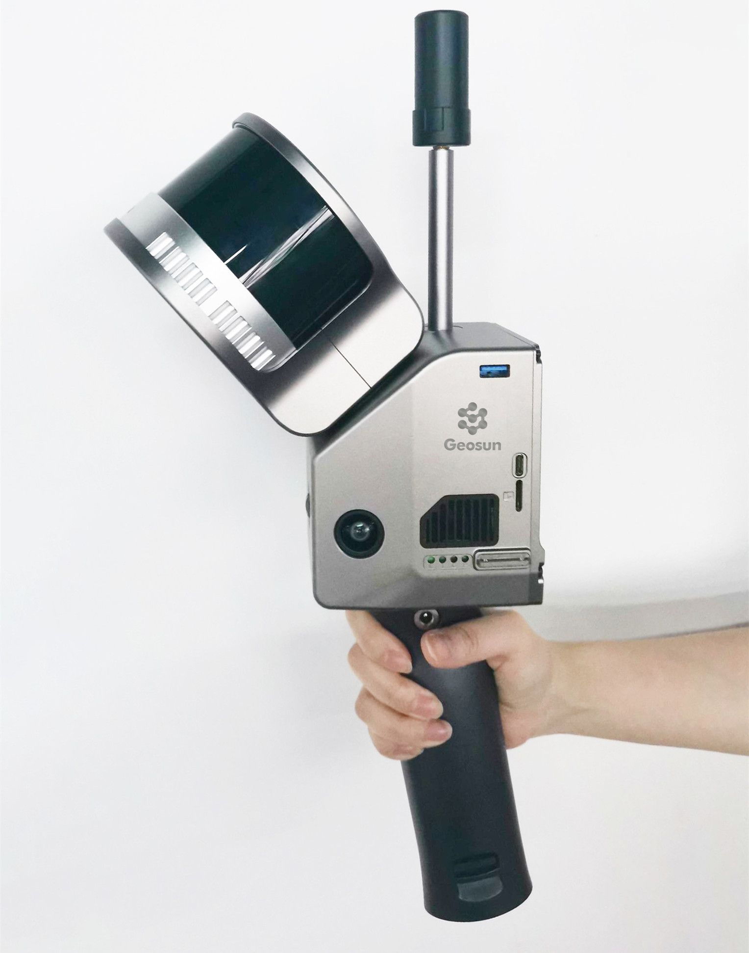
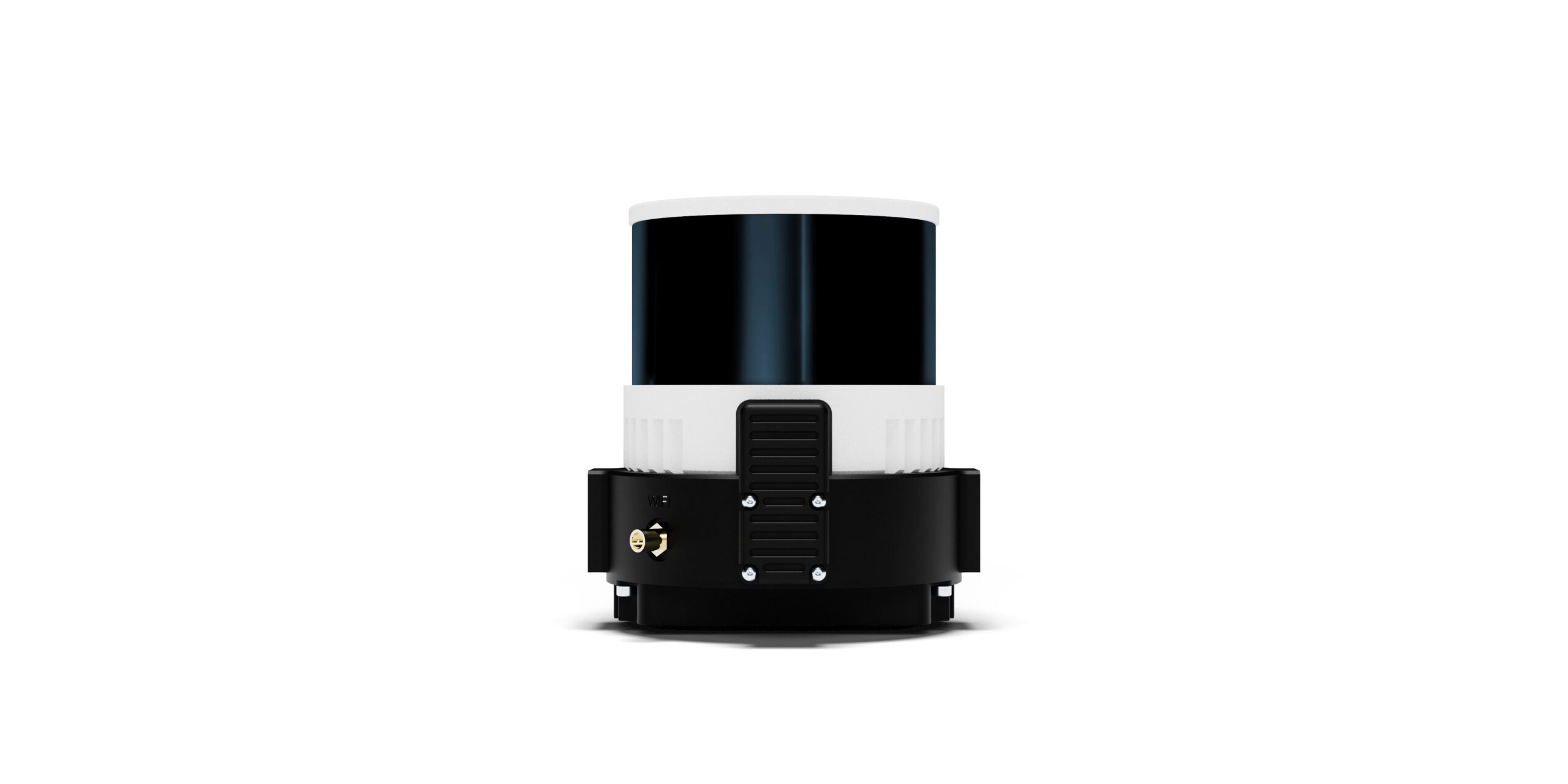
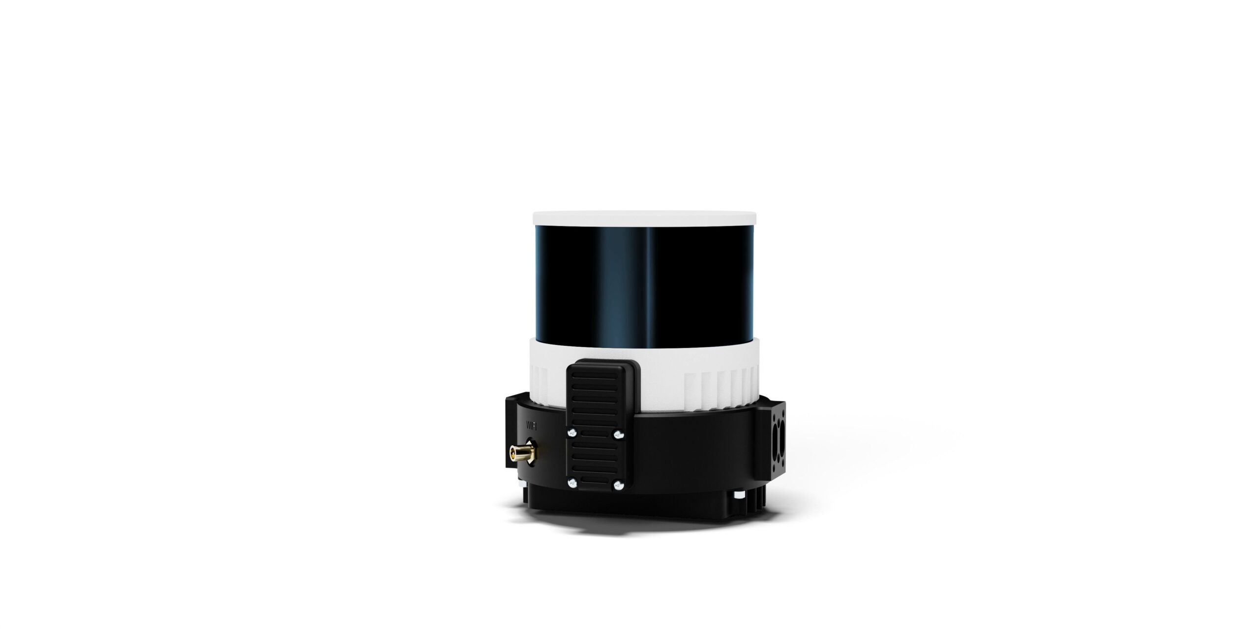
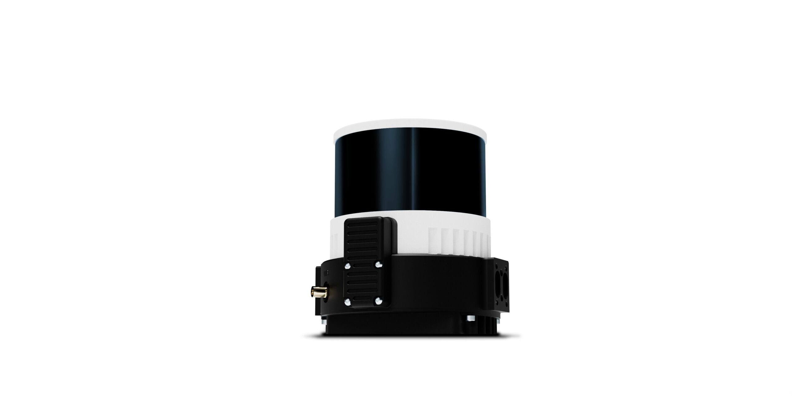
Geosun Lidars
Geosun LiDARs are a high-quality products that offers a combination of accuracy, speed, and efficiency.


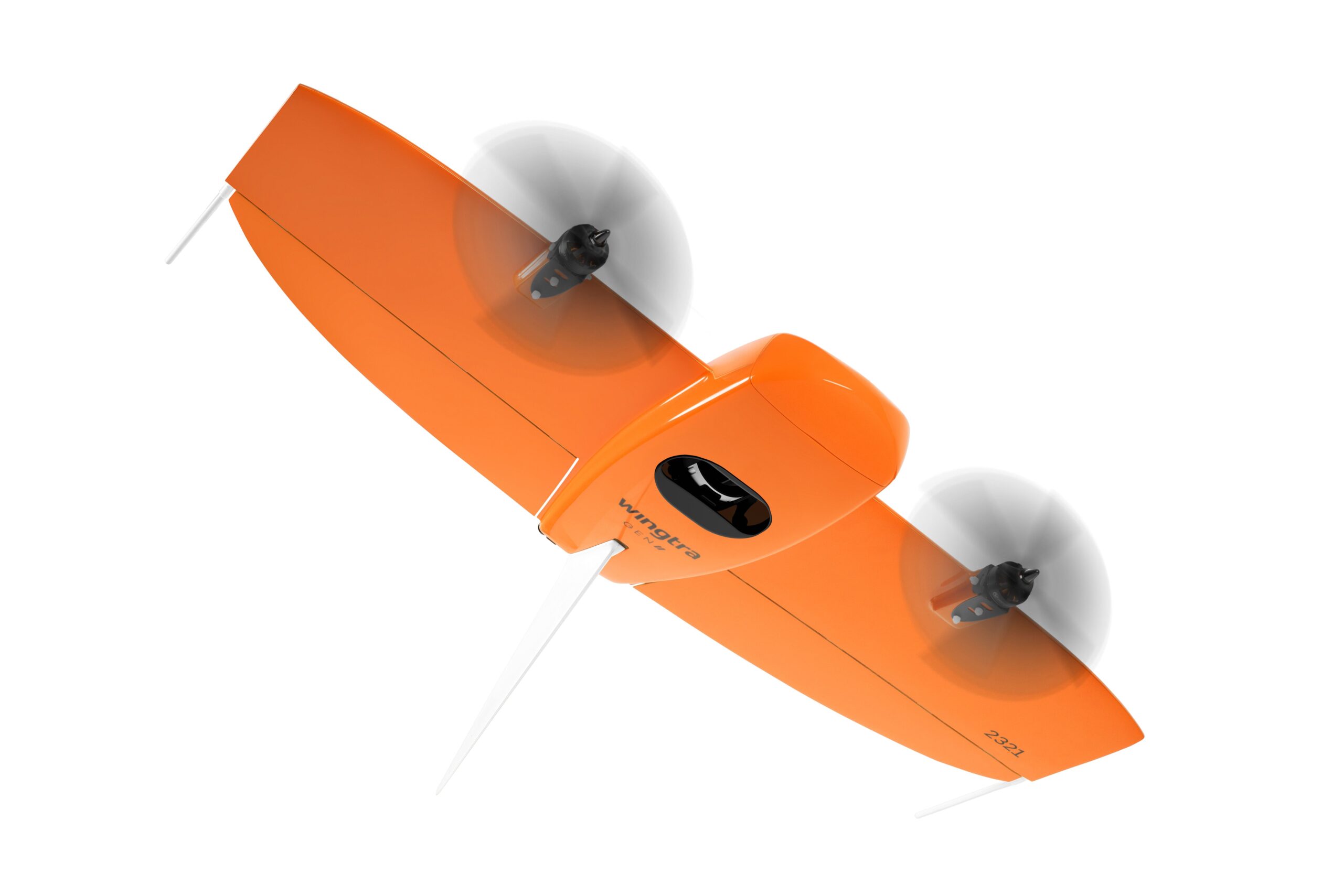
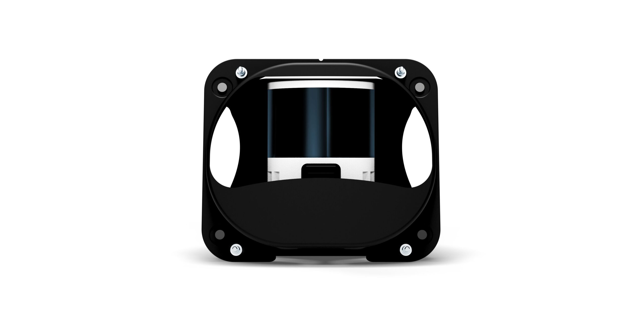
New Wingtra LIDAR
Perfectly integrated with the WingtraOne GEN II drone to ensure a streamlined workflow.

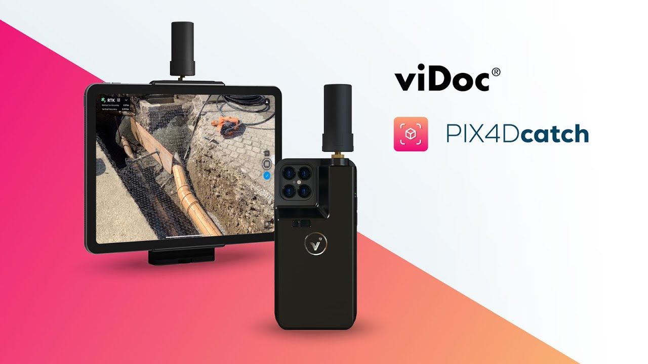
New Emlid Reach RS3
Multi-band base and rover
IMU tilt compensation
LTE modem
Dual-band radio
IMU tilt compensation
LTE modem
Dual-band radio

 Surveying & GIS
-
 Vista Rápida
 -
 Vista Rápida
 -
 Vista Rápida
 -
 Vista Rápida
 -
 Vista Rápida
 -
 Vista Rápida
 -
Sale!Vista Rápida
 Mining & Quarries
-
Sale!Vista Rápida
-
Vista Rápida
-
 Vista Rápida
 -
Vista Rápida
-
Vista Rápida
-
Vista Rápida
-
Vista Rápida
-
Vista Rápida
 Construction
-
Vista Rápida
-
Vista Rápida
-
Vista Rápida
-
Vista Rápida
-
Vista Rápida
-
Vista Rápida
-
Vista Rápida
-
Sale!Vista Rápida
 Agriculture
-
Vista Rápida
-
 Vista Rápida
 -
Vista Rápida
-
Vista Rápida
-
Vista Rápida
-
Vista Rápida
-
Vista Rápida
-
Vista Rápida
 Environment monitoring
-
Vista Rápida
-
Sale!
 Vista Rápida
 -
Sale!Vista Rápida
-
Vista Rápida
-
Vista Rápida
-
Vista Rápida
-
Vista Rápida
-
Vista Rápida
 Search & Rescue
-
Vista Rápida
-
Vista Rápida
-
Sale!Vista Rápida
-
Vista Rápida
-
Sale!Vista Rápida
-
Vista Rápida
-
Vista Rápida
 Other applications
-
Sale!
 Vista Rápida
 -
 Vista Rápida
 -
Sale!Vista Rápida
-
 Vista Rápida
 -
Sale!
 Vista Rápida
 -
Sale!
 Vista Rápida
 -
 Vista Rápida


- Sorry, this product cannot be purchased.
Showing 305–320 of 573 results

Global Mapper Pro USB Dongle License
Global Mapper Pro is an advanced geospatial software program designed for professionals who need more than the basic features of Global Mapper. It includes a wide range of tools for working with imagery, terrain, and LiDAR data. Some of the key features of Global Mapper Pro include: Pixels to Points: This tool allows you to create 3D point clouds, orthoimages, and 3D meshes from drone or UAV-collected images. Terrain Painting: This tool allows you to manually alter digital terrain models (DTMs). Generate Breaklines from Terrain Grid: This tool creates vector line features at distinct changes in elevation/slope. Vectorize Raster: This tool extracts and smooths vector areas from raster image and terrain layers. Advanced LiDAR Processing: Global Mapper Pro includes a number of tools for working with LiDAR data, such as point cloud classification, filtering, -->> This license can be moved between unlimited machines via a USB dongle. <<--
2.172,50 € Exc.VAT (2.172,50 € Inc. 23% VAT)
Global Mapper (Upgrade-to-Pro) Single User – Node Locked
Global Mapper Pro is an advanced geospatial software program designed for professionals who need more than the basic features of Global Mapper. It includes a wide range of tools for working with imagery, terrain, and LiDAR data. Some of the key features of Global Mapper Pro include: Pixels to Points: This tool allows you to create 3D point clouds, orthoimages, and 3D meshes from drone or UAV-collected images. Terrain Painting: This tool allows you to manually alter digital terrain models (DTMs). Generate Breaklines from Terrain Grid: This tool creates vector line features at distinct changes in elevation/slope. Vectorize Raster: This tool extracts and smooths vector areas from raster image and terrain layers. Advanced LiDAR Processing: Global Mapper Pro includes a number of tools for working with LiDAR data, such as point cloud classification, filtering, -->> This license is node-locked to one computer and it cannot be access remotely. <<-- (Upgrade license from Standard to Pro Version)
(Price on request)
Global Mapper (Upgrade-to-Pro) Network License
Global Mapper Pro is an advanced geospatial software program designed for professionals who need more than the basic features of Global Mapper. It includes a wide range of tools for working with imagery, terrain, and LiDAR data. Some of the key features of Global Mapper Pro include: Pixels to Points: This tool allows you to create 3D point clouds, orthoimages, and 3D meshes from drone or UAV-collected images. Terrain Painting: This tool allows you to manually alter digital terrain models (DTMs). Generate Breaklines from Terrain Grid: This tool creates vector line features at distinct changes in elevation/slope. Vectorize Raster: This tool extracts and smooths vector areas from raster image and terrain layers. Advanced LiDAR Processing: Global Mapper Pro includes a number of tools for working with LiDAR data, such as point cloud classification, filtering, -->> Server license starts at two concurrent/shared seats <<-- (Upgrade license from Standard to Pro Version)
(Price on request)
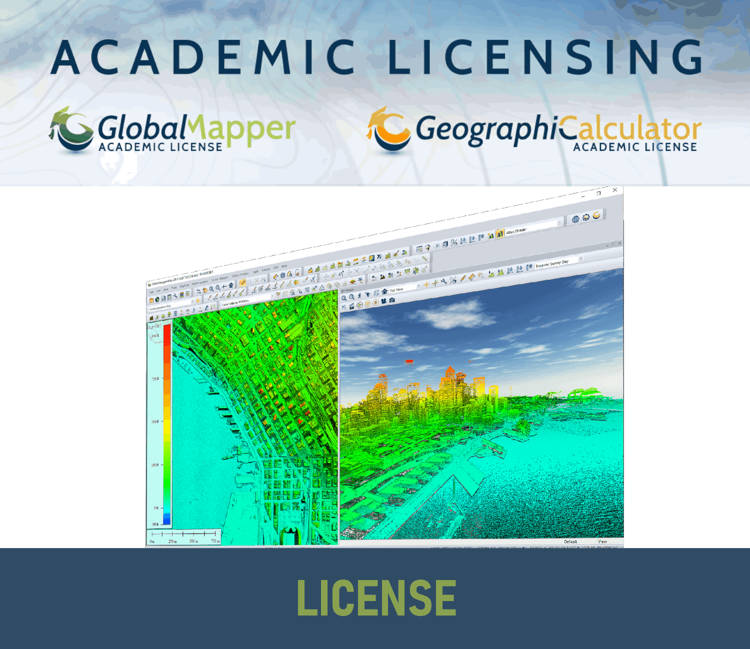
Global Mapper Academic License
Global Mapper Academic License is available to accredited institutions of higher education. This includes colleges, universities, and technical schools. Includes all the features of the Global Mapper Standard Edition, plus some additional features that are useful for academic use, such as the ability to create 3D models and export data to a variety of formats. Can be used for instructional purposes only. This means that students can use it to complete assignments, but they cannot use it for commercial purposes. Can be installed on a classroom or lab computers, as well as on students' personal computers.
(Price on request)
Global Mapper (Upgrade-to-Pro) Single User – Floating License
Global Mapper Pro is an advanced geospatial software program designed for professionals who need more than the basic features of Global Mapper. It includes a wide range of tools for working with imagery, terrain, and LiDAR data. Some of the key features of Global Mapper Pro include: Pixels to Points: This tool allows you to create 3D point clouds, orthoimages, and 3D meshes from drone or UAV-collected images. Terrain Painting: This tool allows you to manually alter digital terrain models (DTMs). Generate Breaklines from Terrain Grid: This tool creates vector line features at distinct changes in elevation/slope. Vectorize Raster: This tool extracts and smooths vector areas from raster image and terrain layers. Advanced LiDAR Processing: Global Mapper Pro includes a number of tools for working with LiDAR data, such as point cloud classification, filtering, -->> The Single User Floating license is remote desktop enabled (RDP), which is convenient for users working between multiple locations. <<-- (Upgrade license from Standard to
(Price on request)
Global Mapper (Upgrade-to-Pro) USB Dongle License
Global Mapper Pro is an advanced geospatial software program designed for professionals who need more than the basic features of Global Mapper. It includes a wide range of tools for working with imagery, terrain, and LiDAR data. Some of the key features of Global Mapper Pro include: Pixels to Points: This tool allows you to create 3D point clouds, orthoimages, and 3D meshes from drone or UAV-collected images. Terrain Painting: This tool allows you to manually alter digital terrain models (DTMs). Generate Breaklines from Terrain Grid: This tool creates vector line features at distinct changes in elevation/slope. Vectorize Raster: This tool extracts and smooths vector areas from raster image and terrain layers. Advanced LiDAR Processing: Global Mapper Pro includes a number of tools for working with LiDAR data, such as point cloud classification, filtering, -->> This license can be moved between unlimited machines via a USB dongle. <<-- (Upgrade license from Standard to Pro Version)
(Price on request)
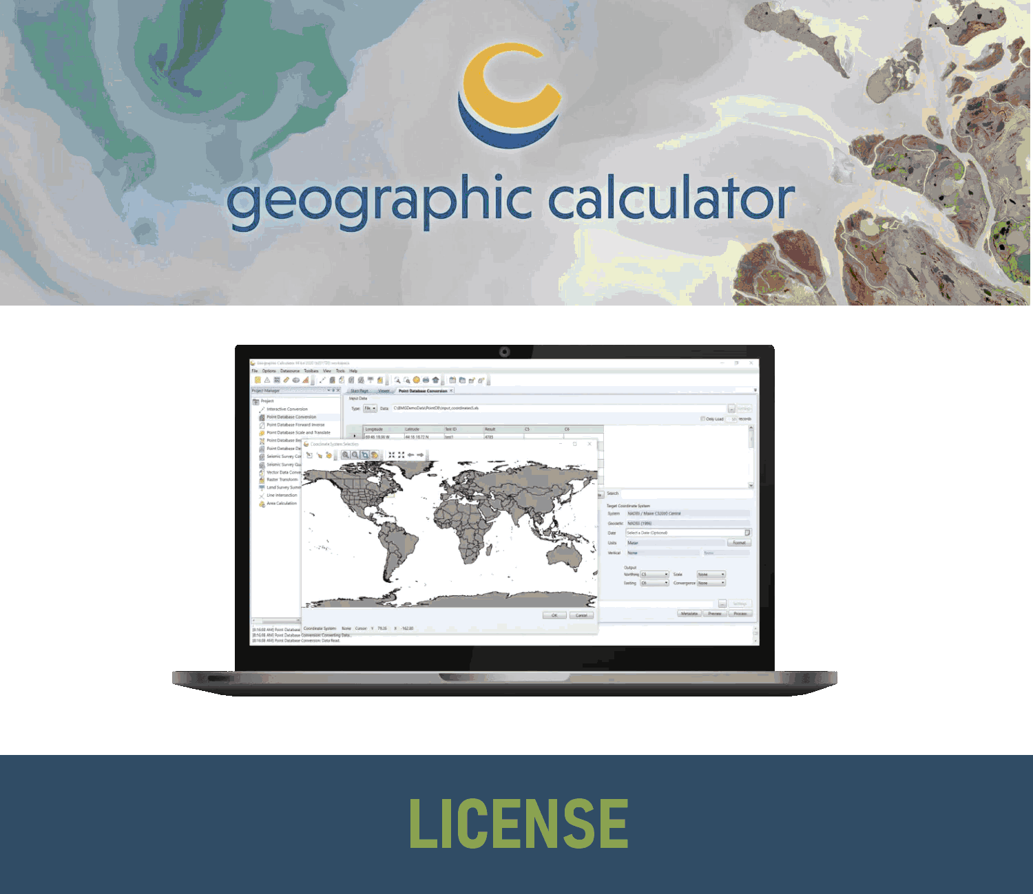
Geographic Calculator – Single User, Node Locked
Geographic Calculator is a powerful geodetic software for accurate coordinate conversion, datum transformation, and file translation. It is designed for GIS professionals, surveyors, engineers, and anyone who works with geospatial data. -->> This license is node-locked to one computer and it cannot be access remotely. <<--
(Price on request)
Geographic Calculator – Single User, Floating
Geographic Calculator is a powerful geodetic software for accurate coordinate conversion, datum transformation, and file translation. It is designed for GIS professionals, surveyors, engineers, and anyone who works with geospatial data. -->> This license is node-locked to one computer and it cannot be access remotely. <<--
(Price on request)
Geographic Calculator – USB Dongle License
Geographic Calculator is a powerful geodetic software for accurate coordinate conversion, datum transformation, and file translation. It is designed for GIS professionals, surveyors, engineers, and anyone who works with geospatial data. -->> This license can be moved between unlimited machines via a USB dongle. <<--
(Price on request)
Geographic Calculator – Network License
Geographic Calculator is a powerful geodetic software for accurate coordinate conversion, datum transformation, and file translation. It is designed for GIS professionals, surveyors, engineers, and anyone who works with geospatial data. -->> This license can be moved between unlimited machines via a USB dongle. <<--
(Price on request)
Global Mapper Standard SDK
The Global Mapper Standard Software Developer Toolkit (also known as an API) entitles one developer to work with the SDK to develop custom applications.
(Price on request)
Global Mapper Pro SDK
The Global Mapper Pro Software Developer Toolkit, which includes lidar functionality and other advanced tools, entitles one developer to work with the SDK to develop custom applications.
(Price on request)
GeoCalc SDK
The GeoCalc Software Developer Toolkit (also known as an API) entitles one developer to work with the SDK to develop custom applications.
(Price on request)
GeoCore SDK
The GeoCalc Software Developer Toolkit (also known as an API) entitles one developer to work with the SDK to develop custom applications.
(Price on request)
Global Mapper (Standard and Pro) – Maintenance & Support
Extension for Maintenance & Support of Global Mapper Standard and Pro versions for 12 months period.
(Price on request)

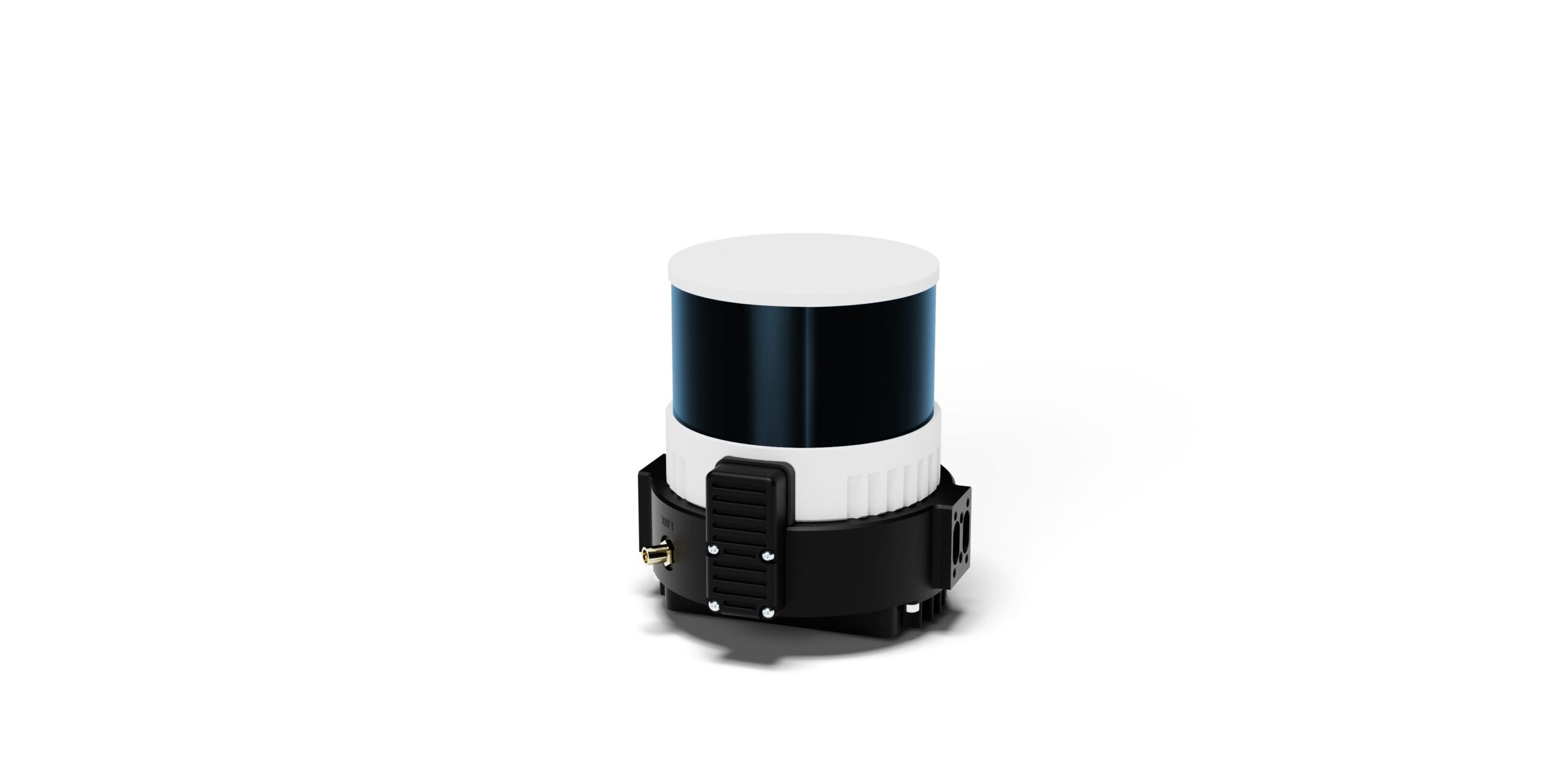
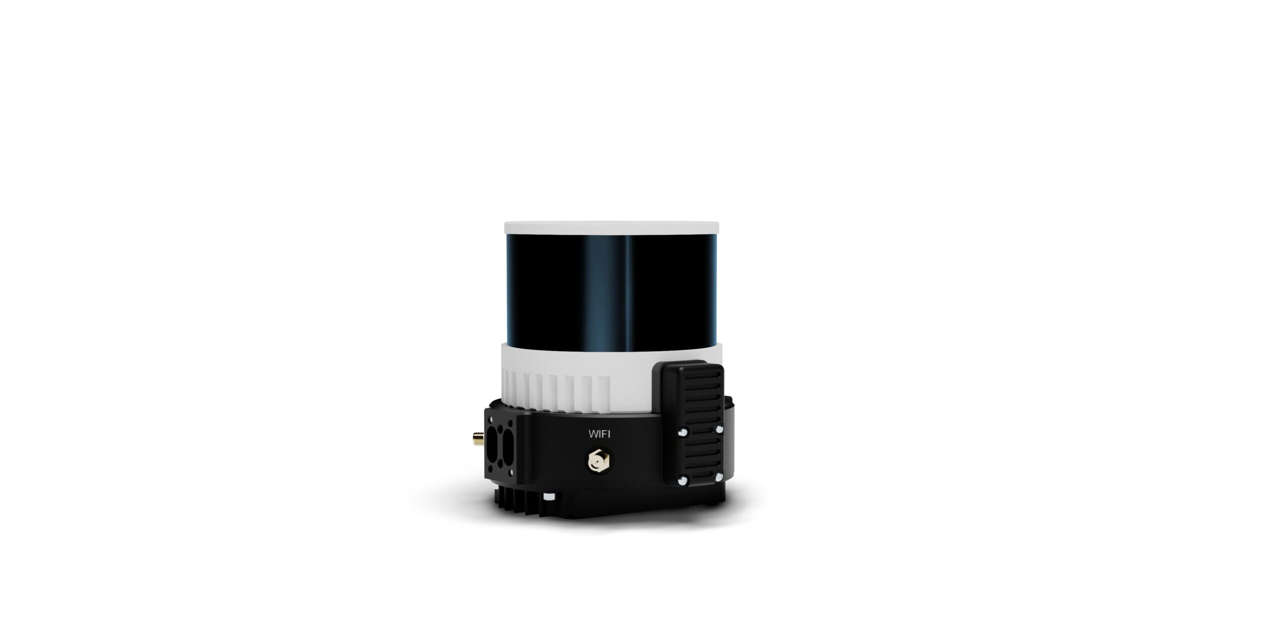
Wingtra Lidar
Wingtra LIDAR sets new standards in aerial mapping. Its high-performance LiDAR sensor seamlessly into Wingtra's already acclaimed WingtraOne drone. This powerful combination boasts: Exceptional accuracy: Capture data with 3 cm (1.2 in) vertical accuracy verified by lead customers, making it top-of-the-range. Effortless operation: The fully integrated system simplifies LiDAR data collection, making it accessible to professionals of all levels. Unmatched efficiency: Cover vast areas with longer flight times and wider swaths, reducing overall project time and cost. Rugged and reliable: The proven WingtraOne platform ensures reliable operation even in challenging conditions.
(Price on request)

-
-
Sale!

 Vista Rápida
 -
-
-
-
Sale!
 Vista Rápida
 -
Sale!
 Vista Rápida
 -
Sale!

 Vista Rápida

-
 Vista Rápida
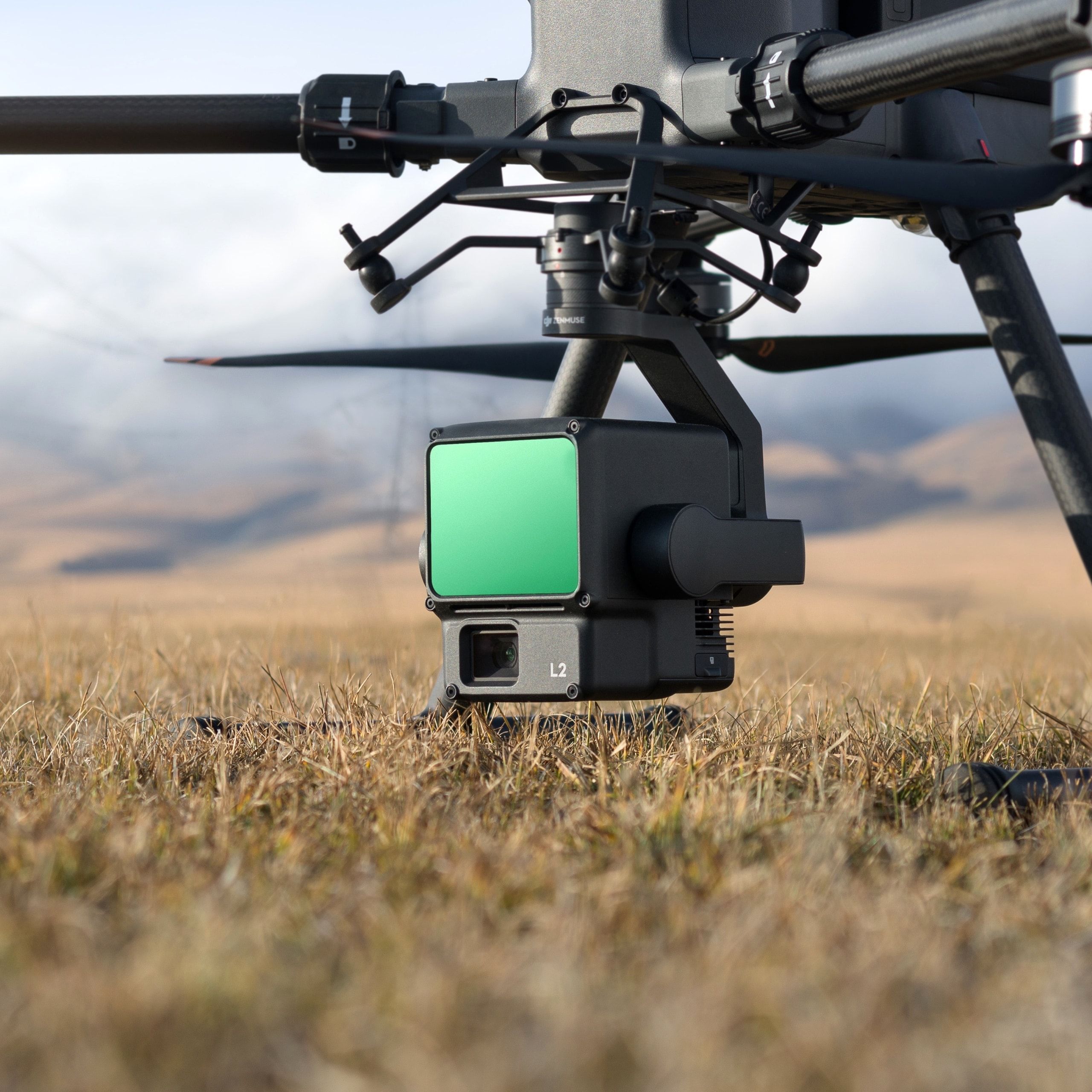
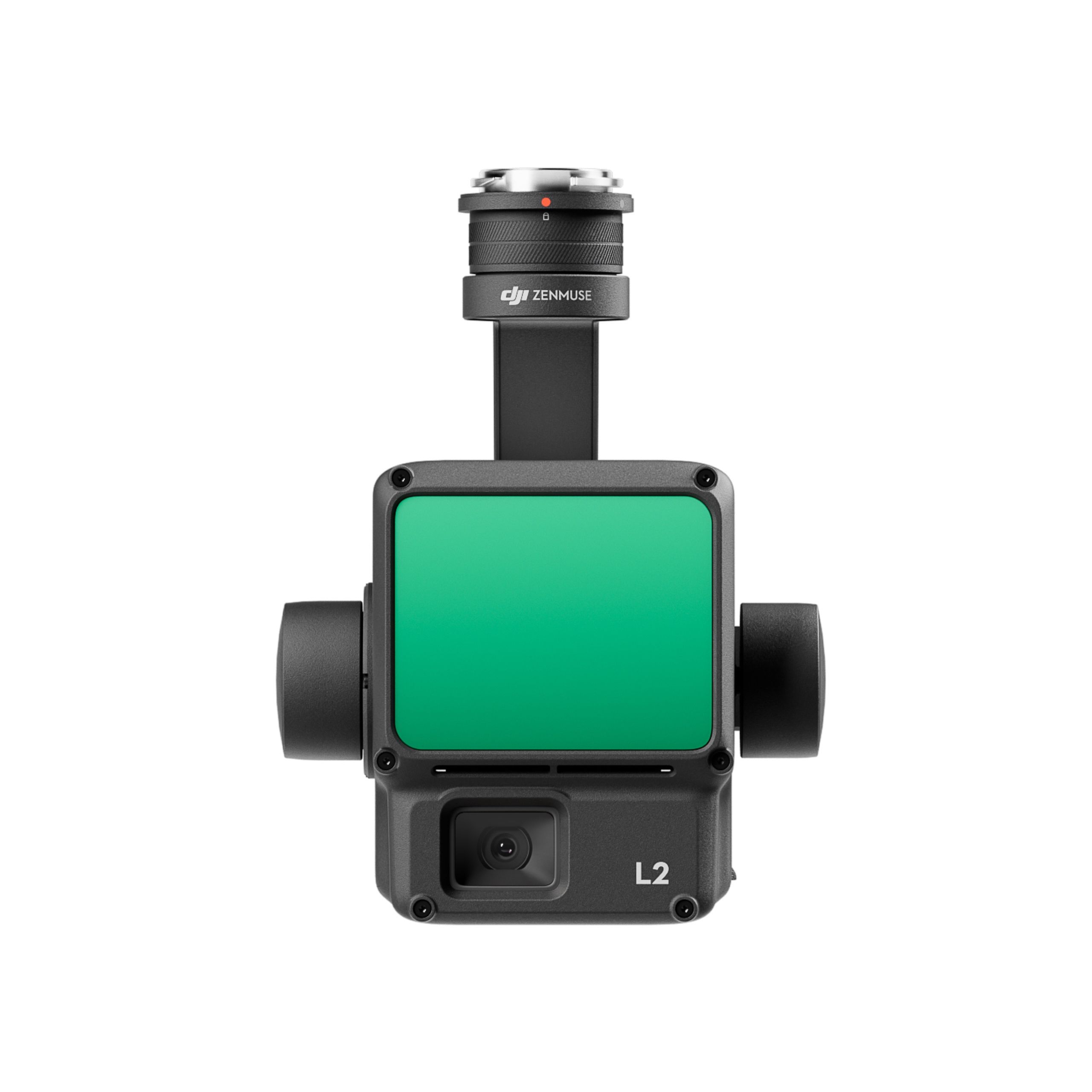
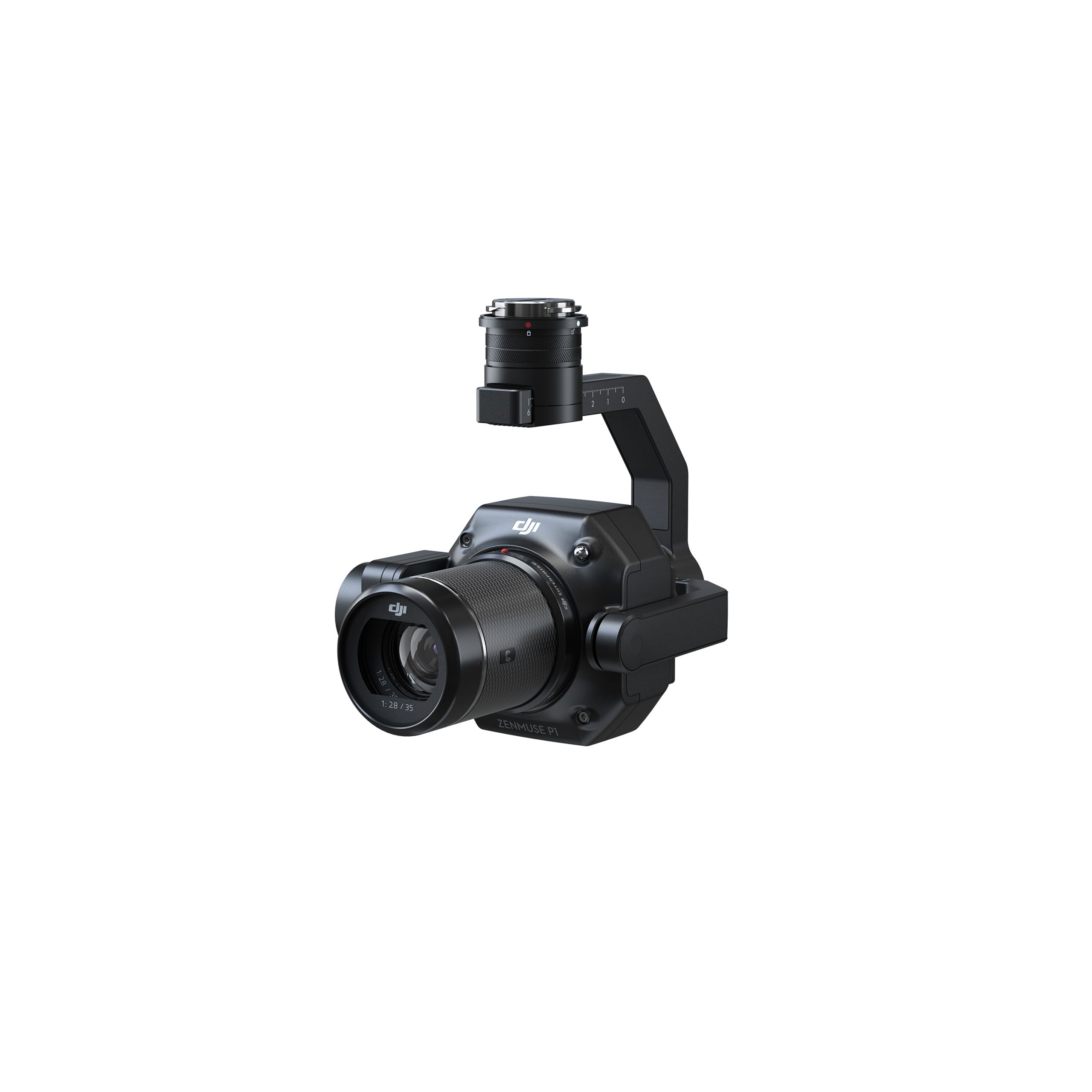
DJI Zenmuse L2 Worry-Free Basic Combo
Accessories DJI Matrice 350 RTK 10.813,01 € Exc.VAT (10.813,01 € Inc. 23% VAT) -
 Vista Rápida
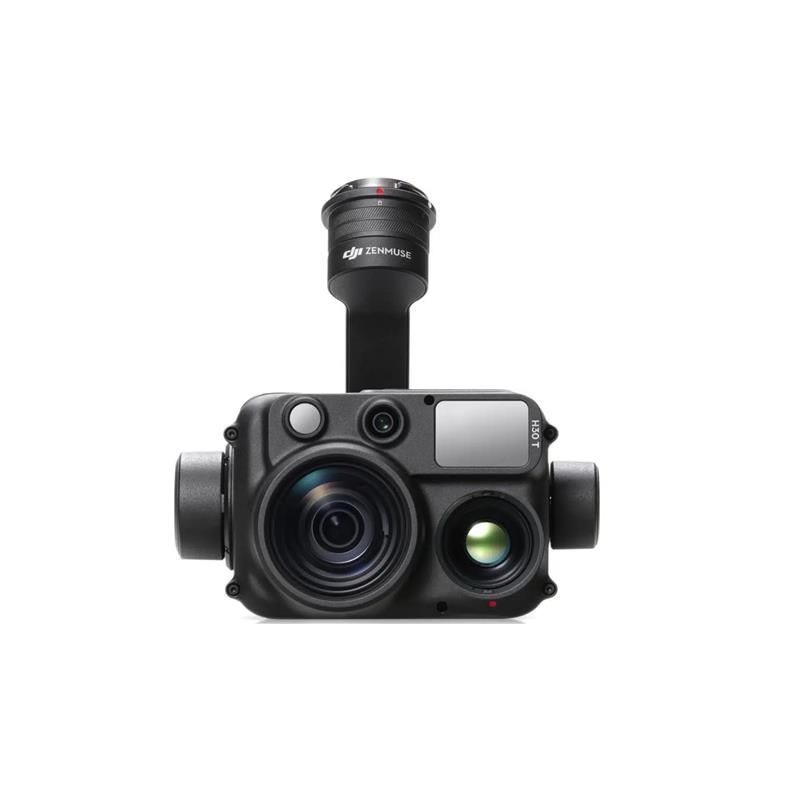
DJI Zenmuse H30T Worry-Free Basic Combo
Accessories DJI Matrice 300 RTK 10.608,94 € Exc.VAT (10.608,94 € Inc. 23% VAT) -
 Vista Rápida
 -
 Vista Rápida
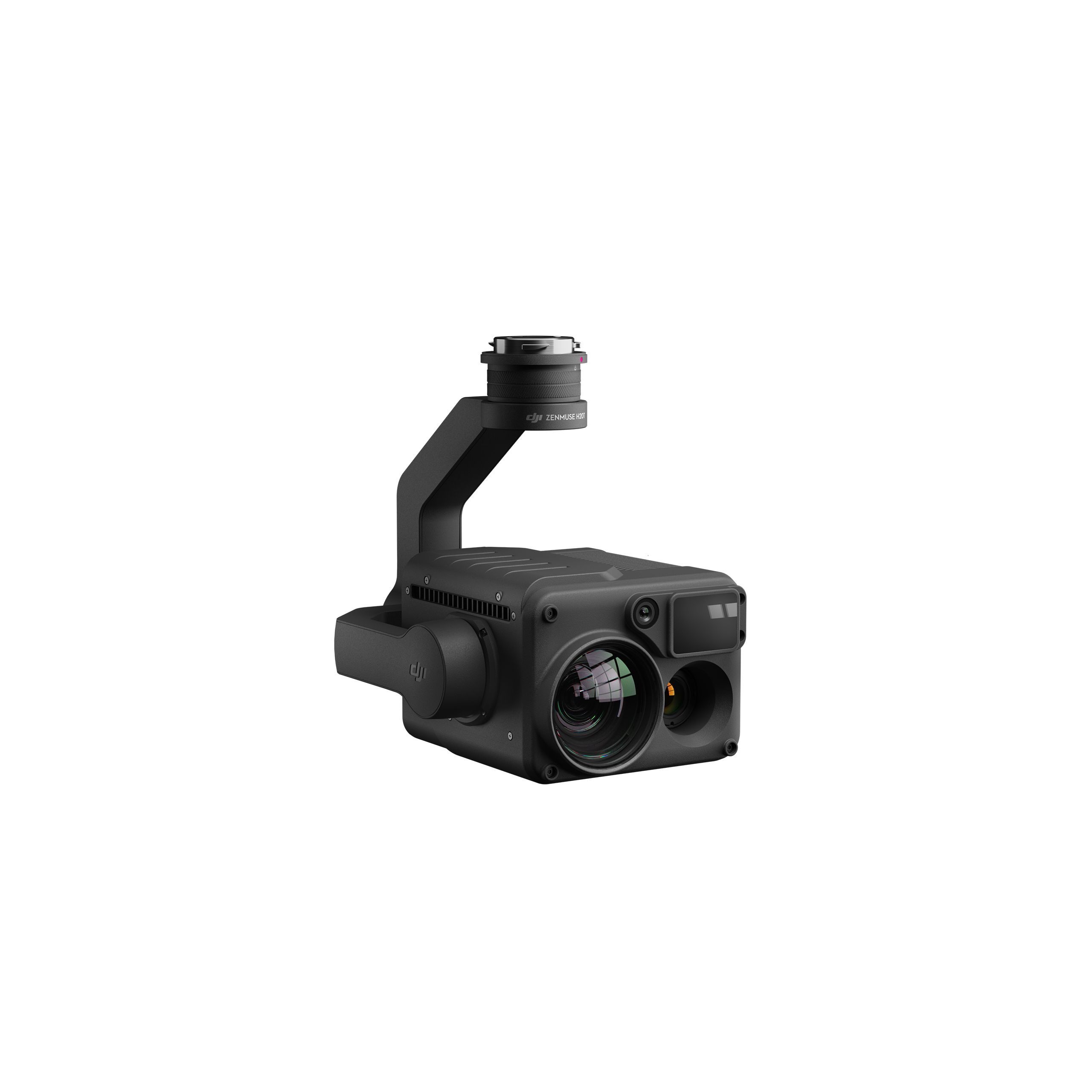
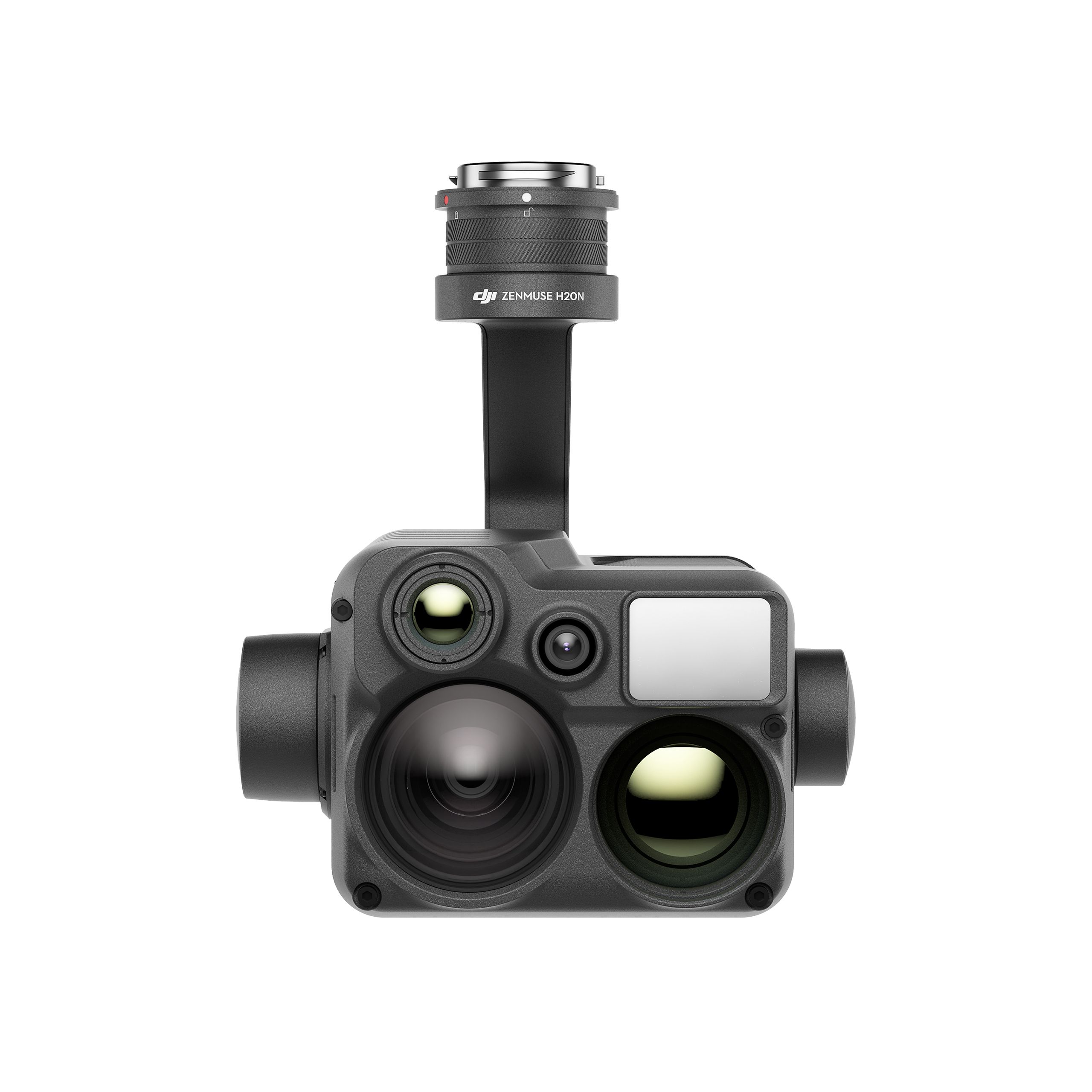
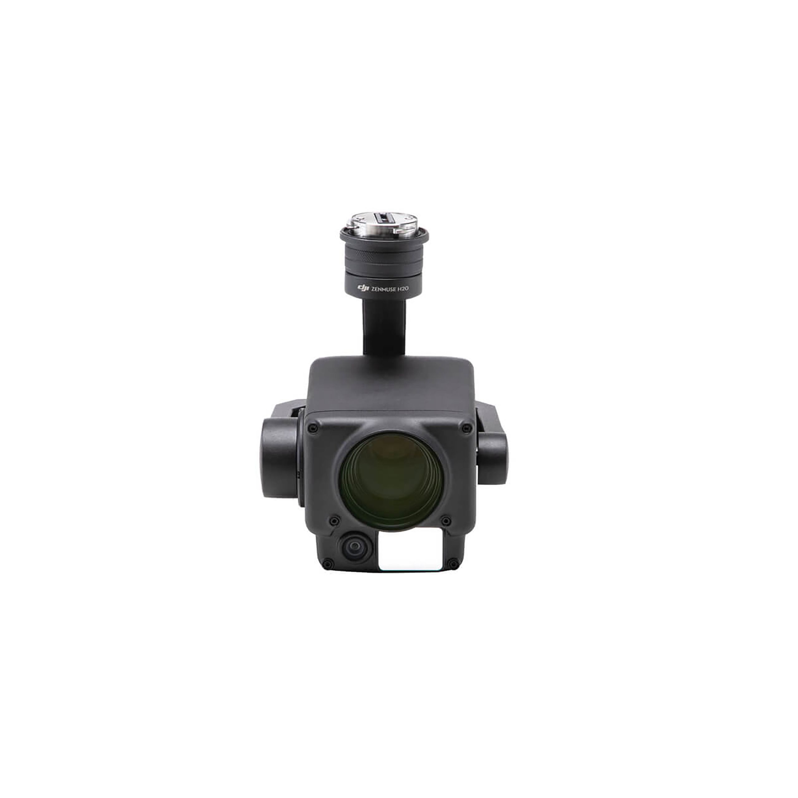
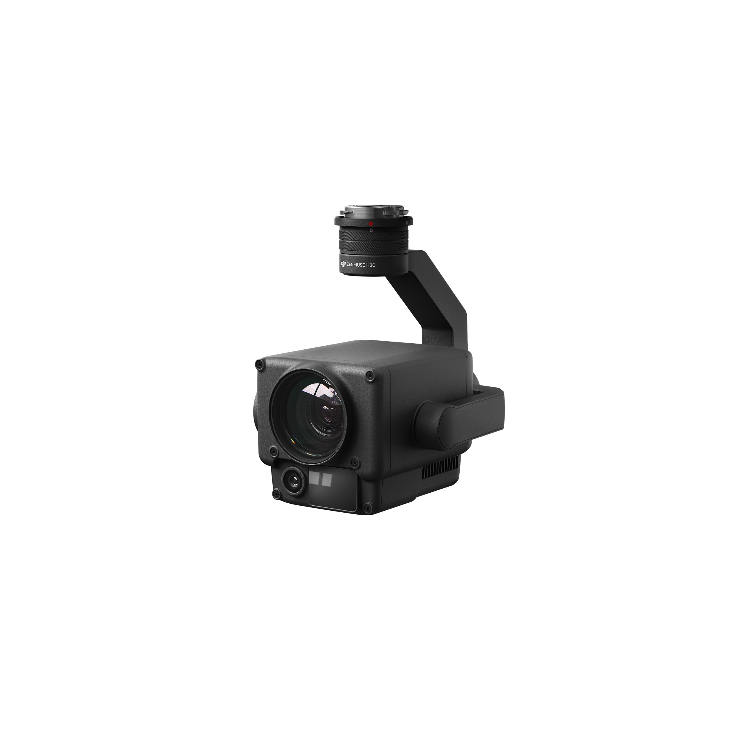
DJI Zenmuse H20N Worry-Free Basic Combo
Accessories DJI Matrice 350 RTK 9.987,80 € Exc.VAT (9.987,80 € Inc. 23% VAT) -
 Vista Rápida
 -
 Vista Rápida
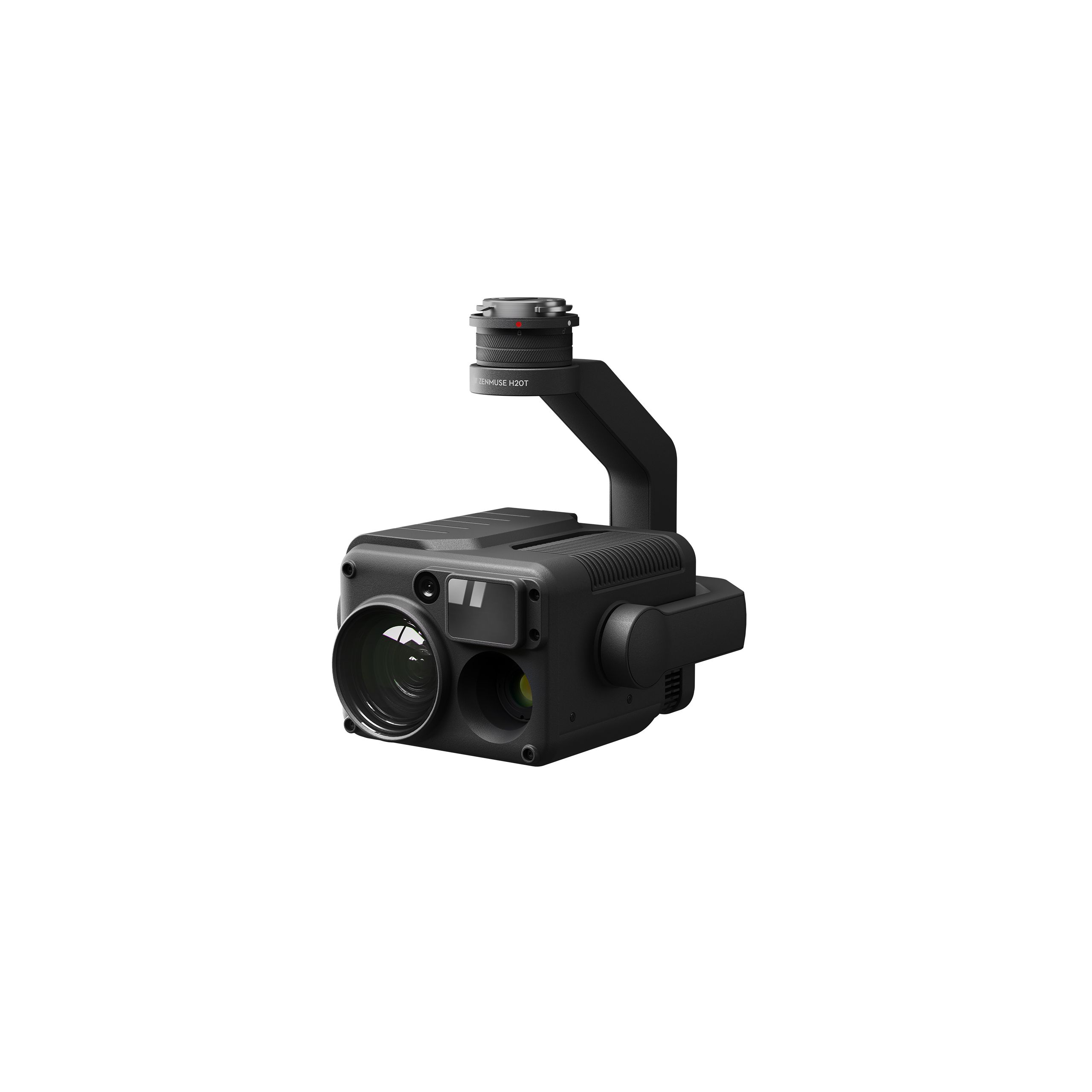
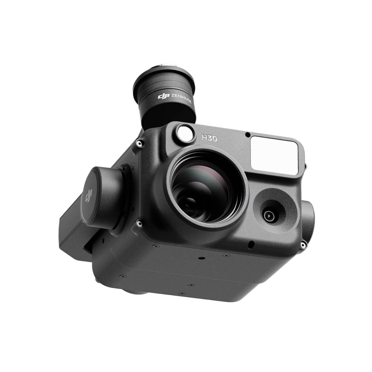
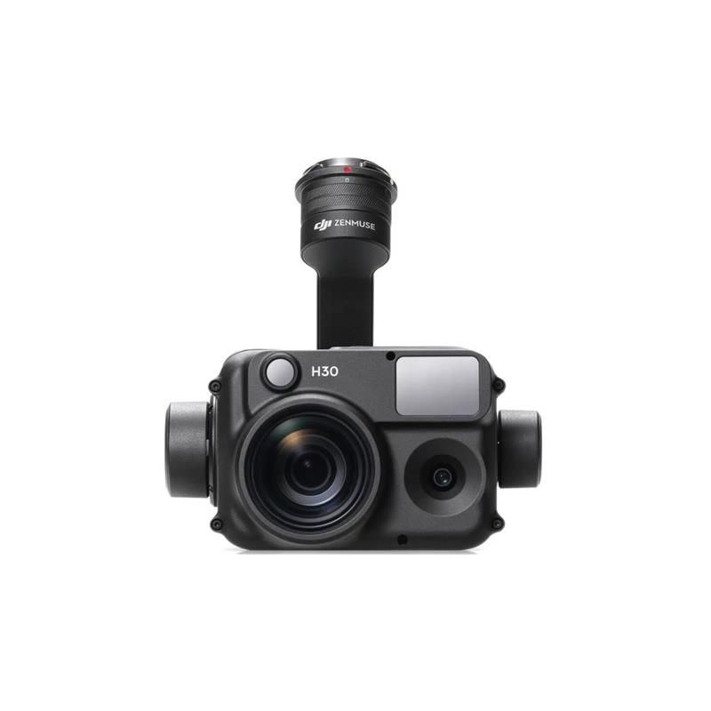
DJI Zenmuse H30 Worry-Free Plus Combo
Accessories DJI Matrice 350 RTK 4.382,11 € Exc.VAT (4.382,11 € Inc. 23% VAT) -
Vista Rápida
DJI Zenmuse H30 Worry-Free Basic Combo
Accessories DJI Matrice 350 RTK 4.045,53 € Exc.VAT (4.045,53 € Inc. 23% VAT) -
 Vista Rápida
-
Vista Rápida
DJI Matrice 350 RTK-Worry-Free Basic Combo
DJI Matrice 350 RTK 10.161,79 € Exc.VAT (10.161,79 € Inc. 23% VAT) -
-
-
-
-
Sale!
 Vista Rápida
 -
 Vista Rápida
DJI Mavic 3M (Multispectral) – Free Basic Combo – 1 Year
DJI 3.727,64 € Exc.VAT (3.727,64 € Inc. 23% VAT) -
Vista Rápida
-
Sale!
 Vista Rápida
 -
Sale!Vista Rápida
-
Vista Rápida
-
Vista Rápida
-
Vista Rápida
Global Mapper Pro Single User – Floating License
Blue Marble 2.172,50 € Exc.VAT (2.172,50 € Inc. 23% VAT) -
Vista Rápida
Global Mapper Pro Single User – Node Locked
Blue Marble 1.599,00 € Exc.VAT (1.599,00 € Inc. 23% VAT) -
Vista Rápida
-
 Vista Rápida
Agisoft Metashape Standard, Node-Locked Educational license, Single
Agisoft 54,00 € Exc.VAT (54,00 € Inc. 23% VAT)
