


EMLID PHOTO CONTEST

Geosun Lidars
Geosun LiDARs are a high-quality products that offers a combination of accuracy, speed, and efficiency.


New Wingtra LIDAR
Perfectly integrated with the WingtraOne GEN II drone to ensure a streamlined workflow.

New Emlid Reach RS3
Multi-band base and rover
IMU tilt compensation
LTE modem
Dual-band radio
IMU tilt compensation
LTE modem
Dual-band radio

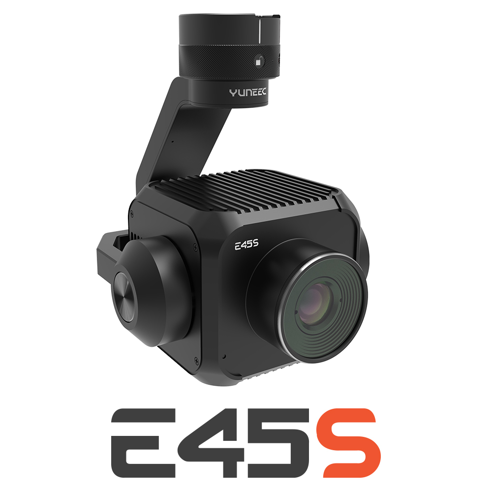
New Yuneec E45S for H510E and H850
Yuneec launched E45S 45MP full frame camera, ideal for professionals in survey and inspection industry!
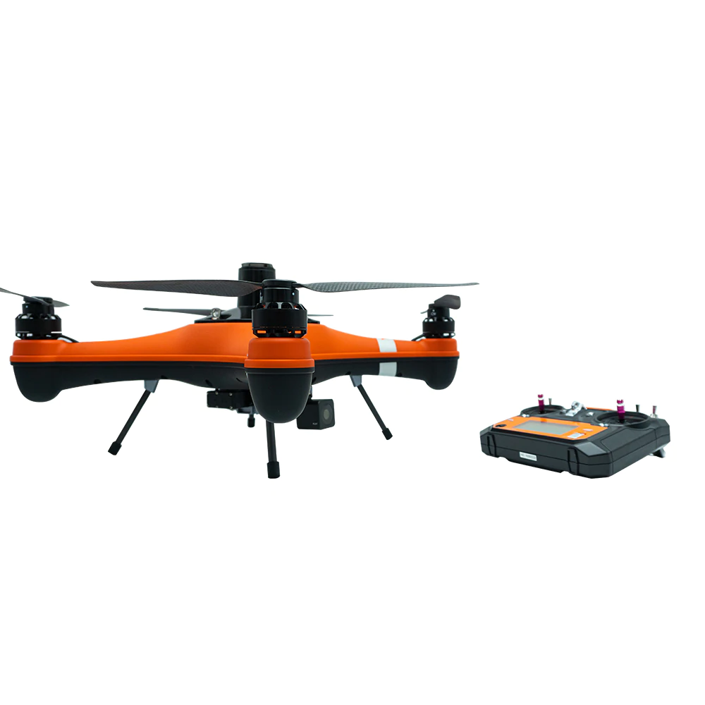
New Swellpro Fisherman MAX
Launch of Fisherman Max is now available for pre-order and shipping starts on August 1st.


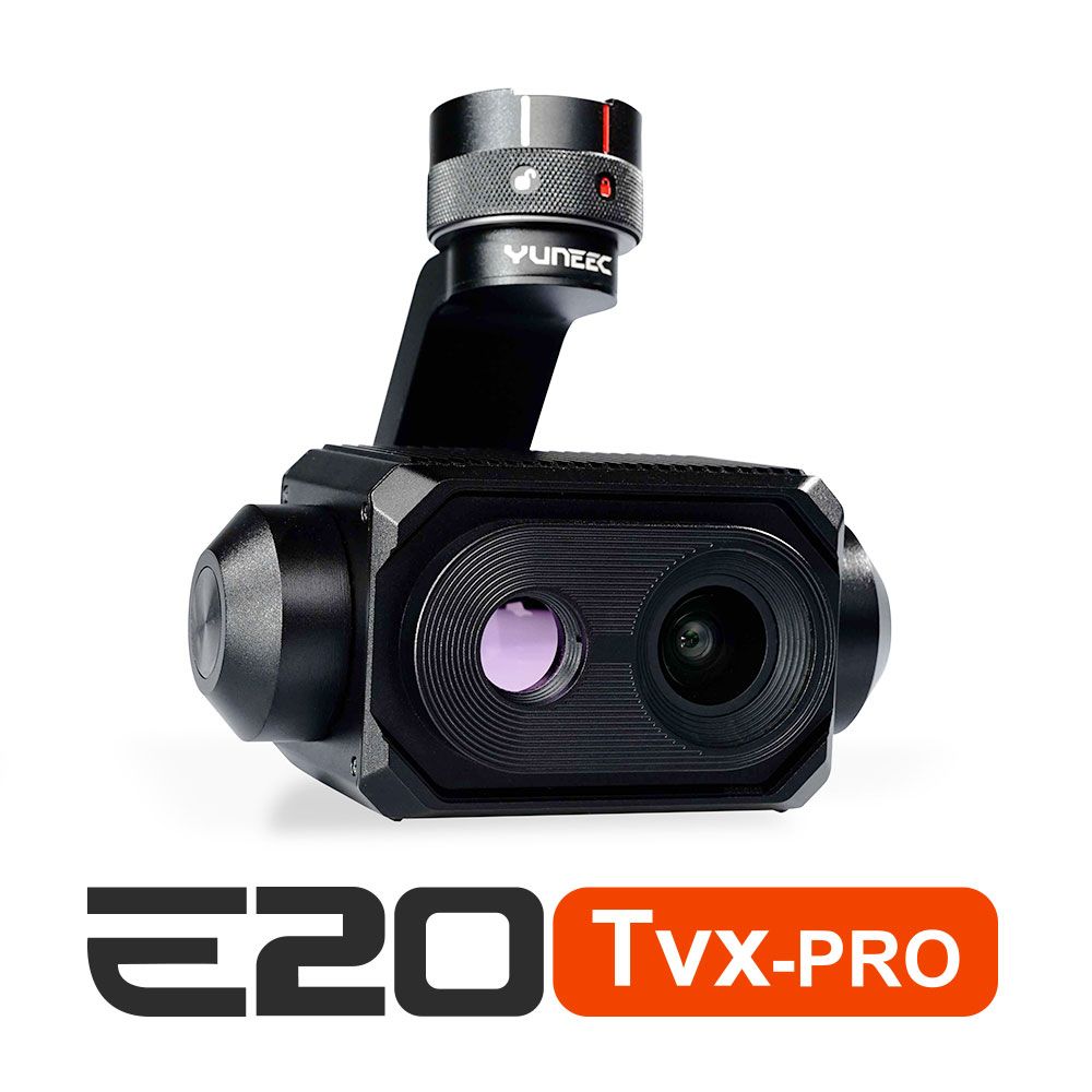
New E20TVX-PRO Thermal camera
Recommended camera for tasks related to Inspection (buildings, solar panels and powerlines), Search and Rescue, Firefighting and Law enforcement

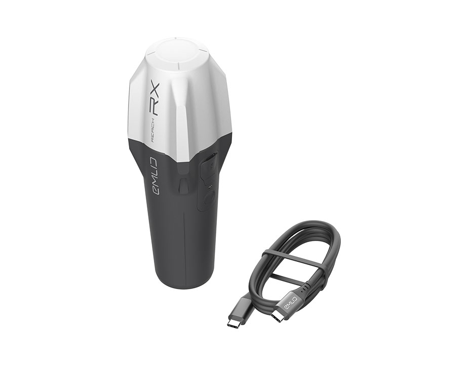
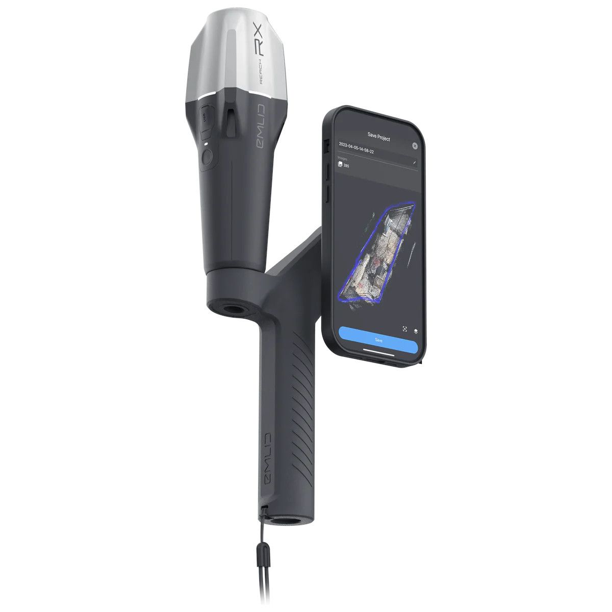
New Emlid Reach RX rover
Emlid Reach RX is a new pocket-sized, lightweight and easy-to-use receiver!

 Surveying & GIS
-
 Vista Rápida
 -
 Vista Rápida
 -
 Vista Rápida
 -
 Vista Rápida
 -
 Vista Rápida
 -
 Vista Rápida
 -
 Vista Rápida
 Mining & Quarries
-
Vista Rápida
-
Vista Rápida
-
Vista Rápida
-
Vista Rápida
-
Vista Rápida
-
Vista Rápida
-
Vista Rápida
 Construction
-
Vista Rápida
-
Vista Rápida
-
Vista Rápida
-
Vista Rápida
-
Vista Rápida
-
Vista Rápida
-
Vista Rápida
 Agriculture
-
Vista Rápida
-
Vista Rápida
-
 Vista Rápida
 -
Vista Rápida
-
Vista Rápida
-
Vista Rápida
-
Vista Rápida
 Environment monitoring
-
Vista Rápida
-
Vista Rápida
-
Vista Rápida
-
Vista Rápida
-
Vista Rápida
-
Vista Rápida
-
Vista Rápida
 Search & Rescue
-
Vista Rápida
-
Vista Rápida
-
Vista Rápida
-
Vista Rápida
-
Vista Rápida
-
Vista Rápida
 Other applications
-
Sale!
 Vista Rápida
 -
Sale!
 Vista Rápida
 -
 Vista Rápida
 -
Sale!
 Vista Rápida
 -
Sale!
 Vista Rápida
 -
 Vista Rápida


Showing 97–112 of 114 results
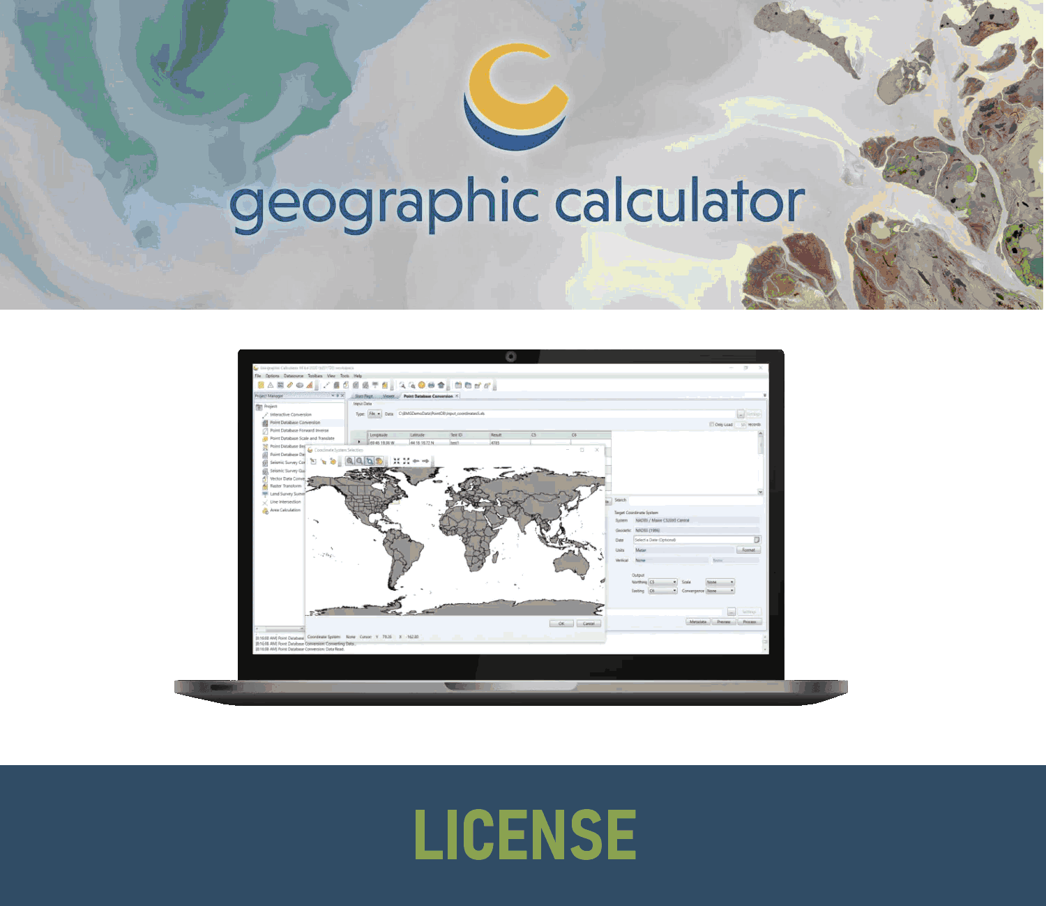
Geographic Calculator – USB Dongle License
Geographic Calculator is a powerful geodetic software for accurate coordinate conversion, datum transformation, and file translation. It is designed for GIS professionals, surveyors, engineers, and anyone who works with geospatial data. -->> This license can be moved between unlimited machines via a USB dongle. <<--
(Price on request)
Geographic Calculator – Network License
Geographic Calculator is a powerful geodetic software for accurate coordinate conversion, datum transformation, and file translation. It is designed for GIS professionals, surveyors, engineers, and anyone who works with geospatial data. -->> This license can be moved between unlimited machines via a USB dongle. <<--
(Price on request)

Global Mapper Standard SDK
The Global Mapper Standard Software Developer Toolkit (also known as an API) entitles one developer to work with the SDK to develop custom applications.
(Price on request)

Global Mapper Pro SDK
The Global Mapper Pro Software Developer Toolkit, which includes lidar functionality and other advanced tools, entitles one developer to work with the SDK to develop custom applications.
(Price on request)
GeoCalc SDK
The GeoCalc Software Developer Toolkit (also known as an API) entitles one developer to work with the SDK to develop custom applications.
(Price on request)
GeoCore SDK
The GeoCalc Software Developer Toolkit (also known as an API) entitles one developer to work with the SDK to develop custom applications.
(Price on request)

GM (Standard and Pro) – Maintenance & Support
Extension for Maintenance & Support of Global Mapper Standard and Pro versions for 12 months period.
(Price on request)
Sale!

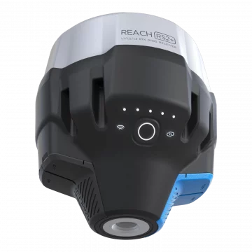
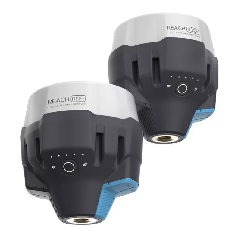
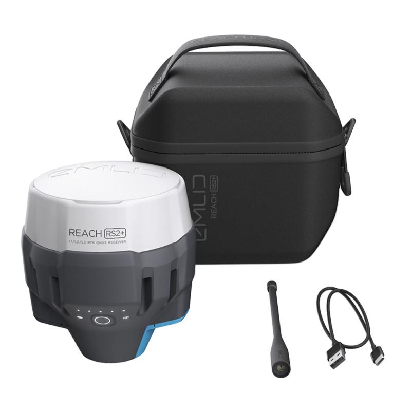
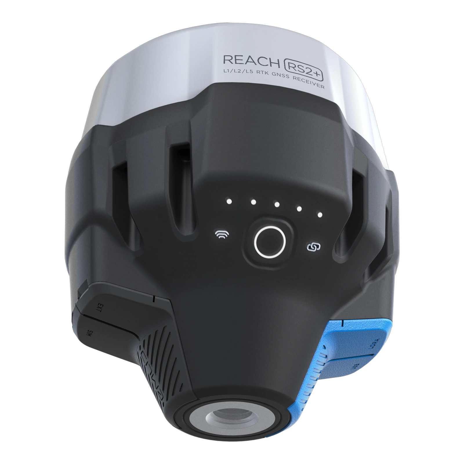
Emlid Reach RS2+ GNSS Receiver
Multi-band RTK GNSS receiver with centimeter precision For surveying, mapping and navigation. Comes with a mobile app, ReachView3. GNSS -GPS/QZSS, GLONASS L1, L2; BeiDou B1, B2; Galileo E1, E5 Long range radio - LoRa 868/915 MHz, range up to 8 km 16 hrs as LTE RTK rover - LiFePO4 battery, 6–40V input, USB Type-C charging Wi-Fi and Bluetooth - For connection with other devices
2.125,00 € Exc.VAT (2.613,75 € Inc. 23% VAT)
NewSale!
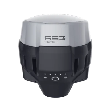
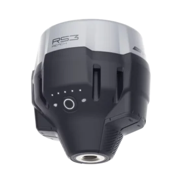
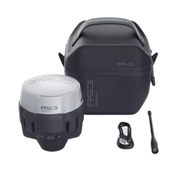
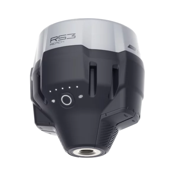
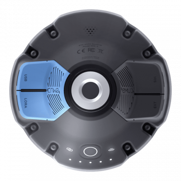
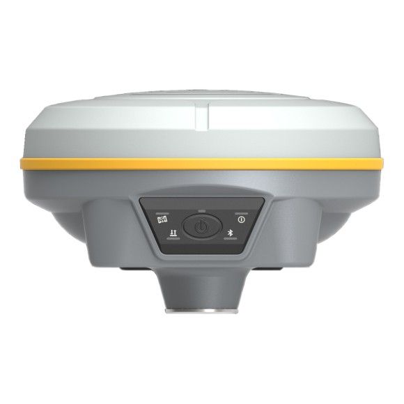
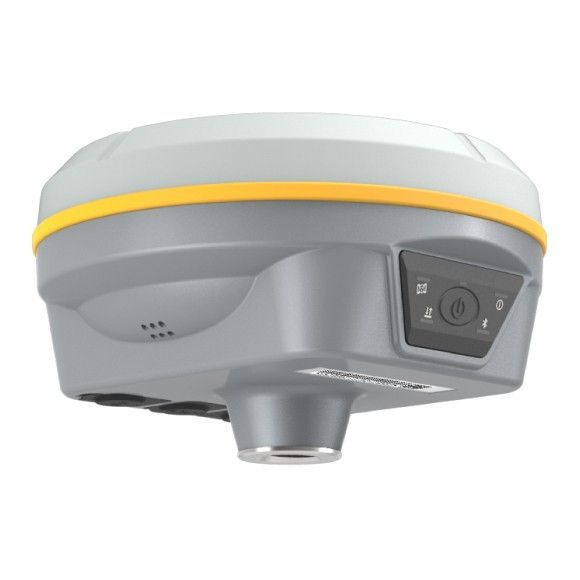
Emlid Reach RS3
Introducing the Emlid Reach RS3: Precision GNSS Receiver for Unparalleled Accuracy Unlock a new level of precision and reliability with the Emlid Reach RS3, the cutting-edge Global Navigation Satellite System (GNSS) receiver engineered to meet the demands of surveying, mapping, and geospatial professionals. Whether you're working in construction, agriculture, land surveying, or any field that relies on accurate positioning data, the Reach RS3 is your ultimate tool for achieving outstanding results. IMU 6DOF, RTK + 2 mm + 0.3 mm/° GNSS GPS/QZSS, GLONASS L1, L2; BeiDou B1, B2; Galileo E1, E5 Autonomy 18 hrs with tilt compensation Li-Ion battery, USB Type-C charging LTE and Wi-Fi To connect the device to the internet Dual-band radio 868/915 MHz LoRa to receive and transmit corrections 450 MHz UHF to receive corrections NTRIP and RTCM3 Supported protocols to send and receive corrections
2.299,00 € Exc.VAT (2.827,77 € Inc. 23% VAT)
Sale!
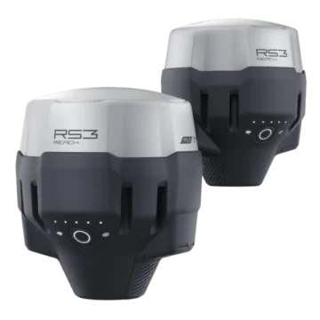
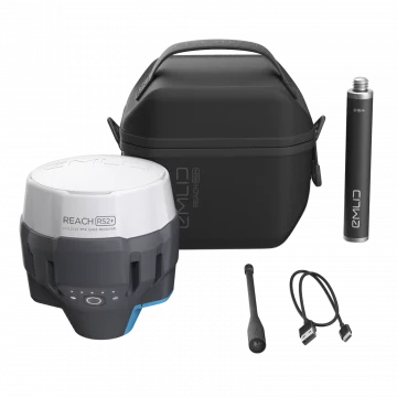
Emlid Reach RS3 Survey Kit
Two Reach RS3 receivers to use as base and rover Survey grade precision with tilt compensation. Comes with a mobile app. IMU 6DOF, RTK + 2 mm + 0.3 mm/° GNSS GPS/QZSS, GLONASS L1, L2; BeiDou B1, B2; Galileo E1, E5 Autonomy 18 hrs with tilt compensation Li-Ion battery, USB Type-C charging LTE and Wi-Fi To connect the device to the internet Dual-band radio 868/915 MHz LoRa to receive and transmit corrections 450 MHz UHF to receive corrections NTRIP and RTCM3 Supported protocols to send and receive corrections
4.500,00 € Exc.VAT (5.535,00 € Inc. 23% VAT)
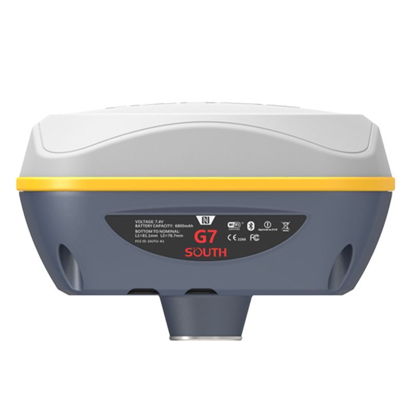
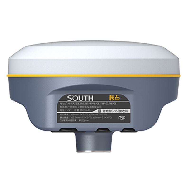
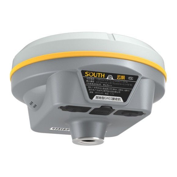
South Galaxy G7 (1598 channels, no modem)
The South Galaxy G7 is a versatile and rugged GNSS RTK receiver with a built-in IMU (Inertial Measurement Unit) that provides centimeter-level accuracy for surveying and mapping applications. It supports multiple GNSS constellations, including GPS, GLONASS, Galileo, BeiDou, QZSS, and SBAS, and can be used in various modes, including RTK, static, and fast RTK. Its compact size, durable design, and comprehensive features make it a valuable tool for professionals in the surveying and mapping industry. 1598 channels No Modem
(Price on request)
South Galaxy G7 (1598 channels, 4G modem)
The South Galaxy G7 is a versatile and rugged GNSS RTK receiver with a built-in IMU (Inertial Measurement Unit) that provides centimeter-level accuracy for surveying and mapping applications. It supports multiple GNSS constellations, including GPS, GLONASS, Galileo, BeiDou, QZSS, and SBAS, and can be used in various modes, including RTK, static, and fast RTK. Its compact size, durable design, and comprehensive features make it a valuable tool for professionals in the surveying and mapping industry. 1598 channels With internal 4G Modem
(Price on request)
South Galaxy G7 (1760 channels, no modem)
The South Galaxy G7 is a versatile and rugged GNSS RTK receiver with a built-in IMU (Inertial Measurement Unit) that provides centimeter-level accuracy for surveying and mapping applications. It supports multiple GNSS constellations, including GPS, GLONASS, Galileo, BeiDou, QZSS, and SBAS, and can be used in various modes, including RTK, static, and fast RTK. Its compact size, durable design, and comprehensive features make it a valuable tool for professionals in the surveying and mapping industry. 1760 channels No Modem
(Price on request)
South Galaxy G2 (965 channels)
The South Instruments Galaxy G2 is a high-precision GNSS receiver designed for professional surveying and mapping applications. It offers a combination of cutting-edge technology, user-friendly features, and advanced capabilities to deliver centimeter-level accuracy in real-time and sub-meter accuracy in static mode.
(Price on request)
South Galaxy G2 (1760 channels)
The South Instruments Galaxy G2 is a high-precision GNSS receiver designed for professional surveying and mapping applications. It offers a combination of cutting-edge technology, user-friendly features, and advanced capabilities to deliver centimeter-level accuracy in real-time and sub-meter accuracy in static mode. 1760 channels
(Price on request)
South Galaxy G3 (1598 channels)
The South Instruments Galaxy G3 is a high-performance GNSS receiver designed for professional surveying and mapping applications. It builds upon the success of its predecessor, the Galaxy G2, offering enhanced accuracy, versatility, and user-friendliness. 1598 channels
(Price on request)

-
-
-
-
-
-
-
Sale!
 Vista Rápida
 -
Sale!
 Vista Rápida
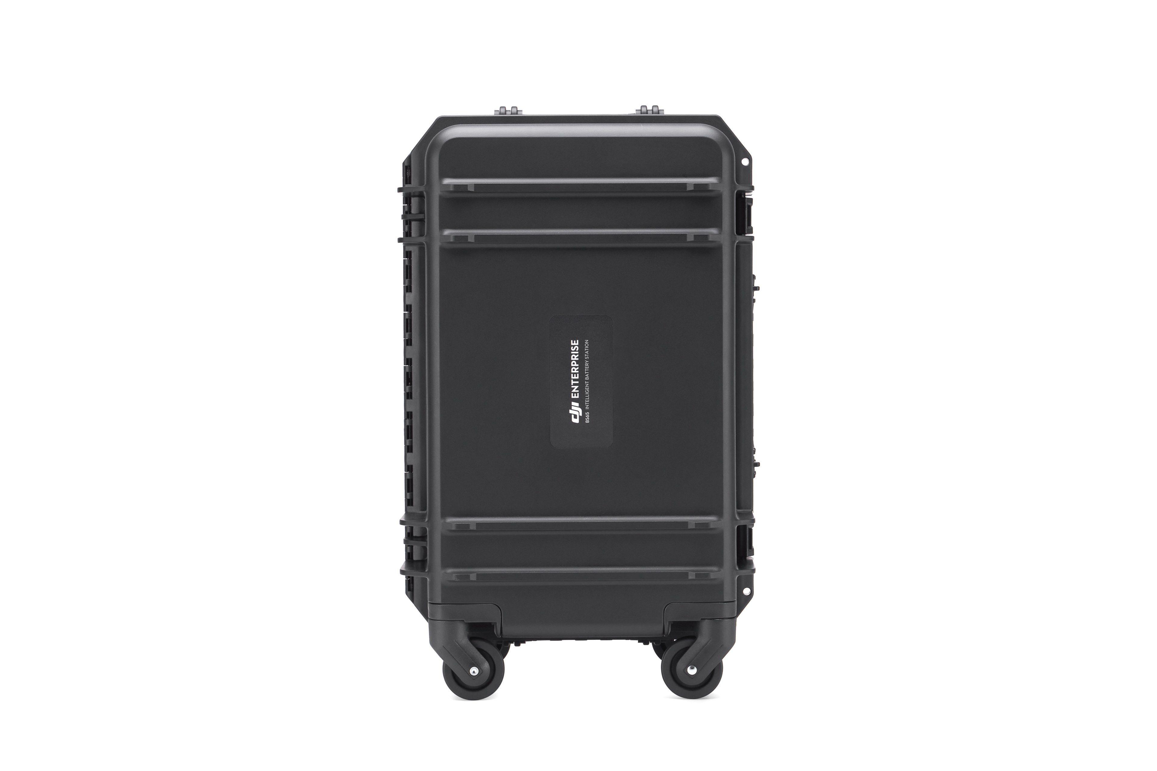
BS65 Intelligent Battery Station
Accessories DJI Matrice 350 RTK 999,00 € Exc.VAT (1.228,77 € Inc. 23% VAT)

-
 Vista Rápida
 -
Vista Rápida
-
 Vista Rápida
 -
-
-
-
-
-
Vista Rápida
DJI Matrice 350 RTK-Worry-Free Basic Combo
DJI Matrice 350 RTK 10.150,00 € Exc.VAT (12.484,50 € Inc. 23% VAT) -
-
-
-
-
 Vista Rápida
DJI Mavic 3M (Multispectral) – Free Basic Combo – 1 Year
DJI 3.889,00 € Exc.VAT (4.783,47 € Inc. 23% VAT) -
 Vista Rápida
DJI Mavic 3E (Enterprise) Worry-Free Basic Combo – 1 Year
DJI 2.899,00 € Exc.VAT (3.565,77 € Inc. 23% VAT) -
-
Vista Rápida
-
Vista Rápida
-
 Vista Rápida
Agisoft Metashape Standard, Node-Locked Educational license, Single
Agisoft 54,00 € Exc.VAT (66,42 € Inc. 23% VAT) -
-
-
-
-
