


EMLID PHOTO CONTEST

Geosun Lidars
Geosun LiDARs are a high-quality products that offers a combination of accuracy, speed, and efficiency.


New Wingtra LIDAR
Perfectly integrated with the WingtraOne GEN II drone to ensure a streamlined workflow.

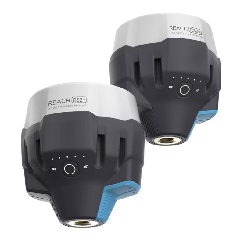
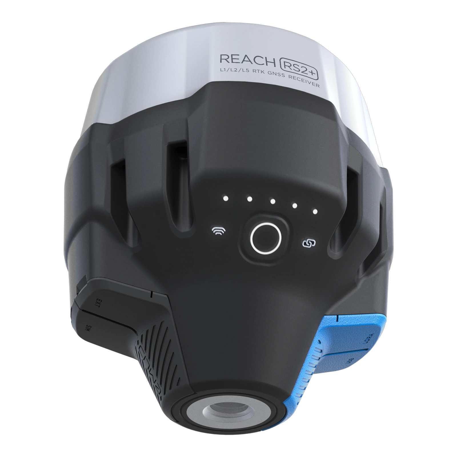
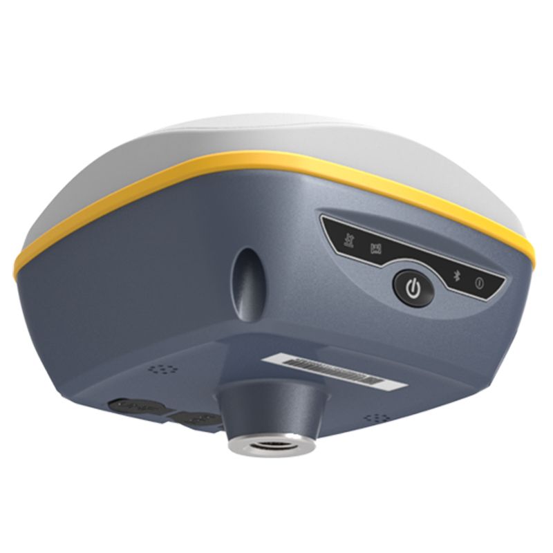
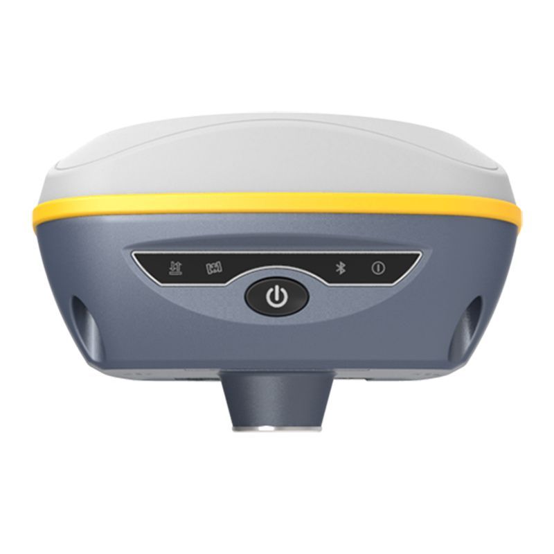
New Emlid Reach RS3
Multi-band base and rover
IMU tilt compensation
LTE modem
Dual-band radio
IMU tilt compensation
LTE modem
Dual-band radio

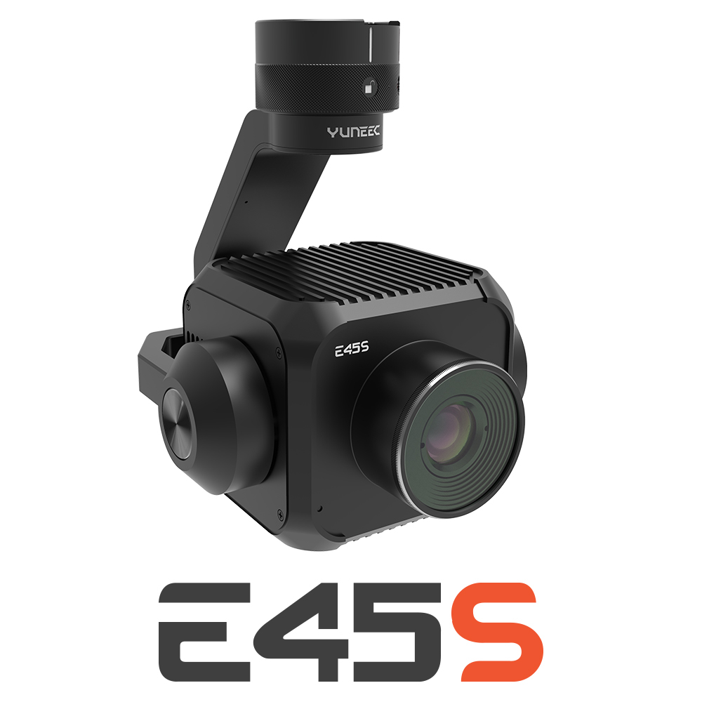
New Yuneec E45S for H510E and H850
Yuneec launched E45S 45MP full frame camera, ideal for professionals in survey and inspection industry!
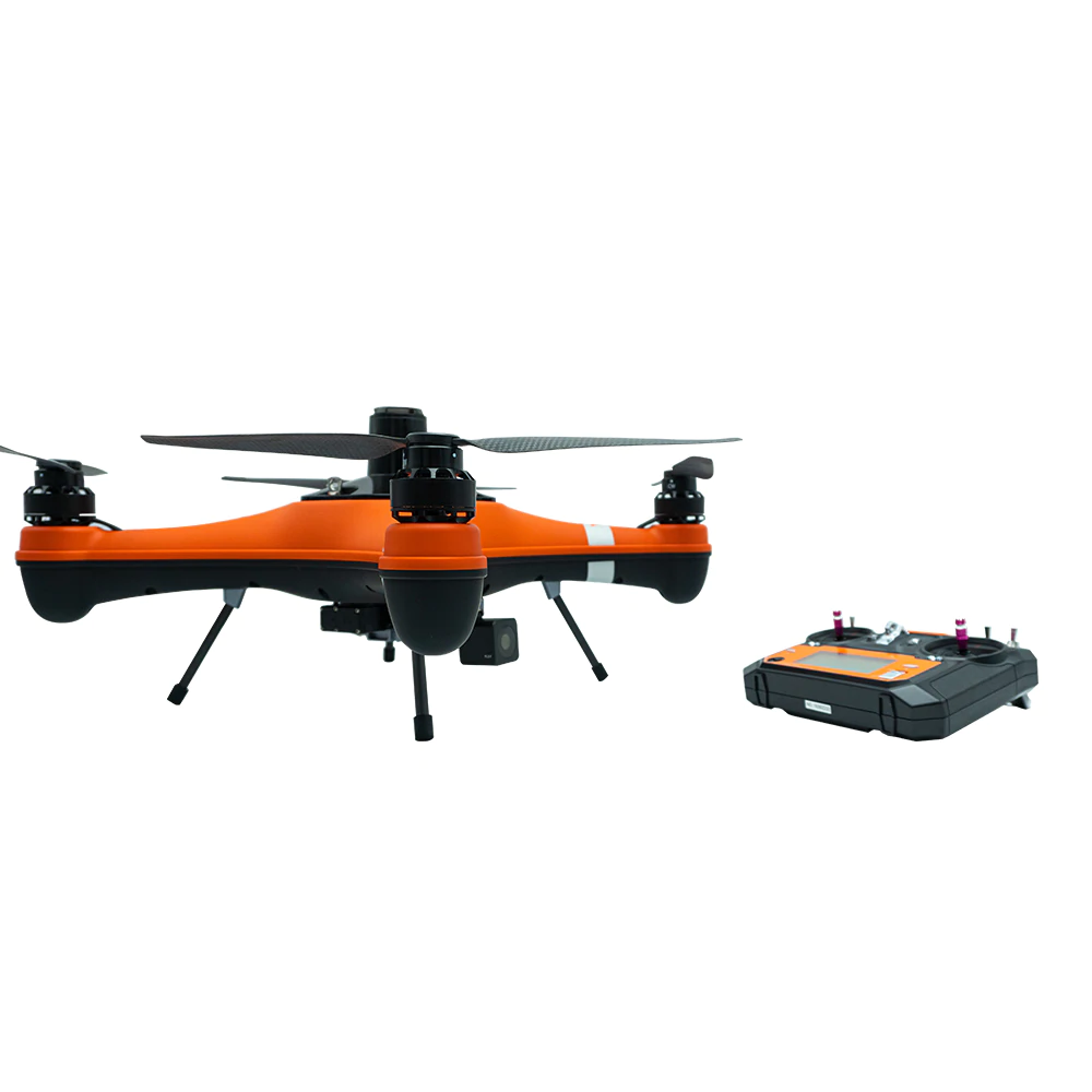
New Swellpro Fisherman MAX
Launch of Fisherman Max is now available for pre-order and shipping starts on August 1st.


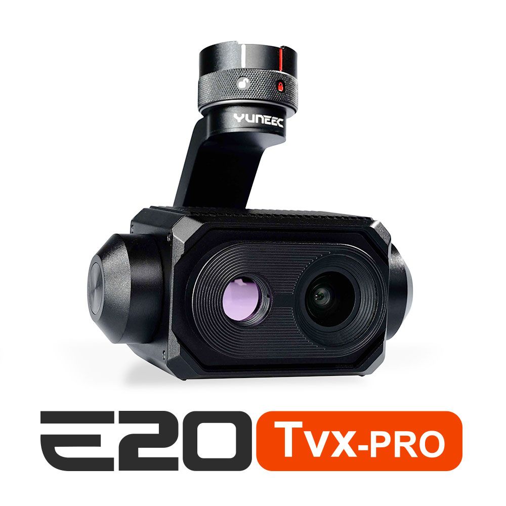
New E20TVX-PRO Thermal camera
Recommended camera for tasks related to Inspection (buildings, solar panels and powerlines), Search and Rescue, Firefighting and Law enforcement

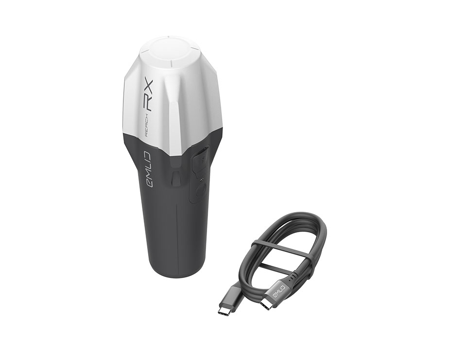
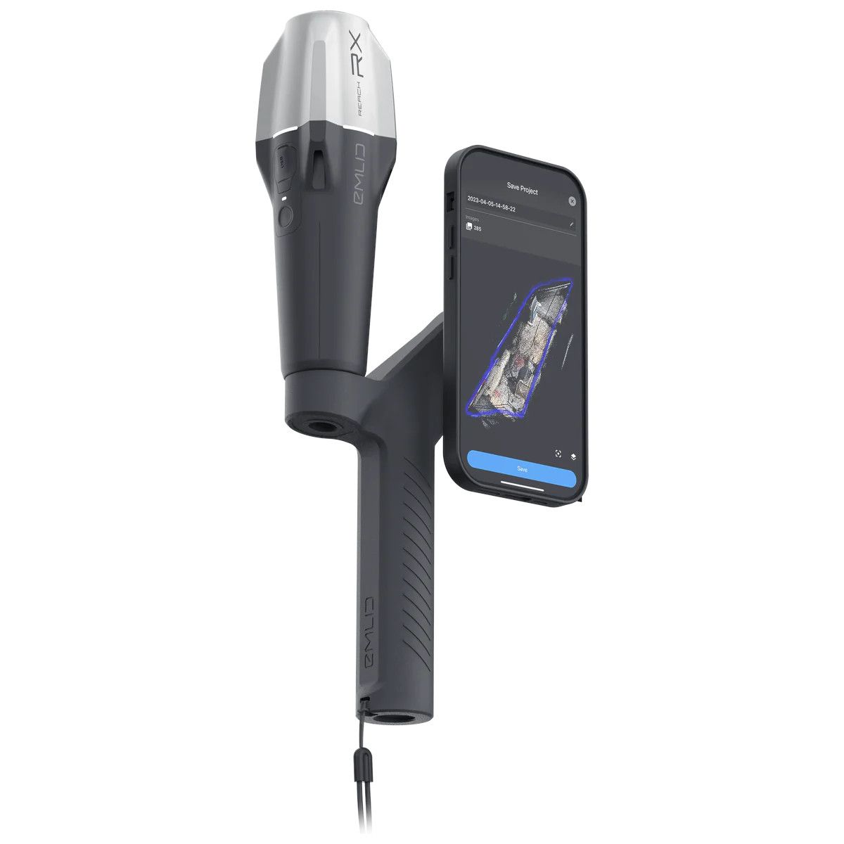
New Emlid Reach RX rover
Emlid Reach RX is a new pocket-sized, lightweight and easy-to-use receiver!

 Surveying & GIS
-
 Vista Rápida
 -
 Vista Rápida
 -
 Vista Rápida
 -
 Vista Rápida
 -
 Vista Rápida
 -
 Vista Rápida
 -
 Vista Rápida
 Mining & Quarries
-
Vista Rápida
-
Vista Rápida
-
Vista Rápida
-
Vista Rápida
-
Vista Rápida
-
Vista Rápida
-
Vista Rápida
 Construction
-
Vista Rápida
-
Vista Rápida
-
Vista Rápida
-
Vista Rápida
-
Vista Rápida
-
Vista Rápida
-
Vista Rápida
 Agriculture
-
Vista Rápida
-
Vista Rápida
-
Vista Rápida
-
 Vista Rápida
 -
Vista Rápida
-
Vista Rápida
-
Vista Rápida
 Environment monitoring
-
Vista Rápida
-
Vista Rápida
-
Vista Rápida
-
Vista Rápida
-
Vista Rápida
-
Vista Rápida
 Search & Rescue
-
Vista Rápida
-
Vista Rápida
-
Vista Rápida
-
Vista Rápida
-
Vista Rápida
-
Vista Rápida
 Other applications
-
Sale!
 Vista Rápida
 -
 Vista Rápida
 -
Sale!
 Vista Rápida
 -
Sale!
 Vista Rápida
 -
 Vista Rápida
 -
Sale!
 Vista Rápida


Showing 17–32 of 74 results
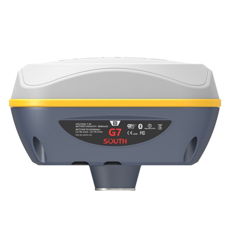

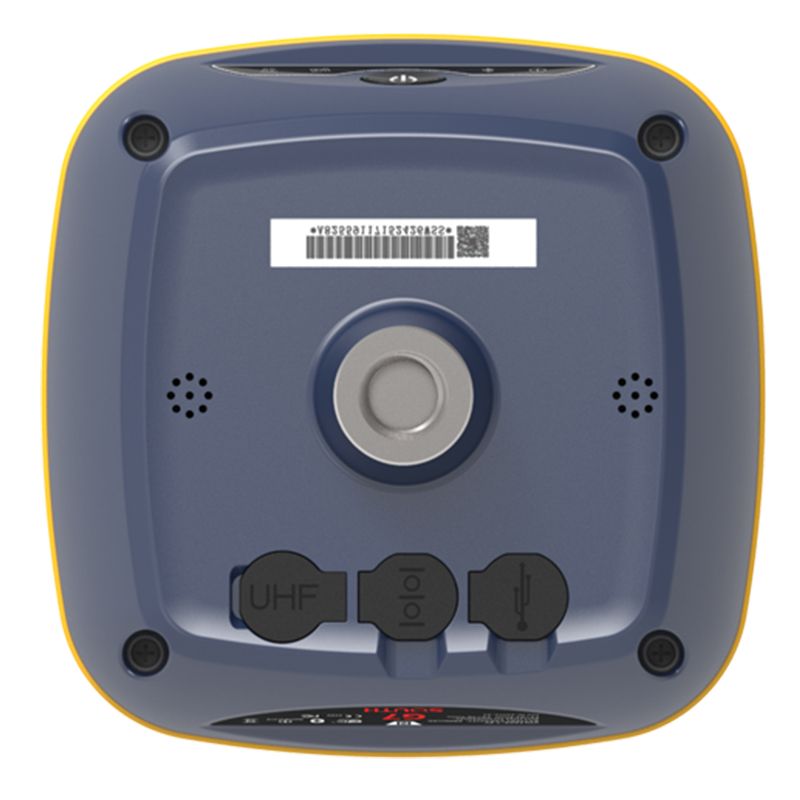
South Galaxy G7 (1760 channels, no modem)
The South Galaxy G7 is a versatile and rugged GNSS RTK receiver with a built-in IMU (Inertial Measurement Unit) that provides centimeter-level accuracy for surveying and mapping applications. It supports multiple GNSS constellations, including GPS, GLONASS, Galileo, BeiDou, QZSS, and SBAS, and can be used in various modes, including RTK, static, and fast RTK. Its compact size, durable design, and comprehensive features make it a valuable tool for professionals in the surveying and mapping industry. 1760 channels No Modem
(Price on request)
South Galaxy G7 (1598 channels, 4G modem)
The South Galaxy G7 is a versatile and rugged GNSS RTK receiver with a built-in IMU (Inertial Measurement Unit) that provides centimeter-level accuracy for surveying and mapping applications. It supports multiple GNSS constellations, including GPS, GLONASS, Galileo, BeiDou, QZSS, and SBAS, and can be used in various modes, including RTK, static, and fast RTK. Its compact size, durable design, and comprehensive features make it a valuable tool for professionals in the surveying and mapping industry. 1598 channels With internal 4G Modem
(Price on request)
South Galaxy G7 (1598 channels, no modem)
The South Galaxy G7 is a versatile and rugged GNSS RTK receiver with a built-in IMU (Inertial Measurement Unit) that provides centimeter-level accuracy for surveying and mapping applications. It supports multiple GNSS constellations, including GPS, GLONASS, Galileo, BeiDou, QZSS, and SBAS, and can be used in various modes, including RTK, static, and fast RTK. Its compact size, durable design, and comprehensive features make it a valuable tool for professionals in the surveying and mapping industry. 1598 channels No Modem
(Price on request)
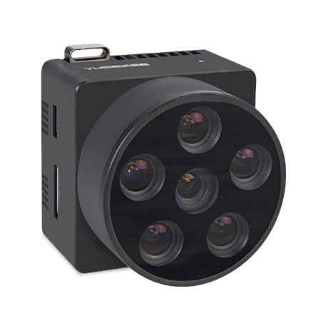
AQ600 (5-bands) Multispectral Camera
The Yusense AQ600 is a professional multispectral camera designed for unmanned aerial vehicles (UAVs). It captures data in five distinct spectral bands beyond the standard RGB spectrum, providing valuable insights for various applications.
11.900,00 € Exc.VAT (14.637,00 € Inc. 23% VAT)
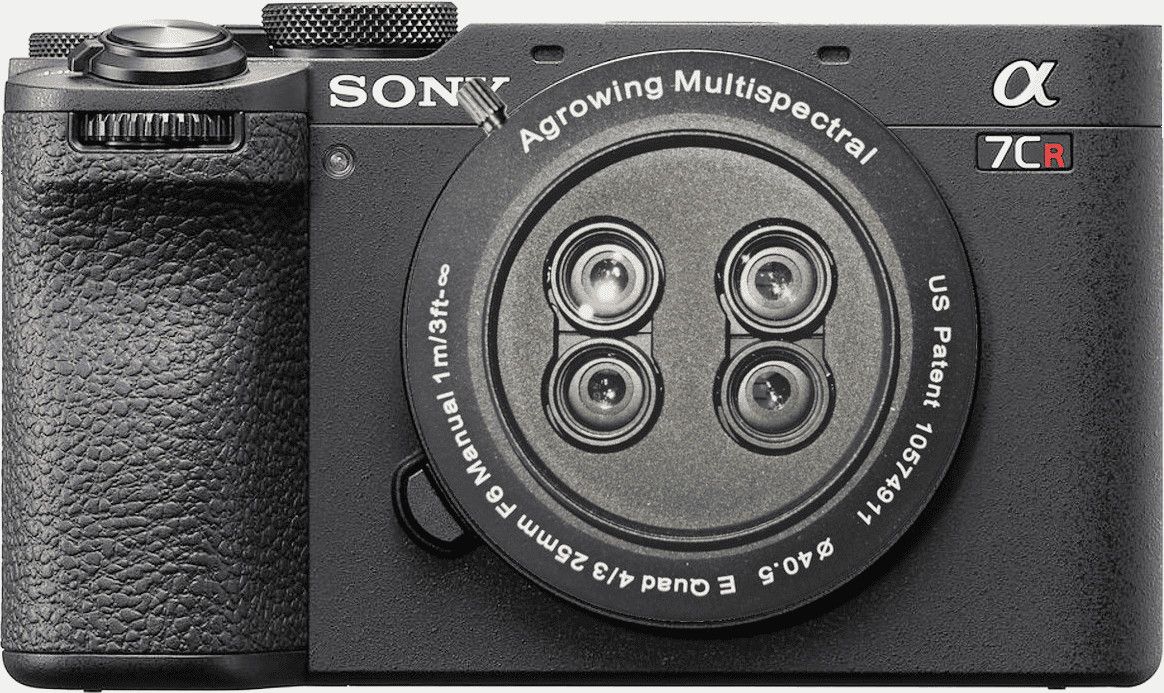
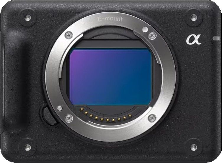
Agrowing 24MP ZV-E10 Quad
The Agrowing 24MP ZV-E10 Quad camera is a cutting-edge imaging solution designed for professional and enthusiast photographers alike. With its quad-camera setup, it offers unparalleled versatility and performance in various shooting scenarios. Technical Specifications 10 Megapixel per Channel NDVI/Red-Edge e 4/5 Narrow Bands 24 Megapixel RGB for APS-C E-Mount Based on modified Sony ZV-E10/Alpha 6xxx
(Price on request)
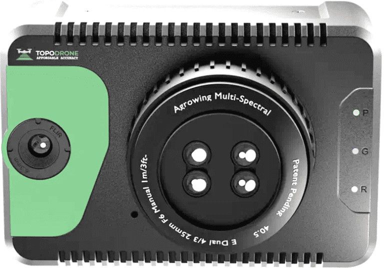
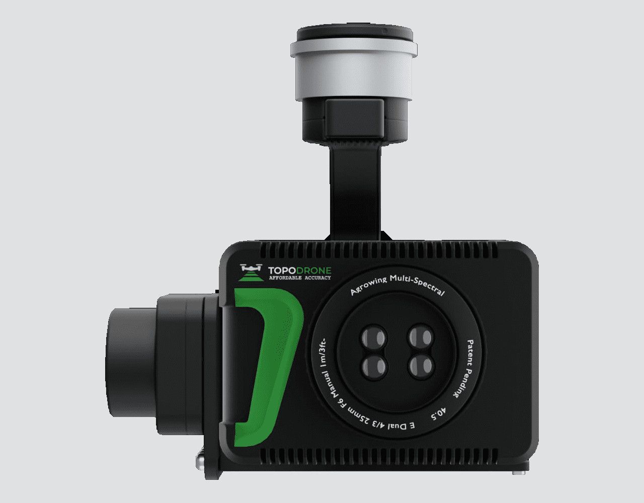
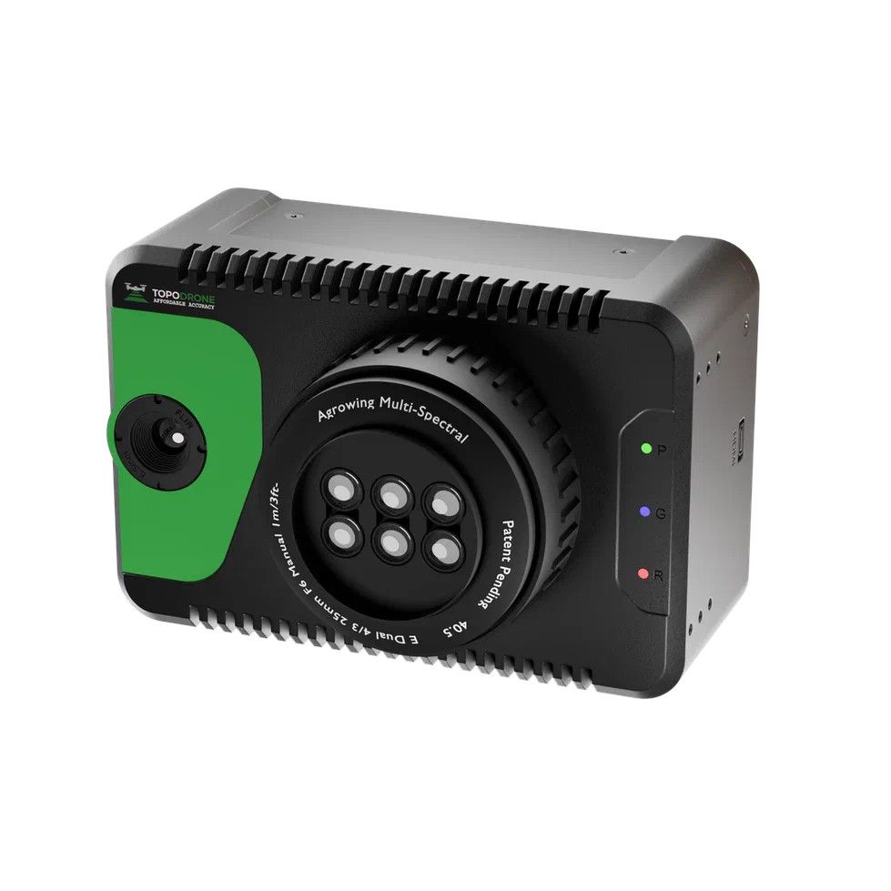
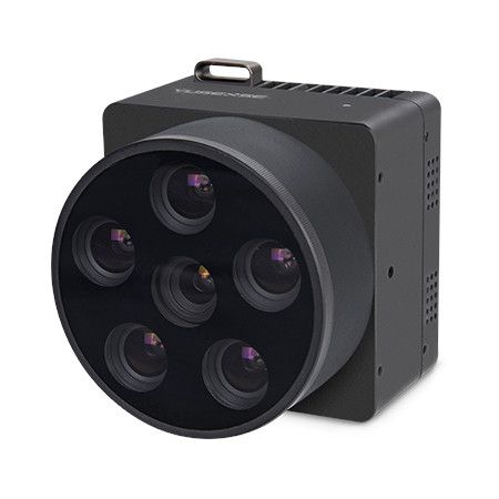
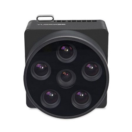
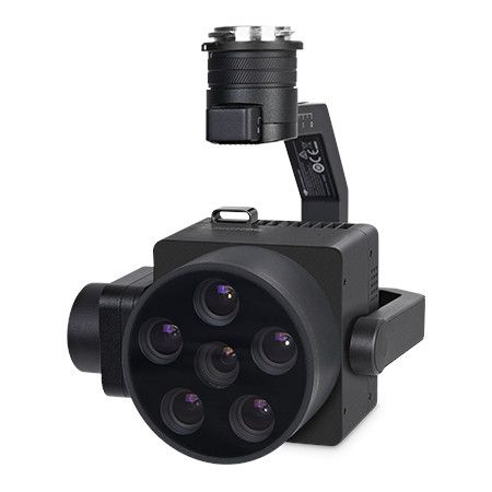
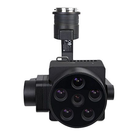
TOPODRONE 61 Sextuple+IR
TOPODRONE 61 Sextuple+IR is a cutting-edge drone system designed for advanced aerial imaging and surveying tasks. This sophisticated drone platform integrates six high-resolution cameras along with infrared (IR) imaging capabilities, providing comprehensive coverage and detailed data collection in various environmental conditions. 61MP mapping 12 Megapixel per band 14 narrow bands or 9 + wide RGB FWHM 30nm per band Repacked modoified Sony E-Mount A7Riv + HVGA/VGA IR
(Price on request)
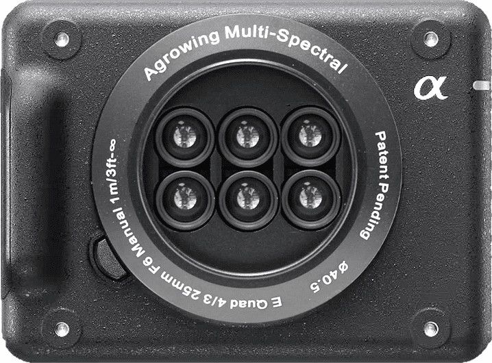
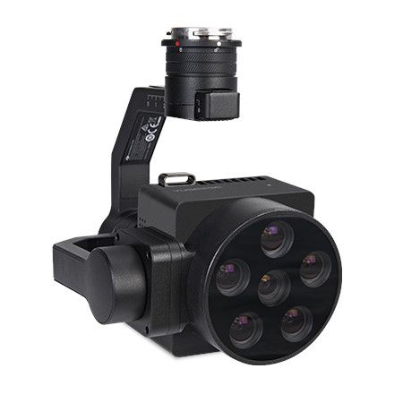
Agrowing 61MP Sextuple
The Agrowing 61MP Sextuple is a cutting-edge imaging device designed for professional photographers and enthusiasts who demand uncompromising image quality and versatility. With a staggering 61 megapixels resolution, this camera delivers stunningly detailed photographs, capturing even the most intricate nuances with breathtaking clarity. 7.5 Megapixel per band 14 Narrow Bands 61 Megapixel RGB for Full-Frame Sony E-Mount 7.5 Megapixel per band For E-Mount Based on modified Sony A7CR (A7riv/vA)
(Price on request)
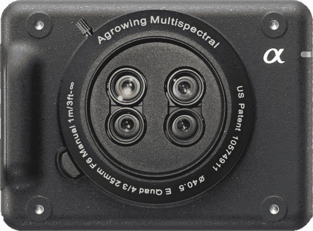
Agrowing 33MP Quad
The Agrowing 33MP Quad is a cutting-edge aerial imaging system designed for professional applications such as agriculture, environmental monitoring, surveying, and mapping. With its advanced quad-camera setup, this device offers high-resolution imaging capabilities, capturing stunning 33-megapixel images with exceptional clarity and detail. 33 MP mapping 7 Megapixel per band 10 narrow bands or 9 + wide RG FWHM 30 nm per band for Full Frame E-Mount for modified Sony A7CII camera body
(Price on request)
Agrowing A7CR 61MP Quad
The Agrowing A7CR 61MP Quad is a cutting-edge agricultural drone equipped with advanced imaging technology designed to enhance precision agriculture practices. With a staggering 61 megapixel (MP) camera sensor, this drone offers incredibly detailed aerial imagery, allowing farmers and agronomists to closely monitor crops, detect issues, and make informed decisions. 12 Megapixel per band (A7CR) NDVI/Red-Edge 10 Narrow Bands or 9 Bands + Wide RGB for Full-Frame E-Mount Based on modified Sony A7CR
(Price on request)
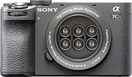
Agrowing LR1 61MP Sextuple
The Agrowing LR1 61MP Sextuple is a cutting-edge aerial camera system designed for high-resolution mapping and surveying applications. With a remarkable 61 megapixel sensor, it captures incredibly detailed images that are ideal for precision agriculture, environmental monitoring, urban planning, and other industries requiring accurate spatial data. 243gr. body + 190gr. multispectral lens RGB 61MP mapping or 14 band Multispectral of 7MP per band or 13 Bands + Wide RGB Full-Frame E-Mount Based on modified Sony ILX-LR1
(Price on request)
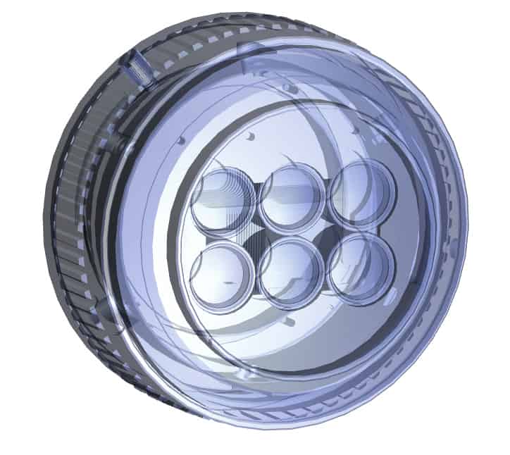
Agrowing LR1 61MP Quad
The Agrowing LR1 61MP Quad camera is a cutting-edge imaging device designed for professional applications in fields like agriculture, forestry, environmental monitoring, and surveying. With its impressive 61-megapixel resolution and quad-camera setup, it offers exceptional clarity and detail in capturing images. The quad-camera configuration enables multi-spectral imaging, allowing users to capture data across different wavelengths of light, such as visible, near-infrared, and thermal. 243gr. body + 181gr. multispectral lens RGB 61MP mapping or 10 band Multispectral of 12MP per band or 9 Bands + Wide RGB Full-Frame E-Mount Based on modified Sony ILX-LR1
(Price on request)
AQ600 Pro (5-bands) Multispectral Camera
The Yusense AQ600 Pro is a professional multispectral camera designed for unmanned aerial vehicles (UAVs), specifically compatible with DJI M300 and M350 RTK drones. Yusense AQ600 Pro is a professional multispectral camera designed for drone-based applications across various industries, adhering to industry standards for quality and performance.
12.500,00 € Exc.VAT (15.375,00 € Inc. 23% VAT)
Sale!
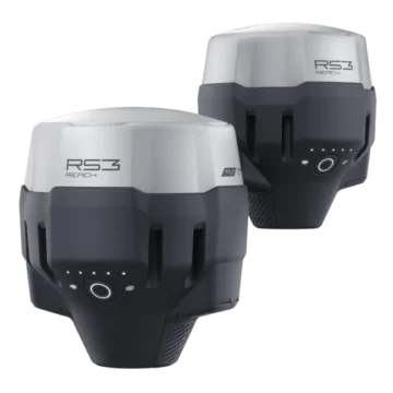
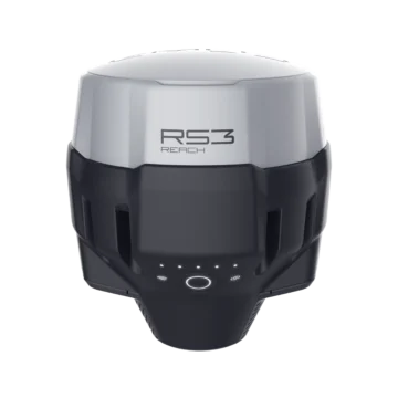
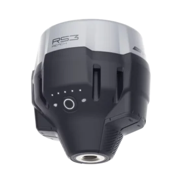
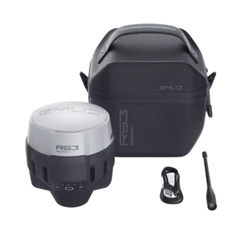
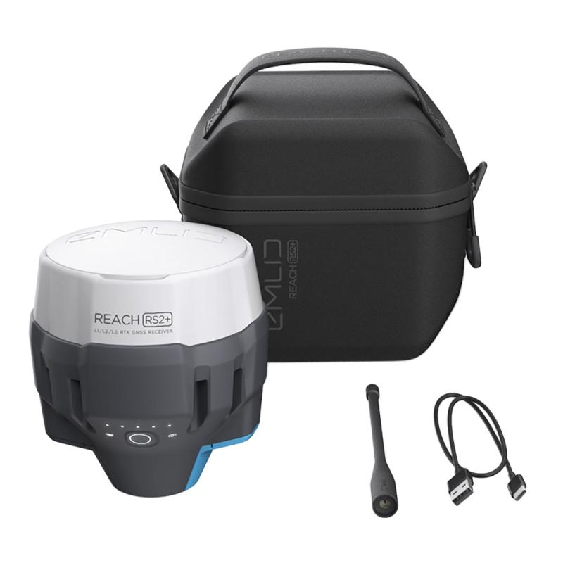
Emlid Reach RS3 Survey Kit
Two Reach RS3 receivers to use as base and rover Survey grade precision with tilt compensation. Comes with a mobile app. IMU 6DOF, RTK + 2 mm + 0.3 mm/° GNSS GPS/QZSS, GLONASS L1, L2; BeiDou B1, B2; Galileo E1, E5 Autonomy 18 hrs with tilt compensation Li-Ion battery, USB Type-C charging LTE and Wi-Fi To connect the device to the internet Dual-band radio 868/915 MHz LoRa to receive and transmit corrections 450 MHz UHF to receive corrections NTRIP and RTCM3 Supported protocols to send and receive corrections
4.500,00 € Exc.VAT (5.535,00 € Inc. 23% VAT)
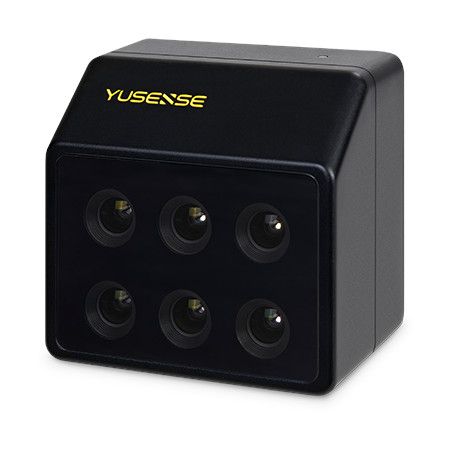
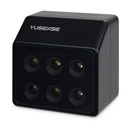
MS600 Dual (6-bands) Multispectral Camera
Yusense MS600 Dual is a multispectral drone payload that is compatible with various multi-rotor and fixed-wind UAV platforms. This lightweight payload is made of aluminum alloy and is equipped with six multispectral channels of 1.2 MP, sapphire optical glass windows, and a Downlink Light Sensor (DLS). Yusense MS600 Dual's spectral bands are similar to those used by the Sentinel-2 and Landsat-Next satellites.
7.400,00 € Exc.VAT (9.102,00 € Inc. 23% VAT)
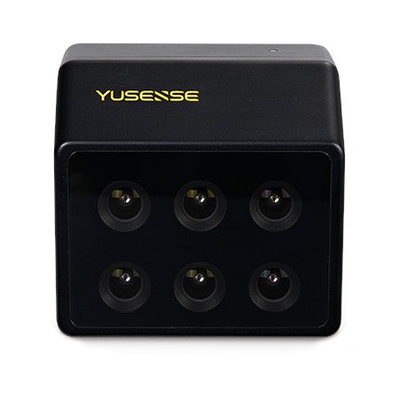
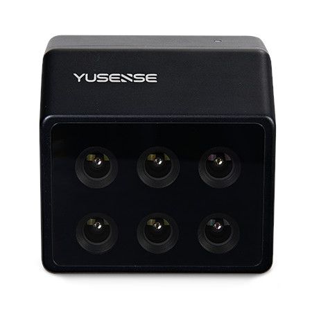
MS600 Pro (6-bands) Multispectral Camera
M300/M350 Specialized for RTK, on-board integrated control The Yusense MS600 Pro is a high-performance multispectral camera designed for capturing data in six specific spectral bands beyond the typical RGB spectrum. This allows for advanced analysis in various fields.
7.900,00 € Exc.VAT (9.717,00 € Inc. 23% VAT)
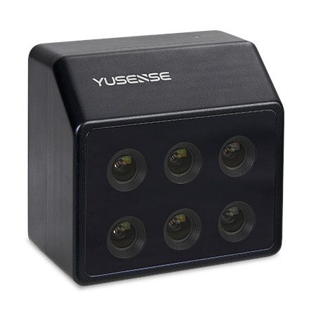
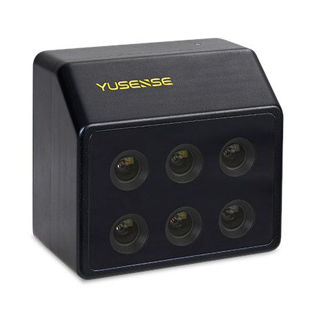
MS600 Advanced V2 (6-bands) Multispectral Camera
7.900,00 € Exc.VAT (9.717,00 € Inc. 23% VAT)
MS600 Advanced V2 (6-bands) Multispectral Camera
The Yusense MS600 Advanced V2 is a high-resolution multispectral camera designed for capturing data in six specific spectral bands. These bands go beyond the typical RGB spectrum, providing valuable information for various applications in agriculture, forestry, environmental monitoring, and more.
7.900,00 € Exc.VAT (9.717,00 € Inc. 23% VAT)

-
-
-
-
-
-
-
Sale!
 Vista Rápida
 -
Sale!
 Vista Rápida
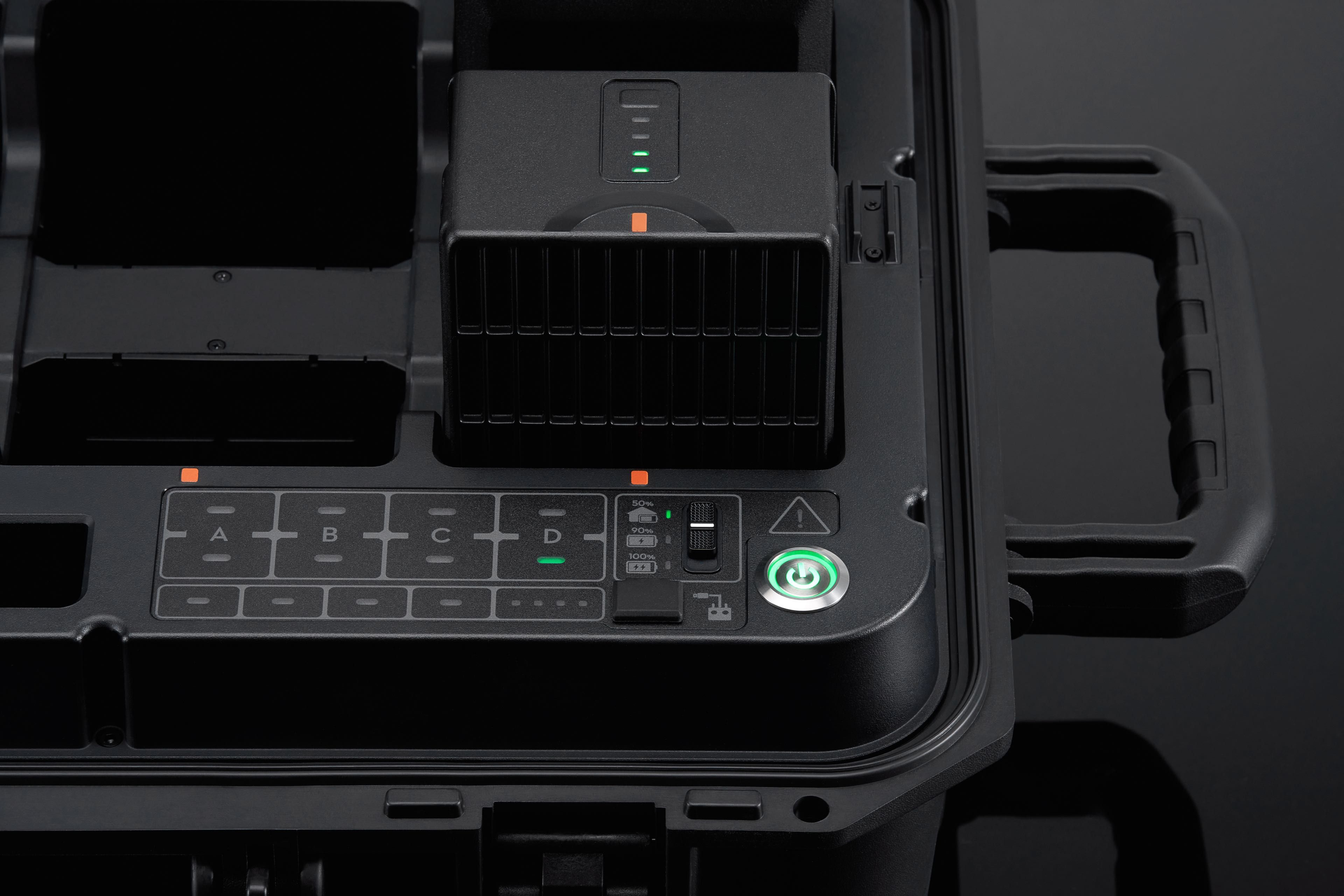
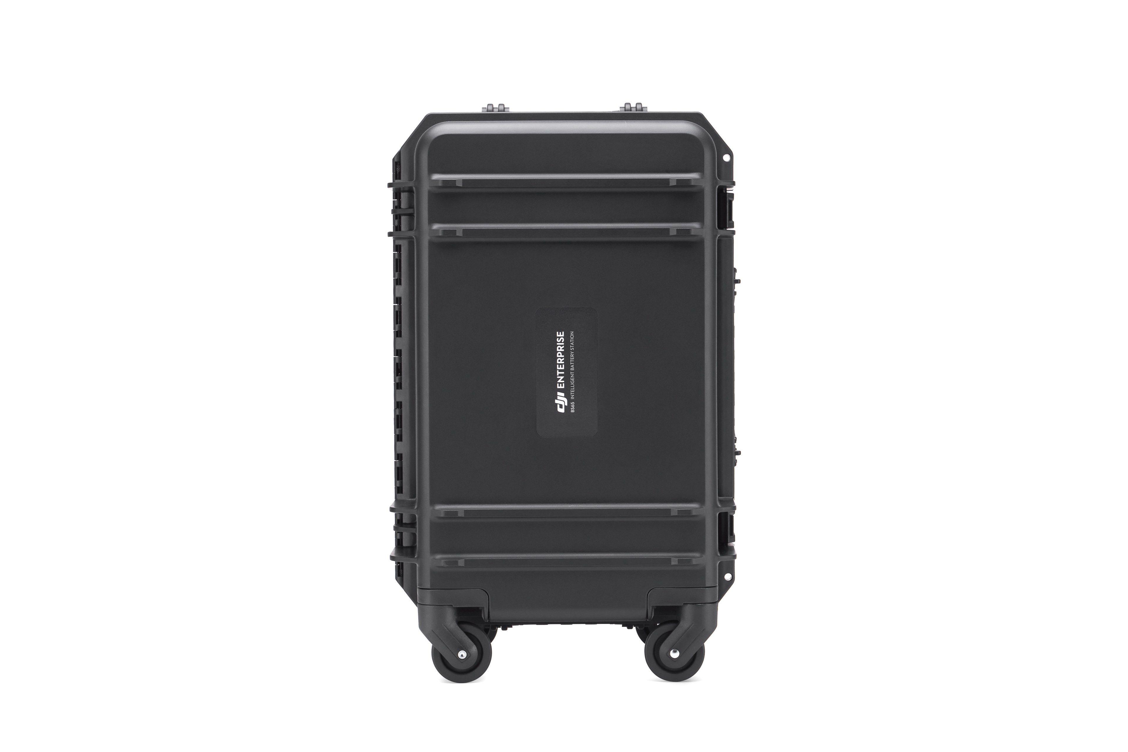
BS65 Intelligent Battery Station
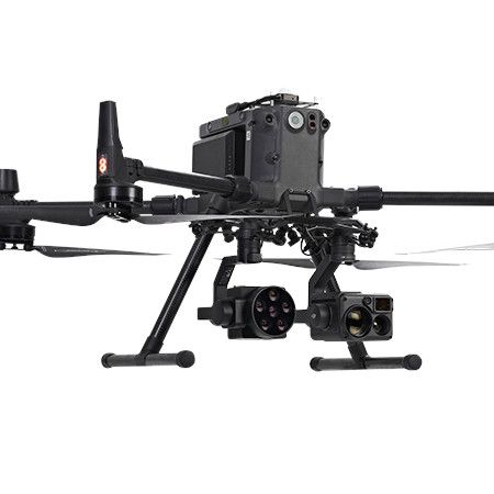
Accessories DJI Matrice 350 RTK 999,00 € Exc.VAT (1.228,77 € Inc. 23% VAT)

-
 Vista Rápida
 -
Vista Rápida
-
 Vista Rápida
 -
-
-
-
-
-
Vista Rápida
DJI Matrice 350 RTK-Worry-Free Basic Combo
DJI Matrice 350 RTK 10.150,00 € Exc.VAT (12.484,50 € Inc. 23% VAT) -
-
-
-
-
 Vista Rápida
DJI Mavic 3M (Multispectral) – Free Basic Combo – 1 Year
DJI 3.889,00 € Exc.VAT (4.783,47 € Inc. 23% VAT) -
 Vista Rápida
DJI Mavic 3E (Enterprise) Worry-Free Basic Combo – 1 Year
DJI 2.899,00 € Exc.VAT (3.565,77 € Inc. 23% VAT) -
-
Vista Rápida
-
Vista Rápida
-
 Vista Rápida
Agisoft Metashape Standard, Node-Locked Educational license, Single
Agisoft 54,00 € Exc.VAT (66,42 € Inc. 23% VAT) -
-
-
-
-
