


EMLID PHOTO CONTEST

Geosun Lidars
Geosun LiDARs are a high-quality products that offers a combination of accuracy, speed, and efficiency.


New Wingtra LIDAR
Perfectly integrated with the WingtraOne GEN II drone to ensure a streamlined workflow.

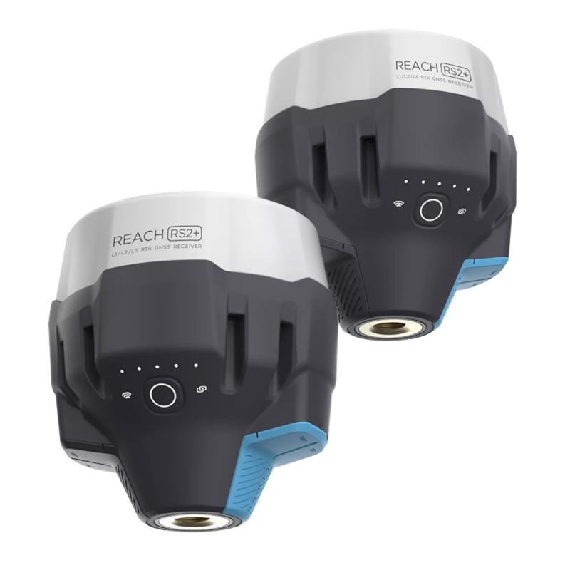
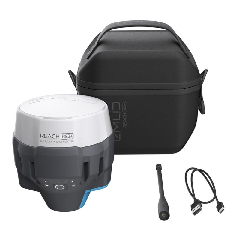
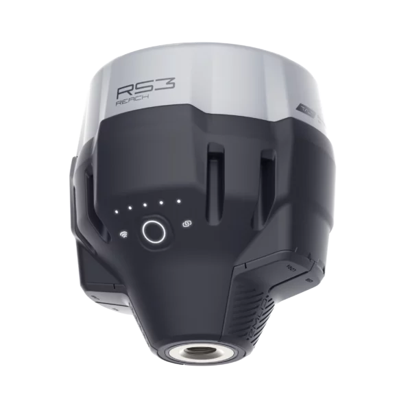
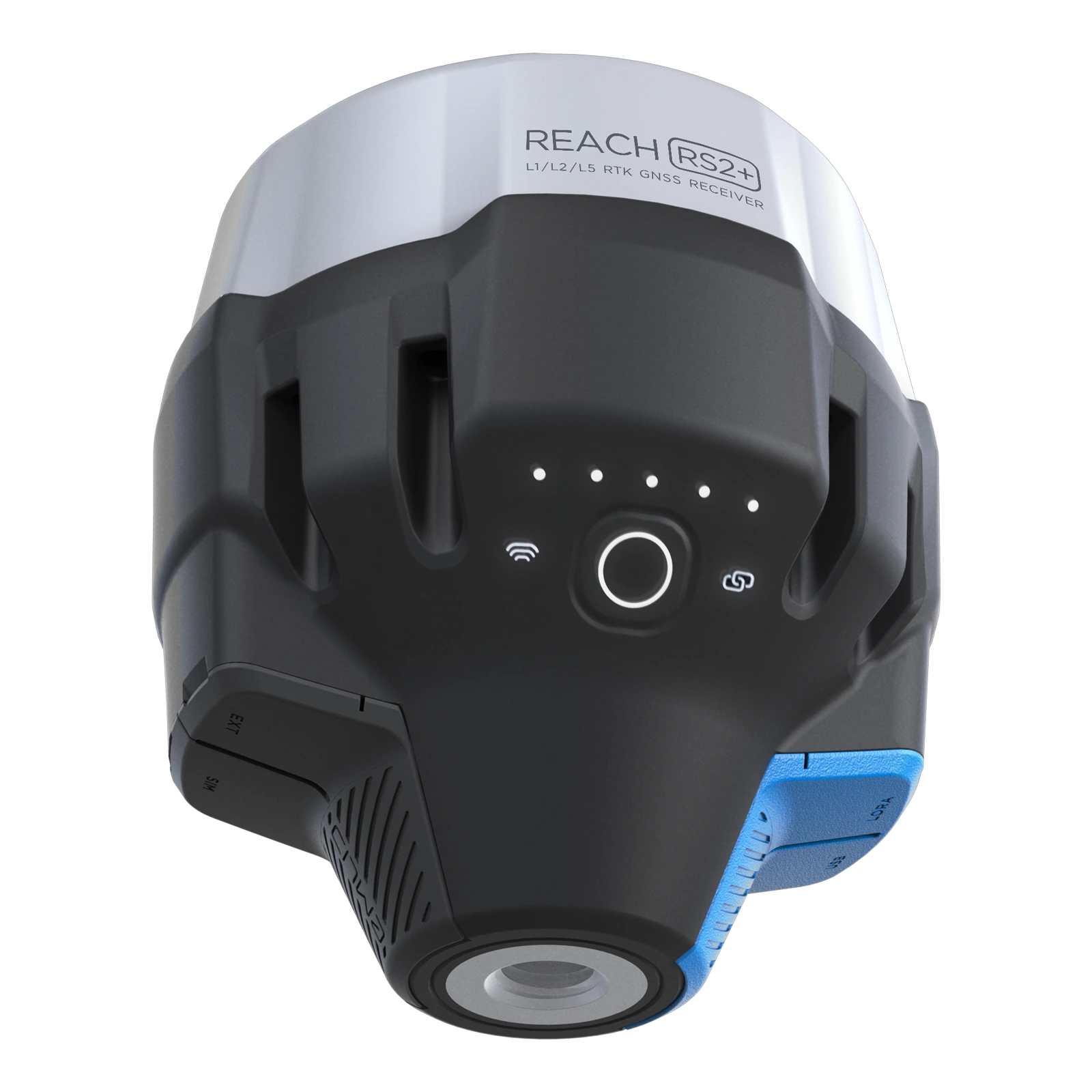
New Emlid Reach RS3
Multi-band base and rover
IMU tilt compensation
LTE modem
Dual-band radio
IMU tilt compensation
LTE modem
Dual-band radio

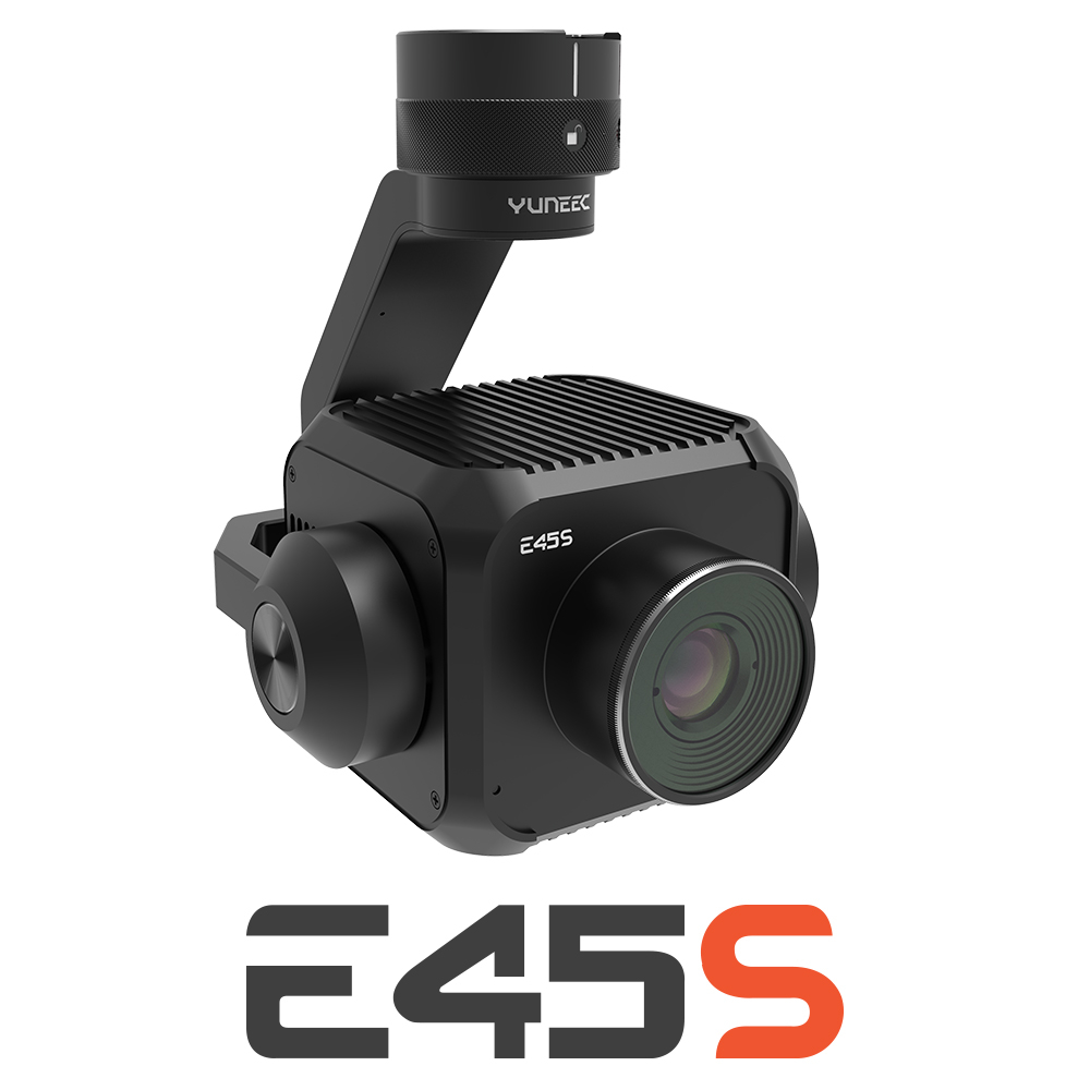
New Yuneec E45S for H510E and H850
Yuneec launched E45S 45MP full frame camera, ideal for professionals in survey and inspection industry!
New Swellpro Fisherman MAX
Launch of Fisherman Max is now available for pre-order and shipping starts on August 1st.


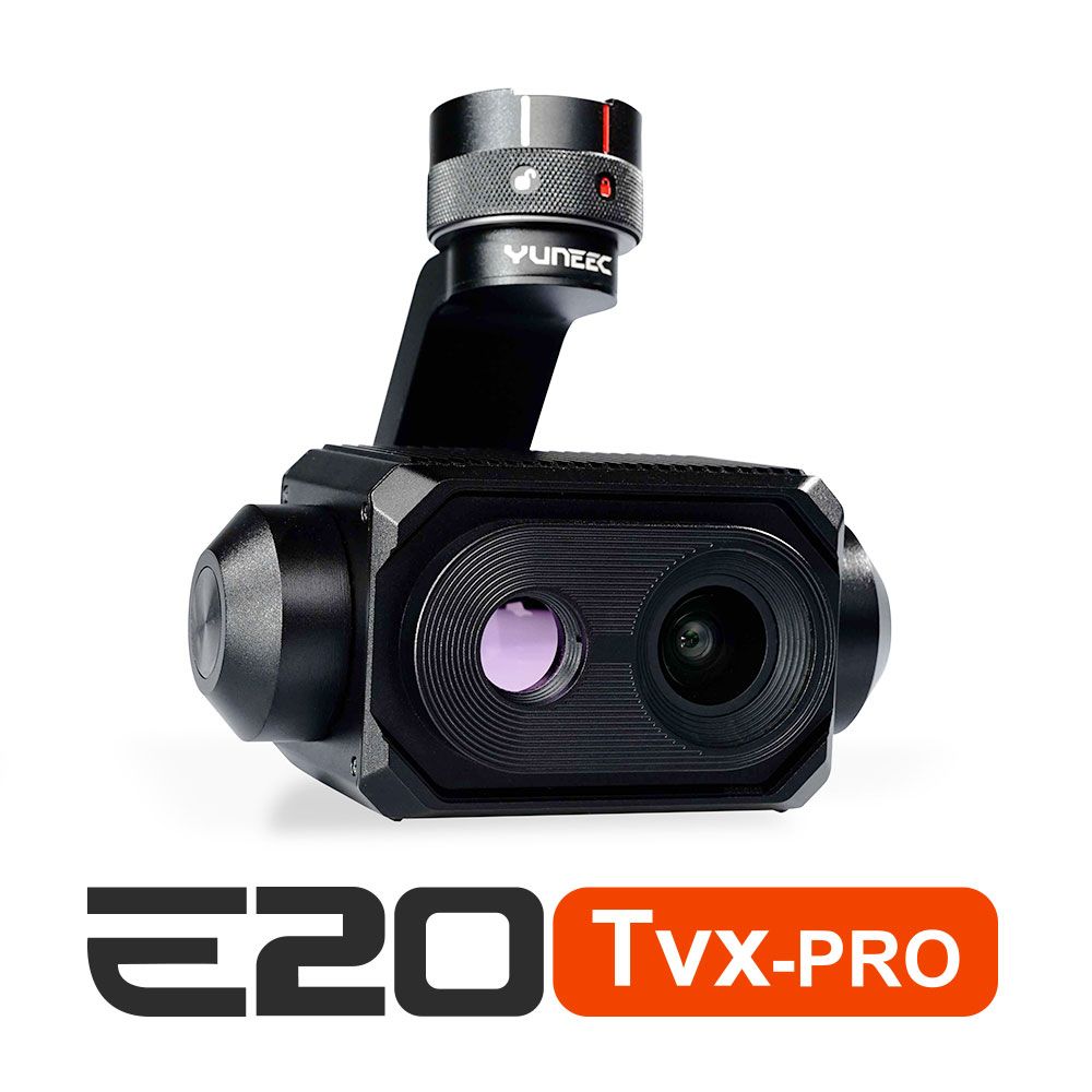
New E20TVX-PRO Thermal camera
Recommended camera for tasks related to Inspection (buildings, solar panels and powerlines), Search and Rescue, Firefighting and Law enforcement

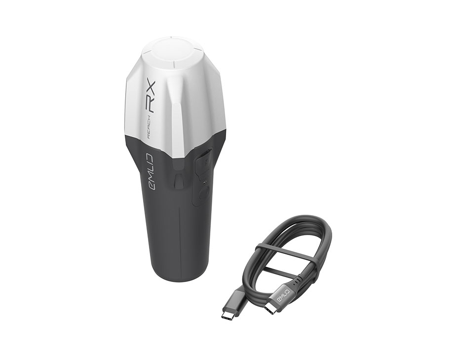
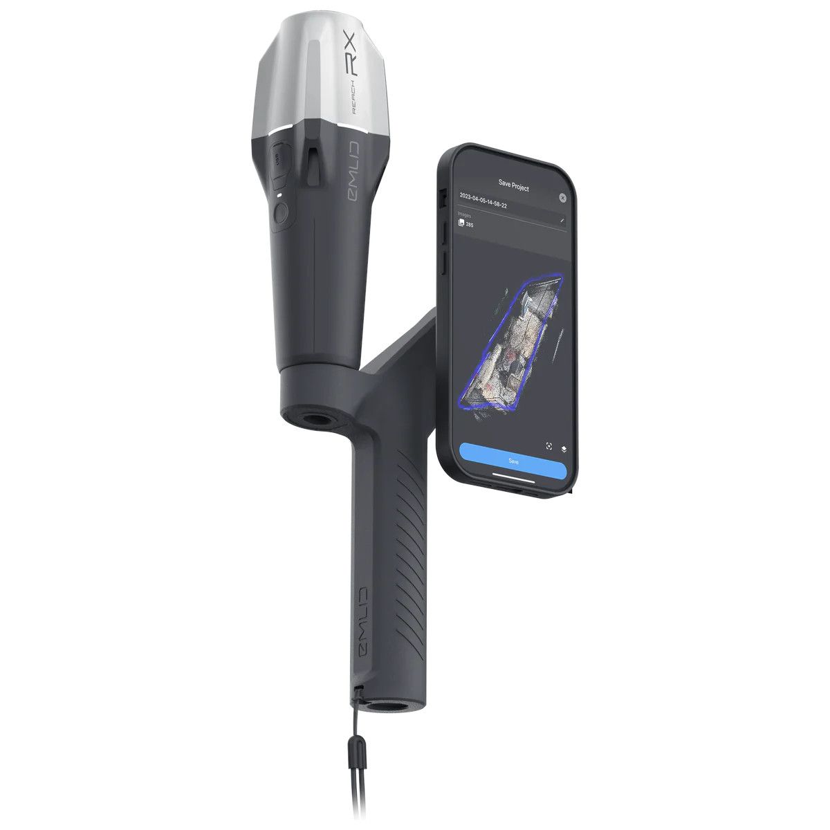
New Emlid Reach RX rover
Emlid Reach RX is a new pocket-sized, lightweight and easy-to-use receiver!

 Surveying & GIS
-
 Vista Rápida
 -
 Vista Rápida
 -
 Vista Rápida
 -
 Vista Rápida
 -
 Vista Rápida
 -
 Vista Rápida
 -
 Vista Rápida
 Mining & Quarries
-
Vista Rápida
-
Vista Rápida
-
Vista Rápida
-
Vista Rápida
-
Vista Rápida
-
Vista Rápida
-
Vista Rápida
 Construction
-
Vista Rápida
-
Vista Rápida
-
Vista Rápida
-
Vista Rápida
-
Vista Rápida
-
Vista Rápida
-
Vista Rápida
 Agriculture
-
Vista Rápida
-
Vista Rápida
-
Vista Rápida
-
Vista Rápida
-
Vista Rápida
-
 Vista Rápida
 -
Vista Rápida
 Environment monitoring
-
Vista Rápida
-
Vista Rápida
-
Vista Rápida
-
Vista Rápida
-
Vista Rápida
-
Vista Rápida
-
Vista Rápida
 Search & Rescue
-
Vista Rápida
-
Vista Rápida
-
Vista Rápida
-
Vista Rápida
-
Vista Rápida
-
Vista Rápida
 Other applications
-
Sale!
 Vista Rápida
 -
Sale!
 Vista Rápida
 -
 Vista Rápida
 -
Sale!
 Vista Rápida
 -
 Vista Rápida
 -
Sale!
 Vista Rápida


Showing 17–32 of 98 results

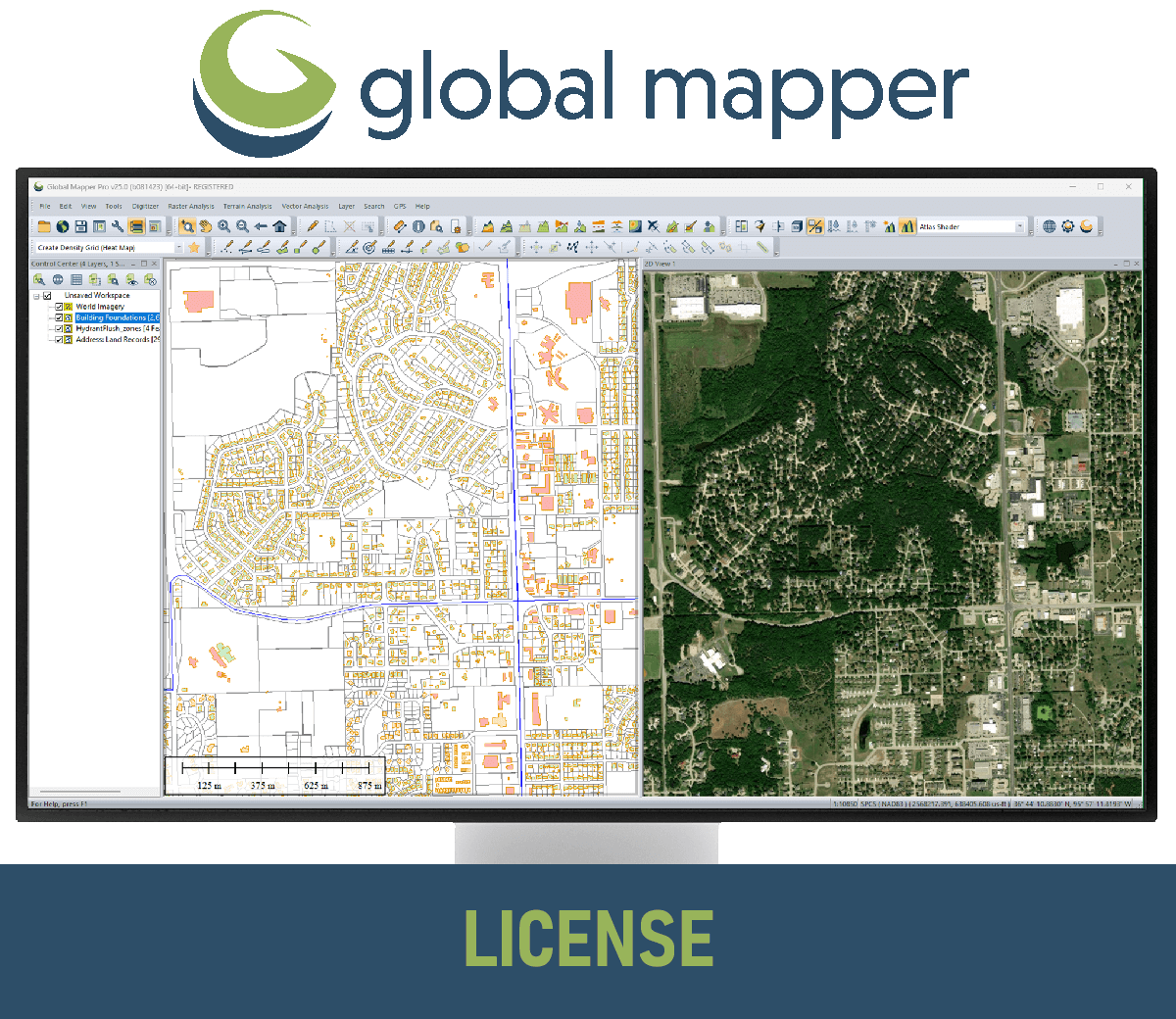
GM (Upgrade-to-Pro) USB Dongle License
Global Mapper Pro is an advanced geospatial software program designed for professionals who need more than the basic features of Global Mapper. It includes a wide range of tools for working with imagery, terrain, and LiDAR data. Some of the key features of Global Mapper Pro include: Pixels to Points: This tool allows you to create 3D point clouds, orthoimages, and 3D meshes from drone or UAV-collected images. Terrain Painting: This tool allows you to manually alter digital terrain models (DTMs). Generate Breaklines from Terrain Grid: This tool creates vector line features at distinct changes in elevation/slope. Vectorize Raster: This tool extracts and smooths vector areas from raster image and terrain layers. Advanced LiDAR Processing: Global Mapper Pro includes a number of tools for working with LiDAR data, such as point cloud classification, filtering, -->> This license can be moved between unlimited machines via a USB dongle. <<-- (Upgrade license from Standard to Pro Version)
(Price on request)
GM (Upgrade-to-Pro) Single User – Floating License
Global Mapper Pro is an advanced geospatial software program designed for professionals who need more than the basic features of Global Mapper. It includes a wide range of tools for working with imagery, terrain, and LiDAR data. Some of the key features of Global Mapper Pro include: Pixels to Points: This tool allows you to create 3D point clouds, orthoimages, and 3D meshes from drone or UAV-collected images. Terrain Painting: This tool allows you to manually alter digital terrain models (DTMs). Generate Breaklines from Terrain Grid: This tool creates vector line features at distinct changes in elevation/slope. Vectorize Raster: This tool extracts and smooths vector areas from raster image and terrain layers. Advanced LiDAR Processing: Global Mapper Pro includes a number of tools for working with LiDAR data, such as point cloud classification, filtering, -->> The Single User Floating license is remote desktop enabled (RDP), which is convenient for users working between multiple locations. <<-- (Upgrade license from Standard to
(Price on request)
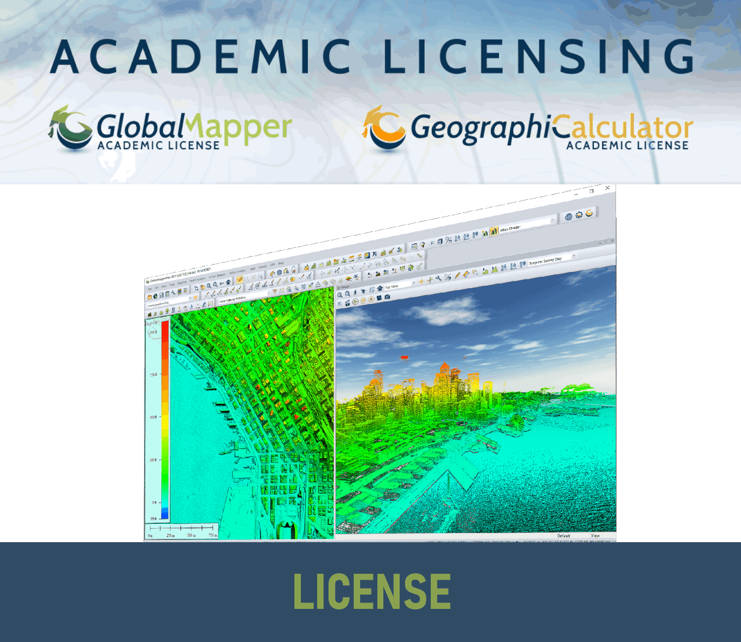
GM Academic License
Global Mapper Academic License is available to accredited institutions of higher education. This includes colleges, universities, and technical schools. Includes all the features of the Global Mapper Standard Edition, plus some additional features that are useful for academic use, such as the ability to create 3D models and export data to a variety of formats. Can be used for instructional purposes only. This means that students can use it to complete assignments, but they cannot use it for commercial purposes. Can be installed on a classroom or lab computers, as well as on students' personal computers.
(Price on request)
GM (Upgrade-to-Pro) Network License
Global Mapper Pro is an advanced geospatial software program designed for professionals who need more than the basic features of Global Mapper. It includes a wide range of tools for working with imagery, terrain, and LiDAR data. Some of the key features of Global Mapper Pro include: Pixels to Points: This tool allows you to create 3D point clouds, orthoimages, and 3D meshes from drone or UAV-collected images. Terrain Painting: This tool allows you to manually alter digital terrain models (DTMs). Generate Breaklines from Terrain Grid: This tool creates vector line features at distinct changes in elevation/slope. Vectorize Raster: This tool extracts and smooths vector areas from raster image and terrain layers. Advanced LiDAR Processing: Global Mapper Pro includes a number of tools for working with LiDAR data, such as point cloud classification, filtering, -->> Server license starts at two concurrent/shared seats <<-- (Upgrade license from Standard to Pro Version)
(Price on request)
GM (Upgrade-to-Pro) Single User – Node Locked
Global Mapper Pro is an advanced geospatial software program designed for professionals who need more than the basic features of Global Mapper. It includes a wide range of tools for working with imagery, terrain, and LiDAR data. Some of the key features of Global Mapper Pro include: Pixels to Points: This tool allows you to create 3D point clouds, orthoimages, and 3D meshes from drone or UAV-collected images. Terrain Painting: This tool allows you to manually alter digital terrain models (DTMs). Generate Breaklines from Terrain Grid: This tool creates vector line features at distinct changes in elevation/slope. Vectorize Raster: This tool extracts and smooths vector areas from raster image and terrain layers. Advanced LiDAR Processing: Global Mapper Pro includes a number of tools for working with LiDAR data, such as point cloud classification, filtering, -->> This license is node-locked to one computer and it cannot be access remotely. <<-- (Upgrade license from Standard to Pro Version)
(Price on request)
GM Pro USB Dongle License
Global Mapper Pro is an advanced geospatial software program designed for professionals who need more than the basic features of Global Mapper. It includes a wide range of tools for working with imagery, terrain, and LiDAR data. Some of the key features of Global Mapper Pro include: Pixels to Points: This tool allows you to create 3D point clouds, orthoimages, and 3D meshes from drone or UAV-collected images. Terrain Painting: This tool allows you to manually alter digital terrain models (DTMs). Generate Breaklines from Terrain Grid: This tool creates vector line features at distinct changes in elevation/slope. Vectorize Raster: This tool extracts and smooths vector areas from raster image and terrain layers. Advanced LiDAR Processing: Global Mapper Pro includes a number of tools for working with LiDAR data, such as point cloud classification, filtering, -->> This license can be moved between unlimited machines via a USB dongle. <<--
(Price on request)
GM Pro Network License
Global Mapper Pro is an advanced geospatial software program designed for professionals who need more than the basic features of Global Mapper. It includes a wide range of tools for working with imagery, terrain, and LiDAR data. Some of the key features of Global Mapper Pro include: Pixels to Points: This tool allows you to create 3D point clouds, orthoimages, and 3D meshes from drone or UAV-collected images. Terrain Painting: This tool allows you to manually alter digital terrain models (DTMs). Generate Breaklines from Terrain Grid: This tool creates vector line features at distinct changes in elevation/slope. Vectorize Raster: This tool extracts and smooths vector areas from raster image and terrain layers. Advanced LiDAR Processing: Global Mapper Pro includes a number of tools for working with LiDAR data, such as point cloud classification, filtering, -->> Server license starts at two concurrent/shared seats <<--
(Price on request)
GM Pro Single User – Floating License
Global Mapper Pro is an advanced geospatial software program designed for professionals who need more than the basic features of Global Mapper. It includes a wide range of tools for working with imagery, terrain, and LiDAR data. Some of the key features of Global Mapper Pro include: Pixels to Points: This tool allows you to create 3D point clouds, orthoimages, and 3D meshes from drone or UAV-collected images. Terrain Painting: This tool allows you to manually alter digital terrain models (DTMs). Generate Breaklines from Terrain Grid: This tool creates vector line features at distinct changes in elevation/slope. Vectorize Raster: This tool extracts and smooths vector areas from raster image and terrain layers. Advanced LiDAR Processing: Global Mapper Pro includes a number of tools for working with LiDAR data, such as point cloud classification, filtering, -->> The Single User Floating license is remote desktop enabled (RDP), which is convenient for users working between multiple locations. <<--
2.111,00 € Exc.VAT (2.596,53 € Inc. 23% VAT)
GM Pro Single User – Node Locked
Global Mapper Pro is an advanced geospatial software program designed for professionals who need more than the basic features of Global Mapper. It includes a wide range of tools for working with imagery, terrain, and LiDAR data. Some of the key features of Global Mapper Pro include: Pixels to Points: This tool allows you to create 3D point clouds, orthoimages, and 3D meshes from drone or UAV-collected images. Terrain Painting: This tool allows you to manually alter digital terrain models (DTMs). Generate Breaklines from Terrain Grid: This tool creates vector line features at distinct changes in elevation/slope. Vectorize Raster: This tool extracts and smooths vector areas from raster image and terrain layers. Advanced LiDAR Processing: Global Mapper Pro includes a number of tools for working with LiDAR data, such as point cloud classification, filtering, -->> This license is node-locked to one computer and it cannot be access remotely. <<--
1.407,00 € Exc.VAT (1.730,61 € Inc. 23% VAT)
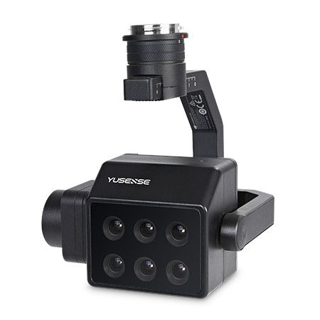
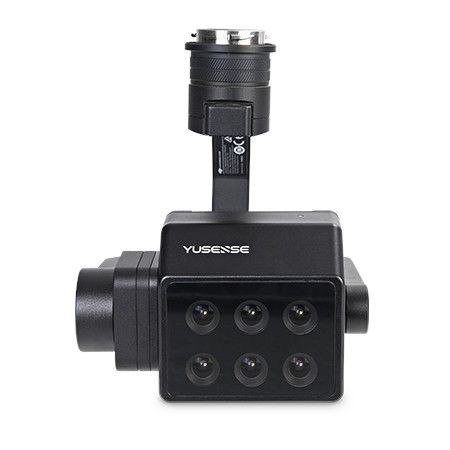
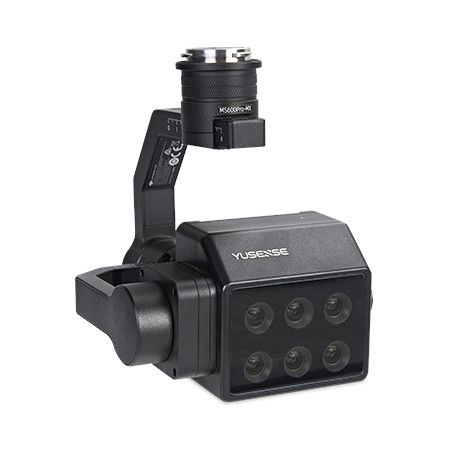
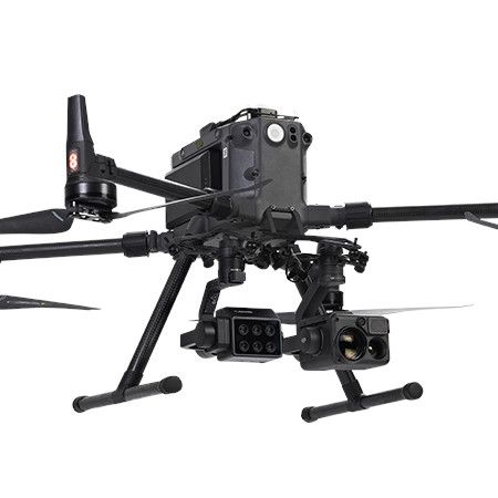
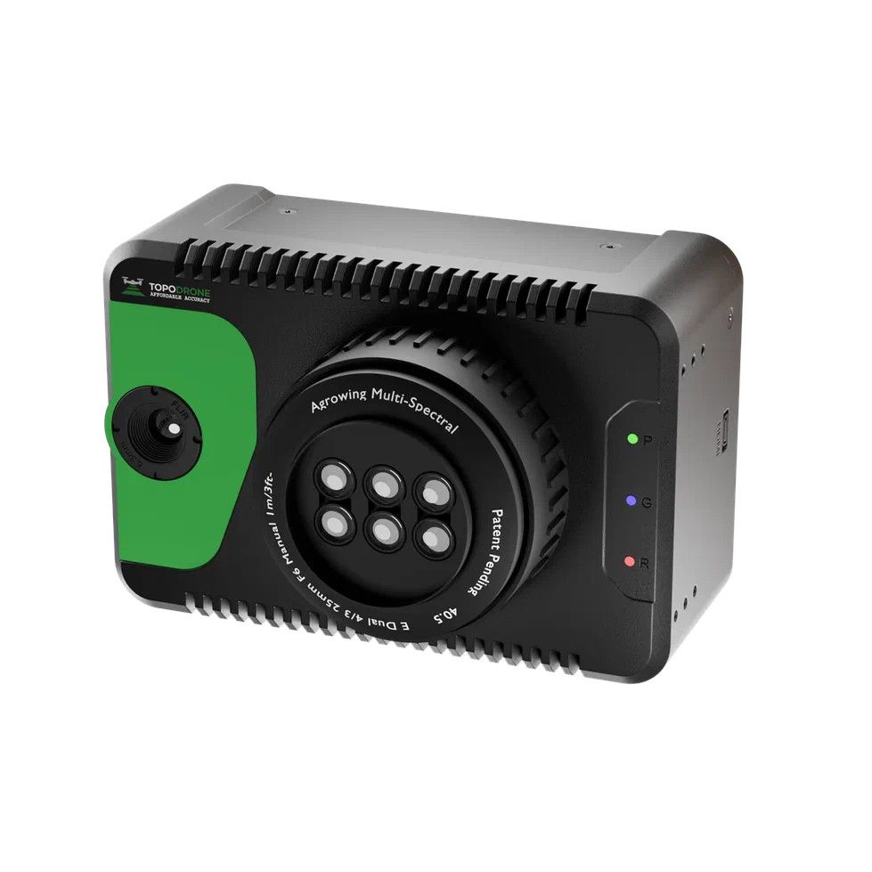
MS600 Pro (6-bands) Multispectral Camera
M300/M350 Specialized for RTK, on-board integrated control The Yusense MS600 Pro is a high-performance multispectral camera designed for capturing data in six specific spectral bands beyond the typical RGB spectrum. This allows for advanced analysis in various fields.
7.900,00 € Exc.VAT (9.717,00 € Inc. 23% VAT)
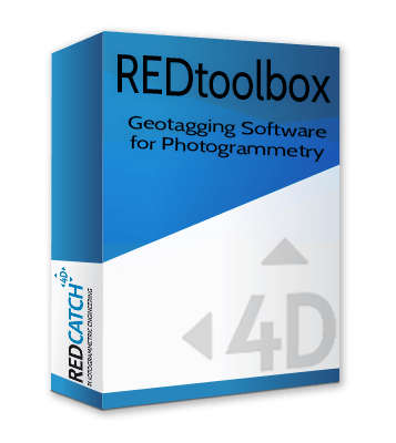
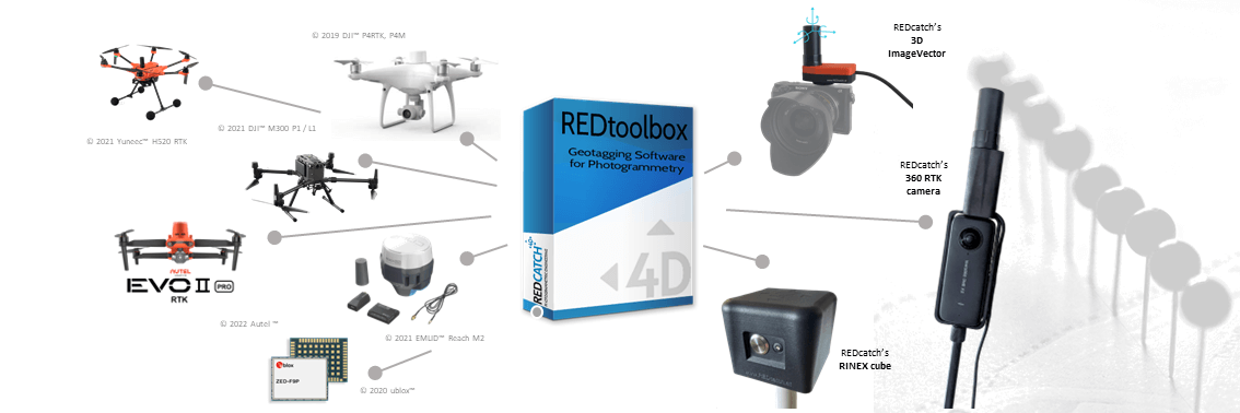
REDcatch REDtoolbox
REDcatch REDtoolbox is a software designed for post-processing and geotagging data captured by drones and terrestrial devices. It specifically focuses on GNSS (Global Navigation Satellite System) data, which is used for positioning and location information.
(Price on request)
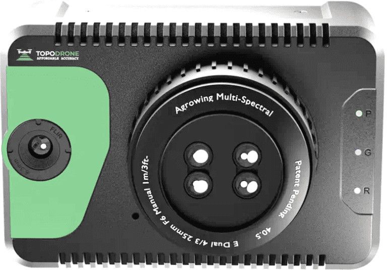
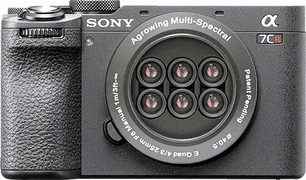
Agrowing 24MP ZV-E10 Quad
The Agrowing 24MP ZV-E10 Quad camera is a cutting-edge imaging solution designed for professional and enthusiast photographers alike. With its quad-camera setup, it offers unparalleled versatility and performance in various shooting scenarios. Technical Specifications 10 Megapixel per Channel NDVI/Red-Edge e 4/5 Narrow Bands 24 Megapixel RGB for APS-C E-Mount Based on modified Sony ZV-E10/Alpha 6xxx
(Price on request)
TOPODRONE 61 Sextuple+IR
TOPODRONE 61 Sextuple+IR is a cutting-edge drone system designed for advanced aerial imaging and surveying tasks. This sophisticated drone platform integrates six high-resolution cameras along with infrared (IR) imaging capabilities, providing comprehensive coverage and detailed data collection in various environmental conditions. 61MP mapping 12 Megapixel per band 14 narrow bands or 9 + wide RGB FWHM 30nm per band Repacked modoified Sony E-Mount A7Riv + HVGA/VGA IR
(Price on request)
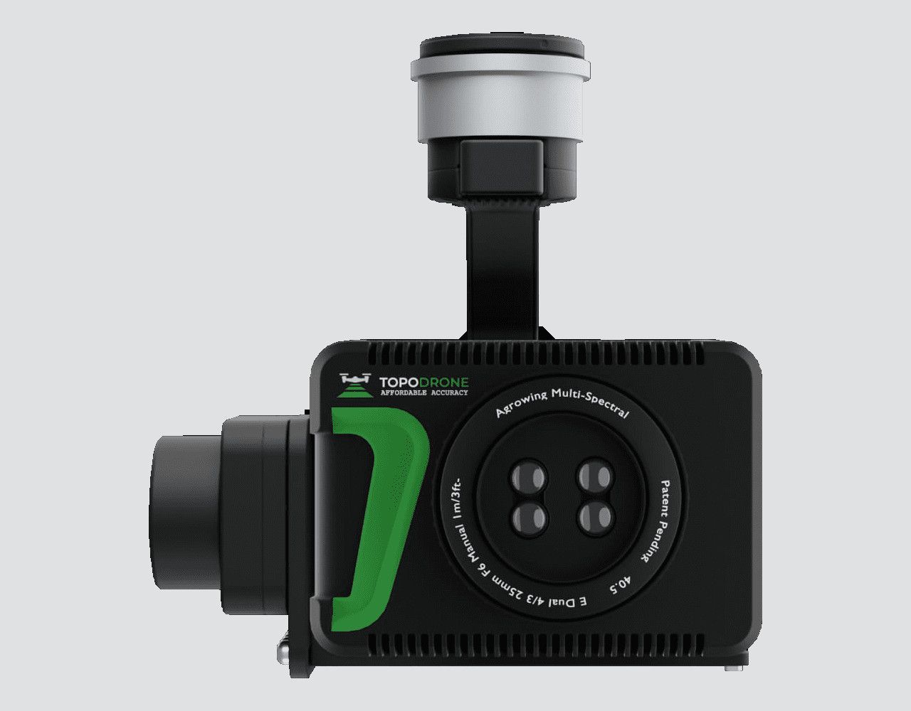
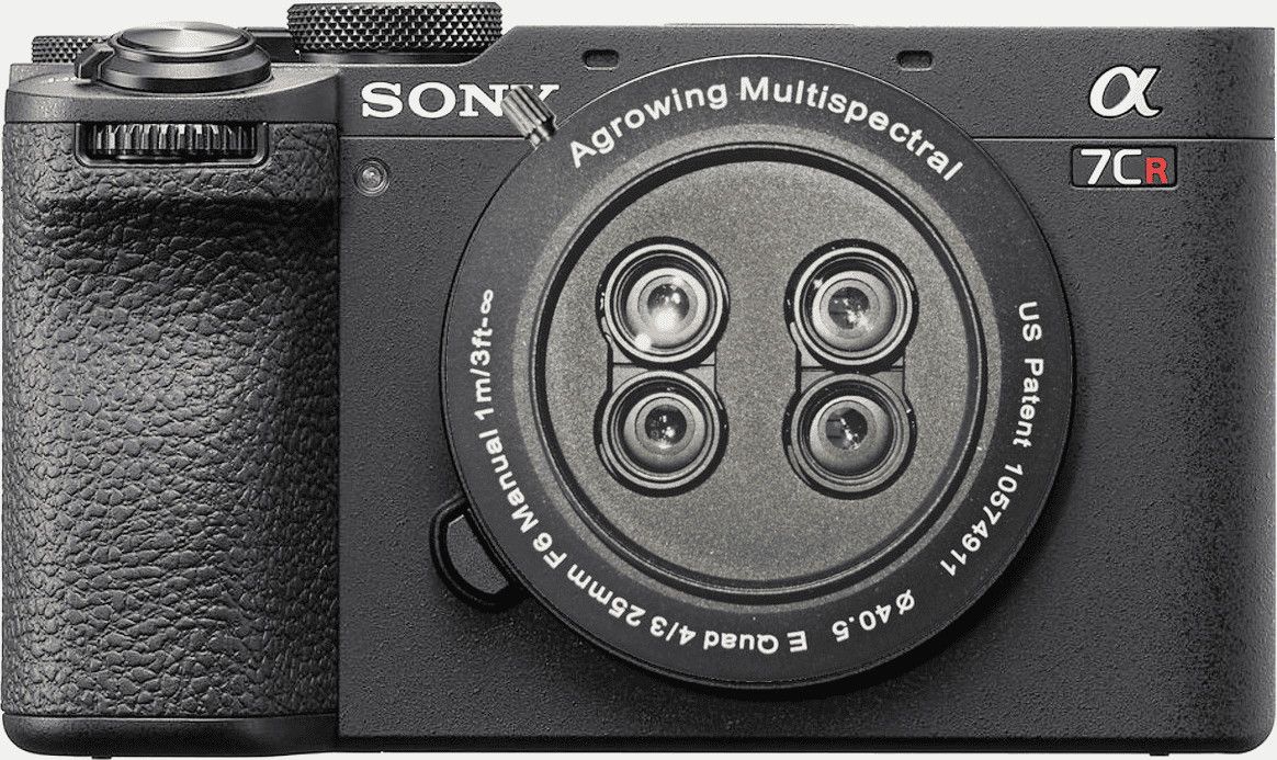
Agrowing 61MP Sextuple
The Agrowing 61MP Sextuple is a cutting-edge imaging device designed for professional photographers and enthusiasts who demand uncompromising image quality and versatility. With a staggering 61 megapixels resolution, this camera delivers stunningly detailed photographs, capturing even the most intricate nuances with breathtaking clarity. 7.5 Megapixel per band 14 Narrow Bands 61 Megapixel RGB for Full-Frame Sony E-Mount 7.5 Megapixel per band For E-Mount Based on modified Sony A7CR (A7riv/vA)
(Price on request)
Agrowing 33MP Quad
The Agrowing 33MP Quad is a cutting-edge aerial imaging system designed for professional applications such as agriculture, environmental monitoring, surveying, and mapping. With its advanced quad-camera setup, this device offers high-resolution imaging capabilities, capturing stunning 33-megapixel images with exceptional clarity and detail. 33 MP mapping 7 Megapixel per band 10 narrow bands or 9 + wide RG FWHM 30 nm per band for Full Frame E-Mount for modified Sony A7CII camera body
(Price on request)
Agrowing A7CR 61MP Quad
The Agrowing A7CR 61MP Quad is a cutting-edge agricultural drone equipped with advanced imaging technology designed to enhance precision agriculture practices. With a staggering 61 megapixel (MP) camera sensor, this drone offers incredibly detailed aerial imagery, allowing farmers and agronomists to closely monitor crops, detect issues, and make informed decisions. 12 Megapixel per band (A7CR) NDVI/Red-Edge 10 Narrow Bands or 9 Bands + Wide RGB for Full-Frame E-Mount Based on modified Sony A7CR
(Price on request)

-
-
-
-
-
-
-
Sale!
 Vista Rápida
 -
Sale!
 Vista Rápida
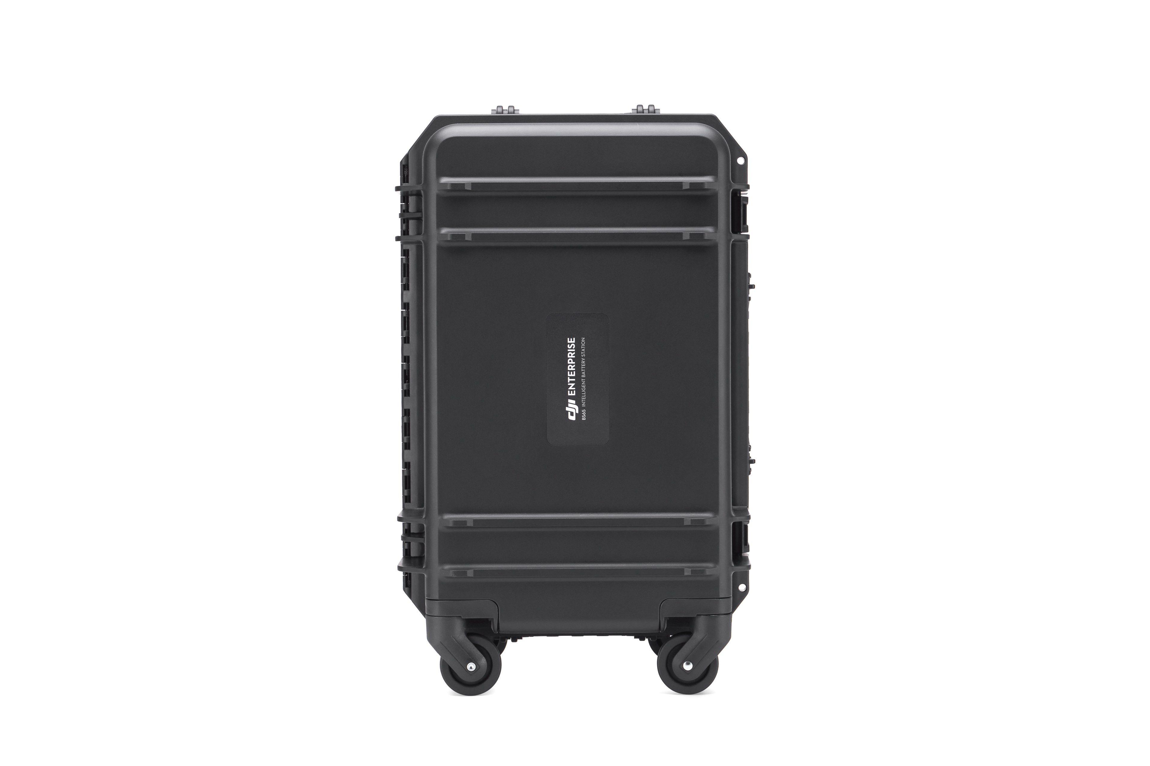
BS65 Intelligent Battery Station
Accessories DJI Matrice 350 RTK 999,00 € Exc.VAT (1.228,77 € Inc. 23% VAT)

-
Vista Rápida
-
Vista Rápida
-
 Vista Rápida
 -
-
-
-
-
-
Vista Rápida
DJI Matrice 350 RTK-Worry-Free Basic Combo
DJI Matrice 350 RTK 10.150,00 € Exc.VAT (12.484,50 € Inc. 23% VAT) -
-
-
-
-
 Vista Rápida
DJI Mavic 3M (Multispectral) – Free Basic Combo – 1 Year
DJI 3.889,00 € Exc.VAT (4.783,47 € Inc. 23% VAT) -
 Vista Rápida
DJI Mavic 3E (Enterprise) Worry-Free Basic Combo – 1 Year
DJI 2.899,00 € Exc.VAT (3.565,77 € Inc. 23% VAT) -
-
Vista Rápida
-
Vista Rápida
-
 Vista Rápida
Agisoft Metashape Standard, Node-Locked Educational license, Single
Agisoft 54,00 € Exc.VAT (66,42 € Inc. 23% VAT) -
-
-
-
-
